
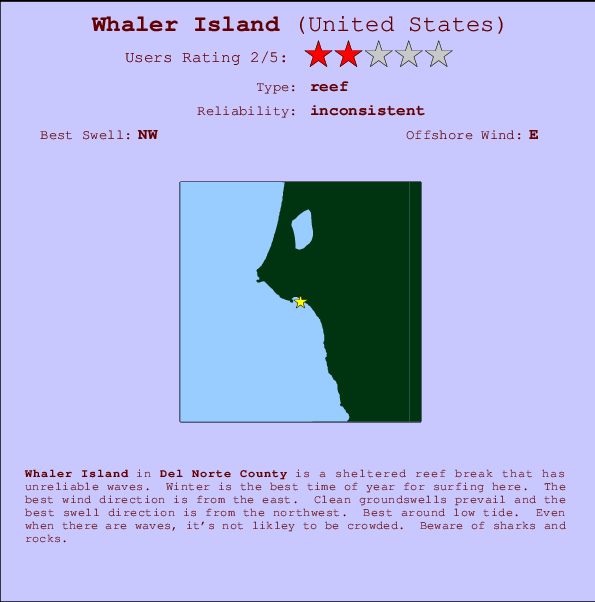
Whaler Island Surf Guide
Whaler Island in Del Norte County is a sheltered reef break that has inconsistent surf. Winter is the best time of year for surfing here. Offshore winds are from the east. Most of the surf here comes from groundswells and the optimum swell angle is from the northwest. A right hand reef break. Best around low tide. Unlikely to be too crowded, even when the surf is up. Watch out for sharks and rocks.
Whaler Island Spot Info
| Type: | Rating: | Reliability: | Todays Sea Temp*: |
|---|---|---|---|
| inconsistent | 11.8°C*ocean temperature recorded from satellite |
Surfing Whaler Island:
The best conditions reported for surf at Whaler Island occur when a Northwest swell combines with an offshore wind direction from the East.

Energía de Olas (poder): 12 horas


Whaler Island Surf:
Thursday, 16 July 2026, 02:43 Local time| jueves 16 | ||||
| 2AM | 5AM | 8AM | 11AM | |
| Wave (m) | ||||
| Período (s) | 16 | 19 | 19 | 19 |
| Viento (km/h) | ||||
| Estado del Viento | glass | glass | glass | cross- on |
- /breaks/Whaler-Island/forecasts/latest
Whaler Island Surf Guide
Whaler Island in Del Norte County is a sheltered reef break that has inconsistent surf. Winter is the best time of year for surfing here. Offshore winds are from the east. Most of the surf here comes from groundswells and the optimum swell angle is from the northwest. A right hand reef break. Best around low tide. Unlikely to be too crowded, even when the surf is up. Watch out for sharks and rocks.
Whaler Island Spot Info
Type: Rating: Reliability: Todays Sea Temp*:  Reef
Reef 2
2inconsistent 11.8°C*ocean temperature recorded from satelliteSurfing Whaler Island:
The best conditions reported for surf at Whaler Island occur when a Northwest swell combines with an offshore wind direction from the East.
Energía de Olas (poder): 12 horas
Usa la barra de navegación de arriba para ver la temperatura del mar en Whaler Island, fotografías Whaler Island, previsiones detalladas de olas para Whaler Island, vientos y previsión del tiempo, webcams para Whaler Island, viento actual desde estaciones meteorológicas en CAL - Del Norte County y predicciones de marea para Whaler Island. Las mapas de olas para United States enseñarán un mapa grande de United States y los mares que rodean. Los mapas de olas pueden ser animadas para mostrar diferentes componentes de olas, la altura de ola, la energía de ola, el período, junto con previsiones de viento y del tiempo. Previsiones actuales del tiempo y del estado del mar provienen de boyas marinas de United States, del barcos que transitan en la zona y de estaciones meteorológicas costeras. Cada página de previsiones tiene un Busca-Olas Regional y Global para localizar las mejores condiciones para surfear en el área de Whaler Island.
Whaler Island Surf:
Thursday, 16 July 2026, 02:43 Local timejueves 16 2AM 5AM 8AM 11AM Wave (m) Período (s) 16 19 19 19 Viento (km/h) Estado del Viento glass glass glass cross-
on- /breaks/Whaler-Island/forecasts/latest
- /breaks/Whaler-Island/forecasts/latest/six_day
Whaler Island Surf Guide
Whaler Island in Del Norte County is a sheltered reef break that has inconsistent surf. Winter is the best time of year for surfing here. Offshore winds are from the east. Most of the surf here comes from groundswells and the optimum swell angle is from the northwest. A right hand reef break. Best around low tide. Unlikely to be too crowded, even when the surf is up. Watch out for sharks and rocks.
Whaler Island Spot Info
Type: Rating: Reliability: Todays Sea Temp*: Reef2inconsistent 11.8°C*ocean temperature recorded from satelliteSurfing Whaler Island:
The best conditions reported for surf at Whaler Island occur when a Northwest swell combines with an offshore wind direction from the East.
Energía de Olas (poder): 12 horas
Usa la barra de navegación de arriba para ver la temperatura del mar en Whaler Island, fotografías Whaler Island, previsiones detalladas de olas para Whaler Island, vientos y previsión del tiempo, webcams para Whaler Island, viento actual desde estaciones meteorológicas en CAL - Del Norte County y predicciones de marea para Whaler Island. Las mapas de olas para United States enseñarán un mapa grande de United States y los mares que rodean. Los mapas de olas pueden ser animadas para mostrar diferentes componentes de olas, la altura de ola, la energía de ola, el período, junto con previsiones de viento y del tiempo. Previsiones actuales del tiempo y del estado del mar provienen de boyas marinas de United States, del barcos que transitan en la zona y de estaciones meteorológicas costeras. Cada página de previsiones tiene un Busca-Olas Regional y Global para localizar las mejores condiciones para surfear en el área de Whaler Island.
Whaler Island Surf:
Thursday, 16 July 2026, 02:43 Local timejueves 16 2AM 5AM 8AM 11AM Wave (m) Período (s) 16 19 19 19 Viento (km/h) Estado del Viento glass glass glass cross-
on- /breaks/Whaler-Island/forecasts/latest
Whaler Island Surf Guide
Whaler Island in Del Norte County is a sheltered reef break that has inconsistent surf. Winter is the best time of year for surfing here. Offshore winds are from the east. Most of the surf here comes from groundswells and the optimum swell angle is from the northwest. A right hand reef break. Best around low tide. Unlikely to be too crowded, even when the surf is up. Watch out for sharks and rocks.
Whaler Island Spot Info
Type: Rating: Reliability: Todays Sea Temp*: Reef2inconsistent 11.8°C*ocean temperature recorded from satelliteSurfing Whaler Island:
The best conditions reported for surf at Whaler Island occur when a Northwest swell combines with an offshore wind direction from the East.
Energía de Olas (poder): 12 horas
Usa la barra de navegación de arriba para ver la temperatura del mar en Whaler Island, fotografías Whaler Island, previsiones detalladas de olas para Whaler Island, vientos y previsión del tiempo, webcams para Whaler Island, viento actual desde estaciones meteorológicas en CAL - Del Norte County y predicciones de marea para Whaler Island. Las mapas de olas para United States enseñarán un mapa grande de United States y los mares que rodean. Los mapas de olas pueden ser animadas para mostrar diferentes componentes de olas, la altura de ola, la energía de ola, el período, junto con previsiones de viento y del tiempo. Previsiones actuales del tiempo y del estado del mar provienen de boyas marinas de United States, del barcos que transitan en la zona y de estaciones meteorológicas costeras. Cada página de previsiones tiene un Busca-Olas Regional y Global para localizar las mejores condiciones para surfear en el área de Whaler Island.
Whaler Island Surf:
Thursday, 16 July 2026, 02:43 Local timejueves 16 2AM 5AM 8AM 11AM Wave (m) Período (s) 16 19 19 19 Viento (km/h) Estado del Viento glass glass glass cross-
onTide Times:
En Crescent City, California (0 km).
PROXIMA ES A LAS (hora local) quedan marea alta marea baja Whaler Island Tide Times and Tide Chart
Live Weather:
At BUOY-CECC1, 1 km from Whaler Island.
light winds from the SSW
(km/h)Air temperature
12.4°CCurrent weather near Whaler Island
Buoy Data:
At St Georges Buoy, 12 miles from Whaler Island.
9PM 10PM 11PM 12AM Antigüedad de datos 4 hr 3 hr 2 hr 1 hr Altura de Olas (m) 


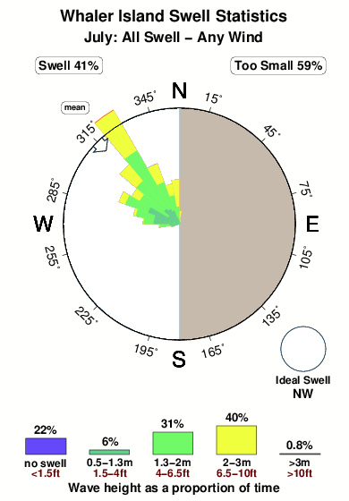
Período Dominante (s) 5 9 - 9 Overall Whaler Island Surf Consistency and Wind Distribution in julio
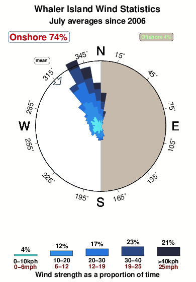


Wind stats for Whaler Island: see the variation in direction and stength by month.
Fotos de Surf
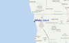
de la galeríaContornos: Carreteras y Ríos: Selecciona un spot desde el menú 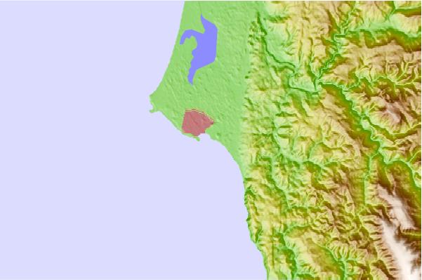
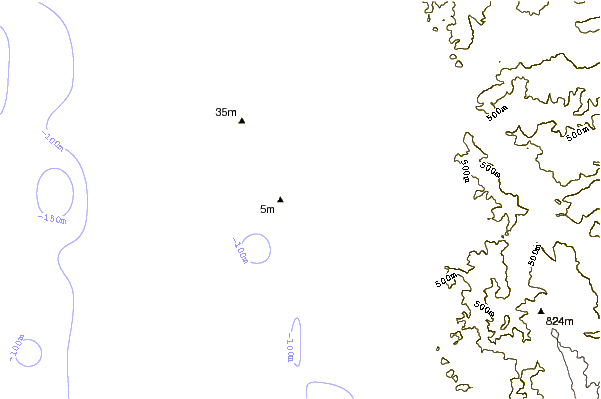
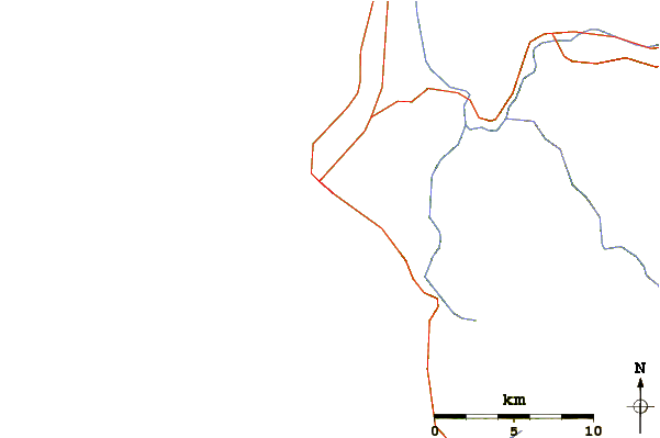
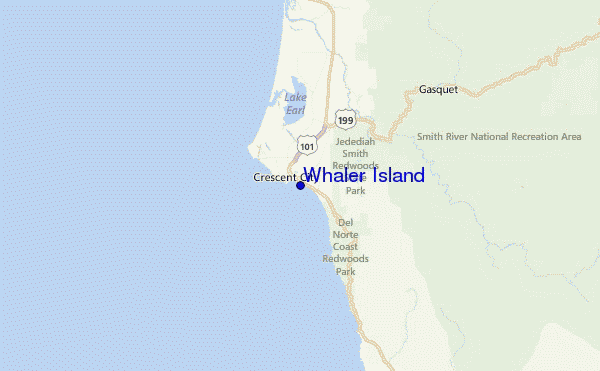
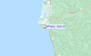
Usa este mapa para navegar hacia las playas de surf de CAL - Del Norte County y estaciones de marea cercanas de Whaler Island
Spots de Surf más cercanos a Whaler Island:
(Clica la ubicación para más detalles)- Closest spot1 mi
- Second closest spot2 mi
- Third closest spot4 mi
- Fourth closest spot5 mi
- Fifth closest spot11 mi
Boyas marinas más cercanas a Whaler Island:
- Closest Boya Marinas12 mi
- Second closest Boya Marinas59 mi
- Third closest Boya Marinas72 mi
- Fourth closest Boya Marinas77 mi
- Fifth closest Boya Marinas104 mi
Estaciones de marea más cercanas a Whaler Island:
- Closest estación de mareaCrescent City0 mi
- Second closest estación de mareaBrookings, Chetco Cove22 mi
- Third closest estación de mareaTrinidad Harbor48 mi
- Fourth closest estación de mareaWedderburn, Rogue River49 mi
- Fifth closest estación de mareaMcKinleyville55 mi
Airports
- The nearest passenger airport to Whaler Island is Chico Muni Airport (CIC) in USA, which is 292 km (181 miles) away (directly).
- The second closest airport to Whaler Island is Beale Afb (Marysville) Airport (BAB), also in USA, 372 km (231 miles) away.
- /breaks/Whaler-Island/forecasts/latest
 Nearest