
Previsiones:

Pronóstico Corto PlazoLluvia ligera (totál 2mm), cayendo mayormente el sábado por la noche. Warm (max 28°C el viernes por la mañana, min 26°C el viernes por la tarde). El viento será generalmente ligero. | ||||||||||||||||||||||||
viernes 31 | sábado 1 | domingo 2 | ||||||||||||||||||||||
1 AM | 4 AM | 7 AM | 10 AM | 1 PM | 4 PM | 7 PM | 10 PM | 1 AM | 4 AM | 7 AM | 10 AM | 1 PM | 4 PM | 7 PM | 10 PM | 1 AM | 4 AM | 7 AM | 10 AM | 1 PM | 4 PM | 7 PM | 10 PM | |
Mapa de Altura de Olas |  | 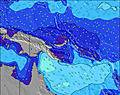 | 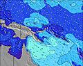 | 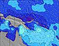 | 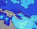 | 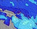 | 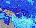 | 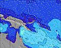 | 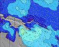 | |||||||||||||||
Oleaje Altura (m) Dirección Período (s) | E 5 | E 6 | ESE 6 | ESE 6 | ESE 6 | E 6 | E 6 | N 12 | ENE 16 | ENE 16 | NE 16 | NE 15 | NE 14 | ENE 14 | NE 13 | NE 13 | NE 13 | ENE 13 | ENE 13 | NE 13 | NE 13 | NE 15 | NE 14 | NE 14 |
Gráfico Olas | ||||||||||||||||||||||||
67 | 62 | 55 | 53 | 42 | 52 | 43 | 11 | 25 | 24 | 64 | 59 | 54 | 80 | 88 | 85 | 85 | 120 | 106 | 79 | 134 | 77 | 158 | 91 | |
Viento (km/h) | ||||||||||||||||||||||||
Estado del Viento Viento de Mar Viento de Mar-Cruzado Cruzado Viento de Tierra-Cruzado Viento de Tierra Cristalino | cross | cross | cross-off | cross-off | cross-on | cross-on | cross-on | cross-on | cross-on | cross | cross | cross | cross-on | cross-on | cross-on | cross-on | cross-on | cross | cross | cross-off | cross-on | cross-on | cross-on | cross-on |
Marea alta | 10:04PM1.22m | 6:43AM1.19m | 10:22PM1.22m | 7:45AM1.16m | 10:38PM1.22m | 8:53AM1.13m | ||||||||||||||||||
Marea baja | 2:36AM1.09m | 2:36PM0.39m | 3:21AM1.03m | 3:13PM0.47m | 4:07AM0.95m | 3:52PM0.56m | ||||||||||||||||||
— | 6:33 | — | — | — | — | — | — | — | 6:33 | — | — | — | — | — | — | — | 6:31 | — | — | — | — | — | — | |
— | — | — | — | — | 6:30 | — | — | — | — | — | — | — | 6:30 | — | — | — | — | — | — | — | 6:30 | — | — | |
mm | — | — | — | — | — | — | — | — | — | — | — | — | — | — | — | — | — | 1 | 1 | — | — | — | — | — |
Temp. °C | 27 | 26 | 25 | 27 | 28 | 27 | 26 | 27 | 27 | 26 | 26 | 27 | 28 | 28 | 27 | 27 | 27 | 26 | 26 | 27 | 28 | 28 | 27 | 27 |
Enfriamiento °C | 29 | 28 | 27 | 30 | 30 | 29 | 28 | 29 | 28 | 27 | 28 | 30 | 31 | 31 | 30 | 30 | 30 | 28 | 29 | 30 | 31 | 31 | 30 | 30 |
Oleaje 1 Altura (m) Dirección Período (s) | ENE 9 | ENE 9 | ENE 9 | ENE 8 | NE 8 | ENE 8 | ENE 8 | N 12 | NNE 12 | ENE 16 | NE 16 | NE 15 | E 8 | E 8 | E 8 | NE 13 | NE 13 | ENE 13 | ENE 13 | E 9 | E 9 | E 9 | NE 14 | NE 14 |
8 | 8 | 7 | 7 | 3 | 6 | 7 | 11 | 14 | 24 | 64 | 59 | 309 | 309 | 264 | 85 | 85 | 120 | 106 | 402 | 421 | 363 | 158 | 91 | |
Oleaje 2 Altura (m) Dirección Período (s) | NW 6 | N 13 | N 13 | N 13 | N 12 | N 12 | N 12 | NE 16 | ENE 16 | NNE 12 | N 11 | N 11 | NE 14 | ENE 14 | NE 13 | N 11 | N 10 | N 10 | N 10 | NE 13 | NE 13 | NE 12 | N 10 | NE 11 |
1 | 3 | 3 | 13 | 3 | 11 | 11 | 10 | 25 | 13 | 9 | 9 | 54 | 80 | 88 | 9 | 8 | 8 | 8 | 79 | 134 | 77 | 7 | 32 | |
Oleaje 3 Altura (m) Dirección Período (s) | N 13 | NW 6 | E 13 | E 13 | E 12 | E 12 | E 12 | E 12 | E 12 | E 12 | N 11 | NNE 11 | NNE 11 | N 11 | NNE 11 | NE 19 | NE 18 | NE 18 | NE 18 | NNE 10 | N 10 | NE 15 | E 16 | N 9 |
3 | 1 | 3 | 3 | 3 | 3 | 3 | 3 | 3 | 3 | 9 | 11 | 12 | 9 | 11 | 15 | 13 | 12 | 12 | 10 | 8 | 56 | 5 | 7 | |
Olas de Viento Altura (m) Dirección Período (s) | E 5 | E 6 | ESE 6 | ESE 6 | ESE 6 | E 6 | E 6 | E 7 | E 7 | E 7 | E 7 | E 8 | — | — | — | E 8 | E 8 | E 8 | E 8 | — | — | — | ESE 9 | E 8 |
67 | 62 | 55 | 53 | 42 | 52 | 43 | 103 | 152 | 181 | 246 | 326 | — | — | — | 257 | 295 | 341 | 358 | — | — | — | 304 | 283 | |
Viento del Tierra o Mar Limpio más proximo | ||||||||||||||||||||||||
Distancia (km) | 935 | 1882 | 1882 | 0 | 1883 | 793 | 1883 | 151 | 182 | 182 | 28 | 28 | 793 | 793 | 793 | 57 | 151 | 151 | 28 | 0 | 793 | 793 | 793 | 151 |
Mejores Olas Previstas en East Sepik | ||||||||||||||||||||||||
Mejores Olas Previstas en Papua New Guinea | ||||||||||||||||||||||||
Busca-Olas Global | ||||||||||||||||||||||||
- Map Icons:
 Break
Break Live Wave Height (m)
 Live Wind Speed (km/h)
 Surf Rating (10 Max)
 Ocean Swells (m)
- Wind Speed (km/h)
GRÁTIS! Un widget de Surf-Forecast.com para tu sitio
Este widget grátis de previsiones de surf y tiempo puede ser añadido a cualquier otro sitio y da un resumen de previsiones de olas para Wewak Point. Solo necesita cortar y pegar el código HTML de abajo en su web. Puede elegir preferencias de idioma y de unidades (métricas o imperiales) para convenir a los usuarios de su sitio. Clica aquí para obtener el código.
 Nearest