
Previsiones:

Pronóstico Corto PlazoLluvia ligera (totál 4mm), cayendo mayormente el lunes por la mañana. Warm (max 28°C el lunes por la mañana, min 27°C el lunes por la noche). El viento será generalmente ligero. | ||||||||||||||||||||||||
lunes 3 | martes 4 | miércoles 5 | ||||||||||||||||||||||
2 AM | 5 AM | 8 AM | 11 AM | 2 PM | 5 PM | 8 PM | 11 PM | 2 AM | 5 AM | 8 AM | 11 AM | 2 PM | 5 PM | 8 PM | 11 PM | 2 AM | 5 AM | 8 AM | 11 AM | 2 PM | 5 PM | 8 PM | 11 PM | |
Mapa de Altura de Olas | 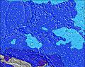 | 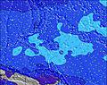 | 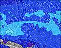 | 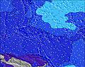 |  | 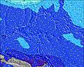 | 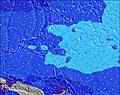 | 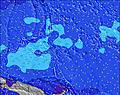 | 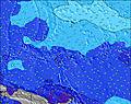 | |||||||||||||||
Oleaje Altura (m) Dirección Período (s) | WNW 9 | WNW 9 | WNW 9 | WNW 9 | WNW 9 | NNW 12 | NNW 12 | NNW 13 | NNW 13 | NNW 13 | NNW 13 | WNW 10 | WNW 10 | WNW 10 | WNW 10 | WNW 9 | WNW 9 | WNW 9 | WNW 9 | WNW 10 | WNW 10 | WNW 10 | WNW 10 | WNW 10 |
Gráfico Olas | ||||||||||||||||||||||||
313 | 292 | 286 | 280 | 250 | 250 | 212 | 298 | 326 | 321 | 307 | 278 | 281 | 275 | 231 | 212 | 207 | 203 | 242 | 290 | 302 | 302 | 296 | 302 | |
Viento (km/h) | ||||||||||||||||||||||||
Estado del Viento Viento de Mar Viento de Mar-Cruzado Cruzado Viento de Tierra-Cruzado Viento de Tierra Cristalino | cross-on | cross-on | cross-on | cross-on | cross-on | cross-on | cross-on | cross-on | cross | cross-off | cross | cross | cross | cross | cross | cross-off | cross-off | cross | cross-off | cross-off | cross | cross | cross-off | cross-off |
Marea alta | 5:33AM1.47m | 6:02PM1.32m | 6:03AM1.35m | 6:38PM1.30m | 6:37AM1.19m | 7:23PM1.25m | ||||||||||||||||||
Marea baja | 11:22PM0.22m | 11:52AM0.12m | 11:58PM0.28m | 12:19PM0.19m | 00:41AM0.37m | 12:50PM0.28m | ||||||||||||||||||
— | 6:03 | — | — | — | — | — | — | — | 6:03 | — | — | — | — | — | — | — | 6:03 | — | — | — | — | — | — | |
— | — | — | — | — | 6:23 | — | — | — | — | — | — | — | 6:23 | — | — | — | — | — | — | — | 6:23 | — | — | |
mm | 1 | 2 | 3 | — | — | — | — | — | 1 | — | — | — | — | — | — | — | — | — | — | — | — | — | — | — |
Temp. °C | 28 | 28 | 28 | 28 | 28 | 28 | 28 | 28 | 27 | 27 | 27 | 28 | 28 | 28 | 28 | 28 | 27 | 27 | 27 | 28 | 28 | 28 | 28 | 28 |
Enfriamiento °C | 31 | 30 | 30 | 31 | 31 | 31 | 31 | 33 | 30 | 31 | 30 | 31 | 30 | 31 | 31 | 31 | 29 | 29 | 30 | 31 | 30 | 30 | 31 | 31 |
Oleaje 1 Altura (m) Dirección Período (s) | WNW 9 | WNW 9 | WNW 9 | WNW 9 | WNW 9 | WNW 9 | WNW 9 | WNW 9 | WNW 9 | WNW 9 | WNW 9 | WNW 10 | WNW 10 | WNW 10 | WNW 10 | WNW 9 | WNW 9 | WNW 9 | WNW 9 | WNW 10 | WNW 10 | WNW 10 | WNW 10 | WNW 10 |
313 | 292 | 286 | 280 | 238 | 217 | 212 | 181 | 190 | 199 | 212 | 275 | 281 | 275 | 231 | 212 | 207 | 203 | 242 | 272 | 302 | 302 | 296 | 302 | |
Oleaje 2 Altura (m) Dirección Período (s) | NNW 12 | NNW 12 | NNW 12 | NNW 12 | NNW 12 | NNW 12 | NNW 12 | NNW 13 | NNW 13 | NNW 13 | NNW 13 | NNW 12 | NNW 12 | NNW 12 | NNW 12 | NNW 12 | NNW 12 | NNW 11 | NNW 11 | NNW 13 | NNW 12 | NNW 12 | NW 12 | NNW 12 |
244 | 244 | 244 | 240 | 250 | 250 | 206 | 298 | 326 | 321 | 307 | 278 | 274 | 230 | 222 | 158 | 150 | 109 | 115 | 290 | 268 | 255 | 212 | 260 | |
Oleaje 3 Altura (m) Dirección Período (s) | SW 6 | SSE 10 | SSE 10 | SE 9 | SSE 9 | SSE 9 | SE 9 | SW 8 | SSE 9 | SE 9 | SW 7 | SW 7 | SSE 8 | SE 8 | SE 8 | SW 7 | SW 7 | S 10 | S 10 | S 10 | S 10 | S 10 | S 10 | SSE 10 |
39 | 122 | 148 | 88 | 108 | 106 | 84 | 55 | 103 | 81 | 42 | 42 | 64 | 72 | 74 | 22 | 21 | 50 | 73 | 73 | 133 | 164 | 161 | 167 | |
Olas de Viento Altura (m) Dirección Período (s) | — | — | — | — | — | — | — | — | — | — | — | — | — | — | — | — | — | — | SW 7 | SSW 3 | SW 6 | — | — | — |
— | — | — | — | — | — | — | — | — | — | — | — | — | — | — | — | — | — | 21 | 3 | 10 | — | — | — | |
Viento del Tierra o Mar Limpio más proximo | ||||||||||||||||||||||||
Distancia (km) | 1607 | 1607 | 1607 | 1607 | 1607 | 1612 | 1607 | 1187 | 1187 | 0 | 1187 | 1187 | 1607 | 1187 | 1187 | 0 | 1187 | 1187 | 0 | 1187 | 1187 | 1187 | 0 | 1187 |
Mejores Olas Previstas en Micronesia - Kosrae | ||||||||||||||||||||||||
Mejores Olas Previstas en Micronesia | ||||||||||||||||||||||||
Busca-Olas Global | ||||||||||||||||||||||||
- Map Icons:
 Break
Break Live Wave Height (m)
 Live Wind Speed (km/h)
 Surf Rating (10 Max)
 Ocean Swells (m)
- Wind Speed (km/h)
GRÁTIS! Un widget de Surf-Forecast.com para tu sitio
Este widget grátis de previsiones de surf y tiempo puede ser añadido a cualquier otro sitio y da un resumen de previsiones de olas para Walung. Solo necesita cortar y pegar el código HTML de abajo en su web. Puede elegir preferencias de idioma y de unidades (métricas o imperiales) para convenir a los usuarios de su sitio. Clica aquí para obtener el código.
 Nearest