
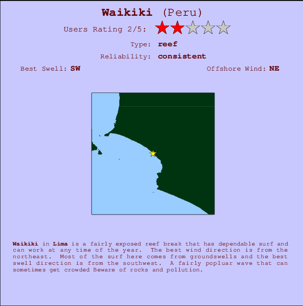
Waikiki Surf Guide
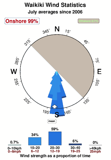
Waikiki in Lima is a fairly exposed reef break that has reliable surf and can work at any time of the year. Offshore winds blow from the northeast. Groundswells are more common than windswells and the best swell direction is from the southwest. A choice of left and right reefs. A fairly popluar wave that can sometimes get crowded Beware of rocks and pollution.
Waikiki Spot Info
| Type: | Rating: | Reliability: | Todays Sea Temp*: |
|---|---|---|---|
| consistent | 21.7°C*ocean temperature recorded from satellite |
Surfing Waikiki:
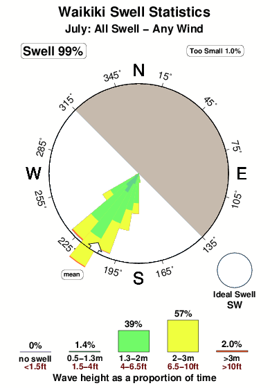
The best conditions reported for surf at Waikiki occur when a Southwest swell combines with an offshore wind direction from the Northeast.

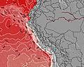
Energía de Olas (poder): 12 horas


Waikiki Surf:
Thursday, 16 July 2026, 09:00 Local time| jueves 16 | ||||
| 10AM | 1PM | 4PM | 7PM | |
| Wave (m) | ||||
| Período (s) | 13 | 13 | 13 | 13 |
| Viento (km/h) | ||||
| Estado del Viento | cross- on |
cross- on |
cross- on |
cross- on |
- /breaks/Waikiki_1/forecasts/latest
Waikiki Surf Guide
Waikiki in Lima is a fairly exposed reef break that has reliable surf and can work at any time of the year. Offshore winds blow from the northeast. Groundswells are more common than windswells and the best swell direction is from the southwest. A choice of left and right reefs. A fairly popluar wave that can sometimes get crowded Beware of rocks and pollution.
Waikiki Spot Info
Type: Rating: Reliability: Todays Sea Temp*:  Reef
Reef 2
2consistent 21.7°C*ocean temperature recorded from satelliteSurfing Waikiki:
The best conditions reported for surf at Waikiki occur when a Southwest swell combines with an offshore wind direction from the Northeast.
Energía de Olas (poder): 12 horas
Usa la barra de navegación de arriba para ver la temperatura del mar en Waikiki, fotografías Waikiki, previsiones detalladas de olas para Waikiki, vientos y previsión del tiempo, webcams para Waikiki, viento actual desde estaciones meteorológicas en Lima y predicciones de marea para Waikiki. Las mapas de olas para Peru enseñarán un mapa grande de Peru y los mares que rodean. Los mapas de olas pueden ser animadas para mostrar diferentes componentes de olas, la altura de ola, la energía de ola, el período, junto con previsiones de viento y del tiempo. Previsiones actuales del tiempo y del estado del mar provienen de boyas marinas de Peru, del barcos que transitan en la zona y de estaciones meteorológicas costeras. Cada página de previsiones tiene un Busca-Olas Regional y Global para localizar las mejores condiciones para surfear en el área de Waikiki.
Waikiki Surf:
Thursday, 16 July 2026, 09:00 Local timejueves 16 10AM 1PM 4PM 7PM Wave (m) Período (s) 13 13 13 13 Viento (km/h) Estado del Viento cross-
oncross-
oncross-
oncross-
on- /breaks/Waikiki_1/forecasts/latest
- /breaks/Waikiki_1/forecasts/latest/six_day
Waikiki Surf Guide
Waikiki in Lima is a fairly exposed reef break that has reliable surf and can work at any time of the year. Offshore winds blow from the northeast. Groundswells are more common than windswells and the best swell direction is from the southwest. A choice of left and right reefs. A fairly popluar wave that can sometimes get crowded Beware of rocks and pollution.
Waikiki Spot Info
Type: Rating: Reliability: Todays Sea Temp*: Reef2consistent 21.7°C*ocean temperature recorded from satelliteSurfing Waikiki:
The best conditions reported for surf at Waikiki occur when a Southwest swell combines with an offshore wind direction from the Northeast.
Energía de Olas (poder): 12 horas
Usa la barra de navegación de arriba para ver la temperatura del mar en Waikiki, fotografías Waikiki, previsiones detalladas de olas para Waikiki, vientos y previsión del tiempo, webcams para Waikiki, viento actual desde estaciones meteorológicas en Lima y predicciones de marea para Waikiki. Las mapas de olas para Peru enseñarán un mapa grande de Peru y los mares que rodean. Los mapas de olas pueden ser animadas para mostrar diferentes componentes de olas, la altura de ola, la energía de ola, el período, junto con previsiones de viento y del tiempo. Previsiones actuales del tiempo y del estado del mar provienen de boyas marinas de Peru, del barcos que transitan en la zona y de estaciones meteorológicas costeras. Cada página de previsiones tiene un Busca-Olas Regional y Global para localizar las mejores condiciones para surfear en el área de Waikiki.
Waikiki Surf:
Thursday, 16 July 2026, 09:00 Local timejueves 16 10AM 1PM 4PM 7PM Wave (m) Período (s) 13 13 13 13 Viento (km/h) Estado del Viento cross-
oncross-
oncross-
oncross-
on- /breaks/Waikiki_1/forecasts/latest
Waikiki Surf Guide
Waikiki in Lima is a fairly exposed reef break that has reliable surf and can work at any time of the year. Offshore winds blow from the northeast. Groundswells are more common than windswells and the best swell direction is from the southwest. A choice of left and right reefs. A fairly popluar wave that can sometimes get crowded Beware of rocks and pollution.
Waikiki Spot Info
Type: Rating: Reliability: Todays Sea Temp*: Reef2consistent 21.7°C*ocean temperature recorded from satelliteSurfing Waikiki:
The best conditions reported for surf at Waikiki occur when a Southwest swell combines with an offshore wind direction from the Northeast.
Energía de Olas (poder): 12 horas
Usa la barra de navegación de arriba para ver la temperatura del mar en Waikiki, fotografías Waikiki, previsiones detalladas de olas para Waikiki, vientos y previsión del tiempo, webcams para Waikiki, viento actual desde estaciones meteorológicas en Lima y predicciones de marea para Waikiki. Las mapas de olas para Peru enseñarán un mapa grande de Peru y los mares que rodean. Los mapas de olas pueden ser animadas para mostrar diferentes componentes de olas, la altura de ola, la energía de ola, el período, junto con previsiones de viento y del tiempo. Previsiones actuales del tiempo y del estado del mar provienen de boyas marinas de Peru, del barcos que transitan en la zona y de estaciones meteorológicas costeras. Cada página de previsiones tiene un Busca-Olas Regional y Global para localizar las mejores condiciones para surfear en el área de Waikiki.
Waikiki Surf:
Thursday, 16 July 2026, 09:00 Local timejueves 16 10AM 1PM 4PM 7PM Wave (m) Período (s) 13 13 13 13 Viento (km/h) Estado del Viento cross-
oncross-
oncross-
oncross-
onTide Times:
Para Lima, a %{dist} %{km} de %{location}.
PROXIMA ES A LAS (hora local) quedan marea alta marea baja Waikiki Tide Times and Tide Chart
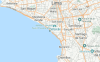
Live Weather:
At La Molina wx, 12 km from Waikiki.
calm
(km/h)
dryAir temperature
21°COverall Waikiki Surf Consistency and Wind Distribution in julio
Fotos de Surf
de la galeríaContornos: Carreteras y Ríos: Selecciona un spot desde el menú 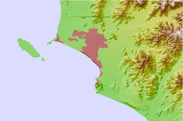
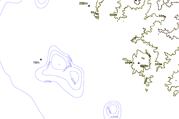
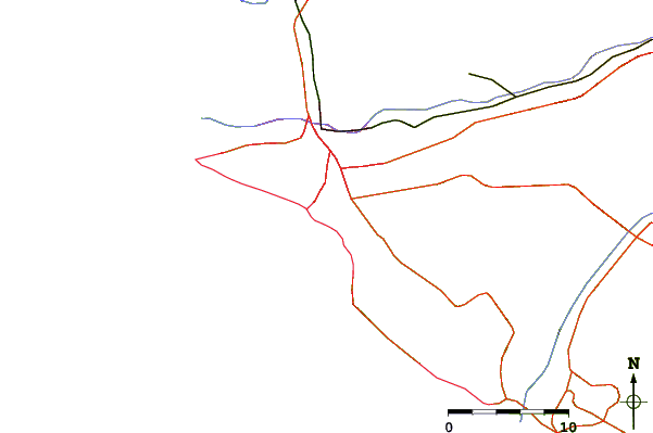
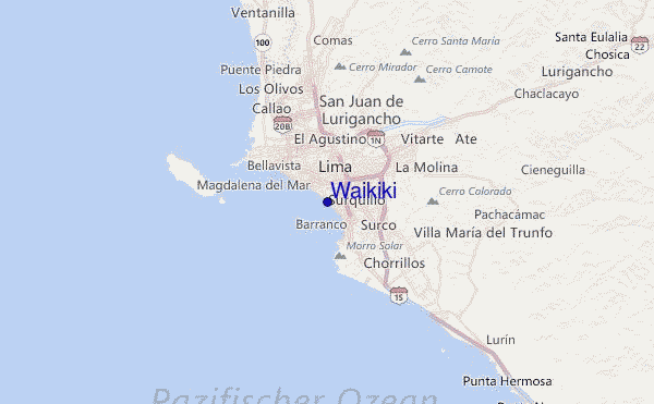
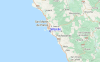
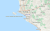
Usa este mapa para navegar hacia las playas de surf de Lima y estaciones de marea cercanas de Waikiki
Spots de Surf más cercanos a Waikiki:
(Clica la ubicación para más detalles)- Closest spot0 mi
- Second closest spot1 mi
- Third closest spot1 mi
- Fourth closest spot1 mi
- Fifth closest spot1 mi
Boyas marinas más cercanas a Waikiki:
- Closest Boya Marinas735 mi
- Second closest Boya Marinas2024 mi
- Third closest Boya Marinas2185 mi
- Fourth closest Boya Marinas2187 mi
- Fifth closest Boya Marinas2193 mi
Estaciones de marea más cercanas a Waikiki:
- Closest estación de mareaLima1 mi
- Second closest estación de mareaCallao9 mi
- Third closest estación de mareaSan Bartolo25 mi
- Fourth closest estación de mareaChilca35 mi
- Fifth closest estación de mareaChancay41 mi
Airports
- The nearest passenger airport to Waikiki is Jorge Chavez International (Lima) Airport (LIM) in Peru, which is 13 km (8 miles) away (directly).
- The second closest airport to Waikiki is Pisco Airport (PIO), also in Peru, 202 km (125 miles) away.
- /breaks/Waikiki_1/forecasts/latest


 Nearest