

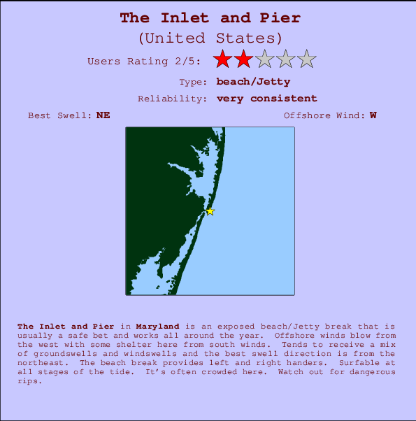
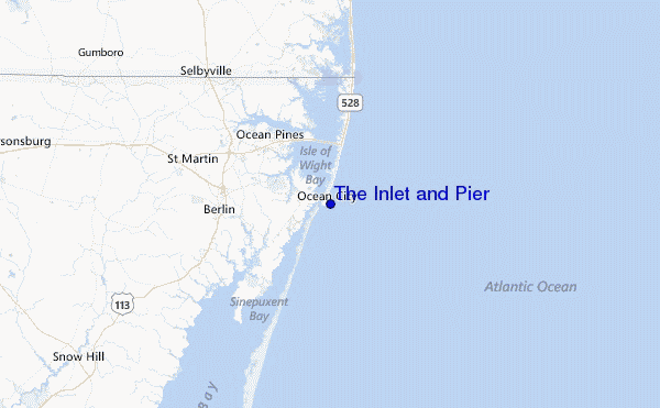
The Inlet and Pier Surf Guide
The Inlet and Pier in Maryland is an exposed beach/Jetty break that has very consistent waves and works all around the year. Works best in offshore winds from the west with some shelter here from south winds. Waves just as likely from local windswells as from distant groundswells and the ideal swell angle is from the northeast. Waves at the beach break both left and right. The quality of the surf isn't affected by the tide. Likely to be crowded if working. Take care of the strong rips here.
The Inlet and Pier Spot Info
| Type: | Rating: | Reliability: | Todays Sea Temp*: |
|---|---|---|---|
| very consistent | 24.0°C*ocean temperature recorded from satellite |
Surfing The Inlet and Pier:
The best conditions reported for surf at The Inlet and Pier occur when a Northeast swell combines with an offshore wind direction from the West.

Energía de Olas (poder): 12 horas


The Inlet and Pier Surf:
Friday, 31 July 2026, 09:15 Local time| viernes 31 | ||||
| 5AM | 8AM | 11AM | 2PM | |
| Wave (m) | ||||
| Período (s) | 5 | 5 | 5 | 5 |
| Viento (km/h) | ||||
| Estado del Viento | cross- off |
cross- off |
cross | on |
- /breaks/The-Inlet-and-Pier/forecasts/latest
The Inlet and Pier Surf Guide
The Inlet and Pier in Maryland is an exposed beach/Jetty break that has very consistent waves and works all around the year. Works best in offshore winds from the west with some shelter here from south winds. Waves just as likely from local windswells as from distant groundswells and the ideal swell angle is from the northeast. Waves at the beach break both left and right. The quality of the surf isn't affected by the tide. Likely to be crowded if working. Take care of the strong rips here.
The Inlet and Pier Spot Info
Type: Rating: Reliability: Todays Sea Temp*:  Beach/jetty
 2
2very consistent 24.0°C*ocean temperature recorded from satelliteSurfing The Inlet and Pier:
The best conditions reported for surf at The Inlet and Pier occur when a Northeast swell combines with an offshore wind direction from the West.
Energía de Olas (poder): 12 horas
Usa la barra de navegación de arriba para ver la temperatura del mar en The Inlet and Pier, fotografías The Inlet and Pier, previsiones detalladas de olas para The Inlet and Pier, vientos y previsión del tiempo, webcams para The Inlet and Pier, viento actual desde estaciones meteorológicas en Maryland y predicciones de marea para The Inlet and Pier. Las mapas de olas para United States enseñarán un mapa grande de United States y los mares que rodean. Los mapas de olas pueden ser animadas para mostrar diferentes componentes de olas, la altura de ola, la energía de ola, el período, junto con previsiones de viento y del tiempo. Previsiones actuales del tiempo y del estado del mar provienen de boyas marinas de United States, del barcos que transitan en la zona y de estaciones meteorológicas costeras. Cada página de previsiones tiene un Busca-Olas Regional y Global para localizar las mejores condiciones para surfear en el área de The Inlet and Pier.
The Inlet and Pier Surf:
Friday, 31 July 2026, 09:15 Local timeviernes 31 5AM 8AM 11AM 2PM Wave (m) Período (s) 5 5 5 5 Viento (km/h) Estado del Viento cross-
offcross-
offcross on - /breaks/The-Inlet-and-Pier/forecasts/latest
- /breaks/The-Inlet-and-Pier/forecasts/latest/six_day
The Inlet and Pier Surf Guide
The Inlet and Pier in Maryland is an exposed beach/Jetty break that has very consistent waves and works all around the year. Works best in offshore winds from the west with some shelter here from south winds. Waves just as likely from local windswells as from distant groundswells and the ideal swell angle is from the northeast. Waves at the beach break both left and right. The quality of the surf isn't affected by the tide. Likely to be crowded if working. Take care of the strong rips here.
The Inlet and Pier Spot Info
Type: Rating: Reliability: Todays Sea Temp*: Beach/jetty2very consistent 24.0°C*ocean temperature recorded from satelliteSurfing The Inlet and Pier:
The best conditions reported for surf at The Inlet and Pier occur when a Northeast swell combines with an offshore wind direction from the West.
Energía de Olas (poder): 12 horas
Usa la barra de navegación de arriba para ver la temperatura del mar en The Inlet and Pier, fotografías The Inlet and Pier, previsiones detalladas de olas para The Inlet and Pier, vientos y previsión del tiempo, webcams para The Inlet and Pier, viento actual desde estaciones meteorológicas en Maryland y predicciones de marea para The Inlet and Pier. Las mapas de olas para United States enseñarán un mapa grande de United States y los mares que rodean. Los mapas de olas pueden ser animadas para mostrar diferentes componentes de olas, la altura de ola, la energía de ola, el período, junto con previsiones de viento y del tiempo. Previsiones actuales del tiempo y del estado del mar provienen de boyas marinas de United States, del barcos que transitan en la zona y de estaciones meteorológicas costeras. Cada página de previsiones tiene un Busca-Olas Regional y Global para localizar las mejores condiciones para surfear en el área de The Inlet and Pier.
The Inlet and Pier Surf:
Friday, 31 July 2026, 09:15 Local timeviernes 31 5AM 8AM 11AM 2PM Wave (m) Período (s) 5 5 5 5 Viento (km/h) Estado del Viento cross-
offcross-
offcross on - /breaks/The-Inlet-and-Pier/forecasts/latest
The Inlet and Pier Surf Guide
The Inlet and Pier in Maryland is an exposed beach/Jetty break that has very consistent waves and works all around the year. Works best in offshore winds from the west with some shelter here from south winds. Waves just as likely from local windswells as from distant groundswells and the ideal swell angle is from the northeast. Waves at the beach break both left and right. The quality of the surf isn't affected by the tide. Likely to be crowded if working. Take care of the strong rips here.
The Inlet and Pier Spot Info
Type: Rating: Reliability: Todays Sea Temp*: Beach/jetty2very consistent 24.0°C*ocean temperature recorded from satelliteSurfing The Inlet and Pier:
The best conditions reported for surf at The Inlet and Pier occur when a Northeast swell combines with an offshore wind direction from the West.
Energía de Olas (poder): 12 horas
Usa la barra de navegación de arriba para ver la temperatura del mar en The Inlet and Pier, fotografías The Inlet and Pier, previsiones detalladas de olas para The Inlet and Pier, vientos y previsión del tiempo, webcams para The Inlet and Pier, viento actual desde estaciones meteorológicas en Maryland y predicciones de marea para The Inlet and Pier. Las mapas de olas para United States enseñarán un mapa grande de United States y los mares que rodean. Los mapas de olas pueden ser animadas para mostrar diferentes componentes de olas, la altura de ola, la energía de ola, el período, junto con previsiones de viento y del tiempo. Previsiones actuales del tiempo y del estado del mar provienen de boyas marinas de United States, del barcos que transitan en la zona y de estaciones meteorológicas costeras. Cada página de previsiones tiene un Busca-Olas Regional y Global para localizar las mejores condiciones para surfear en el área de The Inlet and Pier.
The Inlet and Pier Surf:
Friday, 31 July 2026, 09:15 Local timeviernes 31 5AM 8AM 11AM 2PM Wave (m) Período (s) 5 5 5 5 Viento (km/h) Estado del Viento cross-
offcross-
offcross on Tide Times:
En Ocean City (fishing pier), Maryland (0 km).
PROXIMA ES A LAS (hora local) quedan marea alta marea baja The Inlet and Pier Tide Times and Tide Chart
Live Weather:
At BUOY-OCIM2, 1 km from The Inlet and Pier.
calm
(km/h)Air temperature
22.6°COverall The Inlet and Pier Surf Consistency and Wind Distribution in julio


Wind stats for The Inlet and Pier: see the variation in direction and stength by month.
Fotos de Surf
de la galeríaContornos: Carreteras y Ríos: Selecciona un spot desde el menú 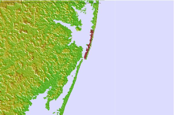
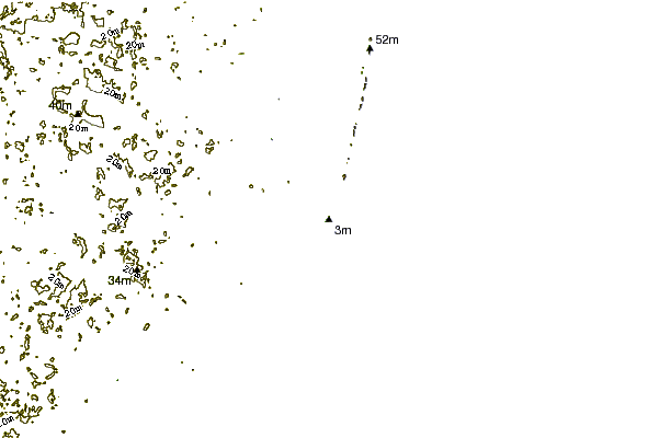
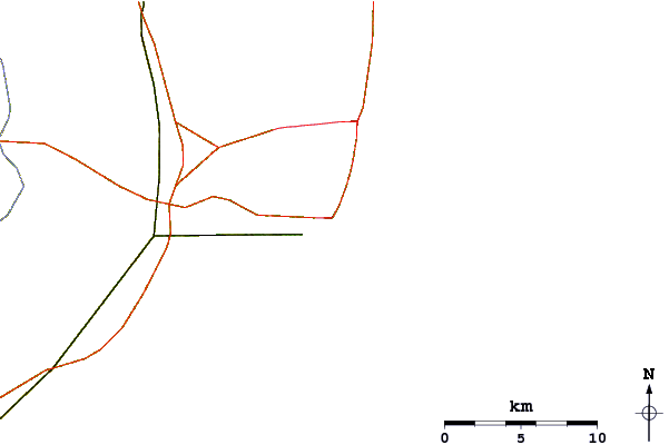
Usa este mapa para navegar hacia las playas de surf de Maryland y estaciones de marea cercanas de The Inlet and Pier
Spots de Surf más cercanos a The Inlet and Pier:
(Clica la ubicación para más detalles)- Closest spot1 mi
- Second closest spot2 mi
- Third closest spot2 mi
- Fourth closest spot5 mi
- Fifth closest spot6 mi
Boyas marinas más cercanas a The Inlet and Pier:
- Closest Boya Marinas22 mi
- Second closest Boya Marinas42 mi
- Third closest Boya Marinas71 mi
- Fourth closest Boya Marinas74 mi
- Fifth closest Boya Marinas83 mi
Estaciones de marea más cercanas a The Inlet and Pier:
- Closest estación de mareaOcean City (fishing pier)0 mi
- Second closest estación de mareaOcean City Inlet1 mi
- Third closest estación de mareaOcean City, Isle of Wight Bay1 mi
- Fourth closest estación de mareaKeydash, Isle of Wight Bay1 mi
- Fifth closest estación de mareaOcean Pines6 mi
Airports
- The closest passenger airport to The Inlet and Pier is Salisbury Ocean City Wicomico Rgnl Airport (SBY) in USA, 37 km (23 miles) away (directly).
- The second nearest airport to The Inlet and Pier is Wallops Flight Facility Airport (WAL), also in USA, 55 km (34 miles) away.
- Third is Cape May Co (Wildwood) Airport (WWD) in USA, 77 km (48 miles) away.
- Dover Afb Airport (DOV) in USA is 95 km (59 miles) away.
- Millville Muni Airport (MIV), also in USA is the fifth nearest airport to The Inlet and Pier and is 116 km (72 miles) away.
- /breaks/The-Inlet-and-Pier/forecasts/latest


 Nearest