
Previsiones:

Pronóstico Corto PlazoAlgo de llovizna, más pesada durante la mañana de lunes. Warm (max 29°C el lunes por la tarde, min 18°C el domingo por la mañana). Vientos decreciente (vientos frescos desde el NNE el domingo por la tarde, calma por la tarde de lunes). | ||||||||||||||||||||||||
domingo 2 | lunes 3 | martes 4 | ||||||||||||||||||||||
2 AM | 5 AM | 8 AM | 11 AM | 2 PM | 5 PM | 8 PM | 11 PM | 2 AM | 5 AM | 8 AM | 11 AM | 2 PM | 5 PM | 8 PM | 11 PM | 2 AM | 5 AM | 8 AM | 11 AM | 2 PM | 5 PM | 8 PM | 11 PM | |
Mapa de Altura de Olas |  |  |  |  |  |  |  | 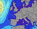 |  | |||||||||||||||
Oleaje Altura (m) Dirección Período (s) | NNW 5 | NNW 5 | NNW 5 | NNW 6 | NNW 6 | N 4 | N 4 | NNE 4 | NNE 5 | NNE 5 | NNW 8 | NNE 5 | NNW 8 | NNW 8 | N 8 | NNW 8 | NNW 8 | NNW 7 | NNW 8 | NNW 9 | NNW 9 | NNW 9 | NNW 9 | WSW 5 |
Gráfico Olas | ||||||||||||||||||||||||
6 | 6 | 6 | 6 | 10 | 16 | 40 | 27 | 26 | 8 | 6 | 3 | 6 | 12 | 19 | 6 | 11 | 11 | 12 | 8 | 16 | 16 | 15 | 19 | |
Viento (km/h) | ||||||||||||||||||||||||
Estado del Viento Viento de Mar Viento de Mar-Cruzado Cruzado Viento de Tierra-Cruzado Viento de Tierra Cristalino | cross-off | cross-off | cross-off | cross-off | cross-on | cross-on | cross | cross | cross-off | cross-off | cross-off | cross-off | glassy | on | cross-on | cross-off | cross-off | cross-off | cross | cross | cross | cross-on | cross | cross |
Marea alta | 6:48AM2.45m | 6:56PM2.28m | 7:27AM2.45m | 7:37PM2.26m | 8:08AM2.41m | 8:20PM2.19m | ||||||||||||||||||
Marea baja | 1:54AM0.26m | 2:34PM0.57m | 2:30AM0.28m | 3:12PM0.59m | 3:02AM0.34m | 3:47PM0.63m | ||||||||||||||||||
— | 6:05 | — | — | — | — | — | — | — | 6:07 | — | — | — | — | — | — | — | 6:07 | — | — | — | — | — | — | |
— | — | — | — | — | — | 9:31 | — | — | — | — | — | — | — | 9:30 | — | — | — | — | — | — | — | 9:29 | — | |
mm | — | — | — | — | — | — | — | — | — | — | — | 1 | — | — | — | — | — | — | — | — | — | — | — | — |
Temp. °C | 19 | 18 | 18 | 21 | 23 | 23 | 24 | 21 | 22 | 21 | 19 | 23 | 29 | 29 | 27 | 28 | 27 | 24 | 22 | 22 | 22 | 24 | 23 | 23 |
Enfriamiento °C | 17 | 16 | 16 | 18 | 18 | 17 | 18 | 15 | 16 | 16 | 15 | 21 | 29 | 27 | 26 | 26 | 26 | 23 | 21 | 19 | 19 | 21 | 22 | 23 |
Oleaje 1 Altura (m) Dirección Período (s) | NNW 5 | NNW 5 | NNW 5 | NNW 6 | — | — | — | N 8 | N 9 | NNE 5 | NNE 5 | NNE 5 | NNE 5 | — | — | NNW 8 | NNW 8 | NNW 7 | NNW 8 | NNW 7 | NNW 9 | NNW 9 | NNW 9 | NNW 8 |
6 | 6 | 6 | 6 | — | — | — | 1 | 2 | 8 | 4 | 2 | 2 | — | — | 6 | 11 | 11 | 12 | 5 | 16 | 16 | 15 | 14 | |
Oleaje 2 Altura (m) Dirección Período (s) | — | — | — | — | — | — | — | — | — | NNW 6 | NNW 6 | NNW 5 | NNW 5 | — | — | N 5 | — | N 6 | N 6 | NNW 9 | — | — | — | — |
— | — | — | — | — | — | — | — | — | 7 | 3 | 3 | 3 | — | — | 1 | — | 1 | 1 | 8 | — | — | — | — | |
Oleaje 3 Altura (m) Dirección Período (s) | — | — | — | — | — | — | — | — | — | N 8 | NNW 8 | NW 8 | NNW 8 | — | — | — | N 6 | — | — | N 6 | — | — | — | — |
— | — | — | — | — | — | — | — | — | 1 | 6 | 3 | 6 | — | — | — | 1 | — | — | 1 | — | — | — | — | |
Olas de Viento Altura (m) Dirección Período (s) | — | — | — | — | NNW 6 | N 4 | N 4 | NNE 4 | NNE 5 | E 3 | E 3 | ESE 3 | — | NNW 8 | N 8 | N 3 | — | — | — | WSW 2 | WSW 3 | WSW 4 | WSW 4 | WSW 5 |
— | — | — | — | 10 | 16 | 40 | 27 | 26 | 3 | 4 | 2 | — | 12 | 19 | 1 | — | — | — | 1 | 4 | 5 | 8 | 19 | |
Viento del Tierra o Mar Limpio más proximo | ||||||||||||||||||||||||
Distancia (km) | 617 | 718 | 700 | 753 | 721 | 700 | 684 | 651 | 517 | 583 | 498 | 517 | 583 | 583 | 583 | 583 | 195 | 195 | 180 | 301 | 334 | 356 | 334 | 334 |
Mejores Olas Previstas en Netherlands | ||||||||||||||||||||||||
Mejores Olas Previstas en Netherlands | ||||||||||||||||||||||||
Busca-Olas Global | ||||||||||||||||||||||||
- Map Icons:
 Break
Break Live Wave Height (m)
 Live Wind Speed (km/h)
 Surf Rating (10 Max)
 Ocean Swells (m)
- Wind Speed (km/h)
GRÁTIS! Un widget de Surf-Forecast.com para tu sitio
Este widget grátis de previsiones de surf y tiempo puede ser añadido a cualquier otro sitio y da un resumen de previsiones de olas para Ter Heijde. Solo necesita cortar y pegar el código HTML de abajo en su web. Puede elegir preferencias de idioma y de unidades (métricas o imperiales) para convenir a los usuarios de su sitio. Clica aquí para obtener el código.
 Nearest