
Previsiones:

Pronóstico Corto PlazoFuerte lluvia (totál 25mm), más pesada durante la mañana de lunes. Warm (max 20°C el lunes por la tarde, min 17°C el lunes por la mañana). Vientos crecientes (calma el lunes por la mañana, vientos fuertes desde el SE por la noche de miércoles). | |||||||||||||||||||||||
lunes 3 | martes 4 | miércoles 5 | |||||||||||||||||||||
3 AM | 6 AM | 9 AM | 12 PM | 3 PM | 6 PM | 9 PM | 12 AM | 3 AM | 6 AM | 9 AM | 12 PM | 3 PM | 6 PM | 9 PM | 12 AM | 3 AM | 6 AM | 9 AM | 12 PM | 3 PM | 6 PM | 9 PM | |
Mapa de Altura de Olas |  | 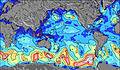 | 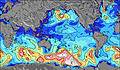 | 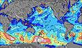 | 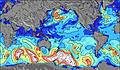 | 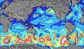 | 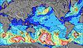 | 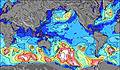 | 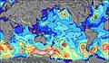 | ||||||||||||||
Oleaje Altura (m) Dirección Período (s) | SW 13 | SW 13 | SW 17 | SW 16 | SW 16 | SW 16 | SW 16 | SW 15 | SW 15 | SW 14 | SW 14 | NNW 7 | SW 14 | SW 14 | SW 13 | SW 13 | SW 13 | SW 8 | SW 8 | SW 8 | NW 6 | SW 16 | SW 15 |
Gráfico Olas | |||||||||||||||||||||||
757 | 828 | 1489 | 3336 | 3137 | 3059 | 2881 | 2557 | 2061 | 1626 | 1407 | 482 | 1170 | 816 | 632 | 552 | 494 | 528 | 803 | 354 | 363 | 783 | 733 | |
Viento (km/h) | |||||||||||||||||||||||
Estado del Viento Viento de Mar Viento de Mar-Cruzado Cruzado Viento de Tierra-Cruzado Viento de Tierra Cristalino | cross | glassy | glassy | off | cross-off | cross-on | on | cross-on | cross-on | cross | cross-on | cross-on | cross-on | cross-on | cross-on | cross-on | cross-on | cross | cross-off | cross | cross-off | cross-off | cross-off |
Marea alta | 8:37AM0.57m | 9:10PM0.59m | 9:35AM0.52m | 10:12PM0.59m | 10:43AM0.49m | ||||||||||||||||||
Marea baja | 2:09AM0.24m | 2:31PM0.22m | 3:13AM0.26m | 3:31PM0.25m | 4:29AM0.27m | 4:41PM0.26m | |||||||||||||||||
— | 7:56 | — | — | — | — | — | — | — | 7:56 | — | — | — | — | — | — | — | 7:54 | — | — | — | — | — | |
— | — | — | — | — | 6:51 | — | — | — | — | — | — | — | 6:51 | — | — | — | — | — | — | — | 6:52 | — | |
mm | 14 | 4 | 6 | 1 | — | 1 | — | 1 | 1 | 1 | 2 | 1 | 2 | 1 | — | — | — | — | — | 2 | 3 | 2 | — |
Temp. °C | 18 | 17 | 17 | 18 | 19 | 20 | 20 | 20 | 20 | 19 | 19 | 20 | 20 | 20 | 20 | 18 | 18 | 19 | 19 | 19 | 20 | 20 | 20 |
Enfriamiento °C | 17 | 18 | 19 | 18 | 18 | 21 | 18 | 17 | 15 | 16 | 12 | 14 | 16 | 17 | 15 | 11 | 13 | 16 | 15 | 15 | 17 | 16 | 15 |
Oleaje 1 Altura (m) Dirección Período (s) | NNW 7 | NW 7 | SSW 13 | SW 16 | SW 16 | SW 16 | SW 16 | SW 15 | SW 15 | SE 9 | SE 10 | SE 10 | SE 10 | SSE 10 | SSE 10 | SSE 10 | SSE 10 | SE 10 | SE 10 | SE 10 | SSE 10 | SSE 10 | SSE 10 |
220 | 371 | 932 | 3336 | 3137 | 3059 | 2881 | 2557 | 2061 | 965 | 1235 | 1104 | 1200 | 1514 | 1690 | 1856 | 1920 | 1136 | 916 | 849 | 882 | 1126 | 1050 | |
Oleaje 2 Altura (m) Dirección Período (s) | W 8 | SW 13 | SW 17 | WNW 8 | NW 7 | SSE 8 | SSE 8 | SSE 8 | SSE 9 | NW 8 | SW 14 | SW 14 | SW 14 | SW 14 | SW 13 | SW 13 | SW 13 | SW 13 | SW 12 | SW 8 | SW 8 | SW 16 | SW 15 |
259 | 828 | 1489 | 178 | 340 | 315 | 403 | 551 | 707 | 543 | 1407 | 1303 | 1170 | 816 | 632 | 552 | 494 | 418 | 392 | 354 | 235 | 783 | 733 | |
Oleaje 3 Altura (m) Dirección Período (s) | SW 13 | SW 16 | SSE 7 | N 7 | SSE 8 | WSW 11 | W 11 | NW 8 | NW 8 | SW 14 | NNW 7 | NW 7 | NNW 7 | NE 8 | NE 8 | NNW 6 | N 5 | S 12 | S 12 | SW 12 | SW 13 | SW 8 | SW 8 |
757 | 1097 | 132 | 131 | 191 | 23 | 20 | 358 | 461 | 1626 | 382 | 312 | 209 | 16 | 15 | 55 | 21 | 138 | 100 | 325 | 238 | 125 | 77 | |
Olas de Viento Altura (m) Dirección Período (s) | NW 7 | — | NW 7 | NW 7 | — | NW 7 | NW 8 | — | — | — | — | NNW 7 | NNW 7 | NNW 6 | NNW 6 | NNW 6 | NW 6 | SW 8 | SW 8 | WNW 6 | NW 6 | N 6 | N 6 |
396 | — | 346 | 418 | — | 349 | 358 | — | — | — | — | 482 | 352 | 118 | 100 | 212 | 137 | 528 | 803 | 211 | 363 | 314 | 463 | |
Viento del Tierra o Mar Limpio más proximo | |||||||||||||||||||||||
Distancia (km) | 3641 | 0 | 0 | 0 | 0 | 4 | 5 | 6 | 13 | 7 | 3547 | 3547 | 3531 | 3531 | 3531 | 3531 | 3594 | 4 | 4 | 3643 | 4 | 3610 | 3610 |
Mejores Olas Previstas en Easter Island | |||||||||||||||||||||||
Mejores Olas Previstas en Chile | |||||||||||||||||||||||
Busca-Olas Global | |||||||||||||||||||||||
- Map Icons:
 Break
Break Live Wave Height (m)
 Live Wind Speed (km/h)
 Surf Rating (10 Max)
 Ocean Swells (m)
- Wind Speed (km/h)
GRÁTIS! Un widget de Surf-Forecast.com para tu sitio
Este widget grátis de previsiones de surf y tiempo puede ser añadido a cualquier otro sitio y da un resumen de previsiones de olas para Tahai. Solo necesita cortar y pegar el código HTML de abajo en su web. Puede elegir preferencias de idioma y de unidades (métricas o imperiales) para convenir a los usuarios de su sitio. Clica aquí para obtener el código.
 Nearest