
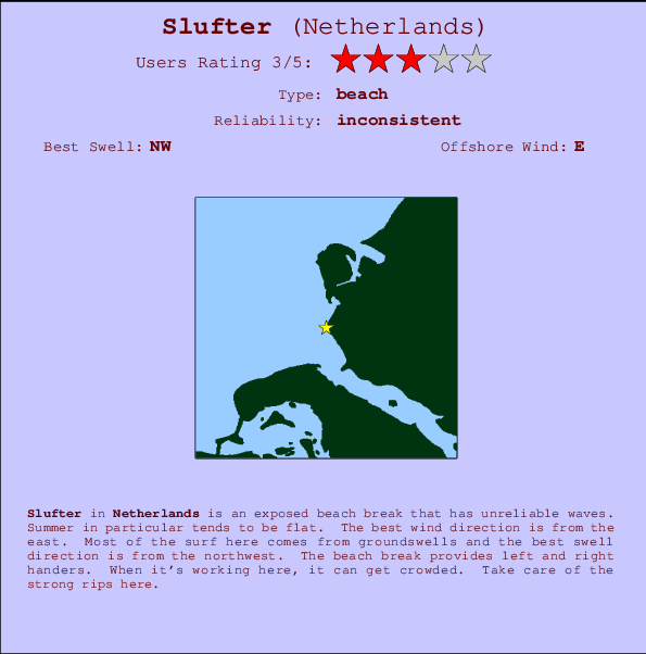
Slufter Surf Guide
Slufter on the West Coast is an exposed beach break that does not work very often. Summer in particular tends to be flat. The best wind direction is from the east. Waves just as likely from local windswells as from distant groundswells and the best swell direction is from the northwest. The beach breaks offer lefts and rights. It's sometimes crowded here. Watch out for dangerous rips.
Slufter Spot Info
| Type: | Rating: | Reliability: | Todays Sea Temp*: |
|---|---|---|---|
| inconsistent | 21.7°C*ocean temperature recorded from satellite |
Surfing Slufter:
The best conditions reported for surf at Slufter occur when a Northwest swell combines with an offshore wind direction from the East.
Energía de Olas (poder): 12 horas


Slufter Surf:
Thursday, 16 July 2026, 01:41 Local time| mié | jueves 16 | |||
| 11PM | 2AM | 5AM | 8AM | |
| Wave (m) | ||||
| Período (s) | 5 | - | 5 | 5 |
| Viento (km/h) | ||||
| Estado del Viento | cross- off |
cross- off |
cross- off |
cross- off |
- /breaks/Slufter/forecasts/latest
Slufter Surf Guide
Slufter on the West Coast is an exposed beach break that does not work very often. Summer in particular tends to be flat. The best wind direction is from the east. Waves just as likely from local windswells as from distant groundswells and the best swell direction is from the northwest. The beach breaks offer lefts and rights. It's sometimes crowded here. Watch out for dangerous rips.
Slufter Spot Info
Type: Rating: Reliability: Todays Sea Temp*:  Beach
Beach 3
3inconsistent 21.7°C*ocean temperature recorded from satelliteSurfing Slufter:
The best conditions reported for surf at Slufter occur when a Northwest swell combines with an offshore wind direction from the East.
Energía de Olas (poder): 12 horas
Usa la barra de navegación de arriba para ver la temperatura del mar en Slufter, fotografías Slufter, previsiones detalladas de olas para Slufter, vientos y previsión del tiempo, webcams para Slufter, viento actual desde estaciones meteorológicas en Netherlands y predicciones de marea para Slufter. Las mapas de olas para Netherlands enseñarán un mapa grande de Netherlands y los mares que rodean. Los mapas de olas pueden ser animadas para mostrar diferentes componentes de olas, la altura de ola, la energía de ola, el período, junto con previsiones de viento y del tiempo. Previsiones actuales del tiempo y del estado del mar provienen de boyas marinas de Netherlands, del barcos que transitan en la zona y de estaciones meteorológicas costeras. Cada página de previsiones tiene un Busca-Olas Regional y Global para localizar las mejores condiciones para surfear en el área de Slufter.
Slufter Surf:
Thursday, 16 July 2026, 01:41 Local timemié jueves 16 11PM 2AM 5AM 8AM Wave (m) Período (s) 5 - 5 5 Viento (km/h) Estado del Viento cross-
offcross-
offcross-
offcross-
off- /breaks/Slufter/forecasts/latest
- /breaks/Slufter/forecasts/latest/six_day
Slufter Surf Guide
Slufter on the West Coast is an exposed beach break that does not work very often. Summer in particular tends to be flat. The best wind direction is from the east. Waves just as likely from local windswells as from distant groundswells and the best swell direction is from the northwest. The beach breaks offer lefts and rights. It's sometimes crowded here. Watch out for dangerous rips.
Slufter Spot Info
Type: Rating: Reliability: Todays Sea Temp*: Beach3inconsistent 21.7°C*ocean temperature recorded from satelliteSurfing Slufter:
The best conditions reported for surf at Slufter occur when a Northwest swell combines with an offshore wind direction from the East.
Energía de Olas (poder): 12 horas
Usa la barra de navegación de arriba para ver la temperatura del mar en Slufter, fotografías Slufter, previsiones detalladas de olas para Slufter, vientos y previsión del tiempo, webcams para Slufter, viento actual desde estaciones meteorológicas en Netherlands y predicciones de marea para Slufter. Las mapas de olas para Netherlands enseñarán un mapa grande de Netherlands y los mares que rodean. Los mapas de olas pueden ser animadas para mostrar diferentes componentes de olas, la altura de ola, la energía de ola, el período, junto con previsiones de viento y del tiempo. Previsiones actuales del tiempo y del estado del mar provienen de boyas marinas de Netherlands, del barcos que transitan en la zona y de estaciones meteorológicas costeras. Cada página de previsiones tiene un Busca-Olas Regional y Global para localizar las mejores condiciones para surfear en el área de Slufter.
Slufter Surf:
Thursday, 16 July 2026, 01:41 Local timemié jueves 16 11PM 2AM 5AM 8AM Wave (m) Período (s) 5 - 5 5 Viento (km/h) Estado del Viento cross-
offcross-
offcross-
offcross-
off- /breaks/Slufter/forecasts/latest
Slufter Surf Guide
Slufter on the West Coast is an exposed beach break that does not work very often. Summer in particular tends to be flat. The best wind direction is from the east. Waves just as likely from local windswells as from distant groundswells and the best swell direction is from the northwest. The beach breaks offer lefts and rights. It's sometimes crowded here. Watch out for dangerous rips.
Slufter Spot Info
Type: Rating: Reliability: Todays Sea Temp*: Beach3inconsistent 21.7°C*ocean temperature recorded from satelliteSurfing Slufter:
The best conditions reported for surf at Slufter occur when a Northwest swell combines with an offshore wind direction from the East.
Energía de Olas (poder): 12 horas
Usa la barra de navegación de arriba para ver la temperatura del mar en Slufter, fotografías Slufter, previsiones detalladas de olas para Slufter, vientos y previsión del tiempo, webcams para Slufter, viento actual desde estaciones meteorológicas en Netherlands y predicciones de marea para Slufter. Las mapas de olas para Netherlands enseñarán un mapa grande de Netherlands y los mares que rodean. Los mapas de olas pueden ser animadas para mostrar diferentes componentes de olas, la altura de ola, la energía de ola, el período, junto con previsiones de viento y del tiempo. Previsiones actuales del tiempo y del estado del mar provienen de boyas marinas de Netherlands, del barcos que transitan en la zona y de estaciones meteorológicas costeras. Cada página de previsiones tiene un Busca-Olas Regional y Global para localizar las mejores condiciones para surfear en el área de Slufter.
Slufter Surf:
Thursday, 16 July 2026, 01:41 Local timemié jueves 16 11PM 2AM 5AM 8AM Wave (m) Período (s) 5 - 5 5 Viento (km/h) Estado del Viento cross-
offcross-
offcross-
offcross-
offTide Times:
Para Haringvlietsluizen, Netherlands, a %{dist} %{km} de %{location}.
PROXIMA ES A LAS (hora local) quedan marea alta marea baja Slufter Tide Times and Tide Chart
Live Weather:
At BeachLine Events, 13 km from Slufter.
wind obs. (13 kph from 313 degs) was rejected
(km/h)Air temperature
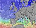
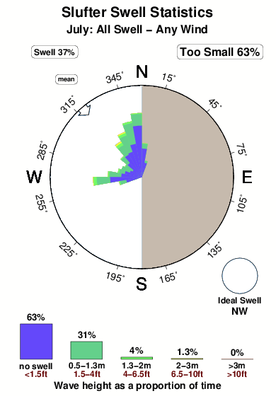
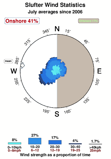
20.2°COverall Slufter Surf Consistency and Wind Distribution in julio
Fotos de Surf
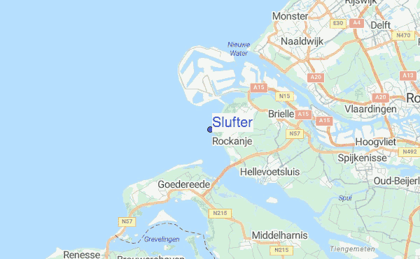
de la galeríaContornos: Carreteras y Ríos: Selecciona un spot desde el menú 
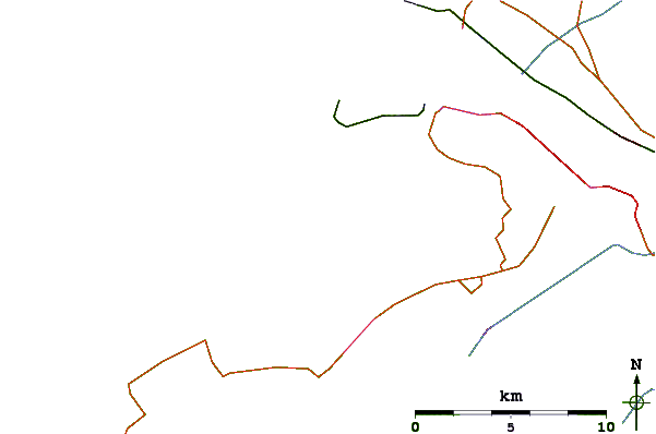
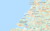
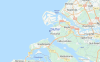
Usa este mapa para navegar hacia las playas de surf de Netherlands y estaciones de marea cercanas de Slufter
Spots de Surf más cercanos a Slufter:
(Clica la ubicación para más detalles)- Closest spot1 mi
- Second closest spot2 mi
- Third closest spot6 mi
- Fourth closest spot11 mi
- Fifth closest spot13 mi
Boyas marinas más cercanas a Slufter:
- Closest Boya Marinas82 mi
- Second closest Boya Marinas98 mi
- Third closest Boya Marinas99 mi
- Fourth closest Boya Marinas99 mi
- Fifth closest Boya Marinas99 mi
Estaciones de marea más cercanas a Slufter:
- Closest estación de mareaHaringvlietsluizen4 mi
- Second closest estación de mareaGoedereede5 mi
- Third closest estación de mareaHaringvliet 107 mi
- Fourth closest estación de mareaHellevoetsluis7 mi
- Fifth closest estación de mareaHoek van Holland7 mi
Airports
- The closest passenger airport to Slufter is Rotterdam Airport (RTM) in Netherlands, 30 km (19 miles) away (directly).
- The second nearest airport to Slufter is Valkenburg Airport (LID), also in Netherlands, 42 km (26 miles) away.
- Third is Woensdrecht Airport (WOE) in Netherlands, 53 km (33 miles) away.
- Schiphol (Amsterdam) Airport (AMS) in Netherlands is 69 km (43 miles) away.
- Deurne (Antwerp) Airport (ANR) in Belgium is the fifth nearest airport to Slufter and is 83 km (52 miles) away.
- /breaks/Slufter/forecasts/latest


 Nearest