

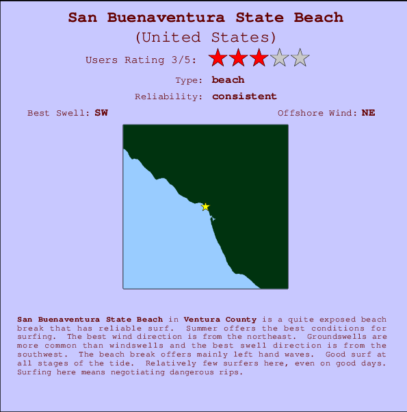
San Buenaventura State Beach Surf Guide
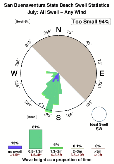
San Buenaventura State Beach in Ventura is a fairly exposed beach break that has reliable surf. Summer offers the best conditions for surfing. Offshore winds blow from the northeast. Tends to receive distant groundswells and the optimum swell angle is from the southwest. Waves at the beach tend to peel to the left. Surfable at all stages of the tide. It very rarely gets crowded here. Dangerous rips are a hazard of surfing here.
San Buenaventura State Beach Spot Info
| Type: | Rating: | Reliability: | Todays Sea Temp*: |
|---|---|---|---|
| consistent | 21.1°C*ocean temperature recorded from satellite |
Surfing San Buenaventura State Beach:
The best conditions reported for surf at San Buenaventura State Beach occur when a Southwest swell combines with an offshore wind direction from the Northeast.

Energía de Olas (poder): 12 horas


San Buenaventura State Beach Surf:
Wednesday, 29 July 2026, 00:47 Local time| mar | mié | |||
| 8PM | 11PM | 2AM | 5AM | |
| Wave (m) | ||||
| Período (s) | 17 | 16 | 16 | 16 |
| Viento (km/h) | ||||
| Estado del Viento | cross- on |
glass | glass | glass |
- /breaks/San-Buenaventura-State-Beach/forecasts/latest
San Buenaventura State Beach Surf Guide
San Buenaventura State Beach in Ventura is a fairly exposed beach break that has reliable surf. Summer offers the best conditions for surfing. Offshore winds blow from the northeast. Tends to receive distant groundswells and the optimum swell angle is from the southwest. Waves at the beach tend to peel to the left. Surfable at all stages of the tide. It very rarely gets crowded here. Dangerous rips are a hazard of surfing here.
San Buenaventura State Beach Spot Info
Type: Rating: Reliability: Todays Sea Temp*:  Beach
Beach 3
3consistent 21.1°C*ocean temperature recorded from satelliteSurfing San Buenaventura State Beach:
The best conditions reported for surf at San Buenaventura State Beach occur when a Southwest swell combines with an offshore wind direction from the Northeast.
Energía de Olas (poder): 12 horas
Usa la barra de navegación de arriba para ver la temperatura del mar en San Buenaventura State Beach, fotografías San Buenaventura State Beach, previsiones detalladas de olas para San Buenaventura State Beach, vientos y previsión del tiempo, webcams para San Buenaventura State Beach, viento actual desde estaciones meteorológicas en CAL - Ventura y predicciones de marea para San Buenaventura State Beach. Las mapas de olas para United States enseñarán un mapa grande de United States y los mares que rodean. Los mapas de olas pueden ser animadas para mostrar diferentes componentes de olas, la altura de ola, la energía de ola, el período, junto con previsiones de viento y del tiempo. Previsiones actuales del tiempo y del estado del mar provienen de boyas marinas de United States, del barcos que transitan en la zona y de estaciones meteorológicas costeras. Cada página de previsiones tiene un Busca-Olas Regional y Global para localizar las mejores condiciones para surfear en el área de San Buenaventura State Beach.
San Buenaventura State Beach Surf:
Wednesday, 29 July 2026, 00:47 Local timemar mié 8PM 11PM 2AM 5AM Wave (m) Período (s) 17 16 16 16 Viento (km/h) Estado del Viento cross-
onglass glass glass - /breaks/San-Buenaventura-State-Beach/forecasts/latest
- /breaks/San-Buenaventura-State-Beach/forecasts/latest/six_day
San Buenaventura State Beach Surf Guide
San Buenaventura State Beach in Ventura is a fairly exposed beach break that has reliable surf. Summer offers the best conditions for surfing. Offshore winds blow from the northeast. Tends to receive distant groundswells and the optimum swell angle is from the southwest. Waves at the beach tend to peel to the left. Surfable at all stages of the tide. It very rarely gets crowded here. Dangerous rips are a hazard of surfing here.
San Buenaventura State Beach Spot Info
Type: Rating: Reliability: Todays Sea Temp*: Beach3consistent 21.1°C*ocean temperature recorded from satelliteSurfing San Buenaventura State Beach:
The best conditions reported for surf at San Buenaventura State Beach occur when a Southwest swell combines with an offshore wind direction from the Northeast.
Energía de Olas (poder): 12 horas
Usa la barra de navegación de arriba para ver la temperatura del mar en San Buenaventura State Beach, fotografías San Buenaventura State Beach, previsiones detalladas de olas para San Buenaventura State Beach, vientos y previsión del tiempo, webcams para San Buenaventura State Beach, viento actual desde estaciones meteorológicas en CAL - Ventura y predicciones de marea para San Buenaventura State Beach. Las mapas de olas para United States enseñarán un mapa grande de United States y los mares que rodean. Los mapas de olas pueden ser animadas para mostrar diferentes componentes de olas, la altura de ola, la energía de ola, el período, junto con previsiones de viento y del tiempo. Previsiones actuales del tiempo y del estado del mar provienen de boyas marinas de United States, del barcos que transitan en la zona y de estaciones meteorológicas costeras. Cada página de previsiones tiene un Busca-Olas Regional y Global para localizar las mejores condiciones para surfear en el área de San Buenaventura State Beach.
San Buenaventura State Beach Surf:
Wednesday, 29 July 2026, 00:47 Local timemar mié 8PM 11PM 2AM 5AM Wave (m) Período (s) 17 16 16 16 Viento (km/h) Estado del Viento cross-
onglass glass glass - /breaks/San-Buenaventura-State-Beach/forecasts/latest
San Buenaventura State Beach Surf Guide
San Buenaventura State Beach in Ventura is a fairly exposed beach break that has reliable surf. Summer offers the best conditions for surfing. Offshore winds blow from the northeast. Tends to receive distant groundswells and the optimum swell angle is from the southwest. Waves at the beach tend to peel to the left. Surfable at all stages of the tide. It very rarely gets crowded here. Dangerous rips are a hazard of surfing here.
San Buenaventura State Beach Spot Info
Type: Rating: Reliability: Todays Sea Temp*: Beach3consistent 21.1°C*ocean temperature recorded from satelliteSurfing San Buenaventura State Beach:
The best conditions reported for surf at San Buenaventura State Beach occur when a Southwest swell combines with an offshore wind direction from the Northeast.
Energía de Olas (poder): 12 horas
Usa la barra de navegación de arriba para ver la temperatura del mar en San Buenaventura State Beach, fotografías San Buenaventura State Beach, previsiones detalladas de olas para San Buenaventura State Beach, vientos y previsión del tiempo, webcams para San Buenaventura State Beach, viento actual desde estaciones meteorológicas en CAL - Ventura y predicciones de marea para San Buenaventura State Beach. Las mapas de olas para United States enseñarán un mapa grande de United States y los mares que rodean. Los mapas de olas pueden ser animadas para mostrar diferentes componentes de olas, la altura de ola, la energía de ola, el período, junto con previsiones de viento y del tiempo. Previsiones actuales del tiempo y del estado del mar provienen de boyas marinas de United States, del barcos que transitan en la zona y de estaciones meteorológicas costeras. Cada página de previsiones tiene un Busca-Olas Regional y Global para localizar las mejores condiciones para surfear en el área de San Buenaventura State Beach.
San Buenaventura State Beach Surf:
Wednesday, 29 July 2026, 00:47 Local timemar mié 8PM 11PM 2AM 5AM Wave (m) Período (s) 17 16 16 16 Viento (km/h) Estado del Viento cross-
onglass glass glass Tide Times:
En Ventura, California (0 km).
PROXIMA ES A LAS (hora local) quedan marea alta marea baja San Buenaventura State Beach Tide Times and Tide Chart
Live Weather:
At Oxnard Airport, 11 km from San Buenaventura State Beach.
light winds from the W
(km/h)
ClearAir temperature
18.3°COverall San Buenaventura State Beach Surf Consistency and Wind Distribution in julio


Wind stats for San Buenaventura State Beach: see the variation in direction and stength by month.
Fotos de Surf
de la galeríaContornos: Carreteras y Ríos: Selecciona un spot desde el menú 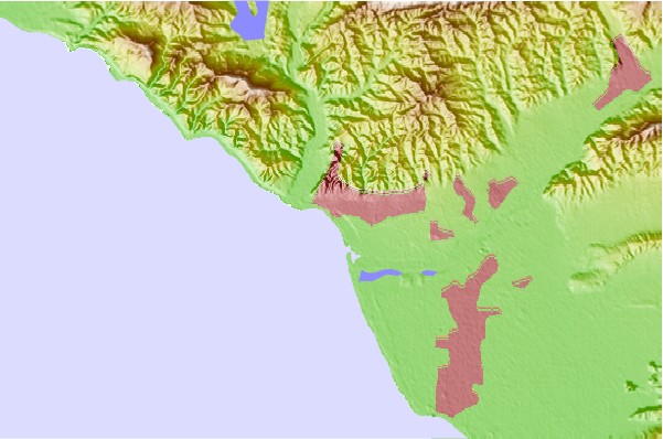
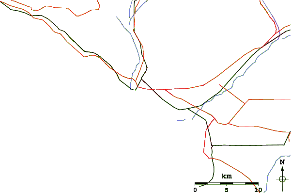
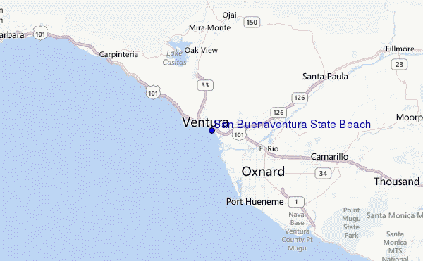
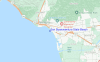
Usa este mapa para navegar hacia las playas de surf de CAL - Ventura y estaciones de marea cercanas de San Buenaventura State Beach
Spots de Surf más cercanos a San Buenaventura State Beach:
(Clica la ubicación para más detalles)- Closest spot1 mi
- Second closest spot2 mi
- Third closest spot2 mi
- Fourth closest spot2 mi
- Fifth closest spot2 mi
Boyas marinas más cercanas a San Buenaventura State Beach:
- Closest Boya Marinas11 mi
- Second closest Boya Marinas32 mi
- Third closest Boya Marinas39 mi
- Fourth closest Boya Marinas39 mi
- Fifth closest Boya Marinas42 mi
Estaciones de marea más cercanas a San Buenaventura State Beach:
- Closest estación de mareaVentura0 mi
- Second closest estación de mareaOxnard Shores6 mi
- Third closest estación de mareaOxnard9 mi
- Fourth closest estación de mareaPort Hueneme9 mi
- Fifth closest estación de mareaRincon Island11 mi
Airports
- The closest passenger airport to San Buenaventura State Beach is Point Mugu Nas Airport (NTD) in USA, 22 km (14 miles) away (directly).
- The second nearest airport to San Buenaventura State Beach is Burbank Glendale Pasadena Airport (BUR), also in USA, 85 km (53 miles) away.
- Third is Los Angeles International Airport (LAX) in USA, 88 km (55 miles) away.
- Jack Northrop Fld Hawthorne Muni Airport (HHR) in USA is 95 km (59 miles) away.
- Long Beach Airport (LGB), also in USA is the fifth nearest airport to San Buenaventura State Beach and is 116 km (72 miles) away.
- /breaks/San-Buenaventura-State-Beach/forecasts/latest
 Nearest