
Salinas River State Beach Surf Guide
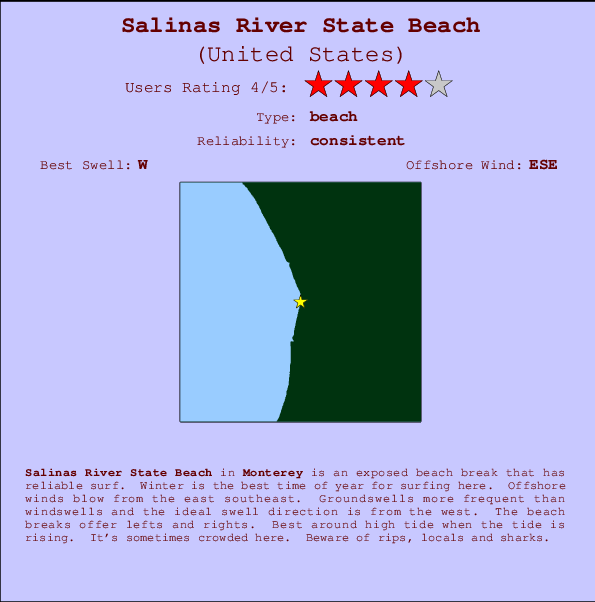
Salinas River State Beach in Monterey is an exposed beach break that usually has waves. Winter is the favoured time of year for surfing here. The best wind direction is from the east southeast. Most of the surf here comes from groundswells and the ideal swell angle is from the west. The beach break provides left and right handers. Best around high tide when the tide is rising. It's sometimes crowded here. Beware of rips, locals and sharks.
Salinas River State Beach Spot Info
| Type: | Rating: | Reliability: | Todays Sea Temp*: |
|---|---|---|---|
| consistent | 15.5°C*ocean temperature recorded from satellite |
Surfing Salinas River State Beach:
The best conditions reported for surf at Salinas River State Beach occur when a West swell combines with an offshore wind direction from the East-southeast.

Energía de Olas (poder): 12 horas


Salinas River State Beach Surf:
Saturday, 18 July 2026, 23:04 Local time| sáb | dom | |||
| 8PM | 11PM | 2AM | 5AM | |
| Wave (m) | ||||
| Período (s) | 16 | 16 | 16 | 16 |
| Viento (km/h) | ||||
| Estado del Viento | cross- on |
cross- on |
glass | glass |
- /breaks/Salinas-River-State-Beach/forecasts/latest
Salinas River State Beach Surf Guide
Salinas River State Beach in Monterey is an exposed beach break that usually has waves. Winter is the favoured time of year for surfing here. The best wind direction is from the east southeast. Most of the surf here comes from groundswells and the ideal swell angle is from the west. The beach break provides left and right handers. Best around high tide when the tide is rising. It's sometimes crowded here. Beware of rips, locals and sharks.
Salinas River State Beach Spot Info
Type: Rating: Reliability: Todays Sea Temp*:  Beach
Beach 4
4consistent 15.5°C*ocean temperature recorded from satelliteSurfing Salinas River State Beach:
The best conditions reported for surf at Salinas River State Beach occur when a West swell combines with an offshore wind direction from the East-southeast.
Energía de Olas (poder): 12 horas
Usa la barra de navegación de arriba para ver la temperatura del mar en Salinas River State Beach, fotografías Salinas River State Beach, previsiones detalladas de olas para Salinas River State Beach, vientos y previsión del tiempo, webcams para Salinas River State Beach, viento actual desde estaciones meteorológicas en CAL - Monterey y predicciones de marea para Salinas River State Beach. Las mapas de olas para United States enseñarán un mapa grande de United States y los mares que rodean. Los mapas de olas pueden ser animadas para mostrar diferentes componentes de olas, la altura de ola, la energía de ola, el período, junto con previsiones de viento y del tiempo. Previsiones actuales del tiempo y del estado del mar provienen de boyas marinas de United States, del barcos que transitan en la zona y de estaciones meteorológicas costeras. Cada página de previsiones tiene un Busca-Olas Regional y Global para localizar las mejores condiciones para surfear en el área de Salinas River State Beach.
Salinas River State Beach Surf:
Saturday, 18 July 2026, 23:04 Local timesáb dom 8PM 11PM 2AM 5AM Wave (m) Período (s) 16 16 16 16 Viento (km/h) Estado del Viento cross-
oncross-
onglass glass - /breaks/Salinas-River-State-Beach/forecasts/latest
- /breaks/Salinas-River-State-Beach/forecasts/latest/six_day
Salinas River State Beach Surf Guide
Salinas River State Beach in Monterey is an exposed beach break that usually has waves. Winter is the favoured time of year for surfing here. The best wind direction is from the east southeast. Most of the surf here comes from groundswells and the ideal swell angle is from the west. The beach break provides left and right handers. Best around high tide when the tide is rising. It's sometimes crowded here. Beware of rips, locals and sharks.
Salinas River State Beach Spot Info
Type: Rating: Reliability: Todays Sea Temp*: Beach4consistent 15.5°C*ocean temperature recorded from satelliteSurfing Salinas River State Beach:
The best conditions reported for surf at Salinas River State Beach occur when a West swell combines with an offshore wind direction from the East-southeast.
Energía de Olas (poder): 12 horas
Usa la barra de navegación de arriba para ver la temperatura del mar en Salinas River State Beach, fotografías Salinas River State Beach, previsiones detalladas de olas para Salinas River State Beach, vientos y previsión del tiempo, webcams para Salinas River State Beach, viento actual desde estaciones meteorológicas en CAL - Monterey y predicciones de marea para Salinas River State Beach. Las mapas de olas para United States enseñarán un mapa grande de United States y los mares que rodean. Los mapas de olas pueden ser animadas para mostrar diferentes componentes de olas, la altura de ola, la energía de ola, el período, junto con previsiones de viento y del tiempo. Previsiones actuales del tiempo y del estado del mar provienen de boyas marinas de United States, del barcos que transitan en la zona y de estaciones meteorológicas costeras. Cada página de previsiones tiene un Busca-Olas Regional y Global para localizar las mejores condiciones para surfear en el área de Salinas River State Beach.
Salinas River State Beach Surf:
Saturday, 18 July 2026, 23:04 Local timesáb dom 8PM 11PM 2AM 5AM Wave (m) Período (s) 16 16 16 16 Viento (km/h) Estado del Viento cross-
oncross-
onglass glass - /breaks/Salinas-River-State-Beach/forecasts/latest
Salinas River State Beach Surf Guide
Salinas River State Beach in Monterey is an exposed beach break that usually has waves. Winter is the favoured time of year for surfing here. The best wind direction is from the east southeast. Most of the surf here comes from groundswells and the ideal swell angle is from the west. The beach break provides left and right handers. Best around high tide when the tide is rising. It's sometimes crowded here. Beware of rips, locals and sharks.
Salinas River State Beach Spot Info
Type: Rating: Reliability: Todays Sea Temp*: Beach4consistent 15.5°C*ocean temperature recorded from satelliteSurfing Salinas River State Beach:
The best conditions reported for surf at Salinas River State Beach occur when a West swell combines with an offshore wind direction from the East-southeast.
Energía de Olas (poder): 12 horas
Usa la barra de navegación de arriba para ver la temperatura del mar en Salinas River State Beach, fotografías Salinas River State Beach, previsiones detalladas de olas para Salinas River State Beach, vientos y previsión del tiempo, webcams para Salinas River State Beach, viento actual desde estaciones meteorológicas en CAL - Monterey y predicciones de marea para Salinas River State Beach. Las mapas de olas para United States enseñarán un mapa grande de United States y los mares que rodean. Los mapas de olas pueden ser animadas para mostrar diferentes componentes de olas, la altura de ola, la energía de ola, el período, junto con previsiones de viento y del tiempo. Previsiones actuales del tiempo y del estado del mar provienen de boyas marinas de United States, del barcos que transitan en la zona y de estaciones meteorológicas costeras. Cada página de previsiones tiene un Busca-Olas Regional y Global para localizar las mejores condiciones para surfear en el área de Salinas River State Beach.
Salinas River State Beach Surf:
Saturday, 18 July 2026, 23:04 Local timesáb dom 8PM 11PM 2AM 5AM Wave (m) Período (s) 16 16 16 16 Viento (km/h) Estado del Viento cross-
oncross-
onglass glass Tide Times:
En Moss Landing, California (0 km).
PROXIMA ES A LAS (hora local) quedan marea alta marea baja Salinas River State Beach Tide Times and Tide Chart
Live Weather:
At BUOY-MLSC1, 0 km from Salinas River State Beach.
- Air temperature
13.0°COverall Salinas River State Beach Surf Consistency and Wind Distribution in julio


Wind stats for Salinas River State Beach: see the variation in direction and stength by month.
Fotos de Surf
de la galeríaContornos: Carreteras y Ríos: Selecciona un spot desde el menú 


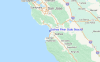
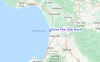
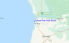
Usa este mapa para navegar hacia las playas de surf de CAL - Monterey y estaciones de marea cercanas de Salinas River State Beach
Spots de Surf más cercanos a Salinas River State Beach:
(Clica la ubicación para más detalles)- Closest spot1 mi
- Second closest spot1 mi
- Third closest spot4 mi
- Fourth closest spot7 mi
- Fifth closest spot7 mi
Boyas marinas más cercanas a Salinas River State Beach:
- Closest Boya Marinas14 mi
- Second closest Boya Marinas31 mi
- Third closest Boya Marinas34 mi
- Fourth closest Boya Marinas36 mi
- Fifth closest Boya Marinas71 mi
Estaciones de marea más cercanas a Salinas River State Beach:
- Closest estación de mareaMoss Landing0 mi
- Second closest estación de mareaElkhorn Slough, Highway 1 Bridge1 mi
- Third closest estación de mareaElkhorn Slough, Highway 1 Bridge, Monterey Bay1 mi
- Fourth closest estación de mareaElkhorn Yacht Club1 mi
- Fifth closest estación de mareaGeneral Fish Company Pier1 mi
Airports
- The closest passenger airport to Salinas River State Beach is Norman Y Mineta San Jose International Airport (SJC) in USA, 63 km (39 miles) away (directly).
- The second nearest airport to Salinas River State Beach is Moffett Federal Afld (Mountain View) Airport (NUQ), also in USA, 72 km (45 miles) away.
- Third is San Francisco International Airport (SFO) in USA, 104 km (65 miles) away.
- Metropolitan Oakland International Airport (OAK) in USA is 109 km (68 miles) away.
- Modesto City Co Harry Sham Airport (MOD), also in USA is the fifth nearest airport to Salinas River State Beach and is 118 km (73 miles) away.
- /breaks/Salinas-River-State-Beach/forecasts/latest


 Nearest