
Previsiones:

Pronóstico Corto PlazoLluvia ligera (totál 5mm), cayendo mayormente el miércoles por la tarde. Warm (max 28°C el martes por la mañana, min 26°C el lunes por la noche). Mayormente vientos frescos. | ||||||||||||||||||
lun 27 | martes 28 | miércoles 29 | ||||||||||||||||
7 PM | 10 PM | 1 AM | 4 AM | 7 AM | 10 AM | 1 PM | 4 PM | 7 PM | 10 PM | 1 AM | 4 AM | 7 AM | 10 AM | 1 PM | 4 PM | 7 PM | 10 PM | |
Mapa de Altura de Olas |  | 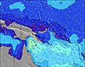 | 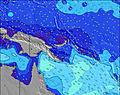 | 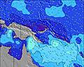 | 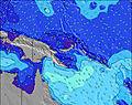 | 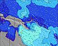 |  | |||||||||||
Oleaje Altura (m) Dirección Período (s) | ENE 8 | ESE 8 | ESE 8 | ESE 8 | ESE 8 | ESE 8 | ENE 10 | ENE 10 | ESE 8 | ESE 8 | E 8 | E 8 | E 8 | E 8 | ESE 9 | ESE 5 | ESE 5 | ESE 8 |
Gráfico Olas | ||||||||||||||||||
7 | 7 | 7 | 7 | 7 | 7 | 10 | 9 | 13 | 13 | 33 | 33 | 34 | 37 | 116 | 46 | 74 | 23 | |
Viento (km/h) | ||||||||||||||||||
Estado del Viento Viento de Mar Viento de Mar-Cruzado Cruzado Viento de Tierra-Cruzado Viento de Tierra Cristalino | cross-off | cross-off | cross-off | cross-off | cross-off | cross-off | cross-off | cross-off | cross-off | cross-off | cross-off | cross-off | cross-off | cross-off | cross-off | cross-off | cross-off | cross-off |
Marea alta | 2:09AM0.94m | 2:34AM0.98m | 5:37PM0.40m | |||||||||||||||
Marea baja | 10:31AM0.02m | 10:43AM0.04m | 7:00PM0.40m | |||||||||||||||
— | — | — | 5:58 | — | — | — | — | — | — | — | 5:58 | — | — | — | — | — | — | |
— | — | — | — | — | — | — | 5:55 | — | — | — | — | — | — | — | 5:55 | — | — | |
mm | — | — | — | — | — | — | — | — | — | — | — | — | — | 1 | 1 | 2 | — | — |
Temp. °C | 26 | 26 | 26 | 26 | 26 | 27 | 28 | 27 | 26 | 26 | 26 | 26 | 26 | 26 | 26 | 26 | 26 | 26 |
Enfriamiento °C | 25 | 25 | 26 | 27 | 26 | 27 | 28 | 27 | 25 | 26 | 26 | 26 | 26 | 27 | 26 | 26 | 25 | 25 |
Oleaje 1 Altura (m) Dirección Período (s) | ENE 8 | ESE 8 | ESE 8 | ESE 8 | ESE 8 | ESE 8 | ESE 8 | ESE 8 | ESE 8 | ESE 8 | E 8 | E 8 | E 8 | E 8 | ENE 9 | ESE 8 | ENE 9 | ESE 8 |
7 | 7 | 7 | 7 | 7 | 7 | 7 | 7 | 13 | 13 | 33 | 33 | 34 | 37 | 8 | 24 | 8 | 23 | |
Oleaje 2 Altura (m) Dirección Período (s) | E 11 | NE 8 | NE 8 | NE 8 | NE 8 | NE 8 | ENE 10 | ENE 10 | ENE 10 | ENE 10 | ENE 9 | ENE 9 | ENE 9 | ENE 9 | ENE 13 | ENE 9 | E 13 | ENE 9 |
2 | 3 | 3 | 3 | 3 | 2 | 10 | 9 | 9 | 9 | 9 | 8 | 8 | 8 | 16 | 8 | 3 | 8 | |
Oleaje 3 Altura (m) Dirección Período (s) | E 16 | E 11 | E 11 | NE 10 | NE 10 | NE 10 | NE 8 | NE 8 | NE 8 | NE 8 | NE 8 | E 14 | E 13 | ENE 13 | SW 5 | E 13 | SW 5 | E 13 |
5 | 2 | 2 | 4 | 4 | 4 | 2 | 2 | 2 | 2 | 2 | 4 | 3 | 16 | 1 | 3 | 1 | 3 | |
Olas de Viento Altura (m) Dirección Período (s) | SSE 5 | SSE 5 | SSE 5 | SSE 5 | S 5 | SSE 4 | SSE 4 | SSE 4 | SSE 5 | SSE 5 | S 5 | S 4 | S 4 | SSE 4 | ESE 9 | ESE 5 | ESE 5 | SSE 5 |
86 | 98 | 78 | 64 | 43 | 32 | 18 | 25 | 69 | 102 | 64 | 33 | 24 | 15 | 116 | 46 | 74 | 78 | |
Viento del Tierra o Mar Limpio más proximo | ||||||||||||||||||
Distancia (km) | 2551 | 2396 | 2396 | 2396 | 2396 | 2396 | 2502 | 2551 | 2475 | 2475 | 2039 | 2039 | 760 | 2040 | 2039 | 2039 | 2039 | 1982 |
Mejores Olas Previstas en New Ireland | ||||||||||||||||||
Mejores Olas Previstas en Papua New Guinea | ||||||||||||||||||
Busca-Olas Global | ||||||||||||||||||
- Map Icons:
 Break
Break Live Wave Height (m)
 Live Wind Speed (km/h)
 Surf Rating (10 Max)
 Ocean Swells (m)
- Wind Speed (km/h)
GRÁTIS! Un widget de Surf-Forecast.com para tu sitio
Este widget grátis de previsiones de surf y tiempo puede ser añadido a cualquier otro sitio y da un resumen de previsiones de olas para Rubio. Solo necesita cortar y pegar el código HTML de abajo en su web. Puede elegir preferencias de idioma y de unidades (métricas o imperiales) para convenir a los usuarios de su sitio. Clica aquí para obtener el código.
 Nearest