
Previsiones:

Pronóstico Corto PlazoFuerte lluvia (totál 59mm), más pesada durante la mañana de jueves. Warm (max 26°C el jueves por la mañana, min 24°C el jueves por la mañana). Mayormente vientos frescos. | ||||||||||||||||||||||||
jueves 16 | viernes 17 | sábado 18 | ||||||||||||||||||||||
2 AM | 5 AM | 8 AM | 11 AM | 2 PM | 5 PM | 8 PM | 11 PM | 2 AM | 5 AM | 8 AM | 11 AM | 2 PM | 5 PM | 8 PM | 11 PM | 2 AM | 5 AM | 8 AM | 11 AM | 2 PM | 5 PM | 8 PM | 11 PM | |
Mapa de Altura de Olas | 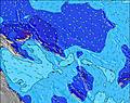 | 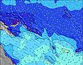 | 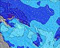 | 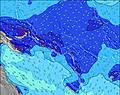 | 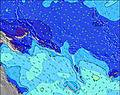 | 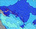 | 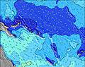 | 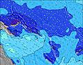 | 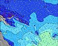 | |||||||||||||||
Oleaje Altura (m) Dirección Período (s) | S 7 | S 8 | SSE 8 | SSE 8 | SSE 8 | SSE 8 | SSE 8 | SSE 8 | SSE 8 | SSE 7 | SSE 7 | SSE 7 | S 7 | S 7 | SSE 7 | S 6 | SSE 7 | SSE 7 | S 7 | SSE 7 | SSE 7 | S 7 | S 7 | S 7 |
Gráfico Olas | ||||||||||||||||||||||||
231 | 279 | 350 | 380 | 404 | 394 | 385 | 336 | 311 | 268 | 252 | 237 | 212 | 200 | 192 | 188 | 181 | 191 | 192 | 127 | 120 | 159 | 158 | 154 | |
Viento (km/h) | ||||||||||||||||||||||||
Estado del Viento Viento de Mar Viento de Mar-Cruzado Cruzado Viento de Tierra-Cruzado Viento de Tierra Cristalino | cross-on | cross-on | cross-on | cross-on | cross-on | cross-on | cross-on | cross-on | cross-on | cross-on | cross-on | cross-on | cross-on | cross-on | cross-on | cross-on | cross-on | cross-on | cross-on | cross-on | cross-on | cross-on | cross-on | cross-on |
Marea alta | 2:19AM0.88m | 3:02AM0.86m | 3:37AM0.82m | |||||||||||||||||||||
Marea baja | 1:47PM0.08m | 1:49PM0.15m | 1:35PM0.21m | |||||||||||||||||||||
— | 6:48 | — | — | — | — | — | — | — | 6:48 | — | — | — | — | — | — | — | 6:48 | — | — | — | — | — | — | |
— | — | — | — | — | 6:29 | — | — | — | — | — | — | — | 6:29 | — | — | — | — | — | — | — | 6:30 | — | — | |
mm | 1 | 4 | 5 | 16 | 7 | 2 | 2 | 2 | 2 | 3 | 2 | 2 | 1 | 1 | 1 | 1 | 1 | 1 | 1 | 1 | 1 | 1 | 1 | 1 |
Temp. °C | 26 | 26 | 26 | 24 | 25 | 25 | 26 | 26 | 25 | 25 | 25 | 26 | 26 | 26 | 26 | 26 | 26 | 26 | 26 | 26 | 26 | 26 | 26 | 26 |
Enfriamiento °C | 26 | 26 | 26 | 25 | 26 | 25 | 26 | 26 | 25 | 24 | 24 | 25 | 25 | 25 | 25 | 25 | 26 | 26 | 26 | 26 | 26 | 25 | 25 | 26 |
Oleaje 1 Altura (m) Dirección Período (s) | — | SE 9 | S 6 | — | S 21 | S 21 | S 20 | S 20 | S 10 | S 10 | S 10 | SSW 6 | S 9 | SSW 9 | SW 6 | SSW 8 | SSW 9 | S 14 | SSW 9 | SSW 7 | SSW 8 | S 13 | SE 10 | SE 10 |
— | 21 | 116 | — | 9 | 9 | 8 | 7 | 2 | 2 | 2 | 26 | 2 | 8 | 38 | 14 | 7 | 4 | 8 | 40 | 84 | 13 | 16 | 15 | |
Oleaje 2 Altura (m) Dirección Período (s) | — | — | SSE 8 | S 22 | — | S 14 | S 13 | — | S 19 | S 19 | S 18 | S 18 | SW 10 | S 9 | SSW 8 | S 16 | S 15 | S 11 | S 14 | SSW 8 | S 13 | SE 10 | S 12 | S 12 |
— | — | 40 | 9 | — | 4 | 4 | — | 7 | 7 | 6 | 6 | 4 | 7 | 7 | 5 | 4 | 2 | 4 | 28 | 3 | 4 | 12 | 11 | |
Oleaje 3 Altura (m) Dirección Período (s) | — | — | — | — | — | — | — | — | — | S 13 | SE 13 | SW 10 | S 17 | S 16 | S 16 | S 13 | — | S 11 | S 11 | S 13 | SE 11 | S 21 | S 20 | S 20 |
— | — | — | — | — | — | — | — | — | 3 | 7 | 4 | 6 | 5 | 5 | 3 | — | 3 | 3 | 3 | 5 | 8 | 8 | 8 | |
Olas de Viento Altura (m) Dirección Período (s) | S 7 | S 8 | SSE 8 | SSE 8 | SSE 8 | SSE 8 | SSE 8 | SSE 8 | SSE 8 | SSE 7 | SSE 7 | SSE 7 | S 7 | S 7 | SSE 7 | S 6 | SSE 7 | SSE 7 | S 7 | SSE 7 | SSE 7 | S 7 | S 7 | S 7 |
231 | 279 | 350 | 380 | 404 | 394 | 385 | 336 | 311 | 268 | 252 | 237 | 212 | 200 | 192 | 188 | 181 | 191 | 192 | 127 | 120 | 159 | 158 | 154 | |
Viento del Tierra o Mar Limpio más proximo | ||||||||||||||||||||||||
Distancia (km) | 1767 | 57 | 810 | 57 | 57 | 1767 | 1767 | 1767 | 1320 | 1767 | 1767 | 1767 | 1767 | 810 | 810 | 57 | 1767 | 57 | 57 | 57 | 1767 | 810 | 1767 | 1645 |
Mejores Olas Previstas en New Georgia | ||||||||||||||||||||||||
Mejores Olas Previstas en Solomon Islands | ||||||||||||||||||||||||
Busca-Olas Global | ||||||||||||||||||||||||
- Map Icons:
 Break
Break Live Wave Height (m)
 Live Wind Speed (km/h)
 Surf Rating (10 Max)
 Ocean Swells (m)
- Wind Speed (km/h)
GRÁTIS! Un widget de Surf-Forecast.com para tu sitio
Este widget grátis de previsiones de surf y tiempo puede ser añadido a cualquier otro sitio y da un resumen de previsiones de olas para Pailongge. Solo necesita cortar y pegar el código HTML de abajo en su web. Puede elegir preferencias de idioma y de unidades (métricas o imperiales) para convenir a los usuarios de su sitio. Clica aquí para obtener el código.
 Nearest