

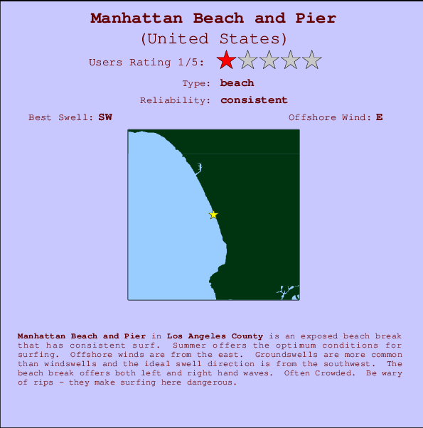
Manhattan Beach and Pier Surf Guide
Manhattan Beach and Pier in LA County is an exposed beach break that has consistent surf. Summer offers the favoured conditions for surfing. The best wind direction is from the east. Most of the surf here comes from groundswells and the ideal swell direction is from the southwest. Waves at the beach are both lefts and rights. Often Crowded. Be wary of rips - they make surfing here dangerous.
Manhattan Beach and Pier Spot Info
| Type: | Rating: | Reliability: | Todays Sea Temp*: |
|---|---|---|---|
| consistent | 22.5°C*ocean temperature recorded from satellite |
Surfing Manhattan Beach and Pier:
The best conditions reported for surf at Manhattan Beach and Pier occur when a Southwest swell combines with an offshore wind direction from the East.

Energía de Olas (poder): 12 horas


Manhattan Beach and Pier Surf:
Sunday, 2 August 2026, 08:15 Local time| domingo 02 | ||||
| 8AM | 11AM | 2PM | 5PM | |
| Wave (m) | ||||
| Período (s) | 14 | 14 | 14 | 18 |
| Viento (km/h) | ||||
| Estado del Viento | glass | cross | cross- on |
cross- on |
- /breaks/Manhattan-Beach-Pier/forecasts/latest
Manhattan Beach and Pier Surf Guide
Manhattan Beach and Pier in LA County is an exposed beach break that has consistent surf. Summer offers the favoured conditions for surfing. The best wind direction is from the east. Most of the surf here comes from groundswells and the ideal swell direction is from the southwest. Waves at the beach are both lefts and rights. Often Crowded. Be wary of rips - they make surfing here dangerous.
Manhattan Beach and Pier Spot Info
Type: Rating: Reliability: Todays Sea Temp*:  Beach
Beach 1
1consistent 22.5°C*ocean temperature recorded from satelliteSurfing Manhattan Beach and Pier:
The best conditions reported for surf at Manhattan Beach and Pier occur when a Southwest swell combines with an offshore wind direction from the East.
Energía de Olas (poder): 12 horas
Usa la barra de navegación de arriba para ver la temperatura del mar en Manhattan Beach and Pier, fotografías Manhattan Beach and Pier, previsiones detalladas de olas para Manhattan Beach and Pier, vientos y previsión del tiempo, webcams para Manhattan Beach and Pier, viento actual desde estaciones meteorológicas en CAL - LA County y predicciones de marea para Manhattan Beach and Pier. Las mapas de olas para United States enseñarán un mapa grande de United States y los mares que rodean. Los mapas de olas pueden ser animadas para mostrar diferentes componentes de olas, la altura de ola, la energía de ola, el período, junto con previsiones de viento y del tiempo. Previsiones actuales del tiempo y del estado del mar provienen de boyas marinas de United States, del barcos que transitan en la zona y de estaciones meteorológicas costeras. Cada página de previsiones tiene un Busca-Olas Regional y Global para localizar las mejores condiciones para surfear en el área de Manhattan Beach and Pier.
Manhattan Beach and Pier Surf:
Sunday, 2 August 2026, 08:15 Local timedomingo 02 8AM 11AM 2PM 5PM Wave (m) Período (s) 14 14 14 18 Viento (km/h) Estado del Viento glass cross cross-
oncross-
on- /breaks/Manhattan-Beach-Pier/forecasts/latest
- /breaks/Manhattan-Beach-Pier/forecasts/latest/six_day
Manhattan Beach and Pier Surf Guide
Manhattan Beach and Pier in LA County is an exposed beach break that has consistent surf. Summer offers the favoured conditions for surfing. The best wind direction is from the east. Most of the surf here comes from groundswells and the ideal swell direction is from the southwest. Waves at the beach are both lefts and rights. Often Crowded. Be wary of rips - they make surfing here dangerous.
Manhattan Beach and Pier Spot Info
Type: Rating: Reliability: Todays Sea Temp*: Beach1consistent 22.5°C*ocean temperature recorded from satelliteSurfing Manhattan Beach and Pier:
The best conditions reported for surf at Manhattan Beach and Pier occur when a Southwest swell combines with an offshore wind direction from the East.
Energía de Olas (poder): 12 horas
Usa la barra de navegación de arriba para ver la temperatura del mar en Manhattan Beach and Pier, fotografías Manhattan Beach and Pier, previsiones detalladas de olas para Manhattan Beach and Pier, vientos y previsión del tiempo, webcams para Manhattan Beach and Pier, viento actual desde estaciones meteorológicas en CAL - LA County y predicciones de marea para Manhattan Beach and Pier. Las mapas de olas para United States enseñarán un mapa grande de United States y los mares que rodean. Los mapas de olas pueden ser animadas para mostrar diferentes componentes de olas, la altura de ola, la energía de ola, el período, junto con previsiones de viento y del tiempo. Previsiones actuales del tiempo y del estado del mar provienen de boyas marinas de United States, del barcos que transitan en la zona y de estaciones meteorológicas costeras. Cada página de previsiones tiene un Busca-Olas Regional y Global para localizar las mejores condiciones para surfear en el área de Manhattan Beach and Pier.
Manhattan Beach and Pier Surf:
Sunday, 2 August 2026, 08:15 Local timedomingo 02 8AM 11AM 2PM 5PM Wave (m) Período (s) 14 14 14 18 Viento (km/h) Estado del Viento glass cross cross-
oncross-
on- /breaks/Manhattan-Beach-Pier/forecasts/latest
Manhattan Beach and Pier Surf Guide
Manhattan Beach and Pier in LA County is an exposed beach break that has consistent surf. Summer offers the favoured conditions for surfing. The best wind direction is from the east. Most of the surf here comes from groundswells and the ideal swell direction is from the southwest. Waves at the beach are both lefts and rights. Often Crowded. Be wary of rips - they make surfing here dangerous.
Manhattan Beach and Pier Spot Info
Type: Rating: Reliability: Todays Sea Temp*: Beach1consistent 22.5°C*ocean temperature recorded from satelliteSurfing Manhattan Beach and Pier:
The best conditions reported for surf at Manhattan Beach and Pier occur when a Southwest swell combines with an offshore wind direction from the East.
Energía de Olas (poder): 12 horas
Usa la barra de navegación de arriba para ver la temperatura del mar en Manhattan Beach and Pier, fotografías Manhattan Beach and Pier, previsiones detalladas de olas para Manhattan Beach and Pier, vientos y previsión del tiempo, webcams para Manhattan Beach and Pier, viento actual desde estaciones meteorológicas en CAL - LA County y predicciones de marea para Manhattan Beach and Pier. Las mapas de olas para United States enseñarán un mapa grande de United States y los mares que rodean. Los mapas de olas pueden ser animadas para mostrar diferentes componentes de olas, la altura de ola, la energía de ola, el período, junto con previsiones de viento y del tiempo. Previsiones actuales del tiempo y del estado del mar provienen de boyas marinas de United States, del barcos que transitan en la zona y de estaciones meteorológicas costeras. Cada página de previsiones tiene un Busca-Olas Regional y Global para localizar las mejores condiciones para surfear en el área de Manhattan Beach and Pier.
Manhattan Beach and Pier Surf:
Sunday, 2 August 2026, 08:15 Local timedomingo 02 8AM 11AM 2PM 5PM Wave (m) Período (s) 14 14 14 18 Viento (km/h) Estado del Viento glass cross cross-
oncross-
onTide Times:
Para Manhattan Beach, a %{dist} %{km} de %{location}.
PROXIMA ES A LAS (hora local) quedan marea alta marea baja Manhattan Beach and Pier Tide Times and Tide Chart
Live Weather:
At Los Angeles Airport, 6 km from Manhattan Beach and Pier.
calm
(km/h)
Dry and partly cloudyAir temperature
20.6°CCurrent weather near Manhattan Beach and Pier
Buoy Data:
At Santa Monica Bay, CA, 12 miles from Manhattan Beach and Pier.
3AM 4AM 5AM 6AM Antigüedad de datos 4 hr 3 hr 2 hr 1 hr Altura de Olas (m) 

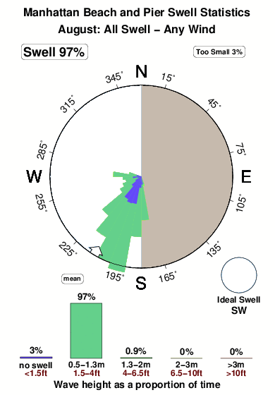
Período Dominante (s) 9 14 13 13 Overall Manhattan Beach and Pier Surf Consistency and Wind Distribution in agosto
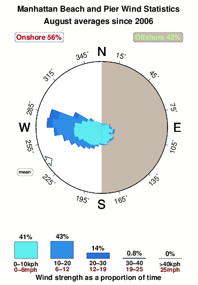


Wind stats for Manhattan Beach and Pier: see the variation in direction and stength by month.
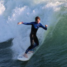
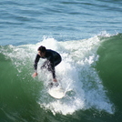
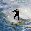
Fotos de Surf
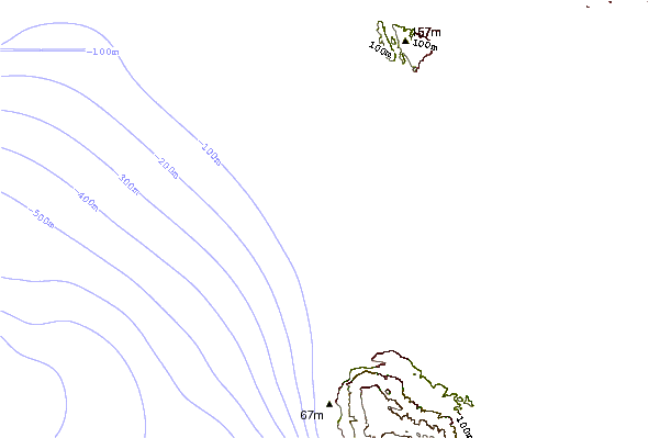
de la galeríaContornos: Carreteras y Ríos: Selecciona un spot desde el menú 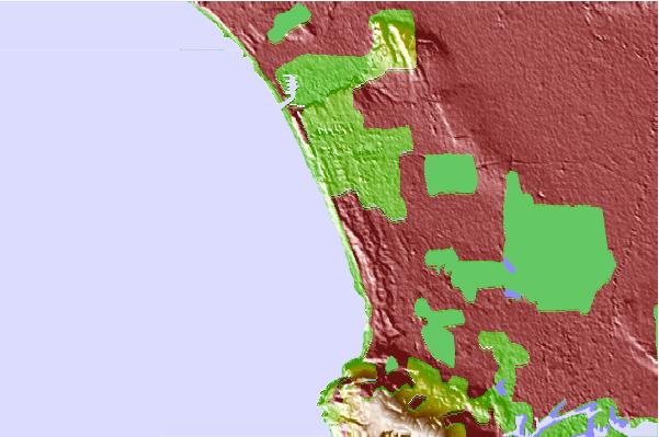
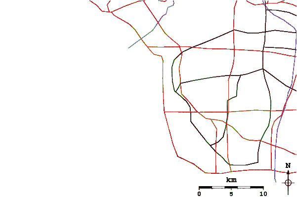
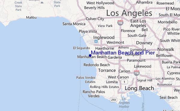
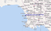
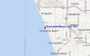
Usa este mapa para navegar hacia las playas de surf de CAL - LA County y estaciones de marea cercanas de Manhattan Beach and Pier
Spots de Surf más cercanos a Manhattan Beach and Pier:
(Clica la ubicación para más detalles)- Closest spot1 mi
- Second closest spot1 mi
- Third closest spot1 mi
- Fourth closest spot1 mi
- Fifth closest spot2 mi
Boyas marinas más cercanas a Manhattan Beach and Pier:
- Closest Boya Marinas12 mi
- Second closest Boya Marinas19 mi
- Third closest Boya Marinas20 mi
- Fourth closest Boya Marinas25 mi
- Fifth closest Boya Marinas36 mi
Estaciones de marea más cercanas a Manhattan Beach and Pier:
- Closest estación de mareaManhattan Beach1 mi
- Second closest estación de mareaEl Segundo, Santa Monica Bay2 mi
- Third closest estación de mareaKing Harbor, Santa Monica Bay3 mi
- Fourth closest estación de mareaMarina del Rey6 mi
- Fifth closest estación de mareaPalos Verdes Estates7 mi
Airports
- The closest passenger airport to Manhattan Beach and Pier is Los Angeles International Airport (LAX) in USA, 6 km (4 miles) away (directly).
- The second nearest airport to Manhattan Beach and Pier is Jack Northrop Fld Hawthorne Muni Airport (HHR), also in USA, 9 km (6 miles) away.
- Third is Long Beach Airport (LGB) in USA, 26 km (16 miles) away.
- Burbank Glendale Pasadena Airport (BUR) in USA is 35 km (22 miles) away.
- John Wayne Arpt Orange Co (Santa Ana) Airport (SNA), also in USA is the fifth nearest airport to Manhattan Beach and Pier and is 56 km (35 miles) away.
- /breaks/Manhattan-Beach-Pier/forecasts/latest
 Nearest