
Previsiones:

Pronóstico Corto PlazoFuerte lluvia (totál 28mm), más pesada durante la noche de miércoles. Warm (max 28°C el martes por la mañana, min 27°C el lunes por la noche). El viento será generalmente ligero. | ||||||||||||||||||
lun 3 | martes 4 | miércoles 5 | ||||||||||||||||
7 PM | 10 PM | 1 AM | 4 AM | 7 AM | 10 AM | 1 PM | 4 PM | 7 PM | 10 PM | 1 AM | 4 AM | 7 AM | 10 AM | 1 PM | 4 PM | 7 PM | 10 PM | |
Mapa de Altura de Olas |  | 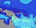 | 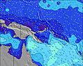 | 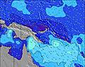 | 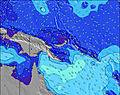 | 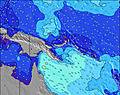 |  | |||||||||||
Oleaje Altura (m) Dirección Período (s) | NNE 13 | NNE 13 | NNE 13 | NNE 14 | NNE 14 | NNE 13 | NNE 13 | NNE 13 | NNE 13 | N 13 | N 12 | N 13 | N 13 | N 13 | N 13 | N 12 | N 12 | N 12 |
Gráfico Olas | ||||||||||||||||||
147 | 129 | 93 | 154 | 189 | 187 | 187 | 184 | 176 | 161 | 72 | 166 | 88 | 171 | 166 | 148 | 145 | 105 | |
Viento (km/h) | ||||||||||||||||||
Estado del Viento Viento de Mar Viento de Mar-Cruzado Cruzado Viento de Tierra-Cruzado Viento de Tierra Cristalino | cross-on | cross-on | cross-on | cross-on | cross-on | on | on | cross-on | cross-on | cross-on | cross-on | cross-on | cross-on | cross-on | cross-on | cross-on | cross-on | cross-on |
Marea alta | 7:32PM1.20m | 11:39PM0.90m | 3:57AM0.85m | 7:52AM0.89m | 5:13PM1.09m | 8:01PM1.19m | 00:02AM0.89m | 8:43AM0.75m | 5:16PM1.15m | 8:29PM1.19m | ||||||||
Marea baja | 11:00PM0.89m | 2:11AM0.81m | 5:47AM0.81m | 10:27AM0.71m | 5:27PM1.09m | 11:32PM0.89m | 6:23AM0.64m | 10:33AM0.68m | 6:31PM1.13m | |||||||||
— | — | — | 6:01 | — | — | — | — | — | — | — | 6:01 | — | — | — | — | — | — | |
— | — | — | — | — | — | — | 6:02 | — | — | — | — | — | — | — | 6:02 | — | — | |
mm | — | — | — | — | 1 | — | — | — | — | — | — | — | 2 | — | 2 | — | 2 | 1 |
Temp. °C | 27 | 27 | 27 | 27 | 27 | 28 | 28 | 28 | 27 | 27 | 27 | 27 | 27 | 28 | 28 | 28 | 27 | 27 |
Enfriamiento °C | 28 | 28 | 28 | 28 | 29 | 29 | 29 | 29 | 29 | 27 | 27 | 29 | 29 | 30 | 29 | 30 | 29 | 29 |
Oleaje 1 Altura (m) Dirección Período (s) | NNE 13 | NNE 13 | ESE 10 | NNE 14 | NNE 14 | NNE 13 | NNE 13 | NNE 13 | NNE 13 | N 13 | N 12 | N 13 | N 13 | N 13 | N 13 | N 12 | N 12 | N 12 |
147 | 129 | 52 | 154 | 189 | 187 | 187 | 184 | 176 | 161 | 72 | 166 | 88 | 171 | 166 | 148 | 145 | 105 | |
Oleaje 2 Altura (m) Dirección Período (s) | ENE 13 | ESE 10 | NNE 13 | ESE 10 | ESE 10 | E 10 | E 9 | ESE 9 | ENE 12 | SSW 6 | NNE 14 | ESE 9 | NNE 12 | ESE 9 | ENE 11 | ENE 11 | ENE 11 | ENE 11 |
60 | 33 | 93 | 52 | 52 | 47 | 43 | 28 | 60 | 15 | 62 | 27 | 46 | 26 | 48 | 48 | 49 | 51 | |
Oleaje 3 Altura (m) Dirección Período (s) | ESE 10 | ENE 13 | SSW 7 | SSW 7 | ENE 13 | ENE 13 | ENE 12 | ENE 12 | ESE 9 | ESE 9 | ENE 13 | ENE 13 | ESE 9 | ENE 11 | ESE 9 | ESE 9 | SSW 6 | SW 6 |
33 | 60 | 26 | 17 | 68 | 65 | 61 | 60 | 28 | 28 | 64 | 64 | 26 | 51 | 26 | 26 | 14 | 9 | |
Olas de Viento Altura (m) Dirección Período (s) | S 7 | S 7 | SSW 7 | SSW 6 | SSW 6 | SSW 6 | SSW 6 | SSW 6 | SSW 6 | — | SSW 6 | — | SSW 6 | SSW 6 | SSW 6 | SSW 6 | SSW 6 | — |
45 | 34 | 62 | 59 | 16 | 23 | 16 | 15 | 15 | — | 3 | — | 31 | 14 | 15 | 15 | 30 | — | |
Viento del Tierra o Mar Limpio más proximo | ||||||||||||||||||
Distancia (km) | 2 | 3 | 3 | 2 | 2 | 2 | 2 | 2 | 3 | 3 | 839 | 3 | 3 | 2 | 2 | 2 | 2 | 2 |
Mejores Olas Previstas en New Ireland | ||||||||||||||||||
Mejores Olas Previstas en Papua New Guinea | ||||||||||||||||||
Busca-Olas Global | ||||||||||||||||||
- Map Icons:
 Break
Break Live Wave Height (m)
 Live Wind Speed (km/h)
 Surf Rating (10 Max)
 Ocean Swells (m)
- Wind Speed (km/h)
GRÁTIS! Un widget de Surf-Forecast.com para tu sitio
Este widget grátis de previsiones de surf y tiempo puede ser añadido a cualquier otro sitio y da un resumen de previsiones de olas para Long Long. Solo necesita cortar y pegar el código HTML de abajo en su web. Puede elegir preferencias de idioma y de unidades (métricas o imperiales) para convenir a los usuarios de su sitio. Clica aquí para obtener el código.
 Nearest