

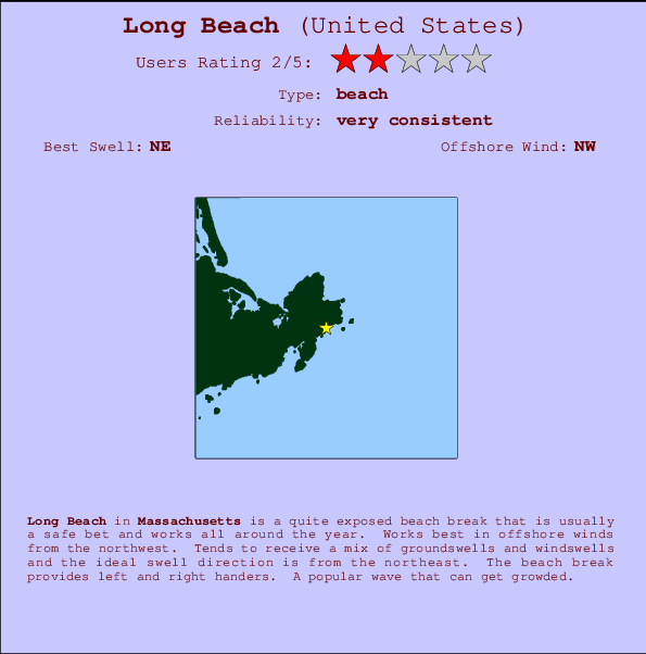
Long Beach Surf Guide
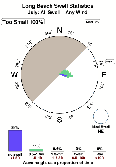
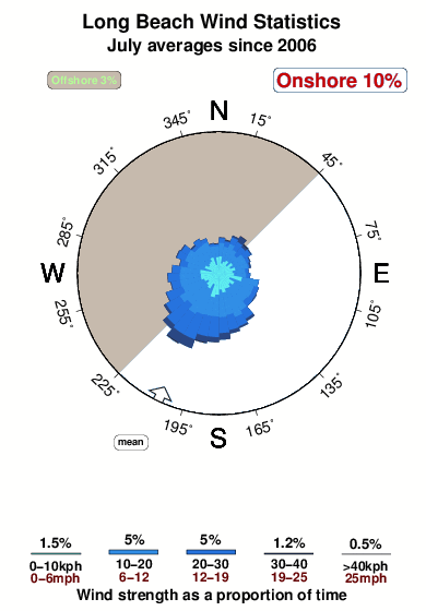
Long Beach in Massachusetts is a fairly exposed beach break that is usually a safe bet and works all around the year. The best wind direction is from the northwest. Tends to receive a mix of groundswells and windswells and the optimum swell angle is from the northeast. The beach break provides left and right handers. Often Crowded.
Long Beach Spot Info
| Type: | Rating: | Reliability: | Todays Sea Temp*: |
|---|---|---|---|
| very consistent | 15.7°C*ocean temperature recorded from satellite |
Surfing Long Beach:
The best conditions reported for surf at Long Beach occur when a Northeast swell combines with an offshore wind direction from the Northwest.

Energía de Olas (poder): 12 horas


Long Beach Surf:
Wednesday, 22 July 2026, 12:26 Local time| miércoles 22 | ||||
| 11AM | 2PM | 5PM | 8PM | |
| Wave (m) | ||||
| Período (s) | 8 | - | 8 | - |
| Viento (km/h) | ||||
| Estado del Viento | cross | cross | cross | cross- off |
- /breaks/Long-Beach/forecasts/latest
Long Beach Surf Guide
Long Beach in Massachusetts is a fairly exposed beach break that is usually a safe bet and works all around the year. The best wind direction is from the northwest. Tends to receive a mix of groundswells and windswells and the optimum swell angle is from the northeast. The beach break provides left and right handers. Often Crowded.
Long Beach Spot Info
Type: Rating: Reliability: Todays Sea Temp*:  Beach
Beach 2
2very consistent 15.7°C*ocean temperature recorded from satelliteSurfing Long Beach:
The best conditions reported for surf at Long Beach occur when a Northeast swell combines with an offshore wind direction from the Northwest.
Energía de Olas (poder): 12 horas
Usa la barra de navegación de arriba para ver la temperatura del mar en Long Beach, fotografías Long Beach, previsiones detalladas de olas para Long Beach, vientos y previsión del tiempo, webcams para Long Beach, viento actual desde estaciones meteorológicas en Massachusetts y predicciones de marea para Long Beach. Las mapas de olas para United States enseñarán un mapa grande de United States y los mares que rodean. Los mapas de olas pueden ser animadas para mostrar diferentes componentes de olas, la altura de ola, la energía de ola, el período, junto con previsiones de viento y del tiempo. Previsiones actuales del tiempo y del estado del mar provienen de boyas marinas de United States, del barcos que transitan en la zona y de estaciones meteorológicas costeras. Cada página de previsiones tiene un Busca-Olas Regional y Global para localizar las mejores condiciones para surfear en el área de Long Beach.
Long Beach Surf:
Wednesday, 22 July 2026, 12:26 Local timemiércoles 22 11AM 2PM 5PM 8PM Wave (m) Período (s) 8 - 8 - Viento (km/h) Estado del Viento cross cross cross cross-
off- /breaks/Long-Beach/forecasts/latest
- /breaks/Long-Beach/forecasts/latest/six_day
Long Beach Surf Guide
Long Beach in Massachusetts is a fairly exposed beach break that is usually a safe bet and works all around the year. The best wind direction is from the northwest. Tends to receive a mix of groundswells and windswells and the optimum swell angle is from the northeast. The beach break provides left and right handers. Often Crowded.
Long Beach Spot Info
Type: Rating: Reliability: Todays Sea Temp*: Beach2very consistent 15.7°C*ocean temperature recorded from satelliteSurfing Long Beach:
The best conditions reported for surf at Long Beach occur when a Northeast swell combines with an offshore wind direction from the Northwest.
Energía de Olas (poder): 12 horas
Usa la barra de navegación de arriba para ver la temperatura del mar en Long Beach, fotografías Long Beach, previsiones detalladas de olas para Long Beach, vientos y previsión del tiempo, webcams para Long Beach, viento actual desde estaciones meteorológicas en Massachusetts y predicciones de marea para Long Beach. Las mapas de olas para United States enseñarán un mapa grande de United States y los mares que rodean. Los mapas de olas pueden ser animadas para mostrar diferentes componentes de olas, la altura de ola, la energía de ola, el período, junto con previsiones de viento y del tiempo. Previsiones actuales del tiempo y del estado del mar provienen de boyas marinas de United States, del barcos que transitan en la zona y de estaciones meteorológicas costeras. Cada página de previsiones tiene un Busca-Olas Regional y Global para localizar las mejores condiciones para surfear en el área de Long Beach.
Long Beach Surf:
Wednesday, 22 July 2026, 12:26 Local timemiércoles 22 11AM 2PM 5PM 8PM Wave (m) Período (s) 8 - 8 - Viento (km/h) Estado del Viento cross cross cross cross-
off- /breaks/Long-Beach/forecasts/latest
Long Beach Surf Guide
Long Beach in Massachusetts is a fairly exposed beach break that is usually a safe bet and works all around the year. The best wind direction is from the northwest. Tends to receive a mix of groundswells and windswells and the optimum swell angle is from the northeast. The beach break provides left and right handers. Often Crowded.
Long Beach Spot Info
Type: Rating: Reliability: Todays Sea Temp*: Beach2very consistent 15.7°C*ocean temperature recorded from satelliteSurfing Long Beach:
The best conditions reported for surf at Long Beach occur when a Northeast swell combines with an offshore wind direction from the Northwest.
Energía de Olas (poder): 12 horas
Usa la barra de navegación de arriba para ver la temperatura del mar en Long Beach, fotografías Long Beach, previsiones detalladas de olas para Long Beach, vientos y previsión del tiempo, webcams para Long Beach, viento actual desde estaciones meteorológicas en Massachusetts y predicciones de marea para Long Beach. Las mapas de olas para United States enseñarán un mapa grande de United States y los mares que rodean. Los mapas de olas pueden ser animadas para mostrar diferentes componentes de olas, la altura de ola, la energía de ola, el período, junto con previsiones de viento y del tiempo. Previsiones actuales del tiempo y del estado del mar provienen de boyas marinas de United States, del barcos que transitan en la zona y de estaciones meteorológicas costeras. Cada página de previsiones tiene un Busca-Olas Regional y Global para localizar las mejores condiciones para surfear en el área de Long Beach.
Long Beach Surf:
Wednesday, 22 July 2026, 12:26 Local timemiércoles 22 11AM 2PM 5PM 8PM Wave (m) Período (s) 8 - 8 - Viento (km/h) Estado del Viento cross cross cross cross-
offTide Times:
Para Rockport, Massachusetts, a %{dist} %{km} de %{location}.
PROXIMA ES A LAS (hora local) quedan marea alta marea baja Long Beach Tide Times and Tide Chart
Live Weather:
At Rockport, 3 km from Long Beach.
calm
(km/h)
dryAir temperature
22°COverall Long Beach Surf Consistency and Wind Distribution in julio
Fotos de Surf
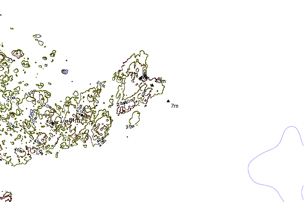
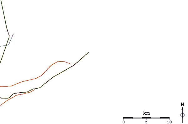
de la galeríaContornos: Carreteras y Ríos: Selecciona un spot desde el menú 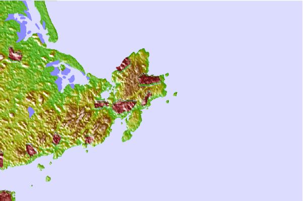
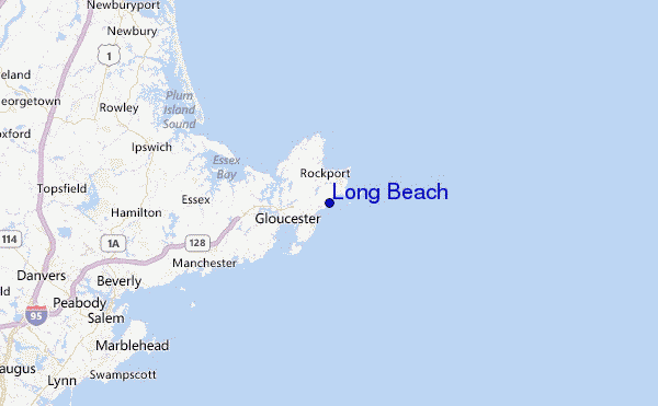
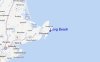
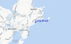
Usa este mapa para navegar hacia las playas de surf de Massachusetts y estaciones de marea cercanas de Long Beach
Spots de Surf más cercanos a Long Beach:
(Clica la ubicación para más detalles)- Closest spot1 mi
- Second closest spot3 mi
- Third closest spot11 mi
- Fourth closest spot14 mi
- Fifth closest spot16 mi
Boyas marinas más cercanas a Long Beach:
- Closest Boya Marinas8 mi
- Second closest Boya Marinas19 mi
- Third closest Boya Marinas25 mi
- Fourth closest Boya Marinas39 mi
- Fifth closest Boya Marinas57 mi
Estaciones de marea más cercanas a Long Beach:
- Closest estación de mareaRockport2 mi
- Second closest estación de mareaGloucester Harbor (Ten Pound Island)3 mi
- Third closest estación de mareaAnnisquam4 mi
- Fourth closest estación de mareaEssex8 mi
- Fifth closest estación de mareaManchester Harbor9 mi
Airports
- The closest passenger airport to Long Beach is General Edward Lawrence Logan International (Boston) Airport (BOS) in USA, 43 km (27 miles) away (directly).
- The second nearest airport to Long Beach is Laurence G Hanscom Fld (Bedford) Airport (BED), also in USA, 58 km (36 miles) away.
- Third is North Central State (Smithfield) Airport (SFZ) in USA, 107 km (66 miles) away.
- Otis Angb (Falmouth) Airport (FMH) in USA is 108 km (67 miles) away.
- Portland International Jetport Airport (PWM), also in USA is the fifth nearest airport to Long Beach and is 116 km (72 miles) away.
- /breaks/Long-Beach/forecasts/latest


 Nearest