

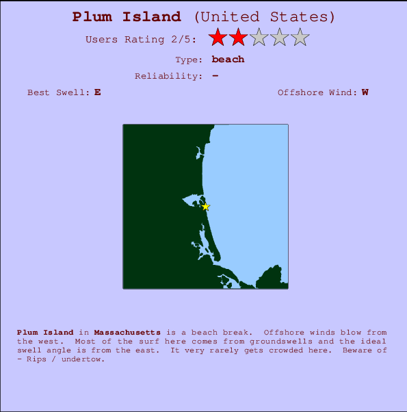
Plum Island Surf Guide
Plum Island in Massachusetts is an exposed beach break. Works best in offshore winds from the west. Tends to receive a mix of groundswells and windswells and the ideal swell direction is from the east. Rarely crowded here. Hazards include - Rips / undertow.
Plum Island Spot Info
| Type: | Rating: | Reliability: | Todays Sea Temp*: |
|---|---|---|---|
20.3°C*ocean temperature recorded from satellite |
Surfing Plum Island:
The best conditions reported for surf at Plum Island occur when a East swell combines with an offshore wind direction from the West.

Energía de Olas (poder): 12 horas


Plum Island Surf:
Wednesday, 15 July 2026, 20:34 Local time| miércoles 15 | jue | |||
| 5PM | 8PM | 11PM | 2AM | |
| Wave (m) | ||||
| Período (s) | 9 | 9 | 9 | 9 |
| Viento (km/h) | ||||
| Estado del Viento | cross- off |
cross- off |
off | off |
- /breaks/Plum-Island/forecasts/latest
Plum Island Surf Guide
Plum Island in Massachusetts is an exposed beach break. Works best in offshore winds from the west. Tends to receive a mix of groundswells and windswells and the ideal swell direction is from the east. Rarely crowded here. Hazards include - Rips / undertow.
Plum Island Spot Info
Type: Rating: Reliability: Todays Sea Temp*:  Beach
Beach 220.3°C*ocean temperature recorded from satellite
Surfing Plum Island:
The best conditions reported for surf at Plum Island occur when a East swell combines with an offshore wind direction from the West.
Energía de Olas (poder): 12 horas
Usa la barra de navegación de arriba para ver la temperatura del mar en Plum Island, fotografías Plum Island, previsiones detalladas de olas para Plum Island, vientos y previsión del tiempo, webcams para Plum Island, viento actual desde estaciones meteorológicas en Massachusetts y predicciones de marea para Plum Island. Las mapas de olas para United States enseñarán un mapa grande de United States y los mares que rodean. Los mapas de olas pueden ser animadas para mostrar diferentes componentes de olas, la altura de ola, la energía de ola, el período, junto con previsiones de viento y del tiempo. Previsiones actuales del tiempo y del estado del mar provienen de boyas marinas de United States, del barcos que transitan en la zona y de estaciones meteorológicas costeras. Cada página de previsiones tiene un Busca-Olas Regional y Global para localizar las mejores condiciones para surfear en el área de Plum Island.
Plum Island Surf:
Wednesday, 15 July 2026, 20:34 Local timemiércoles 15 jue 5PM 8PM 11PM 2AM Wave (m) Período (s) 9 9 9 9 Viento (km/h) Estado del Viento cross-
offcross-
offoff off - /breaks/Plum-Island/forecasts/latest
- /breaks/Plum-Island/forecasts/latest/six_day
Plum Island Surf Guide
Plum Island in Massachusetts is an exposed beach break. Works best in offshore winds from the west. Tends to receive a mix of groundswells and windswells and the ideal swell direction is from the east. Rarely crowded here. Hazards include - Rips / undertow.
Plum Island Spot Info
Type: Rating: Reliability: Todays Sea Temp*: Beach220.3°C*ocean temperature recorded from satelliteSurfing Plum Island:
The best conditions reported for surf at Plum Island occur when a East swell combines with an offshore wind direction from the West.
Energía de Olas (poder): 12 horas
Usa la barra de navegación de arriba para ver la temperatura del mar en Plum Island, fotografías Plum Island, previsiones detalladas de olas para Plum Island, vientos y previsión del tiempo, webcams para Plum Island, viento actual desde estaciones meteorológicas en Massachusetts y predicciones de marea para Plum Island. Las mapas de olas para United States enseñarán un mapa grande de United States y los mares que rodean. Los mapas de olas pueden ser animadas para mostrar diferentes componentes de olas, la altura de ola, la energía de ola, el período, junto con previsiones de viento y del tiempo. Previsiones actuales del tiempo y del estado del mar provienen de boyas marinas de United States, del barcos que transitan en la zona y de estaciones meteorológicas costeras. Cada página de previsiones tiene un Busca-Olas Regional y Global para localizar las mejores condiciones para surfear en el área de Plum Island.
Plum Island Surf:
Wednesday, 15 July 2026, 20:34 Local timemiércoles 15 jue 5PM 8PM 11PM 2AM Wave (m) Período (s) 9 9 9 9 Viento (km/h) Estado del Viento cross-
offcross-
offoff off - /breaks/Plum-Island/forecasts/latest
Plum Island Surf Guide
Plum Island in Massachusetts is an exposed beach break. Works best in offshore winds from the west. Tends to receive a mix of groundswells and windswells and the ideal swell direction is from the east. Rarely crowded here. Hazards include - Rips / undertow.
Plum Island Spot Info
Type: Rating: Reliability: Todays Sea Temp*: Beach220.3°C*ocean temperature recorded from satelliteSurfing Plum Island:
The best conditions reported for surf at Plum Island occur when a East swell combines with an offshore wind direction from the West.
Energía de Olas (poder): 12 horas
Usa la barra de navegación de arriba para ver la temperatura del mar en Plum Island, fotografías Plum Island, previsiones detalladas de olas para Plum Island, vientos y previsión del tiempo, webcams para Plum Island, viento actual desde estaciones meteorológicas en Massachusetts y predicciones de marea para Plum Island. Las mapas de olas para United States enseñarán un mapa grande de United States y los mares que rodean. Los mapas de olas pueden ser animadas para mostrar diferentes componentes de olas, la altura de ola, la energía de ola, el período, junto con previsiones de viento y del tiempo. Previsiones actuales del tiempo y del estado del mar provienen de boyas marinas de United States, del barcos que transitan en la zona y de estaciones meteorológicas costeras. Cada página de previsiones tiene un Busca-Olas Regional y Global para localizar las mejores condiciones para surfear en el área de Plum Island.
Plum Island Surf:
Wednesday, 15 July 2026, 20:34 Local timemiércoles 15 jue 5PM 8PM 11PM 2AM Wave (m) Período (s) 9 9 9 9 Viento (km/h) Estado del Viento cross-
offcross-
offoff off Tide Times:
Para Newburyport, Massachusetts, a %{dist} %{km} de %{location}.
PROXIMA ES A LAS (hora local) quedan marea alta marea baja Plum Island Tide Times and Tide Chart
Live Weather:
At Joppa wx, 5 km from Plum Island.
wind obs. (6 kph from 225 degs) was rejected
(km/h)
dryAir temperature
25°COverall Plum Island Surf Consistency and Wind Distribution in julio


Wind stats for Plum Island: see the variation in direction and stength by month.
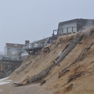
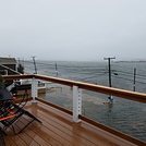
Fotos de Surf
de la galeríaContornos: Carreteras y Ríos: Selecciona un spot desde el menú 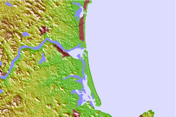


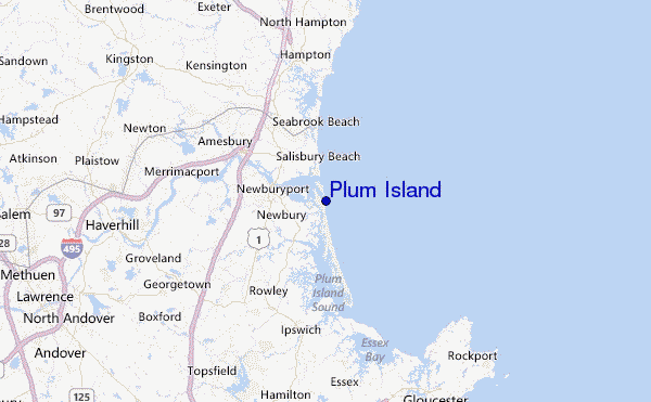
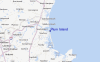
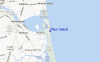
Usa este mapa para navegar hacia las playas de surf de Massachusetts y estaciones de marea cercanas de Plum Island
Spots de Surf más cercanos a Plum Island:
(Clica la ubicación para más detalles)- Closest spot2 mi
- Second closest spot6 mi
- Third closest spot8 mi
- Fourth closest spot9 mi
- Fifth closest spot10 mi
Boyas marinas más cercanas a Plum Island:
- Closest Boya Marinas23 mi
- Second closest Boya Marinas32 mi
- Third closest Boya Marinas32 mi
- Fourth closest Boya Marinas33 mi
- Fifth closest Boya Marinas61 mi
Estaciones de marea más cercanas a Plum Island:
- Closest estación de mareaMerrimack River Entrance1 mi
- Second closest estación de mareaNewburyport4 mi
- Third closest estación de mareaSalisbury Point, Merrimack River6 mi
- Fourth closest estación de mareaPlum Island Sound (south end)6 mi
- Fifth closest estación de mareaHampton Harbor7 mi
Airports
- The closest passenger airport to Plum Island is General Edward Lawrence Logan International (Boston) Airport (BOS) in USA, 51 km (32 miles) away (directly).
- The second nearest airport to Plum Island is Laurence G Hanscom Fld (Bedford) Airport (BED), also in USA, 54 km (34 miles) away.
- Third is Portland International Jetport Airport (PWM) in USA, 102 km (63 miles) away.
- North Central State (Smithfield) Airport (SFZ) in USA is 113 km (70 miles) away.
- Otis Angb (Falmouth) Airport (FMH), also in USA is the fifth nearest airport to Plum Island and is 129 km (80 miles) away.
- /breaks/Plum-Island/forecasts/latest


 Nearest