
Latigo Point Surf Guide
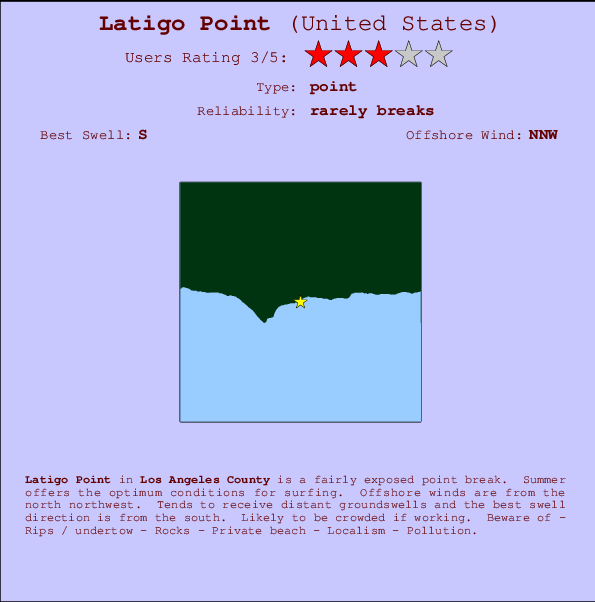
Latigo Point in Los Angeles County is a fairly exposed point break. Summer offers the best conditions for surfing. Offshore winds are from the north northwest. Most of the surf here comes from groundswells and the ideal swell direction is from the south. Often Crowded. Watch out for - Rips / undertow - Rocks - Private beach - Localism - Pollution.
Latigo Point Spot Info
| Type: | Rating: | Reliability: | Todays Sea Temp*: |
|---|---|---|---|
| rarely breaks | 22.5°C*ocean temperature recorded from satellite |
Surfing Latigo Point:
The best conditions reported for surf at Latigo Point occur when a South swell combines with an offshore wind direction from the North-northwest.

Energía de Olas (poder): 12 horas


Latigo Point Surf:
Sunday, 2 August 2026, 12:10 Local time| domingo 02 | ||||
| 8AM | 11AM | 2PM | 5PM | |
| Wave (m) | ||||
| Período (s) | 13 | 12 | 12 | 12 |
| Viento (km/h) | ||||
| Estado del Viento | glass | on | cross- on |
cross |
- /breaks/Latigo-Point/forecasts/latest
Latigo Point Surf Guide
Latigo Point in Los Angeles County is a fairly exposed point break. Summer offers the best conditions for surfing. Offshore winds are from the north northwest. Most of the surf here comes from groundswells and the ideal swell direction is from the south. Often Crowded. Watch out for - Rips / undertow - Rocks - Private beach - Localism - Pollution.
Latigo Point Spot Info
Type: Rating: Reliability: Todays Sea Temp*:  Point
Point 3
3rarely breaks 22.5°C*ocean temperature recorded from satelliteSurfing Latigo Point:
The best conditions reported for surf at Latigo Point occur when a South swell combines with an offshore wind direction from the North-northwest.
Energía de Olas (poder): 12 horas
Usa la barra de navegación de arriba para ver la temperatura del mar en Latigo Point, fotografías Latigo Point, previsiones detalladas de olas para Latigo Point, vientos y previsión del tiempo, webcams para Latigo Point, viento actual desde estaciones meteorológicas en CAL - LA County y predicciones de marea para Latigo Point. Las mapas de olas para United States enseñarán un mapa grande de United States y los mares que rodean. Los mapas de olas pueden ser animadas para mostrar diferentes componentes de olas, la altura de ola, la energía de ola, el período, junto con previsiones de viento y del tiempo. Previsiones actuales del tiempo y del estado del mar provienen de boyas marinas de United States, del barcos que transitan en la zona y de estaciones meteorológicas costeras. Cada página de previsiones tiene un Busca-Olas Regional y Global para localizar las mejores condiciones para surfear en el área de Latigo Point.
Latigo Point Surf:
Sunday, 2 August 2026, 12:10 Local timedomingo 02 8AM 11AM 2PM 5PM Wave (m) Período (s) 13 12 12 12 Viento (km/h) Estado del Viento glass on cross-
oncross - /breaks/Latigo-Point/forecasts/latest
- /breaks/Latigo-Point/forecasts/latest/six_day
Latigo Point Surf Guide
Latigo Point in Los Angeles County is a fairly exposed point break. Summer offers the best conditions for surfing. Offshore winds are from the north northwest. Most of the surf here comes from groundswells and the ideal swell direction is from the south. Often Crowded. Watch out for - Rips / undertow - Rocks - Private beach - Localism - Pollution.
Latigo Point Spot Info
Type: Rating: Reliability: Todays Sea Temp*: Point3rarely breaks 22.5°C*ocean temperature recorded from satelliteSurfing Latigo Point:
The best conditions reported for surf at Latigo Point occur when a South swell combines with an offshore wind direction from the North-northwest.
Energía de Olas (poder): 12 horas
Usa la barra de navegación de arriba para ver la temperatura del mar en Latigo Point, fotografías Latigo Point, previsiones detalladas de olas para Latigo Point, vientos y previsión del tiempo, webcams para Latigo Point, viento actual desde estaciones meteorológicas en CAL - LA County y predicciones de marea para Latigo Point. Las mapas de olas para United States enseñarán un mapa grande de United States y los mares que rodean. Los mapas de olas pueden ser animadas para mostrar diferentes componentes de olas, la altura de ola, la energía de ola, el período, junto con previsiones de viento y del tiempo. Previsiones actuales del tiempo y del estado del mar provienen de boyas marinas de United States, del barcos que transitan en la zona y de estaciones meteorológicas costeras. Cada página de previsiones tiene un Busca-Olas Regional y Global para localizar las mejores condiciones para surfear en el área de Latigo Point.
Latigo Point Surf:
Sunday, 2 August 2026, 12:10 Local timedomingo 02 8AM 11AM 2PM 5PM Wave (m) Período (s) 13 12 12 12 Viento (km/h) Estado del Viento glass on cross-
oncross - /breaks/Latigo-Point/forecasts/latest
Latigo Point Surf Guide
Latigo Point in Los Angeles County is a fairly exposed point break. Summer offers the best conditions for surfing. Offshore winds are from the north northwest. Most of the surf here comes from groundswells and the ideal swell direction is from the south. Often Crowded. Watch out for - Rips / undertow - Rocks - Private beach - Localism - Pollution.
Latigo Point Spot Info
Type: Rating: Reliability: Todays Sea Temp*: Point3rarely breaks 22.5°C*ocean temperature recorded from satelliteSurfing Latigo Point:
The best conditions reported for surf at Latigo Point occur when a South swell combines with an offshore wind direction from the North-northwest.
Energía de Olas (poder): 12 horas
Usa la barra de navegación de arriba para ver la temperatura del mar en Latigo Point, fotografías Latigo Point, previsiones detalladas de olas para Latigo Point, vientos y previsión del tiempo, webcams para Latigo Point, viento actual desde estaciones meteorológicas en CAL - LA County y predicciones de marea para Latigo Point. Las mapas de olas para United States enseñarán un mapa grande de United States y los mares que rodean. Los mapas de olas pueden ser animadas para mostrar diferentes componentes de olas, la altura de ola, la energía de ola, el período, junto con previsiones de viento y del tiempo. Previsiones actuales del tiempo y del estado del mar provienen de boyas marinas de United States, del barcos que transitan en la zona y de estaciones meteorológicas costeras. Cada página de previsiones tiene un Busca-Olas Regional y Global para localizar las mejores condiciones para surfear en el área de Latigo Point.
Latigo Point Surf:
Sunday, 2 August 2026, 12:10 Local timedomingo 02 8AM 11AM 2PM 5PM Wave (m) Período (s) 13 12 12 12 Viento (km/h) Estado del Viento glass on cross-
oncross Tide Times:
Para Malibu Beach, a %{dist} %{km} de %{location}.
PROXIMA ES A LAS (hora local) quedan marea alta marea baja Latigo Point Tide Times and Tide Chart
Live Weather:
At BUOY-46268, 16 km from Latigo Point.
- Air temperature
-°CCurrent weather near Latigo Point
Buoy Data:
At Santa Monica Bay, CA, 14 miles from Latigo Point.
6AM 7AM 8AM 9AM Antigüedad de datos 4 hr 3 hr 2 hr 1 hr Altura de Olas (m) 
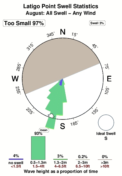
Período Dominante (s) 13 13 13 13 Overall Latigo Point Surf Consistency and Wind Distribution in agosto
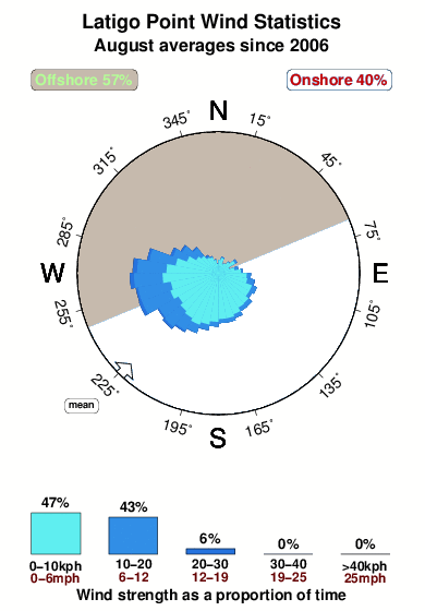


Wind stats for Latigo Point: see the variation in direction and stength by month.
Fotos de Surf
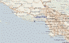
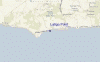
de la galeríaContornos: Carreteras y Ríos: Selecciona un spot desde el menú 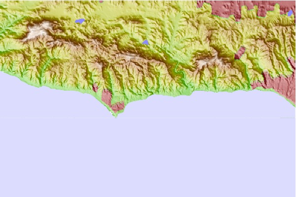
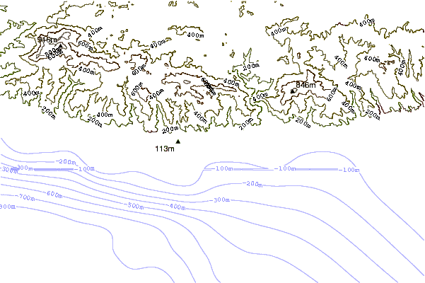
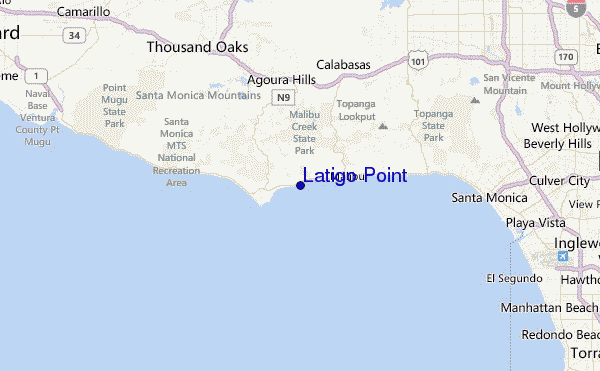
Usa este mapa para navegar hacia las playas de surf de CAL - LA County y estaciones de marea cercanas de Latigo Point
Spots de Surf más cercanos a Latigo Point:
(Clica la ubicación para más detalles)- Closest spot0 mi
- Second closest spot2 mi
- Third closest spot4 mi
- Fourth closest spot4 mi
- Fifth closest spot5 mi
Boyas marinas más cercanas a Latigo Point:
- Closest Boya Marinas14 mi
- Second closest Boya Marinas27 mi
- Third closest Boya Marinas27 mi
- Fourth closest Boya Marinas37 mi
- Fifth closest Boya Marinas39 mi
Estaciones de marea más cercanas a Latigo Point:
- Closest estación de mareaMalibu Beach4 mi
- Second closest estación de mareaMalibu4 mi
- Third closest estación de mareaLas Flores7 mi
- Fourth closest estación de mareaSanta Monica14 mi
- Fifth closest estación de mareaMarina del Rey17 mi
Airports
- The closest passenger airport to Latigo Point is Los Angeles International Airport (LAX) in USA, 33 km (20 miles) away (directly).
- The second nearest airport to Latigo Point is Point Mugu Nas Airport (NTD), also in USA, 35 km (22 miles) away.
- Third is Jack Northrop Fld Hawthorne Muni Airport (HHR) in USA, 40 km (25 miles) away.
- Burbank Glendale Pasadena Airport (BUR) in USA is 41 km (25 miles) away.
- Long Beach Airport (LGB), also in USA is the fifth nearest airport to Latigo Point and is 60 km (37 miles) away.
- /breaks/Latigo-Point/forecasts/latest
 Nearest