
Previsiones:

Pronóstico Corto PlazoLluvia ligera (totál 5mm), cayendo mayormente el martes por la mañana. Warm (max 20°C el martes por la mañana, min 19°C el martes por la noche). Vientos crecientes (Vientos ligeros desde el SO el martes por la tarde, vientos frescos desde el ONO por la noche de miércoles). | |||||||||||||||||||||||
martes 21 | miércoles 22 | jueves 23 | |||||||||||||||||||||
3 AM | 6 AM | 9 AM | 12 PM | 3 PM | 6 PM | 9 PM | 12 AM | 3 AM | 6 AM | 9 AM | 12 PM | 3 PM | 6 PM | 9 PM | 12 AM | 3 AM | 6 AM | 9 AM | 12 PM | 3 PM | 6 PM | 9 PM | |
Mapa de Altura de Olas |  | 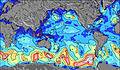 | 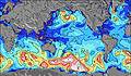 | 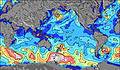 | 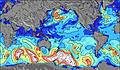 | 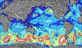 | 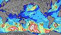 | 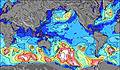 | 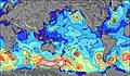 | ||||||||||||||
Oleaje Altura (m) Dirección Período (s) | SW 24 | SW 24 | SW 24 | SW 22 | SW 22 | SW 21 | SW 21 | SW 20 | SW 20 | SW 19 | SW 19 | SW 19 | WSW 18 | WSW 17 | SW 17 | SW 17 | WSW 17 | SW 16 | WSW 16 | WSW 16 | WSW 15 | WSW 15 | WSW 14 |
Gráfico Olas | |||||||||||||||||||||||
815 | 1092 | 1083 | 1556 | 2039 | 2020 | 2371 | 2667 | 2751 | 2723 | 3267 | 6930 | 5928 | 5533 | 2339 | 2471 | 4652 | 3385 | 4001 | 3606 | 3851 | 4089 | 3685 | |
Viento (km/h) | |||||||||||||||||||||||
Estado del Viento Viento de Mar Viento de Mar-Cruzado Cruzado Viento de Tierra-Cruzado Viento de Tierra Cristalino | off | cross-off | cross-off | cross | cross | cross | cross-off | cross-off | cross-off | cross-off | cross-off | cross-off | cross-off | off | off | off | off | cross-off | cross-off | cross | cross | cross-off | cross-off |
Marea alta | 1:13AM0.77m | 1:14PM0.66m | 1:55AM0.80m | 1:55PM0.63m | 2:31AM0.81m | 2:30PM0.59m | |||||||||||||||||
Marea baja | 7:27AM0.23m | 7:20PM0.15m | 8:16AM0.23m | 7:53PM0.16m | 8:58AM0.23m | 8:22PM0.17m | |||||||||||||||||
— | 8:03 | — | — | — | — | — | — | — | 8:03 | — | — | — | — | — | — | — | 8:02 | — | — | — | — | — | |
— | — | — | — | — | 6:44 | — | — | — | — | — | — | — | 6:44 | — | — | — | — | — | — | — | 6:45 | — | |
mm | 4 | 2 | 1 | 1 | — | — | — | — | — | — | — | — | — | — | — | — | 1 | 1 | — | 1 | — | — | — |
Temp. °C | 20 | 21 | 20 | 20 | 20 | 20 | 19 | 19 | 20 | 20 | 20 | 20 | 20 | 20 | 20 | 20 | 20 | 20 | 20 | 19 | 19 | 19 | 20 |
Enfriamiento °C | 16 | 17 | 17 | 17 | 18 | 19 | 18 | 17 | 18 | 17 | 17 | 18 | 17 | 17 | 16 | 16 | 15 | 15 | 15 | 14 | 15 | 14 | 15 |
Oleaje 1 Altura (m) Dirección Período (s) | SW 24 | SW 24 | W 9 | W 10 | W 10 | W 10 | W 10 | SW 20 | SW 20 | SW 19 | SW 19 | SW 19 | WSW 18 | WSW 17 | WSW 14 | WSW 14 | WSW 17 | SW 16 | SW 21 | WSW 16 | WSW 15 | WSW 15 | WSW 14 |
815 | 1092 | 937 | 864 | 804 | 761 | 668 | 2667 | 2751 | 2723 | 3267 | 6930 | 5928 | 5533 | 2136 | 1859 | 4652 | 3385 | 735 | 3606 | 3851 | 4089 | 3685 | |
Oleaje 2 Altura (m) Dirección Período (s) | SW 14 | SW 14 | SW 24 | SW 22 | SW 22 | SW 21 | SW 21 | W 9 | W 9 | W 9 | WSW 13 | S 11 | S 11 | S 11 | SW 17 | SW 17 | SSE 11 | SW 21 | S 10 | SW 19 | SW 20 | SW 20 | SW 19 |
130 | 167 | 1083 | 1556 | 2039 | 2020 | 2371 | 551 | 455 | 386 | 1139 | 119 | 114 | 149 | 2339 | 2471 | 156 | 441 | 104 | 1195 | 1092 | 1081 | 1836 | |
Oleaje 3 Altura (m) Dirección Período (s) | S 9 | SSE 9 | SW 14 | SW 14 | SW 14 | SW 13 | SW 13 | SW 13 | WSW 14 | WSW 16 | WSW 16 | — | SSE 13 | — | S 11 | S 11 | S 15 | S 11 | SSE 13 | S 10 | SSE 12 | SSE 12 | SSE 11 |
41 | 26 | 164 | 198 | 158 | 109 | 106 | 82 | 321 | 604 | 620 | — | 17 | — | 149 | 151 | 4 | 110 | 35 | 100 | 198 | 236 | 229 | |
Olas de Viento Altura (m) Dirección Período (s) | W 7 | W 8 | — | — | — | — | — | — | — | — | — | — | — | — | — | — | WNW 5 | WNW 6 | WSW 16 | — | — | — | — |
522 | 937 | — | — | — | — | — | — | — | — | — | — | — | — | — | — | 59 | 100 | 4001 | — | — | — | — | |
Viento del Tierra o Mar Limpio más proximo | |||||||||||||||||||||||
Distancia (km) | 3523 | 3523 | 3680 | 9 | 9 | 9 | 9 | 3668 | 3606 | 3606 | 3632 | 3606 | 3606 | 0 | 3606 | 3606 | 3632 | 3638 | 3632 | 3632 | 3663 | 3585 | 3539 |
Mejores Olas Previstas en Easter Island | |||||||||||||||||||||||
Mejores Olas Previstas en Chile | |||||||||||||||||||||||
Busca-Olas Global | |||||||||||||||||||||||
- Map Icons:
 Break
Break Live Wave Height (m)
 Live Wind Speed (km/h)
 Surf Rating (10 Max)
 Ocean Swells (m)
- Wind Speed (km/h)
GRÁTIS! Un widget de Surf-Forecast.com para tu sitio
Este widget grátis de previsiones de surf y tiempo puede ser añadido a cualquier otro sitio y da un resumen de previsiones de olas para Koe Koe. Solo necesita cortar y pegar el código HTML de abajo en su web. Puede elegir preferencias de idioma y de unidades (métricas o imperiales) para convenir a los usuarios de su sitio. Clica aquí para obtener el código.
 Nearest