
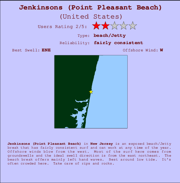
Jenkinsons (Point Pleasant Beach) Surf Guide
Jenkinsons (Point Pleasant) in New Jersey is an exposed beach/Jetty break that has reasonably consistent surf and can work at any time of the year. Works best in offshore winds from the west. Tends to receive a mix of groundswells and windswells and the optimum swell angle is from the east northeast. The beach break favours left handers. Best around low tide. When the surf is up, crowds are likely Hazards include rips and rocks.
Jenkinsons (Point Pleasant Beach) Spot Info
| Type: | Rating: | Reliability: | Todays Sea Temp*: |
|---|---|---|---|
| fairly consistent | 23.9°C*ocean temperature recorded from satellite |
Surfing Jenkinsons (Point Pleasant Beach):
The best conditions reported for surf at Jenkinsons (Point Pleasant Beach) occur when a East-northeast swell combines with an offshore wind direction from the West.

Energía de Olas (poder): 12 horas


Jenkinsons (Point Pleasant Beach) Surf:
Monday, 3 August 2026, 08:24 Local time| lunes 03 | ||||
| 5AM | 8AM | 11AM | 2PM | |
| Wave (m) | ||||
| Período (s) | - | - | - | - |
| Viento (km/h) | ||||
| Estado del Viento | cross- off |
cross- off |
cross- off |
cross- off |
- /breaks/Jenkinsons_Point-Pleasant/forecasts/latest

Jenkinsons (Point Pleasant Beach) Surf Guide
Jenkinsons (Point Pleasant) in New Jersey is an exposed beach/Jetty break that has reasonably consistent surf and can work at any time of the year. Works best in offshore winds from the west. Tends to receive a mix of groundswells and windswells and the optimum swell angle is from the east northeast. The beach break favours left handers. Best around low tide. When the surf is up, crowds are likely Hazards include rips and rocks.
Jenkinsons (Point Pleasant Beach) Spot Info
Type: Rating: Reliability: Todays Sea Temp*:  Beach/jetty
 2
2fairly consistent 23.9°C*ocean temperature recorded from satelliteSurfing Jenkinsons (Point Pleasant Beach):
The best conditions reported for surf at Jenkinsons (Point Pleasant Beach) occur when a East-northeast swell combines with an offshore wind direction from the West.
Energía de Olas (poder): 12 horas
Usa la barra de navegación de arriba para ver la temperatura del mar en Jenkinsons (Point Pleasant Beach), fotografías Jenkinsons (Point Pleasant Beach), previsiones detalladas de olas para Jenkinsons (Point Pleasant Beach), vientos y previsión del tiempo, webcams para Jenkinsons (Point Pleasant Beach), viento actual desde estaciones meteorológicas en New Jersey y predicciones de marea para Jenkinsons (Point Pleasant Beach). Las mapas de olas para United States enseñarán un mapa grande de United States y los mares que rodean. Los mapas de olas pueden ser animadas para mostrar diferentes componentes de olas, la altura de ola, la energía de ola, el período, junto con previsiones de viento y del tiempo. Previsiones actuales del tiempo y del estado del mar provienen de boyas marinas de United States, del barcos que transitan en la zona y de estaciones meteorológicas costeras. Cada página de previsiones tiene un Busca-Olas Regional y Global para localizar las mejores condiciones para surfear en el área de Jenkinsons (Point Pleasant Beach).
Jenkinsons (Point Pleasant Beach) Surf:
Monday, 3 August 2026, 08:24 Local timelunes 03 5AM 8AM 11AM 2PM Wave (m) Período (s) - - - - Viento (km/h) Estado del Viento cross-
offcross-
offcross-
offcross-
off- /breaks/Jenkinsons_Point-Pleasant/forecasts/latest
- /breaks/Jenkinsons_Point-Pleasant/forecasts/latest/six_day
Jenkinsons (Point Pleasant Beach) Surf Guide
Jenkinsons (Point Pleasant) in New Jersey is an exposed beach/Jetty break that has reasonably consistent surf and can work at any time of the year. Works best in offshore winds from the west. Tends to receive a mix of groundswells and windswells and the optimum swell angle is from the east northeast. The beach break favours left handers. Best around low tide. When the surf is up, crowds are likely Hazards include rips and rocks.
Jenkinsons (Point Pleasant Beach) Spot Info
Type: Rating: Reliability: Todays Sea Temp*: Beach/jetty2fairly consistent 23.9°C*ocean temperature recorded from satelliteSurfing Jenkinsons (Point Pleasant Beach):
The best conditions reported for surf at Jenkinsons (Point Pleasant Beach) occur when a East-northeast swell combines with an offshore wind direction from the West.
Energía de Olas (poder): 12 horas
Usa la barra de navegación de arriba para ver la temperatura del mar en Jenkinsons (Point Pleasant Beach), fotografías Jenkinsons (Point Pleasant Beach), previsiones detalladas de olas para Jenkinsons (Point Pleasant Beach), vientos y previsión del tiempo, webcams para Jenkinsons (Point Pleasant Beach), viento actual desde estaciones meteorológicas en New Jersey y predicciones de marea para Jenkinsons (Point Pleasant Beach). Las mapas de olas para United States enseñarán un mapa grande de United States y los mares que rodean. Los mapas de olas pueden ser animadas para mostrar diferentes componentes de olas, la altura de ola, la energía de ola, el período, junto con previsiones de viento y del tiempo. Previsiones actuales del tiempo y del estado del mar provienen de boyas marinas de United States, del barcos que transitan en la zona y de estaciones meteorológicas costeras. Cada página de previsiones tiene un Busca-Olas Regional y Global para localizar las mejores condiciones para surfear en el área de Jenkinsons (Point Pleasant Beach).
Jenkinsons (Point Pleasant Beach) Surf:
Monday, 3 August 2026, 08:24 Local timelunes 03 5AM 8AM 11AM 2PM Wave (m) Período (s) - - - - Viento (km/h) Estado del Viento cross-
offcross-
offcross-
offcross-
off- /breaks/Jenkinsons_Point-Pleasant/forecasts/latest
Jenkinsons (Point Pleasant Beach) Surf Guide
Jenkinsons (Point Pleasant) in New Jersey is an exposed beach/Jetty break that has reasonably consistent surf and can work at any time of the year. Works best in offshore winds from the west. Tends to receive a mix of groundswells and windswells and the optimum swell angle is from the east northeast. The beach break favours left handers. Best around low tide. When the surf is up, crowds are likely Hazards include rips and rocks.
Jenkinsons (Point Pleasant Beach) Spot Info
Type: Rating: Reliability: Todays Sea Temp*: Beach/jetty2fairly consistent 23.9°C*ocean temperature recorded from satelliteSurfing Jenkinsons (Point Pleasant Beach):
The best conditions reported for surf at Jenkinsons (Point Pleasant Beach) occur when a East-northeast swell combines with an offshore wind direction from the West.
Energía de Olas (poder): 12 horas
Usa la barra de navegación de arriba para ver la temperatura del mar en Jenkinsons (Point Pleasant Beach), fotografías Jenkinsons (Point Pleasant Beach), previsiones detalladas de olas para Jenkinsons (Point Pleasant Beach), vientos y previsión del tiempo, webcams para Jenkinsons (Point Pleasant Beach), viento actual desde estaciones meteorológicas en New Jersey y predicciones de marea para Jenkinsons (Point Pleasant Beach). Las mapas de olas para United States enseñarán un mapa grande de United States y los mares que rodean. Los mapas de olas pueden ser animadas para mostrar diferentes componentes de olas, la altura de ola, la energía de ola, el período, junto con previsiones de viento y del tiempo. Previsiones actuales del tiempo y del estado del mar provienen de boyas marinas de United States, del barcos que transitan en la zona y de estaciones meteorológicas costeras. Cada página de previsiones tiene un Busca-Olas Regional y Global para localizar las mejores condiciones para surfear en el área de Jenkinsons (Point Pleasant Beach).
Jenkinsons (Point Pleasant Beach) Surf:
Monday, 3 August 2026, 08:24 Local timelunes 03 5AM 8AM 11AM 2PM Wave (m) Período (s) - - - - Viento (km/h) Estado del Viento cross-
offcross-
offcross-
offcross-
offTide Times:
Para Belmar, Atlantic Ocean, New Jersey, a %{dist} %{km} de %{location}.
PROXIMA ES A LAS (hora local) quedan marea alta marea baja Jenkinsons (Point Pleasant Beach) Tide Times and Tide Chart
Live Weather:
At Belmar/Farmdale Airport, 11 km from Jenkinsons (Point Pleasant Beach).
light winds from the S.(Wind varies from 005 to 011 degs)
(km/h)
Dry and cloudyAir temperature
A2977°CCurrent weather near Jenkinsons (Point Pleasant Beach)
Buoy Data:
At New York Harbour Buoy, 26 miles from Jenkinsons (Point Pleasant Beach).
3AM 4AM 5AM 6AM Antigüedad de datos 4 hr 3 hr 2 hr 1 hr Altura de Olas (m) 


Overall Jenkinsons (Point Pleasant Beach) Surf Consistency and Wind Distribution in agosto


Surf stats for Jenkinsons (Point Pleasant Beach): see the swell variation by month.

Wind stats for Jenkinsons (Point Pleasant Beach): see the variation in direction and stength by month.
Fotos de Surf
de la galeríaContornos: Carreteras y Ríos: Selecciona un spot desde el menú 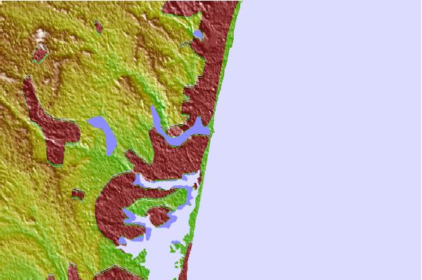
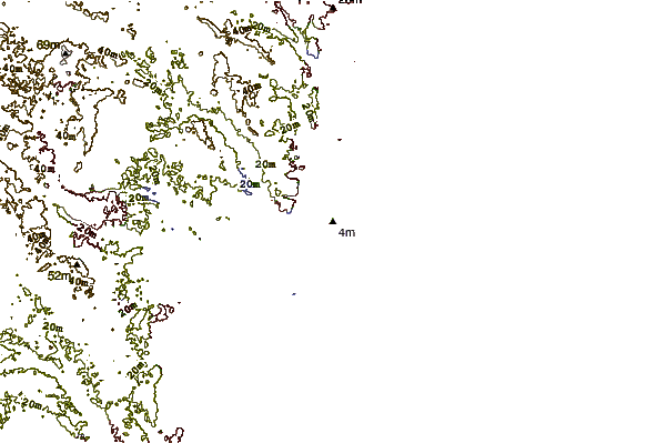
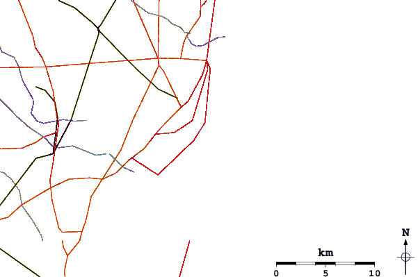
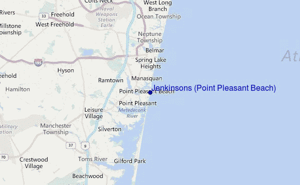
Usa este mapa para navegar hacia las playas de surf de New Jersey y estaciones de marea cercanas de Jenkinsons (Point Pleasant Beach)
Spots de Surf más cercanos a Jenkinsons (Point Pleasant Beach):
(Clica la ubicación para más detalles)- Closest spot1 mi
- Second closest spot2 mi
- Third closest spot2 mi
- Fourth closest spot4 mi
- Fifth closest spot4 mi
Boyas marinas más cercanas a Jenkinsons (Point Pleasant Beach):
- Closest Boya Marinas26 mi
- Second closest Boya Marinas26 mi
- Third closest Boya Marinas35 mi
- Fourth closest Boya Marinas47 mi
- Fifth closest Boya Marinas65 mi
Estaciones de marea más cercanas a Jenkinsons (Point Pleasant Beach):
- Closest estación de mareaManasquan Inlet, USCG Station1 mi
- Second closest estación de mareaRoute 35 bridge1 mi
- Third closest estación de mareaBeaverdam Creek entrance2 mi
- Fourth closest estación de mareaRiviera Beach2 mi
- Fifth closest estación de mareaSea Girt2 mi
Airports
- The closest passenger airport to Jenkinsons (Point Pleasant Beach) is Lakehurst Naes Airport (NEL) in USA, 28 km (17 miles) away (directly).
- The second nearest airport to Jenkinsons (Point Pleasant Beach) is Mc Guire Afb (Wrightstown) Airport (WRI), also in USA, 48 km (30 miles) away.
- Third is John F Kennedy International (New York) Airport (JFK) in USA, 65 km (40 miles) away.
- Newark Liberty International Airport (EWR) in USA is 67 km (42 miles) away.
- Trenton Mercer Airport (TTN), also in USA is the fifth nearest airport to Jenkinsons (Point Pleasant Beach) and is 69 km (43 miles) away.
- /breaks/Jenkinsons_Point-Pleasant/forecasts/latest


 Nearest