
Previsiones:

Pronóstico Corto PlazoFuerte lluvia (totál 26mm), más pesada durante la mañana de lunes. Warm (max 28°C el viernes por la tarde, min 27°C el viernes por la noche). El viento será generalmente ligero. | |||||||||||||||||||||
vie 31 | sábado 1 | domingo 2 | |||||||||||||||||||
11 AM | 2 PM | 5 PM | 8 PM | 11 PM | 2 AM | 5 AM | 8 AM | 11 AM | 2 PM | 5 PM | 8 PM | 11 PM | 2 AM | 5 AM | 8 AM | 11 AM | 2 PM | 5 PM | 8 PM | 11 PM | |
Mapa de Altura de Olas |  |  |  |  | 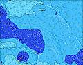 | 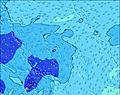 | 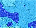 | 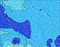 | |||||||||||||
Oleaje Altura (m) Dirección Período (s) | SSW 12 | SSW 14 | SSW 14 | SSW 13 | SSW 13 | SSW 13 | SSW 13 | S 12 | SSW 12 | SSW 12 | SSW 12 | SSW 12 | SSW 12 | SSW 12 | SSW 11 | SSW 11 | SSW 11 | SSW 11 | SSW 11 | SSW 11 | SSW 11 |
Gráfico Olas | |||||||||||||||||||||
133 | 133 | 131 | 137 | 178 | 176 | 170 | 108 | 210 | 213 | 161 | 203 | 203 | 196 | 180 | 170 | 170 | 170 | 167 | 167 | 153 | |
Viento (km/h) | |||||||||||||||||||||
Estado del Viento Viento de Mar Viento de Mar-Cruzado Cruzado Viento de Tierra-Cruzado Viento de Tierra Cristalino | cross-off | glassy | glassy | cross | cross-on | cross-on | cross-on | cross-on | cross-on | cross-on | cross-on | cross-on | cross | cross | cross | cross-off | cross-off | cross-off | cross-off | cross-off | off |
Marea alta | 8:35AM0.46m | 8:33PM0.71m | 9:27AM0.50m | 9:02PM0.64m | 10:25AM0.54m | 9:33PM0.56m | |||||||||||||||
Marea baja | 1:53PM0.23m | 3:27AM0.17m | 2:45PM0.28m | 3:54AM0.16m | 3:53PM0.34m | ||||||||||||||||
— | — | — | — | — | — | 6:35 | — | — | — | — | — | — | — | 6:35 | — | — | — | — | — | — | |
— | — | 6:52 | — | — | — | — | — | — | — | 6:52 | — | — | — | — | — | — | — | 6:52 | — | — | |
mm | — | — | — | 1 | 1 | — | 1 | 3 | 1 | 1 | 2 | — | 2 | 1 | — | 1 | — | — | 1 | 1 | 1 |
Temp. °C | 28 | 28 | 28 | 28 | 28 | 28 | 27 | 27 | 28 | 28 | 28 | 28 | 27 | 27 | 27 | 27 | 28 | 28 | 27 | 27 | 27 |
Enfriamiento °C | 31 | 32 | 32 | 31 | 31 | 30 | 29 | 29 | 29 | 30 | 29 | 30 | 29 | 29 | 29 | 28 | 30 | 30 | 29 | 30 | 29 |
Oleaje 1 Altura (m) Dirección Período (s) | NE 9 | NE 8 | NE 8 | NE 8 | SSW 13 | NE 8 | NE 8 | NE 8 | SSW 12 | SSW 12 | SSW 12 | SSW 12 | SSW 12 | SSW 12 | SSW 11 | SSW 11 | SSW 11 | SSW 11 | SSW 11 | SSW 11 | SSW 11 |
81 | 54 | 54 | 53 | 178 | 100 | 80 | 80 | 210 | 213 | 161 | 203 | 203 | 196 | 180 | 170 | 170 | 170 | 167 | 167 | 153 | |
Oleaje 2 Altura (m) Dirección Período (s) | SSW 12 | SSW 14 | ENE 16 | SSW 13 | NE 8 | SSW 13 | SSW 13 | ENE 15 | NE 8 | NE 8 | ENE 14 | ENE 14 | NE 8 | NE 8 | NE 8 | NE 8 | NE 8 | NE 8 | NE 8 | NE 9 | NE 8 |
133 | 133 | 201 | 137 | 66 | 176 | 170 | 167 | 65 | 60 | 154 | 149 | 62 | 69 | 80 | 80 | 78 | 78 | 70 | 115 | 73 | |
Oleaje 3 Altura (m) Dirección Período (s) | ESE 8 | ESE 8 | SSW 14 | ENE 15 | ENE 15 | ENE 15 | ENE 15 | S 12 | ENE 14 | ENE 14 | NE 8 | NE 8 | ENE 14 | ENE 13 | SE 8 | SE 9 | ESE 8 | ESE 8 | ENE 15 | ENE 13 | ESE 8 |
40 | 41 | 131 | 184 | 172 | 172 | 172 | 108 | 156 | 156 | 45 | 46 | 145 | 101 | 57 | 62 | 46 | 46 | 191 | 139 | 40 | |
Olas de Viento Altura (m) Dirección Período (s) | — | — | — | — | — | — | WSW 7 | S 3 | S 3 | S 4 | S 4 | S 4 | S 4 | S 4 | — | SE 4 | SE 4 | — | — | — | — |
— | — | — | — | — | — | 16 | 3 | 5 | 9 | 7 | 6 | 4 | 4 | — | 3 | 3 | — | — | — | — | |
Viento del Tierra o Mar Limpio más proximo | |||||||||||||||||||||
Distancia (km) | 0 | 0 | 0 | 1787 | 1792 | 1776 | 1776 | 1776 | 1893 | 1809 | 1794 | 1776 | 1726 | 1726 | 1726 | 1787 | 1828 | 1891 | 1828 | 0 | 0 |
Mejores Olas Previstas en Line Islands | |||||||||||||||||||||
Mejores Olas Previstas en Kiribati | |||||||||||||||||||||
Busca-Olas Global | |||||||||||||||||||||
- Map Icons:
 Break
Break Live Wave Height (m)
 Live Wind Speed (km/h)
 Surf Rating (10 Max)
 Ocean Swells (m)
- Wind Speed (km/h)
GRÁTIS! Un widget de Surf-Forecast.com para tu sitio
Este widget grátis de previsiones de surf y tiempo puede ser añadido a cualquier otro sitio y da un resumen de previsiones de olas para English Channel Left (Fanning Island). Solo necesita cortar y pegar el código HTML de abajo en su web. Puede elegir preferencias de idioma y de unidades (métricas o imperiales) para convenir a los usuarios de su sitio. Clica aquí para obtener el código.
 Nearest