
Previsiones:

Pronóstico Corto PlazoMayormente seco. Warm (max 29°C el miércoles por la tarde, min 17°C el jueves por la noche). Vientos decreciente (vientos frescos desde el SO el jueves por la mañana, calma por la noche de jueves). | |||||||||||||||||||||
mar 28 | miércoles 29 | jueves 30 | |||||||||||||||||||
11 AM | 2 PM | 5 PM | 8 PM | 11 PM | 2 AM | 5 AM | 8 AM | 11 AM | 2 PM | 5 PM | 8 PM | 11 PM | 2 AM | 5 AM | 8 AM | 11 AM | 2 PM | 5 PM | 8 PM | 11 PM | |
Mapa de Altura de Olas | 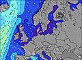 | 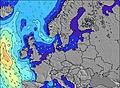 | 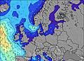 | 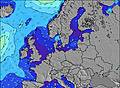 |  |  |  |  | |||||||||||||
Oleaje Altura (m) Dirección Período (s) | NNW 8 | NNW 8 | NNW 9 | NNW 9 | NNW 9 | NNW 9 | NW 9 | NW 9 | NNW 9 | NNW 9 | NNW 9 | NNW 9 | NNW 9 | NNW 9 | NNW 8 | NNW 8 | SW 4 | W 4 | W 4 | W 5 | WNW 5 |
Gráfico Olas | |||||||||||||||||||||
108 | 101 | 84 | 88 | 70 | 70 | 64 | 64 | 44 | 30 | 33 | 32 | 26 | 25 | 28 | 14 | 26 | 22 | 33 | 43 | 33 | |
Viento (km/h) | |||||||||||||||||||||
Estado del Viento Viento de Mar Viento de Mar-Cruzado Cruzado Viento de Tierra-Cruzado Viento de Tierra Cristalino | cross-on | cross-on | cross-on | cross-on | cross-off | cross-off | cross-off | cross-off | off | off | on | cross | cross-off | off | cross-off | cross | cross-on | cross-on | cross-on | cross-on | on |
Marea alta | 10:29AM2.19m | 11:03PM2.03m | 11:17AM2.29m | 11:47PM2.12m | 11:59AM2.38m | ||||||||||||||||
Marea baja | 5:02PM0.29m | 5:12AM0.36m | 5:43PM0.18m | 5:52AM0.24m | 6:21PM0.07m | ||||||||||||||||
— | — | — | — | — | — | 5:41 | — | — | — | — | — | — | — | 5:43 | — | — | — | — | — | — | |
— | — | — | 9:37 | — | — | — | — | — | — | — | 9:36 | — | — | — | — | — | — | — | 9:34 | — | |
mm | — | — | — | — | — | — | — | — | — | — | — | — | — | — | — | — | — | — | — | — | — |
Temp. °C | 19 | 21 | 21 | 21 | 23 | 22 | 22 | 22 | 25 | 29 | 27 | 27 | 29 | 26 | 23 | 20 | 19 | 19 | 18 | 17 | 17 |
Enfriamiento °C | 17 | 18 | 18 | 19 | 23 | 20 | 20 | 20 | 23 | 27 | 25 | 25 | 25 | 23 | 20 | 16 | 15 | 16 | 15 | 14 | 15 |
Oleaje 1 Altura (m) Dirección Período (s) | NNW 8 | NNW 8 | NNW 9 | NNW 9 | NNW 9 | NNW 9 | NW 9 | NW 9 | NNW 9 | NNW 9 | NNW 9 | NNW 9 | NNW 9 | NNW 9 | NNW 8 | NNW 8 | NNW 8 | NNW 8 | NNW 8 | NNW 8 | NNW 8 |
108 | 101 | 84 | 88 | 70 | 70 | 64 | 64 | 44 | 30 | 33 | 32 | 26 | 25 | 28 | 14 | 13 | 13 | 13 | 13 | 6 | |
Oleaje 2 Altura (m) Dirección Período (s) | — | — | — | — | W 4 | W 4 | — | — | WNW 5 | W 5 | W 5 | W 4 | W 4 | — | — | — | — | — | — | — | — |
— | — | — | — | 6 | 3 | — | — | 5 | 4 | 4 | 1 | 2 | — | — | — | — | — | — | — | — | |
Oleaje 3 Altura (m) Dirección Período (s) | — | — | — | — | — | — | — | — | — | — | — | — | — | — | — | — | — | — | — | — | — |
— | — | — | — | — | — | — | — | — | — | — | — | — | — | — | — | — | — | — | — | — | |
Olas de Viento Altura (m) Dirección Período (s) | W 4 | W 4 | W 4 | W 4 | — | — | — | S 2 | SSE 3 | — | — | — | — | SSE 3 | S 4 | SW 4 | SW 4 | W 4 | W 4 | W 5 | WNW 5 |
10 | 6 | 6 | 8 | — | — | — | 1 | 1 | — | — | — | — | 6 | 12 | 18 | 26 | 22 | 33 | 43 | 33 | |
Viento del Tierra o Mar Limpio más proximo | |||||||||||||||||||||
Distancia (km) | 436 | 436 | 582 | 138 | 0 | 3 | 3 | 0 | 701 | 701 | 817 | 818 | 587 | 587 | 826 | 497 | 582 | 860 | 1044 | 933 | 860 |
Mejores Olas Previstas en Nordsee (North Sea) | |||||||||||||||||||||
Mejores Olas Previstas en Germany | |||||||||||||||||||||
Busca-Olas Global | |||||||||||||||||||||
- Map Icons:
 Break
Break Live Wave Height (m)
 Live Wind Speed (km/h)
 Surf Rating (10 Max)
 Ocean Swells (m)
- Wind Speed (km/h)
GRÁTIS! Un widget de Surf-Forecast.com para tu sitio
Este widget grátis de previsiones de surf y tiempo puede ser añadido a cualquier otro sitio y da un resumen de previsiones de olas para Borkum Nordstrand. Solo necesita cortar y pegar el código HTML de abajo en su web. Puede elegir preferencias de idioma y de unidades (métricas o imperiales) para convenir a los usuarios de su sitio. Clica aquí para obtener el código.
 Nearest