
Previsiones:

Pronóstico Corto PlazoMayormente seco. Warm (max 24°C el martes por la tarde, min 17°C el lunes por la noche). El viento será generalmente ligero. | ||||||||||||||||||||
lun 27 | martes 28 | miércoles 29 | ||||||||||||||||||
2 PM | 5 PM | 8 PM | 11 PM | 2 AM | 5 AM | 8 AM | 11 AM | 2 PM | 5 PM | 8 PM | 11 PM | 2 AM | 5 AM | 8 AM | 11 AM | 2 PM | 5 PM | 8 PM | 11 PM | |
Mapa de Altura de Olas |  | 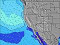 |  |  |  |  |  |  | ||||||||||||
Oleaje Altura (m) Dirección Período (s) | SSW 18 | SSW 19 | SSW 19 | SSW 19 | SSW 17 | SSW 17 | SSW 18 | SSW 18 | SSW 18 | SSW 17 | SSW 17 | SSW 17 | NW 8 | NW 8 | SSW 16 | SSW 16 | SSW 16 | SSW 16 | WNW 8 | NW 8 |
Gráfico Olas | ||||||||||||||||||||
913 | 963 | 750 | 455 | 780 | 807 | 943 | 943 | 943 | 798 | 911 | 684 | 667 | 552 | 635 | 627 | 627 | 620 | 372 | 784 | |
Viento (km/h) | ||||||||||||||||||||
Estado del Viento Viento de Mar Viento de Mar-Cruzado Cruzado Viento de Tierra-Cruzado Viento de Tierra Cristalino | cross | cross | cross | cross-off | cross-off | cross-off | cross-off | cross | cross | cross | cross | cross | cross-off | cross-off | cross-off | cross | cross | cross | cross | glassy |
Marea alta | 11:07AM1.09m | 9:18PM1.74m | 11:31AM1.12m | 9:54PM1.76m | 11:56AM1.15m | 10:30PM1.74m | ||||||||||||||
Marea baja | 3:06PM0.86m | 4:47AM-0.14m | 3:43PM0.81m | 5:18AM-0.16m | 4:22PM0.77m | |||||||||||||||
— | — | — | — | — | 6:09 | — | — | — | — | — | — | — | 6:09 | — | — | — | — | — | — | |
— | — | 8:13 | — | — | — | — | — | — | — | 8:12 | — | — | — | — | — | — | — | 8:10 | — | |
mm | — | — | — | — | — | — | — | — | — | — | — | — | — | — | — | — | — | — | — | — |
Temp. °C | 23 | 22 | 20 | 19 | 18 | 17 | 20 | 23 | 24 | 23 | 21 | 19 | 18 | 18 | 20 | 23 | 23 | 23 | 19 | 17 |
Enfriamiento °C | 20 | 18 | 16 | 16 | 16 | 15 | 17 | 20 | 20 | 19 | 17 | 17 | 16 | 16 | 19 | 22 | 21 | 20 | 17 | 17 |
Oleaje 1 Altura (m) Dirección Período (s) | SSW 18 | SSW 19 | SSW 19 | SSW 19 | WNW 7 | WNW 7 | SSW 18 | SSW 18 | SSW 18 | SSW 17 | SSW 17 | SSW 17 | WNW 7 | WNW 7 | WNW 7 | SSW 16 | SSW 16 | SSW 16 | SSW 16 | WNW 8 |
913 | 963 | 750 | 455 | 163 | 129 | 943 | 943 | 943 | 798 | 911 | 684 | 249 | 178 | 183 | 627 | 627 | 620 | 341 | 392 | |
Oleaje 2 Altura (m) Dirección Período (s) | SW 12 | SW 12 | SW 16 | SW 16 | SSW 17 | SSW 17 | WNW 7 | S 10 | SW 11 | S 20 | S 20 | S 20 | SSW 16 | SSW 16 | SSW 16 | S 18 | S 18 | SSE 14 | SW 16 | SSW 16 |
37 | 23 | 159 | 261 | 780 | 807 | 129 | 2 | 31 | 194 | 119 | 119 | 667 | 552 | 635 | 155 | 155 | 120 | 258 | 425 | |
Oleaje 3 Altura (m) Dirección Período (s) | S 11 | SSW 10 | SW 12 | SW 12 | SSW 12 | SW 12 | S 10 | SE 18 | SSE 18 | SSE 18 | SSE 18 | SSE 17 | SE 16 | S 18 | S 18 | SSE 16 | SSE 15 | S 18 | SSE 14 | S 17 |
9 | 10 | 37 | 37 | 56 | 35 | 2 | 13 | 33 | 32 | 61 | 54 | 66 | 225 | 157 | 142 | 121 | 155 | 77 | 200 | |
Olas de Viento Altura (m) Dirección Período (s) | WNW 6 | WNW 7 | WNW 7 | WNW 7 | NW 7 | NW 7 | NW 7 | WNW 7 | WNW 7 | WNW 7 | WNW 7 | WNW 7 | NW 8 | NW 8 | NW 8 | WNW 7 | WNW 7 | WNW 7 | WNW 8 | NW 8 |
175 | 313 | 363 | 307 | 466 | 352 | 352 | 158 | 297 | 428 | 478 | 397 | 664 | 505 | 441 | 193 | 209 | 264 | 372 | 784 | |
Viento del Tierra o Mar Limpio más proximo | ||||||||||||||||||||
Distancia (km) | 160 | 160 | 68 | 0 | 0 | 0 | 0 | 162 | 160 | 160 | 68 | 68 | 0 | 0 | 0 | 151 | 162 | 160 | 35 | 0 |
Mejores Olas Previstas en San Luis Obispo | ||||||||||||||||||||
Mejores Olas Previstas en United States | ||||||||||||||||||||
Busca-Olas Global | ||||||||||||||||||||
- Map Icons:
 Break
Break Live Wave Height (m)
 Live Wind Speed (km/h)
 Surf Rating (10 Max)
 Ocean Swells (m)
- Wind Speed (km/h)
GRÁTIS! Un widget de Surf-Forecast.com para tu sitio
Este widget grátis de previsiones de surf y tiempo puede ser añadido a cualquier otro sitio y da un resumen de previsiones de olas para Arroyo Laguna. Solo necesita cortar y pegar el código HTML de abajo en su web. Puede elegir preferencias de idioma y de unidades (métricas o imperiales) para convenir a los usuarios de su sitio. Clica aquí para obtener el código.
 Nearest