
Previsiones:

Pronóstico Corto PlazoMayormente seco. Warm (max 21°C el viernes por la mañana, min 18°C el jueves por la mañana). Vientos decreciente (vientos frescos desde el ONO el jueves por la noche, Vientos ligeros desde el O por la noche de sábado). | |||||||||||||||||||||||
jueves 30 | viernes 31 | sábado 1 | |||||||||||||||||||||
3 AM | 6 AM | 9 AM | 12 PM | 3 PM | 6 PM | 9 PM | 12 AM | 3 AM | 6 AM | 9 AM | 12 PM | 3 PM | 6 PM | 9 PM | 12 AM | 3 AM | 6 AM | 9 AM | 12 PM | 3 PM | 6 PM | 9 PM | |
Mapa de Altura de Olas |  | 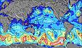 | 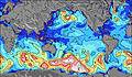 | 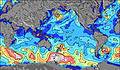 | 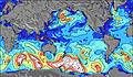 |  |  |  |  | ||||||||||||||
Oleaje Altura (m) Dirección Período (s) | SW 12 | SW 12 | SW 12 | SW 11 | SW 11 | WSW 12 | WSW 12 | WSW 11 | W 7 | W 7 | WSW 10 | WSW 10 | WSW 11 | WSW 11 | WSW 11 | WSW 10 | WSW 11 | WSW 11 | WSW 11 | WSW 11 | WSW 11 | WSW 12 | WSW 11 |
Gráfico Olas | |||||||||||||||||||||||
531 | 522 | 440 | 455 | 455 | 361 | 407 | 243 | 219 | 358 | 1010 | 1147 | 1237 | 1172 | 1080 | 749 | 940 | 1075 | 1485 | 1602 | 1645 | 1784 | 1324 | |
Viento (km/h) | |||||||||||||||||||||||
Estado del Viento Viento de Mar Viento de Mar-Cruzado Cruzado Viento de Tierra-Cruzado Viento de Tierra Cristalino | cross-off | cross-off | cross-off | off | off | off | off | off | cross-off | cross-off | off | off | off | off | off | off | off | off | off | off | off | off | cross-off |
Marea alta | 6:30AM0.70m | 6:58PM0.45m | 7:28AM0.66m | 8:33PM0.46m | 8:38AM0.63m | ||||||||||||||||||
Marea baja | 1:46PM0.33m | 00:08AM0.33m | 2:52PM0.32m | 1:34AM0.37m | 3:52PM0.31m | ||||||||||||||||||
— | 7:58 | — | — | — | — | — | — | — | 7:58 | — | — | — | — | — | — | — | 7:56 | — | — | — | — | — | |
— | — | — | — | — | 6:47 | — | — | — | — | — | — | — | 6:49 | — | — | — | — | — | — | — | 6:49 | — | |
mm | — | — | — | — | — | — | — | — | — | — | — | — | — | — | — | — | — | — | — | — | — | — | — |
Temp. °C | 18 | 18 | 18 | 19 | 19 | 20 | 20 | 20 | 20 | 20 | 21 | 21 | 21 | 21 | 21 | 20 | 20 | 20 | 20 | 20 | 20 | 21 | 21 |
Enfriamiento °C | 16 | 16 | 16 | 16 | 15 | 16 | 16 | 16 | 16 | 15 | 17 | 17 | 17 | 18 | 19 | 17 | 17 | 17 | 16 | 16 | 16 | 17 | 17 |
Oleaje 1 Altura (m) Dirección Período (s) | SW 12 | SW 12 | SW 12 | SW 11 | SW 11 | WSW 12 | WSW 12 | WSW 11 | WSW 11 | WSW 10 | SW 15 | WSW 10 | WSW 11 | WSW 11 | WSW 11 | WSW 10 | WSW 11 | WSW 11 | SE 12 | SE 12 | SE 12 | WSW 12 | WSW 11 |
531 | 522 | 440 | 455 | 455 | 361 | 407 | 243 | 167 | 85 | 55 | 1147 | 1237 | 1172 | 1080 | 749 | 940 | 1075 | 124 | 116 | 139 | 1784 | 1324 | |
Oleaje 2 Altura (m) Dirección Período (s) | WSW 12 | WSW 12 | WSW 12 | WSW 12 | WSW 12 | SSW 11 | SW 15 | SW 11 | SSW 11 | SW 12 | SE 9 | SE 9 | SE 9 | SE 9 | SE 9 | SW 12 | SE 13 | SE 13 | NNW 11 | NNW 11 | N 13 | SE 12 | SSW 13 |
469 | 454 | 373 | 367 | 361 | 154 | 176 | 97 | 87 | 71 | 20 | 20 | 20 | 21 | 13 | 291 | 27 | 79 | 11 | 11 | 14 | 137 | 458 | |
Oleaje 3 Altura (m) Dirección Período (s) | SW 16 | SW 16 | SW 16 | SSE 10 | SSE 10 | SW 15 | SW 11 | SW 15 | SE 9 | SW 10 | NNW 12 | NNW 11 | NNW 11 | NNW 11 | NNW 11 | SE 9 | SE 10 | NNW 11 | N 13 | N 14 | NNW 10 | SSW 14 | SE 12 |
171 | 133 | 130 | 38 | 38 | 174 | 59 | 106 | 21 | 36 | 13 | 13 | 12 | 12 | 12 | 14 | 14 | 11 | 14 | 15 | 10 | 163 | 134 | |
Olas de Viento Altura (m) Dirección Período (s) | — | — | — | — | WNW 3 | WNW 4 | WNW 5 | W 6 | W 7 | W 7 | WSW 10 | — | — | — | — | — | NW 4 | NW 5 | WSW 11 | WSW 11 | WSW 11 | — | — |
— | — | — | — | 5 | 23 | 47 | 121 | 219 | 358 | 1010 | — | — | — | — | — | 34 | 42 | 1485 | 1602 | 1645 | — | — | |
Viento del Tierra o Mar Limpio más proximo | |||||||||||||||||||||||
Distancia (km) | 0 | 0 | 0 | 0 | 3522 | 3522 | 3538 | 3573 | 3573 | 3755 | 3632 | 3673 | 3558 | 3538 | 0 | 3605 | 3631 | 3631 | 3605 | 3662 | 3662 | 3662 | 3660 |
Mejores Olas Previstas en Easter Island | |||||||||||||||||||||||
Mejores Olas Previstas en Chile | |||||||||||||||||||||||
Busca-Olas Global | |||||||||||||||||||||||
- Map Icons:
 Break
Break Live Wave Height (m)
 Live Wind Speed (km/h)
 Surf Rating (10 Max)
 Ocean Swells (m)
- Wind Speed (km/h)
GRÁTIS! Un widget de Surf-Forecast.com para tu sitio
Este widget grátis de previsiones de surf y tiempo puede ser añadido a cualquier otro sitio y da un resumen de previsiones de olas para Akahanga. Solo necesita cortar y pegar el código HTML de abajo en su web. Puede elegir preferencias de idioma y de unidades (métricas o imperiales) para convenir a los usuarios de su sitio. Clica aquí para obtener el código.
 Nearest