
Trearddur Bay (Holy Island) Surf Guide
Trearddur Bay(Holy Island) in Anglesy is a quite exposed beach break that has unreliable waves with no particular seasonal pattern. Works best in offshore winds from the northeast with some shelter here from southeast winds. Windswells and groundswells in equal measure and the ideal swell angle is from the southwest. The beach breaks offer lefts and rights. When the surf is up, it can get quite busy in the water. Hazards include rips and rocks.
Trearddur Bay (Holy Island) Spot Info
| Type: | Rating: | Reliability: | Todays Sea Temp*: |
|---|---|---|---|
| inconsistent | 16.5°C*ocean temperature recorded from satellite |
Surfing Trearddur Bay (Holy Island):
The best conditions reported for surf at Trearddur Bay (Holy Island) occur when a Southwest swell combines with an offshore wind direction from the Northeast.
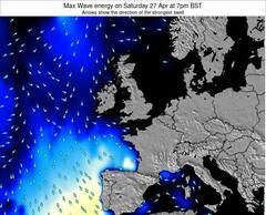
Energía de Olas (poder): 12 horas


Trearddur Bay (Holy Island) Surf:
Thursday, 30 July 2026, 01:36 Local time| mié | jueves 30 | |||
| 10PM | 1AM | 4AM | 7AM | |
| Wave (m) | ||||
| Período (s) | 5 | 5 | 5 | 5 |
| Viento (km/h) | ||||
| Estado del Viento | cross | cross | cross- on |
cross |
- /breaks/Trearddur-Bay_Holy-Island/forecasts/latest
Trearddur Bay (Holy Island) Surf Guide
Trearddur Bay(Holy Island) in Anglesy is a quite exposed beach break that has unreliable waves with no particular seasonal pattern. Works best in offshore winds from the northeast with some shelter here from southeast winds. Windswells and groundswells in equal measure and the ideal swell angle is from the southwest. The beach breaks offer lefts and rights. When the surf is up, it can get quite busy in the water. Hazards include rips and rocks.
Trearddur Bay (Holy Island) Spot Info
Type: Rating: Reliability: Todays Sea Temp*:  Beach
Beach 2
2inconsistent 16.5°C*ocean temperature recorded from satelliteSurfing Trearddur Bay (Holy Island):
The best conditions reported for surf at Trearddur Bay (Holy Island) occur when a Southwest swell combines with an offshore wind direction from the Northeast.
Energía de Olas (poder): 12 horas
Usa la barra de navegación de arriba para ver la temperatura del mar en Trearddur Bay (Holy Island), fotografías Trearddur Bay (Holy Island), previsiones detalladas de olas para Trearddur Bay (Holy Island), vientos y previsión del tiempo, webcams para Trearddur Bay (Holy Island), viento actual desde estaciones meteorológicas en Wales - Anglesy y predicciones de marea para Trearddur Bay (Holy Island). Las mapas de olas para United Kingdom enseñarán un mapa grande de United Kingdom y los mares que rodean. Los mapas de olas pueden ser animadas para mostrar diferentes componentes de olas, la altura de ola, la energía de ola, el período, junto con previsiones de viento y del tiempo. Previsiones actuales del tiempo y del estado del mar provienen de boyas marinas de United Kingdom, del barcos que transitan en la zona y de estaciones meteorológicas costeras. Cada página de previsiones tiene un Busca-Olas Regional y Global para localizar las mejores condiciones para surfear en el área de Trearddur Bay (Holy Island).
Trearddur Bay (Holy Island) Surf:
Thursday, 30 July 2026, 01:36 Local timemié jueves 30 10PM 1AM 4AM 7AM Wave (m) Período (s) 5 5 5 5 Viento (km/h) Estado del Viento cross cross cross-
oncross - /breaks/Trearddur-Bay_Holy-Island/forecasts/latest
- /breaks/Trearddur-Bay_Holy-Island/forecasts/latest/six_day
Trearddur Bay (Holy Island) Surf Guide
Trearddur Bay(Holy Island) in Anglesy is a quite exposed beach break that has unreliable waves with no particular seasonal pattern. Works best in offshore winds from the northeast with some shelter here from southeast winds. Windswells and groundswells in equal measure and the ideal swell angle is from the southwest. The beach breaks offer lefts and rights. When the surf is up, it can get quite busy in the water. Hazards include rips and rocks.
Trearddur Bay (Holy Island) Spot Info
Type: Rating: Reliability: Todays Sea Temp*: Beach2inconsistent 16.5°C*ocean temperature recorded from satelliteSurfing Trearddur Bay (Holy Island):
The best conditions reported for surf at Trearddur Bay (Holy Island) occur when a Southwest swell combines with an offshore wind direction from the Northeast.
Energía de Olas (poder): 12 horas
Usa la barra de navegación de arriba para ver la temperatura del mar en Trearddur Bay (Holy Island), fotografías Trearddur Bay (Holy Island), previsiones detalladas de olas para Trearddur Bay (Holy Island), vientos y previsión del tiempo, webcams para Trearddur Bay (Holy Island), viento actual desde estaciones meteorológicas en Wales - Anglesy y predicciones de marea para Trearddur Bay (Holy Island). Las mapas de olas para United Kingdom enseñarán un mapa grande de United Kingdom y los mares que rodean. Los mapas de olas pueden ser animadas para mostrar diferentes componentes de olas, la altura de ola, la energía de ola, el período, junto con previsiones de viento y del tiempo. Previsiones actuales del tiempo y del estado del mar provienen de boyas marinas de United Kingdom, del barcos que transitan en la zona y de estaciones meteorológicas costeras. Cada página de previsiones tiene un Busca-Olas Regional y Global para localizar las mejores condiciones para surfear en el área de Trearddur Bay (Holy Island).
Trearddur Bay (Holy Island) Surf:
Thursday, 30 July 2026, 01:36 Local timemié jueves 30 10PM 1AM 4AM 7AM Wave (m) Período (s) 5 5 5 5 Viento (km/h) Estado del Viento cross cross cross-
oncross - /breaks/Trearddur-Bay_Holy-Island/forecasts/latest
Trearddur Bay (Holy Island) Surf Guide
Trearddur Bay(Holy Island) in Anglesy is a quite exposed beach break that has unreliable waves with no particular seasonal pattern. Works best in offshore winds from the northeast with some shelter here from southeast winds. Windswells and groundswells in equal measure and the ideal swell angle is from the southwest. The beach breaks offer lefts and rights. When the surf is up, it can get quite busy in the water. Hazards include rips and rocks.
Trearddur Bay (Holy Island) Spot Info
Type: Rating: Reliability: Todays Sea Temp*: Beach2inconsistent 16.5°C*ocean temperature recorded from satelliteSurfing Trearddur Bay (Holy Island):
The best conditions reported for surf at Trearddur Bay (Holy Island) occur when a Southwest swell combines with an offshore wind direction from the Northeast.
Energía de Olas (poder): 12 horas
Usa la barra de navegación de arriba para ver la temperatura del mar en Trearddur Bay (Holy Island), fotografías Trearddur Bay (Holy Island), previsiones detalladas de olas para Trearddur Bay (Holy Island), vientos y previsión del tiempo, webcams para Trearddur Bay (Holy Island), viento actual desde estaciones meteorológicas en Wales - Anglesy y predicciones de marea para Trearddur Bay (Holy Island). Las mapas de olas para United Kingdom enseñarán un mapa grande de United Kingdom y los mares que rodean. Los mapas de olas pueden ser animadas para mostrar diferentes componentes de olas, la altura de ola, la energía de ola, el período, junto con previsiones de viento y del tiempo. Previsiones actuales del tiempo y del estado del mar provienen de boyas marinas de United Kingdom, del barcos que transitan en la zona y de estaciones meteorológicas costeras. Cada página de previsiones tiene un Busca-Olas Regional y Global para localizar las mejores condiciones para surfear en el área de Trearddur Bay (Holy Island).
Trearddur Bay (Holy Island) Surf:
Thursday, 30 July 2026, 01:36 Local timemié jueves 30 10PM 1AM 4AM 7AM Wave (m) Período (s) 5 5 5 5 Viento (km/h) Estado del Viento cross cross cross-
oncross Tide Times:
Para Holyhead, Wales, a %{dist} %{km} de %{location}.
PROXIMA ES A LAS (hora local) quedan marea alta marea baja Trearddur Bay (Holy Island) Tide Times and Tide Chart
Live Weather:
At Valley RAF Airport, 8 km from Trearddur Bay (Holy Island).
calm
(km/h)Air temperature
15°COverall Trearddur Bay (Holy Island) Surf Consistency and Wind Distribution in julio


Wind stats for Trearddur Bay (Holy Island): see the variation in direction and stength by month.
Fotos de Surf
de la galeríaContornos: Carreteras y Ríos: Selecciona un spot desde el menú 


Usa este mapa para navegar hacia las playas de surf de Wales - Anglesy y estaciones de marea cercanas de Trearddur Bay (Holy Island)
Spots de Surf más cercanos a Trearddur Bay (Holy Island):
(Clica la ubicación para más detalles)- Closest spot1 mi
- Second closest spot5 mi
- Third closest spot5 mi
- Fourth closest spot6 mi
- Fifth closest spot7 mi
Boyas marinas más cercanas a Trearddur Bay (Holy Island):
- Closest Boya Marinas35 mi
- Second closest Boya Marinas35 mi
- Third closest Boya Marinas55 mi
- Fourth closest Boya Marinas55 mi
- Fifth closest Boya Marinas58 mi
Estaciones de marea más cercanas a Trearddur Bay (Holy Island):
- Closest estación de mareaHolyhead2 mi
- Second closest estación de mareaCaernarfon17 mi
- Third closest estación de mareaBangor21 mi
- Fourth closest estación de mareaLlandudno, Gwynedd33 mi
- Fifth closest estación de mareaDeganwy33 mi
Airports
- The closest passenger airport to Trearddur Bay (Holy Island) is Isle Of Man Airport (IOM) in England, 90 km (56 miles) away (directly).
- The second nearest airport to Trearddur Bay (Holy Island) is Hawarden Airport (CEG), also in England, 110 km (68 miles) away.
- Third is Dublin Airport (DUB) in Ireland, 110 km (68 miles) away.
- Liverpool Airport (LPL) in England is 118 km (73 miles) away.
- Blackpool Airport (BLK), also in England is the fifth nearest airport to Trearddur Bay (Holy Island) and is 119 km (74 miles) away.

- /breaks/Trearddur-Bay_Holy-Island/forecasts/latest


 Nearest