

- Forecast
- Maps
- Live
- Weather State
- Spot Information

Surf Forecasts
Reef
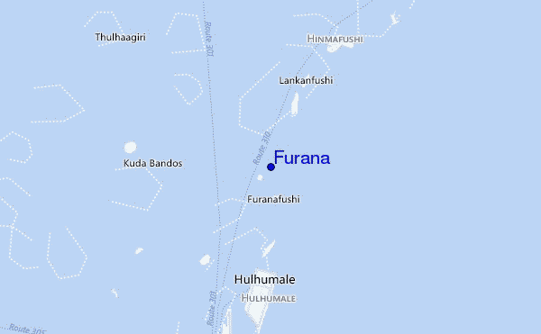
Furana surf Forecast / North Male Atoll / Maldives
48hr Weather and Surf, issued 4 am Saturday 27 Apr 2024 +05
Forecast update in hr min s Update imminent
Furana surf forecast is for near shore open water. Breaking waves will often be smaller at less exposed spots.
Today's Furana sea temperature is 30.8°C (Statistics for 27 Apr 1981-2005 - mean: 29.8 °C max: 31.2 °C min: 28.4 °C)
- Map Icons:
 Break
Break Live Wave Height (m)
 Live Wind Speed (km/h)
 Surf Rating (10 Max)
 Ocean Swells (m)
- Wind Speed (km/h)
Furana surf forecast is for near shore open water. Breaking waves will often be smaller at less exposed spots.
Today's Furana sea temperature is 30.8°C (Statistics for 27 Apr 1981-2005 - mean: 29.8 °C max: 31.2 °C min: 28.4 °C)
How big are the waves at Furana today?
The current surf forecast for Furana at 8AM is: 1.0m 9s primary swell from a Southeast direction and 0.6m 11s secondary swell from a South-southeast direction (forecast issued at 04:00am April 27). The wind direction is predicted to be glassy and the swell rating is 2.
| Time (+05) & Date | Wave Height | Wave Period |
|---|---|---|
| Morning (27 Apr) | 3.5ft (1.0m) | 9s |
| Afternoon (27 Apr) | 2.5ft (0.7m) | 22s |
| Evening (27 Apr) | 3.5ft (1.0m) | 21s |
Table - waves today at Furana. (Swell directed towards the surf break)
Updates in hr min s Update imminent
Saturday 27 | Sunday 28 | Monday 29 | Tuesday 30 | Wednesday 01 | Thursday 02 | Friday 03 | Saturday 04 | |||||||||||||||||||||||||||||||||||||||||||||||||||||
| 2 AM | 5 AM | 8 AM | 11 AM | 2 PM | 5 PM | 8 PM | 11 PM | 2 AM | 5 AM | 8 AM | 11 AM | 2 PM | 5 PM | 8 PM | 11 PM | 2 AM | 5 AM | 8 AM | 11 AM | 2 PM | 5 PM | 8 PM | 11 PM | 2 AM | 5 AM | 8 AM | 11 AM | 2 PM | 5 PM | 8 PM | 11 PM | 2 AM | 5 AM | 8 AM | 11 AM | 2 PM | 5 PM | 8 PM | 11 PM | 2 AM | 5 AM | 8 AM | 11 AM | 2 PM | 5 PM | 8 PM | 11 PM | 2 AM | 5 AM | 8 AM | 11 AM | 2 PM | 5 PM | 8 PM | 11 PM | 2 AM | 5 AM | 8 AM | 11 AM | |
Rating (10 max) | ||||||||||||||||||||||||||||||||||||||||||||||||||||||||||||
Swell Height Map |    |  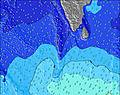 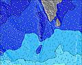 | 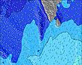 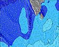 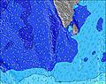 | 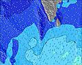 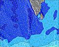 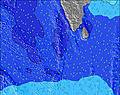 | 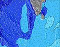  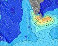 |  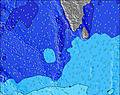 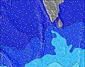 | 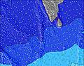 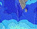 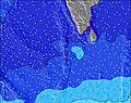 | 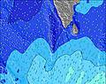 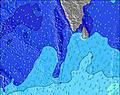 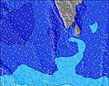 | ||||||||||||||||||||||||||||||||||||||||||||||||||||
| Wave Height (m) & direction (?) | ||||||||||||||||||||||||||||||||||||||||||||||||||||||||||||
| Period(s) (?) | 15 | 15 | 9 | 10 | 22 | 21 | 21 | 20 | 20 | 19 | 19 | 18 | 18 | 18 | 18 | 17 | 17 | 16 | 16 | 16 | 16 | 16 | 16 | 16 | 15 | 15 | 14 | 14 | 14 | 14 | 14 | 14 | 14 | 13 | 13 | 13 | 13 | 13 | 13 | 13 | 13 | 13 | 12 | 19 | 19 | 18 | 18 | 18 | 18 | 18 | 17 | 16 | 16 | 24 | 24 | 22 | 22 | 21 | 21 | 20 |
Wave (?)Graph | ||||||||||||||||||||||||||||||||||||||||||||||||||||||||||||
| Energy (?) | 256 | 188 | 159 | 256 | 453 | 611 | 735 | 1009 | 1141 | 1351 | 1501 | 1451 | 1373 | 1518 | 1753 | 1733 | 1694 | 1393 | 1327 | 1150 | 1150 | 1150 | 1136 | 950 | 786 | 716 | 602 | 594 | 301 | 362 | 362 | 362 | 293 | 229 | 178 | 178 | 178 | 175 | 175 | 175 | 147 | 109 | 103 | 122 | 118 | 79 | 108 | 152 | 150 | 150 | 143 | 173 | 206 | 404 | 541 | 987 | 1568 | 1553 | 1756 | 2321 |
Wind (km/h) | ||||||||||||||||||||||||||||||||||||||||||||||||||||||||||||
| Wind State (?) onshore cross-onshore cross-shore cross-offshore offshore glassy | glass | glass | glass | cross- off | cross- off | cross- off | cross- off | cross- off | off | off | off | off | off | off | off | off | off | off | cross- off | off | off | off | off | off | cross- off | cross- off | cross- off | cross- off | cross- off | cross- off | cross- off | cross- off | cross- off | cross- off | off | off | off | off | off | off | off | off | off | cross- off | off | off | off | off | off | off | off | cross- off | cross- off | cross- off | off | off | off | off | off | off |
High Tide / height (m) | 2:08AM 0.70 | 3:09PM 0.90 | 2:30AM 0.67 | 3:43PM 0.86 | 2:52AM 0.63 | 4:23PM 0.80 | 3:14AM 0.59 | 5:16PM 0.74 | 3:41AM 0.53 | 6:38PM 0.70 | 5:36AM 0.47 | 8:30PM 0.69 | 9:53AM 0.55 | 9:49PM 0.71 | 11:00AM 0.69 | |||||||||||||||||||||||||||||||||||||||||||||
Low Tide / height (m) | 8:20AM 0.00 | 9:12PM 0.28 | 8:47AM 0.03 | 9:44PM 0.34 | 9:17AM 0.08 | 10:25PM 0.40 | 9:50AM 0.15 | 11:27PM 0.46 | 10:32AM 0.26 | 2:38AM 0.47 | 11:58AM 0.37 | 4:08AM 0.39 | 3:17PM 0.42 | 4:39AM 0.30 | ||||||||||||||||||||||||||||||||||||||||||||||
Saturday 27 | Sunday 28 | Monday 29 | Tuesday 30 | Wednesday 01 | Thursday 02 | Friday 03 | Saturday 04 | |||||||||||||||||||||||||||||||||||||||||||||||||||||
| Sunrise | - | - | 5:54 | - | - | - | - | - | - | - | 5:54 | - | - | - | - | - | - | - | 5:54 | - | - | - | - | - | - | - | 5:54 | - | - | - | - | - | - | - | 5:54 | - | - | - | - | - | - | - | 5:54 | - | - | - | - | - | - | - | 5:54 | - | - | - | - | - | - | - | 5:54 | - |
| Sunset | - | - | - | - | - | 6:10 | - | - | - | - | - | - | - | 6:10 | - | - | - | - | - | - | - | 6:10 | - | - | - | - | - | - | - | 6:09 | - | - | - | - | - | - | - | 6:09 | - | - | - | - | - | - | - | 6:09 | - | - | - | - | - | - | - | 6:09 | - | - | - | - | - | - |
Rain (mm) | - | - | 1 | - | - | - | - | - | - | - | - | - | 2 | 2 | 4 | 1 | 1 | 1 | - | 1 | 1 | 2 | 1 | 1 | - | - | - | - | - | - | 1 | 3 | 5 | 1 | 1 | - | - | 1 | 3 | 1 | - | 1 | - | - | 1 | - | - | - | - | - | - | - | - | - | - | - | - | - | - | - |
| Temp. °C | 29 | 29 | 29 | 29 | 30 | 30 | 30 | 30 | 29 | 29 | 29 | 29 | 29 | 29 | 29 | 29 | 29 | 29 | 29 | 29 | 29 | 29 | 29 | 29 | 29 | 29 | 29 | 29 | 29 | 29 | 29 | 29 | 29 | 29 | 29 | 30 | 29 | 29 | 29 | 29 | 29 | 29 | 29 | 29 | 29 | 30 | 29 | 30 | 30 | 29 | 29 | 29 | 29 | 30 | 29 | 29 | 29 | 29 | 29 | 29 |
| Feels °C (?) | 34 | 34 | 34 | 33 | 34 | 33 | 34 | 35 | 33 | 33 | 33 | 32 | 31 | 31 | 31 | 32 | 31 | 31 | 32 | 31 | 31 | 32 | 32 | 32 | 32 | 32 | 33 | 33 | 32 | 31 | 31 | 32 | 32 | 31 | 32 | 32 | 31 | 30 | 31 | 31 | 31 | 31 | 31 | 31 | 31 | 33 | 32 | 34 | 34 | 32 | 32 | 33 | 32 | 33 | 32 | 32 | 32 | 32 | 32 | 32 |
FREE! Surf-Forecast.com widget for your website
The surf report / weather widget below is available to embed on third party websites free of charge and provides a summary of our Furana surf forecast. Simply grab the html code snippet that we provide and paste it into your own site. You can choose your preferred language and metric/imperial units for the surf forecast feed to suit users of your site. Click here to get the code.


 Nearest