
Previsiones:

Pronóstico Corto PlazoFuerte lluvia (totál 20mm), más pesada durante la tarde de domingo. Warm (max 28°C el martes por la mañana, min 27°C el domingo por la tarde). Mayormente vientos frescos. | ||||||||||||||||||||
dom 2 | lunes 3 | martes 4 | ||||||||||||||||||
2 PM | 5 PM | 8 PM | 11 PM | 2 AM | 5 AM | 8 AM | 11 AM | 2 PM | 5 PM | 8 PM | 11 PM | 2 AM | 5 AM | 8 AM | 11 AM | 2 PM | 5 PM | 8 PM | 11 PM | |
Mapa de Altura de Olas |  | 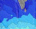 | 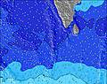 | 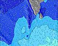 | 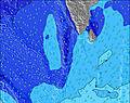 | 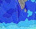 | 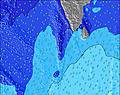 | 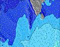 | ||||||||||||
Oleaje Altura (m) Dirección Período (s) | S 8 | SSW 13 | SSE 9 | SSW 13 | SW 14 | SW 16 | SW 16 | SW 16 | SSW 16 | SSW 17 | SSW 17 | SSW 17 | SSW 16 | SSW 16 | SSW 16 | SSW 16 | SSW 15 | SSW 15 | SSW 15 | SSW 15 |
Gráfico Olas | ||||||||||||||||||||
116 | 116 | 129 | 120 | 186 | 367 | 295 | 203 | 475 | 657 | 673 | 657 | 604 | 582 | 679 | 662 | 629 | 612 | 596 | 505 | |
Viento (km/h) | ||||||||||||||||||||
Estado del Viento Viento de Mar Viento de Mar-Cruzado Cruzado Viento de Tierra-Cruzado Viento de Tierra Cristalino | cross-off | cross-off | cross-off | cross-off | cross-off | cross-off | cross-off | cross-off | cross-off | cross-off | cross-off | cross-off | cross-off | cross-off | cross-off | cross-off | cross-off | cross-off | cross-off | cross-off |
Marea alta | 3:15PM0.93m | 3:43AM0.80m | 3:36PM0.88m | 4:20AM0.79m | 3:57PM0.82m | |||||||||||||||
Marea baja | 9:33PM0.13m | 9:27AM0.23m | 9:59PM0.12m | 10:00AM0.29m | 10:27PM0.11m | |||||||||||||||
— | — | — | — | — | 6:03 | — | — | — | — | — | — | — | 6:03 | — | — | — | — | — | — | |
— | 6:21 | — | — | — | — | — | — | — | 6:20 | — | — | — | — | — | — | — | 6:20 | — | — | |
mm | 2 | — | 1 | 1 | — | 1 | 1 | 1 | 1 | — | 1 | 1 | — | 1 | 1 | — | — | 1 | 1 | 2 |
Temp. °C | 27 | 27 | 27 | 27 | 27 | 27 | 27 | 27 | 27 | 27 | 27 | 27 | 27 | 27 | 27 | 28 | 28 | 28 | 28 | 28 |
Enfriamiento °C | 29 | 28 | 30 | 29 | 28 | 28 | 28 | 28 | 28 | 28 | 29 | 29 | 28 | 28 | 28 | 28 | 28 | 29 | 29 | 30 |
Oleaje 1 Altura (m) Dirección Período (s) | NW 11 | WNW 10 | WNW 10 | WNW 10 | WNW 10 | WNW 10 | WNW 9 | WNW 9 | WNW 9 | WNW 9 | WNW 9 | WNW 9 | WNW 9 | WNW 9 | WNW 8 | SSW 16 | SSW 15 | SSW 15 | WNW 8 | WNW 8 |
716 | 624 | 600 | 532 | 522 | 460 | 441 | 387 | 398 | 313 | 389 | 339 | 316 | 316 | 309 | 662 | 629 | 612 | 254 | 254 | |
Oleaje 2 Altura (m) Dirección Período (s) | S 8 | S 8 | SSE 9 | SSE 8 | SSE 9 | SSE 8 | SSE 9 | SSE 8 | SSW 16 | SSW 17 | SSW 17 | SSW 17 | SSW 16 | SSW 16 | SSW 16 | SSE 8 | SSE 8 | SSE 8 | SSW 15 | SSW 15 |
116 | 113 | 129 | 120 | 147 | 125 | 141 | 137 | 475 | 657 | 673 | 657 | 604 | 582 | 679 | 75 | 75 | 67 | 596 | 505 | |
Oleaje 3 Altura (m) Dirección Período (s) | ESE 10 | SSW 13 | SSW 13 | SSW 13 | SW 14 | SW 16 | SW 16 | SW 16 | SSE 8 | SSE 8 | SSE 8 | SSE 8 | SSE 8 | SSE 8 | SSE 8 | SE 9 | E 9 | E 9 | SSE 8 | SSE 8 |
64 | 116 | 114 | 116 | 186 | 367 | 295 | 203 | 137 | 111 | 108 | 99 | 108 | 76 | 76 | 3 | 2 | 2 | 65 | 63 | |
Olas de Viento Altura (m) Dirección Período (s) | — | — | — | — | — | — | — | — | — | W 4 | — | — | — | — | — | WNW 8 | WNW 8 | WNW 8 | — | — |
— | — | — | — | — | — | — | — | — | 16 | — | — | — | — | — | 302 | 302 | 294 | — | — | |
Viento del Tierra o Mar Limpio más proximo | ||||||||||||||||||||
Distancia (km) | 247 | 247 | 0 | 247 | 247 | 247 | 247 | 191 | 247 | 247 | 247 | 247 | 247 | 247 | 247 | 247 | 247 | 247 | 19 | 247 |
Mejores Olas Previstas en North Male Atoll | ||||||||||||||||||||
Mejores Olas Previstas en Maldives | ||||||||||||||||||||
Busca-Olas Global | ||||||||||||||||||||
- Map Icons:
 Break
Break Live Wave Height (m)
 Live Wind Speed (km/h)
 Surf Rating (10 Max)
 Ocean Swells (m)
- Wind Speed (km/h)
GRÁTIS! Un widget de Surf-Forecast.com para tu sitio
Este widget grátis de previsiones de surf y tiempo puede ser añadido a cualquier otro sitio y da un resumen de previsiones de olas para Furana. Solo necesita cortar y pegar el código HTML de abajo en su web. Puede elegir preferencias de idioma y de unidades (métricas o imperiales) para convenir a los usuarios de su sitio. Clica aquí para obtener el código.
 Nearest