

West Point Surf Guide
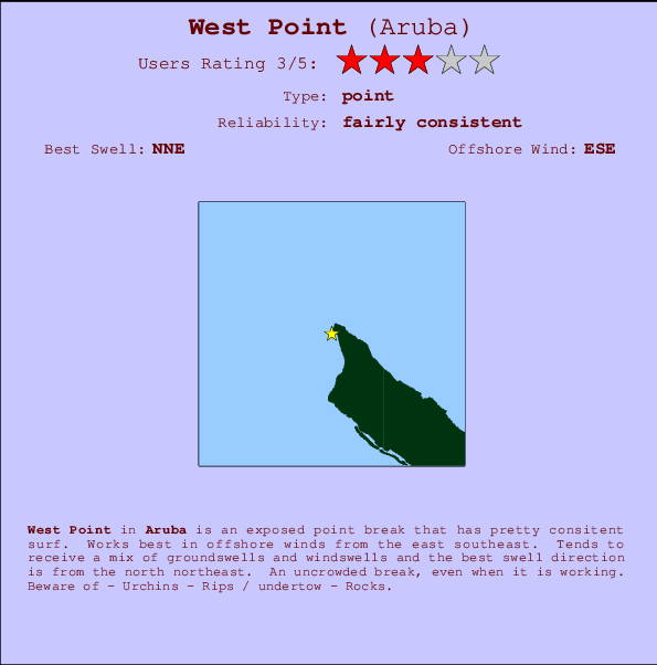
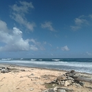
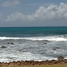
West Point in Aruba is an exposed point break that has reasonably consistent surf. Offshore winds blow from the east southeast. Waves just as likely from local windswells as from distant groundswells and the optimum swell angle is from the north northeast. An uncrowded break, even when it is working. Beware of - Urchins - Rips / undertow - Rocks.
West Point Spot Info
| Type: | Rating: | Reliability: | Todays Sea Temp*: |
|---|---|---|---|
| fairly consistent | 27.8°C*ocean temperature recorded from satellite |
Surfing West Point:
The best conditions reported for surf at West Point occur when a North-northeast swell combines with an offshore wind direction from the East-southeast.
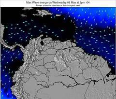
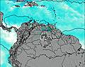
Energía de Olas (poder): 12 horas

West Point Surf:
Wednesday, 15 July 2026, 10:06 Local time| miércoles 15 | ||||
| 11AM | 2PM | 5PM | 8PM | |
| Wave (m) | ||||
| Período (s) | - | - | - | - |
| Viento (km/h) | ||||
| Estado del Viento | off | off | cross- off |
cross- off |
- /breaks/West-Point-Aruba/forecasts/latest
West Point Surf Guide
West Point in Aruba is an exposed point break that has reasonably consistent surf. Offshore winds blow from the east southeast. Waves just as likely from local windswells as from distant groundswells and the optimum swell angle is from the north northeast. An uncrowded break, even when it is working. Beware of - Urchins - Rips / undertow - Rocks.
West Point Spot Info
Type: Rating: Reliability: Todays Sea Temp*:  Point
Point 3
3fairly consistent 27.8°C*ocean temperature recorded from satelliteSurfing West Point:
The best conditions reported for surf at West Point occur when a North-northeast swell combines with an offshore wind direction from the East-southeast.
Energía de Olas (poder): 12 horas
Usa la barra de navegación de arriba para ver la temperatura del mar en West Point, fotografías West Point, previsiones detalladas de olas para West Point, vientos y previsión del tiempo, webcams para West Point, viento actual desde estaciones meteorológicas en Aruba y predicciones de marea para West Point. Las mapas de olas para Aruba enseñarán un mapa grande de Aruba y los mares que rodean. Los mapas de olas pueden ser animadas para mostrar diferentes componentes de olas, la altura de ola, la energía de ola, el período, junto con previsiones de viento y del tiempo. Previsiones actuales del tiempo y del estado del mar provienen de boyas marinas de Aruba, del barcos que transitan en la zona y de estaciones meteorológicas costeras. Cada página de previsiones tiene un Busca-Olas Regional y Global para localizar las mejores condiciones para surfear en el área de West Point.
West Point Surf:
Wednesday, 15 July 2026, 10:06 Local timemiércoles 15 11AM 2PM 5PM 8PM Wave (m) Período (s) - - - - Viento (km/h) Estado del Viento off off cross-
offcross-
off- /breaks/West-Point-Aruba/forecasts/latest
- /breaks/West-Point-Aruba/forecasts/latest/six_day
West Point Surf Guide
West Point in Aruba is an exposed point break that has reasonably consistent surf. Offshore winds blow from the east southeast. Waves just as likely from local windswells as from distant groundswells and the optimum swell angle is from the north northeast. An uncrowded break, even when it is working. Beware of - Urchins - Rips / undertow - Rocks.
West Point Spot Info
Type: Rating: Reliability: Todays Sea Temp*: Point3fairly consistent 27.8°C*ocean temperature recorded from satelliteSurfing West Point:
The best conditions reported for surf at West Point occur when a North-northeast swell combines with an offshore wind direction from the East-southeast.
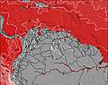
Energía de Olas (poder): 12 horas
Usa la barra de navegación de arriba para ver la temperatura del mar en West Point, fotografías West Point, previsiones detalladas de olas para West Point, vientos y previsión del tiempo, webcams para West Point, viento actual desde estaciones meteorológicas en Aruba y predicciones de marea para West Point. Las mapas de olas para Aruba enseñarán un mapa grande de Aruba y los mares que rodean. Los mapas de olas pueden ser animadas para mostrar diferentes componentes de olas, la altura de ola, la energía de ola, el período, junto con previsiones de viento y del tiempo. Previsiones actuales del tiempo y del estado del mar provienen de boyas marinas de Aruba, del barcos que transitan en la zona y de estaciones meteorológicas costeras. Cada página de previsiones tiene un Busca-Olas Regional y Global para localizar las mejores condiciones para surfear en el área de West Point.
West Point Surf:
Wednesday, 15 July 2026, 10:06 Local timemiércoles 15 11AM 2PM 5PM 8PM Wave (m) Período (s) - - - - Viento (km/h) Estado del Viento off off cross-
offcross-
off- /breaks/West-Point-Aruba/forecasts/latest
West Point Surf Guide
West Point in Aruba is an exposed point break that has reasonably consistent surf. Offshore winds blow from the east southeast. Waves just as likely from local windswells as from distant groundswells and the optimum swell angle is from the north northeast. An uncrowded break, even when it is working. Beware of - Urchins - Rips / undertow - Rocks.
West Point Spot Info
Type: Rating: Reliability: Todays Sea Temp*: Point3fairly consistent 27.8°C*ocean temperature recorded from satelliteSurfing West Point:
The best conditions reported for surf at West Point occur when a North-northeast swell combines with an offshore wind direction from the East-southeast.
Energía de Olas (poder): 12 horas
Usa la barra de navegación de arriba para ver la temperatura del mar en West Point, fotografías West Point, previsiones detalladas de olas para West Point, vientos y previsión del tiempo, webcams para West Point, viento actual desde estaciones meteorológicas en Aruba y predicciones de marea para West Point. Las mapas de olas para Aruba enseñarán un mapa grande de Aruba y los mares que rodean. Los mapas de olas pueden ser animadas para mostrar diferentes componentes de olas, la altura de ola, la energía de ola, el período, junto con previsiones de viento y del tiempo. Previsiones actuales del tiempo y del estado del mar provienen de boyas marinas de Aruba, del barcos que transitan en la zona y de estaciones meteorológicas costeras. Cada página de previsiones tiene un Busca-Olas Regional y Global para localizar las mejores condiciones para surfear en el área de West Point.
West Point Surf:
Wednesday, 15 July 2026, 10:06 Local timemiércoles 15 11AM 2PM 5PM 8PM Wave (m) Período (s) - - - - Viento (km/h) Estado del Viento off off cross-
offcross-
offTide Times:
Para Arasji, a %{dist} %{km} de %{location}.
PROXIMA ES A LAS (hora local) quedan marea alta marea baja West Point Tide Times and Tide Chart
Live Weather:
At Queen Beatrix Airport, 15 km from West Point.
moderate winds from the ESE
(km/h)
Shower moderate rain showerAir temperature
28°COverall West Point Surf Consistency and Wind Distribution in julio
Fotos de Surf
de la galeríaContornos: Carreteras y Ríos: Selecciona un spot desde el menú 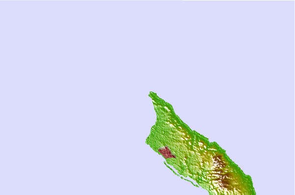
Usa este mapa para navegar hacia las playas de surf de Aruba y estaciones de marea cercanas de West Point
Spots de Surf más cercanos a West Point:
(Clica la ubicación para más detalles)- Closest spot1 mi
- Second closest spot1 mi
- Third closest spot1 mi
- Fourth closest spot3 mi
- Fifth closest spot5 mi
Boyas marinas más cercanas a West Point:
- Closest Boya Marinas433 mi
- Second closest Boya Marinas439 mi
- Third closest Boya Marinas483 mi
- Fourth closest Boya Marinas496 mi
- Fifth closest Boya Marinas515 mi
Estaciones de marea más cercanas a West Point:
- Closest estación de mareaArasji1 mi
- Second closest estación de mareaBabijn7 mi
- Third closest estación de mareaAngochi10 mi
- Fourth closest estación de mareaOranjestad10 mi
- Fifth closest estación de mareaAmuay61 mi
Airports
- The closest passenger airport to West Point is Reina Beatrix International (Oranjestad) Airport (AUA) in Aruba, 14 km (9 miles) away (directly).
- The second nearest airport to West Point is Josefa Camejo (Paraguana) Airport (LSP) in Venezuela, 94 km (58 miles) away.
- Third is Hato (Willemstad) Airport (CUR) in Antilles, 129 km (80 miles) away.
- Jose Leonardo Chirinos (Coro) Airport (CZE) in Venezuela is 140 km (87 miles) away.
- Flamingo (Kralendijk) Airport (BON) in Antilles is the fifth nearest airport to West Point and is 202 km (125 miles) away.
- /breaks/West-Point-Aruba/forecasts/latest


 Nearest