
Previsiones:

Pronóstico Corto PlazoMayormente seco. Very mild (max 19°C el viernes por la mañana, min 14°C el viernes por la noche). Vientos decreciente (vientos fuertes desde el SSO el viernes por la mañana, calma por la noche de sábado). | ||||||||||||||||||||||||
viernes 24 | sábado 25 | domingo 26 | ||||||||||||||||||||||
2 AM | 5 AM | 8 AM | 11 AM | 2 PM | 5 PM | 8 PM | 11 PM | 2 AM | 5 AM | 8 AM | 11 AM | 2 PM | 5 PM | 8 PM | 11 PM | 2 AM | 5 AM | 8 AM | 11 AM | 2 PM | 5 PM | 8 PM | 11 PM | |
Mapa de Altura de Olas |  |  |  |  | 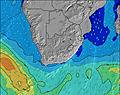 |  |  | 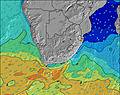 |  | |||||||||||||||
Oleaje Altura (m) Dirección Período (s) | SSW 6 | S 7 | S 8 | S 10 | S 9 | S 9 | S 9 | S 9 | S 9 | SSE 9 | SSE 9 | SSE 10 | SSE 10 | SSE 10 | SSE 10 | SSE 10 | SSE 10 | SSE 9 | SE 9 | SE 9 | SE 9 | SE 9 | SE 9 | SE 9 |
Gráfico Olas | ||||||||||||||||||||||||
131 | 371 | 1006 | 2055 | 1520 | 1080 | 718 | 854 | 432 | 474 | 510 | 587 | 539 | 563 | 506 | 522 | 470 | 404 | 382 | 335 | 266 | 206 | 132 | 107 | |
Viento (km/h) | ||||||||||||||||||||||||
Estado del Viento Viento de Mar Viento de Mar-Cruzado Cruzado Viento de Tierra-Cruzado Viento de Tierra Cristalino | cross | cross | cross | cross-on | cross-on | cross-on | cross | cross-off | cross-off | cross-off | cross-off | cross-on | on | on | glassy | off | off | off | cross-off | cross | cross | cross | cross-off | cross-off |
Marea alta | 11:15PM1.16m | 12:21PM1.07m | 00:56AM1.19m | 1:43PM1.16m | 1:58AM1.29m | 2:31PM1.28m | ||||||||||||||||||
Marea baja | 5:55AM0.71m | 6:18PM0.72m | 7:26AM0.63m | 7:40PM0.63m | 8:18AM0.52m | 8:29PM0.52m | ||||||||||||||||||
— | 6:47 | — | — | — | — | — | — | — | 6:46 | — | — | — | — | — | — | — | 6:46 | — | — | — | — | — | — | |
— | — | — | — | — | 5:17 | — | — | — | — | — | — | — | 5:19 | — | — | — | — | — | — | — | 5:19 | — | — | |
mm | — | — | — | — | — | — | — | — | — | — | — | — | — | — | — | — | — | — | — | — | — | — | — | — |
Temp. °C | 20 | 17 | 18 | 19 | 19 | 17 | 17 | 15 | 15 | 14 | 15 | 18 | 19 | 17 | 16 | 15 | 14 | 14 | 14 | 17 | 19 | 18 | 17 | 15 |
Enfriamiento °C | 15 | 10 | 8 | 9 | 11 | 10 | 12 | 12 | 12 | 12 | 13 | 16 | 17 | 16 | 16 | 14 | 13 | 12 | 12 | 13 | 15 | 14 | 14 | 11 |
Oleaje 1 Altura (m) Dirección Período (s) | SE 12 | SE 11 | SE 11 | SE 11 | SE 11 | SE 11 | SSW 18 | S 8 | S 9 | SSE 9 | SSE 9 | SSE 10 | SSE 10 | SSE 10 | SSE 10 | SSE 10 | SSE 10 | SSE 9 | SE 9 | SE 9 | SE 9 | SE 9 | SE 9 | SE 9 |
106 | 103 | 101 | 60 | 60 | 43 | 251 | 505 | 432 | 474 | 510 | 587 | 539 | 563 | 506 | 522 | 470 | 404 | 382 | 335 | 266 | 206 | 132 | 107 | |
Oleaje 2 Altura (m) Dirección Período (s) | S 12 | S 12 | NE 7 | S 22 | SSW 20 | SSW 19 | SE 11 | SSW 17 | SSW 16 | SSW 16 | SSW 15 | SSW 15 | SSW 15 | SSW 15 | SSW 15 | SSW 14 | SSW 14 | SSW 14 | SSW 14 | SSW 13 | SSW 13 | SSW 13 | SSW 12 | SSW 12 |
106 | 72 | 2 | 9 | 78 | 125 | 42 | 290 | 269 | 357 | 231 | 123 | 172 | 174 | 125 | 120 | 118 | 115 | 143 | 184 | 232 | 181 | 123 | 85 | |
Oleaje 3 Altura (m) Dirección Período (s) | NE 6 | ENE 6 | E 9 | — | E 10 | E 10 | E 10 | SE 11 | SE 11 | SE 11 | SE 10 | S 19 | E 10 | E 9 | E 9 | E 9 | E 9 | E 8 | SSW 18 | E 8 | SSW 16 | E 8 | S 18 | SSW 17 |
9 | 4 | 2 | — | 2 | 2 | 2 | 41 | 40 | 29 | 28 | 63 | 2 | 6 | 6 | 6 | 6 | 6 | 31 | 5 | 107 | 5 | 55 | 92 | |
Olas de Viento Altura (m) Dirección Período (s) | SSW 6 | S 7 | S 8 | S 10 | S 9 | S 9 | S 9 | S 9 | — | — | — | — | — | — | — | — | — | — | — | NE 2 | ENE 3 | ENE 4 | ENE 5 | NE 5 |
131 | 371 | 1006 | 2055 | 1520 | 1080 | 718 | 854 | — | — | — | — | — | — | — | — | — | — | — | 1 | 7 | 18 | 37 | 64 | |
Viento del Tierra o Mar Limpio más proximo | ||||||||||||||||||||||||
Distancia (km) | 382 | 712 | 404 | 656 | 376 | 301 | 25 | 19 | 0 | 0 | 0 | 25 | 376 | 184 | 0 | 0 | 0 | 0 | 0 | 27 | 667 | 659 | 394 | 190 |
Mejores Olas Previstas en Durban/KwaZulu-Natal South Coast | ||||||||||||||||||||||||
Mejores Olas Previstas en South Africa | ||||||||||||||||||||||||
Busca-Olas Global | ||||||||||||||||||||||||
- Map Icons:
 Break
Break Live Wave Height (m)
 Live Wind Speed (km/h)
 Surf Rating (10 Max)
 Ocean Swells (m)
- Wind Speed (km/h)
GRÁTIS! Un widget de Surf-Forecast.com para tu sitio
Este widget grátis de previsiones de surf y tiempo puede ser añadido a cualquier otro sitio y da un resumen de previsiones de olas para Warner Beach. Solo necesita cortar y pegar el código HTML de abajo en su web. Puede elegir preferencias de idioma y de unidades (métricas o imperiales) para convenir a los usuarios de su sitio. Clica aquí para obtener el código.
 Nearest