
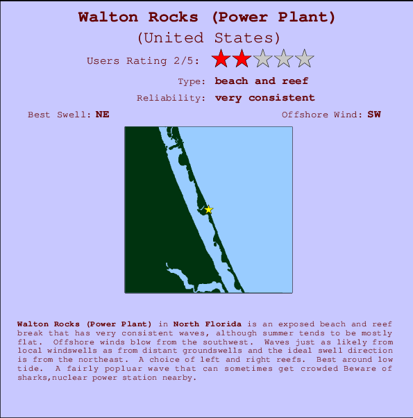
Walton Rocks (Power Plant) Surf Guide
Walton Rocks(Power Plant) in North Florida is an exposed beach and reef break that has very consistent surf, although summer tends to be mostly flat. Offshore winds blow from the southwest. Tends to receive a mix of groundswells and windswells and the best swell direction is from the northeast. Reef breaks provide lefts and rights. Best around low tide. It's sometimes crowded here. Hazards include sharks,nuclear power station nearby.
Walton Rocks (Power Plant) Spot Info
| Type: | Rating: | Reliability: | Todays Sea Temp*: |
|---|---|---|---|
| very consistent | 29.3°C*ocean temperature recorded from satellite |
Surfing Walton Rocks (Power Plant):
The best conditions reported for surf at Walton Rocks (Power Plant) occur when a Northeast swell combines with an offshore wind direction from the Southwest.
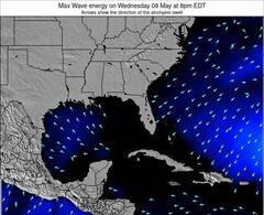
Energía de Olas (poder): 12 horas
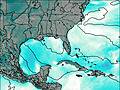

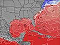
Walton Rocks (Power Plant) Surf:
Wednesday, 22 July 2026, 15:21 Local time| miércoles 22 | ||||
| 11AM | 2PM | 5PM | 8PM | |
| Wave (m) | ||||
| Período (s) | 4 | 8 | 4 | 4 |
| Viento (km/h) | ||||
| Estado del Viento | cross | cross | cross | cross |
- /breaks/Walton-Rocks/forecasts/latest
Walton Rocks (Power Plant) Surf Guide
Walton Rocks(Power Plant) in North Florida is an exposed beach and reef break that has very consistent surf, although summer tends to be mostly flat. Offshore winds blow from the southwest. Tends to receive a mix of groundswells and windswells and the best swell direction is from the northeast. Reef breaks provide lefts and rights. Best around low tide. It's sometimes crowded here. Hazards include sharks,nuclear power station nearby.
Walton Rocks (Power Plant) Spot Info
Type: Rating: Reliability: Todays Sea Temp*:  Beach and reef
 2
2very consistent 29.3°C*ocean temperature recorded from satelliteSurfing Walton Rocks (Power Plant):
The best conditions reported for surf at Walton Rocks (Power Plant) occur when a Northeast swell combines with an offshore wind direction from the Southwest.
Energía de Olas (poder): 12 horas
Usa la barra de navegación de arriba para ver la temperatura del mar en Walton Rocks (Power Plant), fotografías Walton Rocks (Power Plant), previsiones detalladas de olas para Walton Rocks (Power Plant), vientos y previsión del tiempo, webcams para Walton Rocks (Power Plant), viento actual desde estaciones meteorológicas en Florida - North y predicciones de marea para Walton Rocks (Power Plant). Las mapas de olas para United States enseñarán un mapa grande de United States y los mares que rodean. Los mapas de olas pueden ser animadas para mostrar diferentes componentes de olas, la altura de ola, la energía de ola, el período, junto con previsiones de viento y del tiempo. Previsiones actuales del tiempo y del estado del mar provienen de boyas marinas de United States, del barcos que transitan en la zona y de estaciones meteorológicas costeras. Cada página de previsiones tiene un Busca-Olas Regional y Global para localizar las mejores condiciones para surfear en el área de Walton Rocks (Power Plant).
Walton Rocks (Power Plant) Surf:
Wednesday, 22 July 2026, 15:21 Local timemiércoles 22 11AM 2PM 5PM 8PM Wave (m) Período (s) 4 8 4 4 Viento (km/h) Estado del Viento cross cross cross cross - /breaks/Walton-Rocks/forecasts/latest
- /breaks/Walton-Rocks/forecasts/latest/six_day
Walton Rocks (Power Plant) Surf Guide
Walton Rocks(Power Plant) in North Florida is an exposed beach and reef break that has very consistent surf, although summer tends to be mostly flat. Offshore winds blow from the southwest. Tends to receive a mix of groundswells and windswells and the best swell direction is from the northeast. Reef breaks provide lefts and rights. Best around low tide. It's sometimes crowded here. Hazards include sharks,nuclear power station nearby.
Walton Rocks (Power Plant) Spot Info
Type: Rating: Reliability: Todays Sea Temp*: Beach and reef2very consistent 29.3°C*ocean temperature recorded from satelliteSurfing Walton Rocks (Power Plant):
The best conditions reported for surf at Walton Rocks (Power Plant) occur when a Northeast swell combines with an offshore wind direction from the Southwest.
Energía de Olas (poder): 12 horas
Usa la barra de navegación de arriba para ver la temperatura del mar en Walton Rocks (Power Plant), fotografías Walton Rocks (Power Plant), previsiones detalladas de olas para Walton Rocks (Power Plant), vientos y previsión del tiempo, webcams para Walton Rocks (Power Plant), viento actual desde estaciones meteorológicas en Florida - North y predicciones de marea para Walton Rocks (Power Plant). Las mapas de olas para United States enseñarán un mapa grande de United States y los mares que rodean. Los mapas de olas pueden ser animadas para mostrar diferentes componentes de olas, la altura de ola, la energía de ola, el período, junto con previsiones de viento y del tiempo. Previsiones actuales del tiempo y del estado del mar provienen de boyas marinas de United States, del barcos que transitan en la zona y de estaciones meteorológicas costeras. Cada página de previsiones tiene un Busca-Olas Regional y Global para localizar las mejores condiciones para surfear en el área de Walton Rocks (Power Plant).
Walton Rocks (Power Plant) Surf:
Wednesday, 22 July 2026, 15:21 Local timemiércoles 22 11AM 2PM 5PM 8PM Wave (m) Período (s) 4 8 4 4 Viento (km/h) Estado del Viento cross cross cross cross - /breaks/Walton-Rocks/forecasts/latest
Walton Rocks (Power Plant) Surf Guide
Walton Rocks(Power Plant) in North Florida is an exposed beach and reef break that has very consistent surf, although summer tends to be mostly flat. Offshore winds blow from the southwest. Tends to receive a mix of groundswells and windswells and the best swell direction is from the northeast. Reef breaks provide lefts and rights. Best around low tide. It's sometimes crowded here. Hazards include sharks,nuclear power station nearby.
Walton Rocks (Power Plant) Spot Info
Type: Rating: Reliability: Todays Sea Temp*: Beach and reef2very consistent 29.3°C*ocean temperature recorded from satelliteSurfing Walton Rocks (Power Plant):
The best conditions reported for surf at Walton Rocks (Power Plant) occur when a Northeast swell combines with an offshore wind direction from the Southwest.
Energía de Olas (poder): 12 horas
Usa la barra de navegación de arriba para ver la temperatura del mar en Walton Rocks (Power Plant), fotografías Walton Rocks (Power Plant), previsiones detalladas de olas para Walton Rocks (Power Plant), vientos y previsión del tiempo, webcams para Walton Rocks (Power Plant), viento actual desde estaciones meteorológicas en Florida - North y predicciones de marea para Walton Rocks (Power Plant). Las mapas de olas para United States enseñarán un mapa grande de United States y los mares que rodean. Los mapas de olas pueden ser animadas para mostrar diferentes componentes de olas, la altura de ola, la energía de ola, el período, junto con previsiones de viento y del tiempo. Previsiones actuales del tiempo y del estado del mar provienen de boyas marinas de United States, del barcos que transitan en la zona y de estaciones meteorológicas costeras. Cada página de previsiones tiene un Busca-Olas Regional y Global para localizar las mejores condiciones para surfear en el área de Walton Rocks (Power Plant).
Walton Rocks (Power Plant) Surf:
Wednesday, 22 July 2026, 15:21 Local timemiércoles 22 11AM 2PM 5PM 8PM Wave (m) Período (s) 4 8 4 4 Viento (km/h) Estado del Viento cross cross cross cross Tide Times:
Para Fort Pierce Inlet, Florida, a %{dist} %{km} de %{location}.
PROXIMA ES A LAS (hora local) quedan marea alta marea baja Walton Rocks (Power Plant) Tide Times and Tide Chart
Live Weather:
At Stuart/Witham Field Airport, 18 km from Walton Rocks (Power Plant).
moderate winds from the ESE
(km/h)
Shower - in the vicinityAir temperature
33°COverall Walton Rocks (Power Plant) Surf Consistency and Wind Distribution in julio


Wind stats for Walton Rocks (Power Plant): see the variation in direction and stength by month.
Fotos de Surf
de la galeríaContornos: Carreteras y Ríos: Selecciona un spot desde el menú 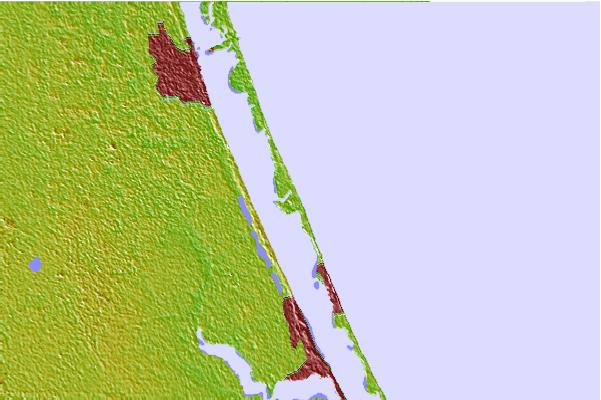

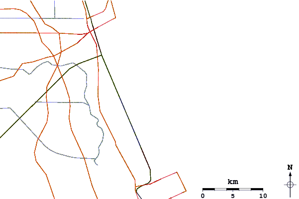
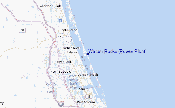
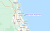
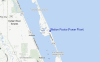
Usa este mapa para navegar hacia las playas de surf de Florida - North y estaciones de marea cercanas de Walton Rocks (Power Plant)
Spots de Surf más cercanos a Walton Rocks (Power Plant):
(Clica la ubicación para más detalles)- Closest spot7 mi
- Second closest spot8 mi
- Third closest spot11 mi
- Fourth closest spot12 mi
- Fifth closest spot17 mi
Boyas marinas más cercanas a Walton Rocks (Power Plant):
- Closest Boya Marinas14 mi
- Second closest Boya Marinas75 mi
- Third closest Boya Marinas81 mi
- Fourth closest Boya Marinas89 mi
- Fifth closest Boya Marinas152 mi
Estaciones de marea más cercanas a Walton Rocks (Power Plant):
- Closest estación de mareaAnkonan River2 mi
- Second closest estación de mareaEden, Nettles Islandn River4 mi
- Third closest estación de mareaIndian River Estates4 mi
- Fourth closest estación de mareaJensen Beachn River8 mi
- Fifth closest estación de mareaNorth Fork, Saint Lucie River9 mi
Airports
- The closest passenger airport to Walton Rocks (Power Plant) is Vero Beach Muni Airport (VRB) in USA, 38 km (24 miles) away (directly).
- The second nearest airport to Walton Rocks (Power Plant) is Palm Beach International (West Palm Beach) Airport (PBI), also in USA, 75 km (47 miles) away.
- Third is Palm Beach Co Park (West Palm Beach) Airport (LNA) in USA, 85 km (53 miles) away.
- Melbourne International Airport (MLB) in USA is 93 km (58 miles) away.
- Patrick Afb (Coco Beach) Airport (COF), also in USA is the fifth nearest airport to Walton Rocks (Power Plant) and is 105 km (65 miles) away.
- /breaks/Walton-Rocks/forecasts/latest

 Nearest