
Previsiones:

Pronóstico Corto PlazoMayormente seco. Warm (max 28°C el lunes por la mañana, min 17°C el martes por la noche). Mayormente vientos frescos. | |||||||||||||||||||||||
domingo 26 | lunes 27 | martes 28 | |||||||||||||||||||||
4 AM | 7 AM | 10 AM | 1 PM | 4 PM | 7 PM | 10 PM | 1 AM | 4 AM | 7 AM | 10 AM | 1 PM | 4 PM | 7 PM | 10 PM | 1 AM | 4 AM | 7 AM | 10 AM | 1 PM | 4 PM | 7 PM | 10 PM | |
Mapa de Altura de Olas | 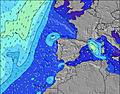 |  | 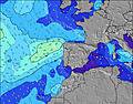 |  | 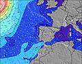 |  |  | 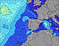 |  | ||||||||||||||
Oleaje Altura (m) Dirección Período (s) | NNW 7 | NNW 6 | NNW 6 | NNW 6 | NNW 6 | NNW 6 | NNW 6 | NNW 7 | NNW 6 | NNW 6 | NNW 7 | NNW 10 | NNW 9 | NNW 9 | NNW 10 | NNW 10 | NW 10 | NW 10 | NW 10 | NW 10 | NW 9 | NW 9 | NW 9 |
Gráfico Olas | |||||||||||||||||||||||
241 | 155 | 103 | 97 | 114 | 156 | 207 | 209 | 145 | 94 | 108 | 320 | 282 | 282 | 320 | 327 | 286 | 250 | 245 | 204 | 196 | 166 | 159 | |
Viento (km/h) | |||||||||||||||||||||||
Estado del Viento Viento de Mar Viento de Mar-Cruzado Cruzado Viento de Tierra-Cruzado Viento de Tierra Cristalino | cross-off | cross-off | cross | cross-on | cross-on | cross-on | cross | cross-off | glassy | cross-off | off | on | cross-on | cross-on | cross-on | glassy | glassy | cross | cross | cross-on | on | cross-on | cross-on |
Marea alta | 1:41AM2.19m | 2:01PM2.42m | 2:28AM2.32m | 2:44PM2.57m | 3:07AM2.44m | 3:21PM2.72m | |||||||||||||||||
Marea baja | 7:43AM0.87m | 8:19PM0.74m | 8:27AM0.73m | 8:59PM0.60m | 9:05AM0.59m | 9:36PM0.47m | |||||||||||||||||
6:22 | — | — | — | — | — | — | — | 6:24 | — | — | — | — | — | — | — | 6:24 | — | — | — | — | — | — | |
— | — | — | — | — | 8:58 | — | — | — | — | — | — | — | 8:57 | — | — | — | — | — | — | — | 8:55 | — | |
mm | — | — | — | — | — | — | — | — | — | — | — | — | — | — | — | — | — | — | — | — | — | — | — |
Temp. °C | 17 | 15 | 18 | 20 | 20 | 20 | 21 | 23 | 21 | 21 | 28 | 27 | 27 | 27 | 26 | 24 | 23 | 20 | 21 | 22 | 22 | 21 | 20 |
Enfriamiento °C | 16 | 14 | 17 | 16 | 15 | 17 | 21 | 23 | 22 | 21 | 27 | 25 | 24 | 25 | 25 | 24 | 23 | 20 | 21 | 22 | 22 | 21 | 21 |
Oleaje 1 Altura (m) Dirección Período (s) | S 11 | WNW 10 | WNW 9 | WNW 9 | WNW 9 | WNW 9 | WNW 9 | NW 12 | NNW 6 | NNW 6 | NNW 7 | NNW 10 | WNW 8 | NNW 9 | NNW 10 | NNW 10 | NW 10 | NW 10 | NW 10 | NW 10 | NW 9 | NW 9 | NW 9 |
2 | 9 | 16 | 16 | 16 | 16 | 16 | 38 | 145 | 94 | 91 | 320 | 14 | 282 | 320 | 327 | 286 | 250 | 245 | 204 | 196 | 166 | 159 | |
Oleaje 2 Altura (m) Dirección Período (s) | WNW 10 | S 11 | N 13 | NW 13 | NW 12 | NNW 13 | NW 13 | WNW 9 | NW 12 | NNW 11 | NW 10 | WNW 8 | — | WNW 9 | WNW 9 | WNW 9 | WNW 8 | WNW 8 | WNW 9 | W 8 | W 8 | WNW 8 | — |
9 | 2 | 3 | 6 | 6 | 18 | 43 | 25 | 66 | 81 | 108 | 23 | — | 15 | 16 | 15 | 14 | 14 | 15 | 5 | 5 | 7 | — | |
Oleaje 3 Altura (m) Dirección Período (s) | — | — | S 11 | — | N 15 | SW 15 | — | NW 12 | WNW 9 | WNW 9 | WNW 9 | WNW 8 | — | — | S 14 | S 14 | — | — | — | W 12 | W 12 | — | W 11 |
— | — | 2 | — | 4 | 9 | — | 23 | 25 | 26 | 25 | 14 | — | — | 4 | 4 | — | — | — | 3 | 3 | — | 2 | |
Olas de Viento Altura (m) Dirección Período (s) | NNW 7 | NNW 6 | NNW 6 | NNW 6 | NNW 6 | NNW 6 | NNW 6 | NNW 7 | — | — | — | — | NNW 9 | — | — | — | — | — | — | — | — | — | — |
241 | 155 | 103 | 97 | 114 | 156 | 207 | 209 | — | — | — | — | 282 | — | — | — | — | — | — | — | — | — | — | |
Viento del Tierra o Mar Limpio más proximo | |||||||||||||||||||||||
Distancia (km) | 0 | 0 | 33 | 350 | 451 | 350 | 0 | 0 | 0 | 0 | 0 | 168 | 168 | 38 | 33 | 0 | 0 | 18 | 89 | 142 | 142 | 132 | 33 |
Mejores Olas Previstas en Douro and Minho | |||||||||||||||||||||||
Mejores Olas Previstas en Portugal | |||||||||||||||||||||||
Busca-Olas Global | |||||||||||||||||||||||
- Map Icons:
 Break
Break Live Wave Height (m)
 Live Wind Speed (km/h)
 Surf Rating (10 Max)
 Ocean Swells (m)
- Wind Speed (km/h)
GRÁTIS! Un widget de Surf-Forecast.com para tu sitio
Este widget grátis de previsiones de surf y tiempo puede ser añadido a cualquier otro sitio y da un resumen de previsiones de olas para Vila do Conde. Solo necesita cortar y pegar el código HTML de abajo en su web. Puede elegir preferencias de idioma y de unidades (métricas o imperiales) para convenir a los usuarios de su sitio. Clica aquí para obtener el código.
 Nearest