

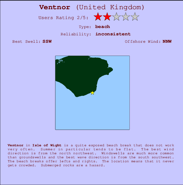
Ventnor Surf Guide
Ventnor in Isle of Wight is a quite exposed beach break that has inconsistent surf. Summer in particular tends to be flat. The best wind direction is from the north northwest. Waves more likely to be from local windswells than distant groundswells and the ideal wave angle is from the south southwest. The beach break provides left and right handers. Take care to avoid the rocks.
Ventnor Spot Info
| Type: | Rating: | Reliability: | Todays Sea Temp*: |
|---|---|---|---|
| inconsistent | 19.8°C*ocean temperature recorded from satellite |
Surfing Ventnor:
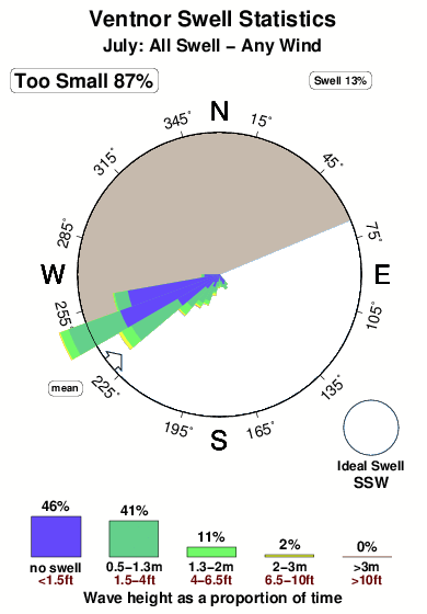
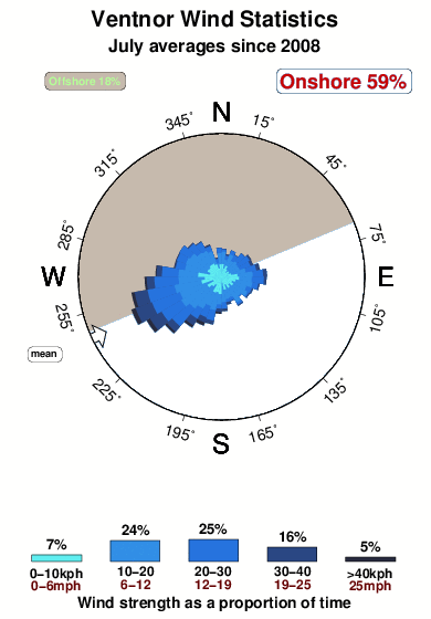
The best conditions reported for surf at Ventnor occur when a South-southwest swell combines with an offshore wind direction from the North-northwest.
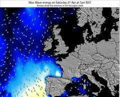
Energía de Olas (poder): 12 horas


Ventnor Surf:
Thursday, 16 July 2026, 20:43 Local time| jueves 16 | vie | |||
| 4PM | 7PM | 10PM | 1AM | |
| Wave (m) | ||||
| Período (s) | 4 | 5 | 5 | 5 |
| Viento (km/h) | ||||
| Estado del Viento | cross- on |
cross- on |
cross- off |
cross- off |
- /breaks/Ventnor/forecasts/latest
Ventnor Surf Guide
Ventnor in Isle of Wight is a quite exposed beach break that has inconsistent surf. Summer in particular tends to be flat. The best wind direction is from the north northwest. Waves more likely to be from local windswells than distant groundswells and the ideal wave angle is from the south southwest. The beach break provides left and right handers. Take care to avoid the rocks.
Ventnor Spot Info
Type: Rating: Reliability: Todays Sea Temp*:  Beach
Beach 2
2inconsistent 19.8°C*ocean temperature recorded from satelliteSurfing Ventnor:
The best conditions reported for surf at Ventnor occur when a South-southwest swell combines with an offshore wind direction from the North-northwest.
Energía de Olas (poder): 12 horas
Usa la barra de navegación de arriba para ver la temperatura del mar en Ventnor, fotografías Ventnor, previsiones detalladas de olas para Ventnor, vientos y previsión del tiempo, webcams para Ventnor, viento actual desde estaciones meteorológicas en Isle of Wight y predicciones de marea para Ventnor. Las mapas de olas para United Kingdom enseñarán un mapa grande de United Kingdom y los mares que rodean. Los mapas de olas pueden ser animadas para mostrar diferentes componentes de olas, la altura de ola, la energía de ola, el período, junto con previsiones de viento y del tiempo. Previsiones actuales del tiempo y del estado del mar provienen de boyas marinas de United Kingdom, del barcos que transitan en la zona y de estaciones meteorológicas costeras. Cada página de previsiones tiene un Busca-Olas Regional y Global para localizar las mejores condiciones para surfear en el área de Ventnor.
Ventnor Surf:
Thursday, 16 July 2026, 20:43 Local timejueves 16 vie 4PM 7PM 10PM 1AM Wave (m) Período (s) 4 5 5 5 Viento (km/h) Estado del Viento cross-
oncross-
oncross-
offcross-
off- /breaks/Ventnor/forecasts/latest
- /breaks/Ventnor/forecasts/latest/six_day
Ventnor Surf Guide
Ventnor in Isle of Wight is a quite exposed beach break that has inconsistent surf. Summer in particular tends to be flat. The best wind direction is from the north northwest. Waves more likely to be from local windswells than distant groundswells and the ideal wave angle is from the south southwest. The beach break provides left and right handers. Take care to avoid the rocks.
Ventnor Spot Info
Type: Rating: Reliability: Todays Sea Temp*: Beach2inconsistent 19.8°C*ocean temperature recorded from satelliteSurfing Ventnor:
The best conditions reported for surf at Ventnor occur when a South-southwest swell combines with an offshore wind direction from the North-northwest.
Energía de Olas (poder): 12 horas
Usa la barra de navegación de arriba para ver la temperatura del mar en Ventnor, fotografías Ventnor, previsiones detalladas de olas para Ventnor, vientos y previsión del tiempo, webcams para Ventnor, viento actual desde estaciones meteorológicas en Isle of Wight y predicciones de marea para Ventnor. Las mapas de olas para United Kingdom enseñarán un mapa grande de United Kingdom y los mares que rodean. Los mapas de olas pueden ser animadas para mostrar diferentes componentes de olas, la altura de ola, la energía de ola, el período, junto con previsiones de viento y del tiempo. Previsiones actuales del tiempo y del estado del mar provienen de boyas marinas de United Kingdom, del barcos que transitan en la zona y de estaciones meteorológicas costeras. Cada página de previsiones tiene un Busca-Olas Regional y Global para localizar las mejores condiciones para surfear en el área de Ventnor.
Ventnor Surf:
Thursday, 16 July 2026, 20:43 Local timejueves 16 vie 4PM 7PM 10PM 1AM Wave (m) Período (s) 4 5 5 5 Viento (km/h) Estado del Viento cross-
oncross-
oncross-
offcross-
off- /breaks/Ventnor/forecasts/latest
Ventnor Surf Guide
Ventnor in Isle of Wight is a quite exposed beach break that has inconsistent surf. Summer in particular tends to be flat. The best wind direction is from the north northwest. Waves more likely to be from local windswells than distant groundswells and the ideal wave angle is from the south southwest. The beach break provides left and right handers. Take care to avoid the rocks.
Ventnor Spot Info
Type: Rating: Reliability: Todays Sea Temp*: Beach2inconsistent 19.8°C*ocean temperature recorded from satelliteSurfing Ventnor:
The best conditions reported for surf at Ventnor occur when a South-southwest swell combines with an offshore wind direction from the North-northwest.
Energía de Olas (poder): 12 horas
Usa la barra de navegación de arriba para ver la temperatura del mar en Ventnor, fotografías Ventnor, previsiones detalladas de olas para Ventnor, vientos y previsión del tiempo, webcams para Ventnor, viento actual desde estaciones meteorológicas en Isle of Wight y predicciones de marea para Ventnor. Las mapas de olas para United Kingdom enseñarán un mapa grande de United Kingdom y los mares que rodean. Los mapas de olas pueden ser animadas para mostrar diferentes componentes de olas, la altura de ola, la energía de ola, el período, junto con previsiones de viento y del tiempo. Previsiones actuales del tiempo y del estado del mar provienen de boyas marinas de United Kingdom, del barcos que transitan en la zona y de estaciones meteorológicas costeras. Cada página de previsiones tiene un Busca-Olas Regional y Global para localizar las mejores condiciones para surfear en el área de Ventnor.
Ventnor Surf:
Thursday, 16 July 2026, 20:43 Local timejueves 16 vie 4PM 7PM 10PM 1AM Wave (m) Período (s) 4 5 5 5 Viento (km/h) Estado del Viento cross-
oncross-
oncross-
offcross-
offTide Times:
Para Ventnor, a %{dist} %{km} de %{location}.
PROXIMA ES A LAS (hora local) quedan marea alta marea baja Ventnor Tide Times and Tide Chart
Live Weather:
At SHIP6093, 21 km from Ventnor.
- Air temperature
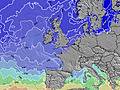
22.3°COverall Ventnor Surf Consistency and Wind Distribution in julio
Fotos de Surf
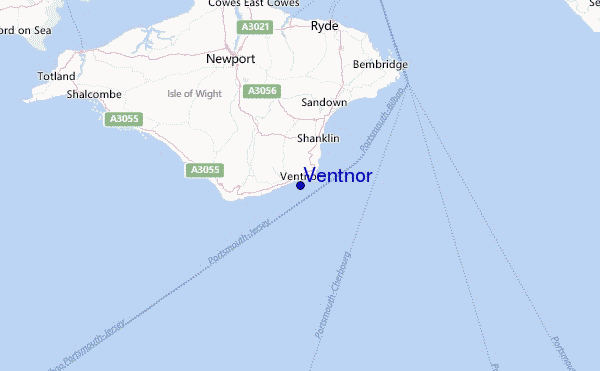
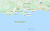
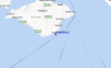
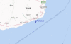
de la galeríaContornos: Carreteras y Ríos: Selecciona un spot desde el menú 
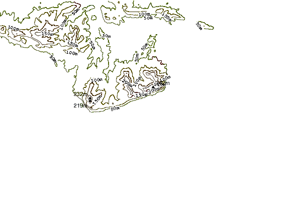
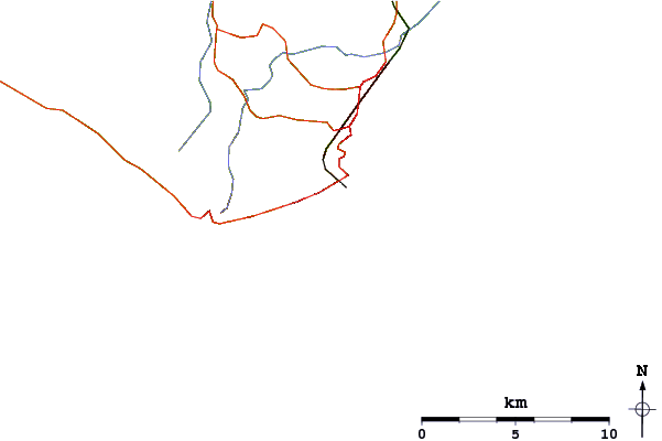
Usa este mapa para navegar hacia las playas de surf de Isle of Wight y estaciones de marea cercanas de Ventnor
Spots de Surf más cercanos a Ventnor:
(Clica la ubicación para más detalles)- Closest spot2 mi
- Second closest spot4 mi
- Third closest spot7 mi
- Fourth closest spot13 mi
- Fifth closest spot14 mi
Boyas marinas más cercanas a Ventnor:
- Closest Boya Marinas6 mi
- Second closest Boya Marinas12 mi
- Third closest Boya Marinas14 mi
- Fourth closest Boya Marinas18 mi
- Fifth closest Boya Marinas20 mi
Estaciones de marea más cercanas a Ventnor:
- Closest estación de mareaVentnor1 mi
- Second closest estación de mareaRyde9 mi
- Third closest estación de mareaCowes12 mi
- Fourth closest estación de mareaLee-on-the-Solent14 mi
- Fifth closest estación de mareaPortsmouth15 mi
Airports
- The closest passenger airport to Ventnor is Southampton Airport (SOU) in England, 42 km (26 miles) away (directly).
- The second nearest airport to Ventnor is Bournemouth Airport (BOH), also in England, 50 km (31 miles) away.
- Third is Gatwick (London) Airport (LGW) in England, 94 km (58 miles) away.
- Maupertus (Cherbourg) Airport (CER) in France is 106 km (66 miles) away.
- Yeovilton Airport (YEO) in U.k. is the fifth nearest airport to Ventnor and is 111 km (69 miles) away.
- /breaks/Ventnor/forecasts/latest


 Nearest