
Previsiones:

Pronóstico Corto PlazoAlgo de llovizna, más pesada durante la noche de domingo. Warm (max 25°C el sábado por la mañana, min 24°C el viernes por la mañana). Mayormente vientos frescos. | |||||||||||||||||||||||
viernes 31 | sábado 1 | domingo 2 | |||||||||||||||||||||
4 AM | 7 AM | 10 AM | 1 PM | 4 PM | 7 PM | 10 PM | 1 AM | 4 AM | 7 AM | 10 AM | 1 PM | 4 PM | 7 PM | 10 PM | 1 AM | 4 AM | 7 AM | 10 AM | 1 PM | 4 PM | 7 PM | 10 PM | |
Mapa de Altura de Olas |  |  |  |  | 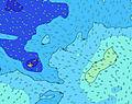 |  |  | 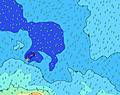 |  | ||||||||||||||
Oleaje Altura (m) Dirección Período (s) | ESE 7 | S 10 | E 7 | E 7 | E 7 | E 7 | SSE 12 | SSE 12 | SSE 12 | SSE 12 | SSE 12 | SSE 12 | SSE 12 | SSE 12 | SSE 12 | SSE 12 | SSE 11 | SSE 11 | SSE 11 | SSE 11 | SSE 11 | SW 14 | SW 14 |
Gráfico Olas | |||||||||||||||||||||||
254 | 244 | 250 | 264 | 233 | 220 | 210 | 226 | 387 | 477 | 477 | 508 | 508 | 500 | 491 | 414 | 393 | 386 | 335 | 335 | 261 | 256 | 256 | |
Viento (km/h) | |||||||||||||||||||||||
Estado del Viento Viento de Mar Viento de Mar-Cruzado Cruzado Viento de Tierra-Cruzado Viento de Tierra Cristalino | on | cross-on | cross-on | cross-on | cross-on | cross-on | cross-on | cross-on | cross-on | on | on | on | on | on | on | on | on | cross-on | on | on | on | on | on |
Marea alta | 8:16AM0.83m | 8:44PM0.73m | 8:57AM0.81m | 9:26PM0.74m | 9:41AM0.78m | ||||||||||||||||||
Marea baja | 1:58AM0.07m | 2:33PM0.05m | 2:41AM0.08m | 3:12PM0.06m | 3:27AM0.10m | 3:54PM0.08m | |||||||||||||||||
6:43 | — | — | — | — | — | — | — | 6:43 | — | — | — | — | — | — | — | 6:43 | — | — | — | — | — | — | |
— | — | — | — | 6:13 | — | — | — | — | — | — | — | 6:13 | — | — | — | — | — | — | — | 6:14 | — | — | |
mm | — | — | — | — | — | — | — | — | — | — | — | — | — | — | — | — | — | — | — | — | — | — | — |
Temp. °C | 24 | 24 | 24 | 24 | 24 | 24 | 24 | 24 | 24 | 24 | 24 | 25 | 25 | 25 | 25 | 25 | 25 | 25 | 25 | 25 | 25 | 25 | 25 |
Enfriamiento °C | 21 | 21 | 21 | 21 | 22 | 22 | 22 | 23 | 24 | 24 | 24 | 25 | 25 | 25 | 25 | 26 | 26 | 26 | 26 | 27 | 27 | 27 | 27 |
Oleaje 1 Altura (m) Dirección Período (s) | S 10 | S 10 | S 10 | S 10 | S 10 | S 10 | SSE 12 | SSE 12 | E 8 | SSE 12 | SSE 12 | SSE 12 | SSE 12 | SSE 12 | SSE 12 | SSE 12 | SSE 11 | SSE 11 | SSE 11 | SSE 11 | SSE 11 | SSE 11 | SSE 11 |
254 | 244 | 198 | 161 | 158 | 125 | 210 | 226 | 159 | 477 | 477 | 508 | 508 | 500 | 491 | 414 | 393 | 386 | 335 | 335 | 261 | 256 | 256 | |
Oleaje 2 Altura (m) Dirección Período (s) | NE 12 | SSE 13 | SSE 13 | SSE 13 | SSE 12 | SSE 12 | S 10 | S 10 | SSE 12 | E 8 | E 8 | E 8 | E 8 | E 8 | SW 16 | E 8 | E 8 | E 8 | E 8 | E 8 | E 8 | E 8 | E 8 |
77 | 95 | 95 | 145 | 175 | 169 | 92 | 92 | 387 | 149 | 149 | 127 | 127 | 129 | 242 | 152 | 148 | 148 | 152 | 125 | 125 | 100 | 100 | |
Oleaje 3 Altura (m) Dirección Período (s) | SSE 11 | NE 12 | NE 12 | NE 12 | NE 12 | NE 12 | SW 15 | SW 15 | SW 15 | SW 17 | SW 14 | SW 14 | SW 15 | SW 16 | NE 10 | SW 16 | SW 15 | SW 15 | SW 15 | SW 15 | SW 14 | SW 14 | SW 14 |
49 | 72 | 72 | 71 | 69 | 47 | 109 | 141 | 141 | 183 | 93 | 164 | 229 | 239 | 51 | 193 | 178 | 212 | 215 | 215 | 203 | 248 | 248 | |
Olas de Viento Altura (m) Dirección Período (s) | ESE 7 | E 7 | E 7 | E 7 | E 7 | E 7 | E 7 | E 7 | — | — | — | — | — | — | E 8 | — | — | — | — | — | — | — | — |
219 | 214 | 250 | 264 | 233 | 220 | 203 | 173 | — | — | — | — | — | — | 156 | — | — | — | — | — | — | — | — | |
Viento del Tierra o Mar Limpio más proximo | |||||||||||||||||||||||
Distancia (km) | 614 | 898 | 898 | 614 | 15 | 13 | 13 | 13 | 13 | 182 | 228 | 18 | 18 | 182 | 18 | 182 | 614 | 13 | 1390 | 2 | 2 | 1392 | 14 |
Mejores Olas Previstas en American-Samoa - Tutuila | |||||||||||||||||||||||
Mejores Olas Previstas en American Samoa | |||||||||||||||||||||||
Busca-Olas Global | |||||||||||||||||||||||
- Map Icons:
 Break
Break Live Wave Height (m)
 Live Wind Speed (km/h)
 Surf Rating (10 Max)
 Ocean Swells (m)
- Wind Speed (km/h)
GRÁTIS! Un widget de Surf-Forecast.com para tu sitio
Este widget grátis de previsiones de surf y tiempo puede ser añadido a cualquier otro sitio y da un resumen de previsiones de olas para Utulei. Solo necesita cortar y pegar el código HTML de abajo en su web. Puede elegir preferencias de idioma y de unidades (métricas o imperiales) para convenir a los usuarios de su sitio. Clica aquí para obtener el código.
 Nearest