
Previsiones:

Pronóstico Corto PlazoMayormente seco. Warm (max 29°C el jueves por la noche, min 26°C el martes por la noche). El viento será generalmente ligero. | ||||||||||||||||||||||||
mar 14 | miércoles 15 | jueves 16 | viernes 17 | |||||||||||||||||||||
6 PM | 9 PM | 12 AM | 3 AM | 6 AM | 9 AM | 12 PM | 3 PM | 6 PM | 9 PM | 12 AM | 3 AM | 6 AM | 9 AM | 12 PM | 3 PM | 6 PM | 9 PM | 12 AM | 3 AM | 6 AM | 9 AM | 12 PM | 3 PM | |
Mapa de Altura de Olas |  |  | 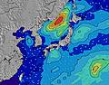 |  |  | 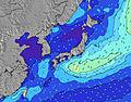 |  |  | 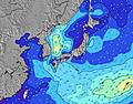 | |||||||||||||||
Oleaje Altura (m) Dirección Período (s) | SW 8 | E 9 | E 9 | E 9 | E 9 | E 9 | E 8 | SW 10 | SW 10 | E 8 | SW 10 | SW 4 | SW 4 | WSW 4 | W 5 | E 10 | E 10 | E 10 | SW 9 | SW 9 | SW 5 | E 9 | E 9 | E 10 |
Gráfico Olas | ||||||||||||||||||||||||
0 | 15 | 15 | 15 | 14 | 15 | 12 | 0 | 0 | 6 | 0 | 16 | 19 | 18 | 11 | 17 | 16 | 17 | 0 | 0 | 25 | 15 | 15 | 16 | |
Viento (km/h) | ||||||||||||||||||||||||
Estado del Viento Viento de Mar Viento de Mar-Cruzado Cruzado Viento de Tierra-Cruzado Viento de Tierra Cristalino | cross-on | cross-on | cross-on | cross-on | cross-on | on | on | on | cross-on | on | on | on | on | on | on | on | on | cross-on | cross-on | cross-on | on | on | on | on |
Marea alta | 7:57PM2.00m | 7:09AM2.16m | 8:39PM2.02m | 7:58AM2.17m | 9:17PM2.01m | 8:46AM2.13m | ||||||||||||||||||
Marea baja | 1:27AM0.90m | 1:59PM-0.09m | 2:12AM0.83m | 2:43PM-0.03m | 2:56AM0.77m | |||||||||||||||||||
— | — | — | 5:45 | — | — | — | — | — | — | — | 5:45 | — | — | — | — | — | — | — | 5:46 | — | — | — | — | |
7:23 | — | — | — | — | — | — | — | 7:23 | — | — | — | — | — | — | — | 7:22 | — | — | — | — | — | — | 7:22 | |
mm | — | — | — | — | — | — | — | — | — | — | — | — | — | — | — | — | — | — | — | — | — | — | — | — |
Temp. °C | 28 | 27 | 26 | 26 | 26 | 27 | 28 | 28 | 28 | 28 | 27 | 27 | 27 | 28 | 28 | 28 | 28 | 28 | 29 | 28 | 28 | 28 | 29 | 29 |
Enfriamiento °C | 32 | 31 | 29 | 29 | 29 | 30 | 31 | 31 | 32 | 32 | 30 | 30 | 30 | 32 | 31 | 31 | 32 | 31 | 32 | 30 | 30 | 30 | 32 | 31 |
Oleaje 1 Altura (m) Dirección Período (s) | SW 8 | S 8 | SW 9 | SW 10 | S 8 | S 8 | S 7 | SW 10 | SW 10 | S 7 | S 7 | SW 10 | SW 10 | SW 10 | SSW 9 | SSW 9 | SW 9 | E 10 | ESE 10 | ESE 10 | SW 9 | E 9 | W 7 | W 7 |
70 | 55 | 83 | 106 | 40 | 40 | 39 | 136 | 133 | 17 | 17 | 77 | 76 | 58 | 59 | 56 | 67 | 17 | 19 | 19 | 49 | 15 | 9 | 14 | |
Oleaje 2 Altura (m) Dirección Período (s) | S 8 | SW 9 | S 8 | S 8 | E 9 | E 9 | E 8 | S 7 | S 7 | SE 10 | ESE 9 | ESE 10 | ESE 9 | ESE 9 | ESE 9 | S 7 | E 10 | S 7 | SSE 9 | S 7 | ESE 10 | SE 10 | E 9 | E 10 |
55 | 83 | 57 | 40 | 14 | 15 | 12 | 27 | 27 | 28 | 16 | 38 | 27 | 29 | 16 | 9 | 16 | 4 | 8 | 4 | 18 | 15 | 15 | 16 | |
Oleaje 3 Altura (m) Dirección Período (s) | SW 10 | E 9 | E 9 | E 9 | SSE 11 | SE 11 | SE 11 | SE 11 | SE 10 | E 8 | SSE 10 | S 7 | S 7 | S 7 | S 7 | E 10 | S 7 | SSE 9 | ESE 10 | SSE 9 | S 7 | W 8 | SE 10 | SE 9 |
16 | 15 | 15 | 15 | 12 | 19 | 18 | 18 | 17 | 6 | 10 | 17 | 9 | 9 | 9 | 17 | 9 | 8 | 10 | 8 | 4 | 5 | 15 | 14 | |
Olas de Viento Altura (m) Dirección Período (s) | — | — | SSW 2 | SW 3 | SW 10 | SW 10 | SW 10 | — | — | SW 10 | SW 10 | SW 4 | SW 4 | WSW 4 | W 5 | W 5 | W 5 | SW 9 | SW 9 | SW 9 | SW 5 | SW 9 | SW 9 | SW 7 |
— | — | 1 | 5 | 167 | 138 | 136 | — | — | 133 | 136 | 16 | 19 | 18 | 11 | 11 | 11 | 99 | 114 | 132 | 25 | 129 | 148 | 102 | |
Viento del Tierra o Mar Limpio más proximo | ||||||||||||||||||||||||
Distancia (km) | 79 | 79 | 79 | 79 | 79 | 600 | 609 | 609 | 609 | 79 | 600 | 600 | 79 | 609 | 609 | 708 | 777 | 65 | 609 | 609 | 609 | 609 | 79 | 669 |
Mejores Olas Previstas en Okinawa | ||||||||||||||||||||||||
Mejores Olas Previstas en Japan | ||||||||||||||||||||||||
Busca-Olas Global | ||||||||||||||||||||||||
- Map Icons:
 Break
Break Live Wave Height (m)
 Live Wind Speed (km/h)
 Surf Rating (10 Max)
 Ocean Swells (m)
- Wind Speed (km/h)
GRÁTIS! Un widget de Surf-Forecast.com para tu sitio
Este widget grátis de previsiones de surf y tiempo puede ser añadido a cualquier otro sitio y da un resumen de previsiones de olas para Turtles. Solo necesita cortar y pegar el código HTML de abajo en su web. Puede elegir preferencias de idioma y de unidades (métricas o imperiales) para convenir a los usuarios de su sitio. Clica aquí para obtener el código.
 Nearest