
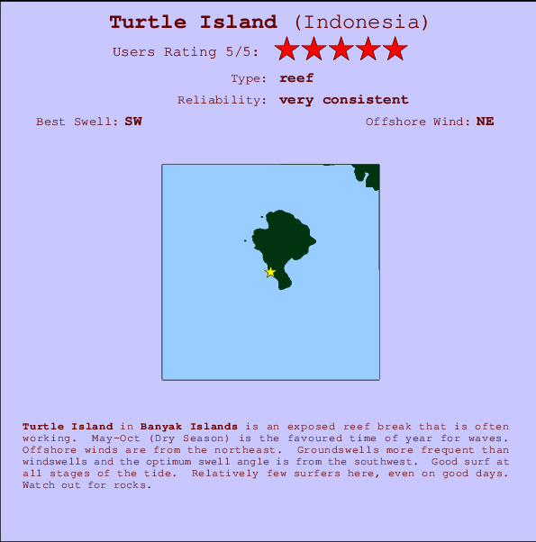
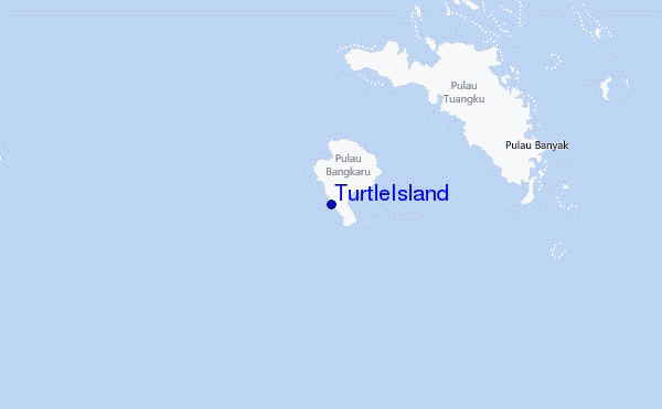
Turtle Island Surf Guide
TurtleIsland in Banyak Islands is an exposed reef break that has very consistent waves. May-Oct (Dry Season) is the optimum time of year for waves. Offshore winds blow from the northeast. Clean groundswells prevail and the ideal swell direction is from the southwest. A reef breaks left. Good surf at all stages of the tide. Rarely crowded here. Watch out for rocks.
Turtle Island Spot Info
| Type: | Rating: | Reliability: | Todays Sea Temp*: |
|---|---|---|---|
| very consistent | 30.0°C*ocean temperature recorded from satellite |
Surfing Turtle Island:
The best conditions reported for surf at Turtle Island occur when a Southwest swell combines with an offshore wind direction from the Northeast.

Energía de Olas (poder): 12 horas


Turtle Island Surf:
Friday, 17 July 2026, 09:42 Local time| viernes 17 | ||||
| 10AM | 1PM | 4PM | 7PM | |
| Wave (m) | ||||
| Período (s) | 15 | 16 | 16 | 15 |
| Viento (km/h) | ||||
| Estado del Viento | cross | cross- on |
cross- on |
cross- on |
- /breaks/Turtle-Island/forecasts/latest
Turtle Island Surf Guide
TurtleIsland in Banyak Islands is an exposed reef break that has very consistent waves. May-Oct (Dry Season) is the optimum time of year for waves. Offshore winds blow from the northeast. Clean groundswells prevail and the ideal swell direction is from the southwest. A reef breaks left. Good surf at all stages of the tide. Rarely crowded here. Watch out for rocks.
Turtle Island Spot Info
Type: Rating: Reliability: Todays Sea Temp*:  Reef
Reef 5
5very consistent 30.0°C*ocean temperature recorded from satelliteSurfing Turtle Island:
The best conditions reported for surf at Turtle Island occur when a Southwest swell combines with an offshore wind direction from the Northeast.
Energía de Olas (poder): 12 horas
Usa la barra de navegación de arriba para ver la temperatura del mar en Turtle Island, fotografías Turtle Island, previsiones detalladas de olas para Turtle Island, vientos y previsión del tiempo, webcams para Turtle Island, viento actual desde estaciones meteorológicas en Banyak Islands y predicciones de marea para Turtle Island. Las mapas de olas para Indonesia enseñarán un mapa grande de Indonesia y los mares que rodean. Los mapas de olas pueden ser animadas para mostrar diferentes componentes de olas, la altura de ola, la energía de ola, el período, junto con previsiones de viento y del tiempo. Previsiones actuales del tiempo y del estado del mar provienen de boyas marinas de Indonesia, del barcos que transitan en la zona y de estaciones meteorológicas costeras. Cada página de previsiones tiene un Busca-Olas Regional y Global para localizar las mejores condiciones para surfear en el área de Turtle Island.
Turtle Island Surf:
Friday, 17 July 2026, 09:42 Local timeviernes 17 10AM 1PM 4PM 7PM Wave (m) Período (s) 15 16 16 15 Viento (km/h) Estado del Viento cross cross-
oncross-
oncross-
on- /breaks/Turtle-Island/forecasts/latest
- /breaks/Turtle-Island/forecasts/latest/six_day
Turtle Island Surf Guide
TurtleIsland in Banyak Islands is an exposed reef break that has very consistent waves. May-Oct (Dry Season) is the optimum time of year for waves. Offshore winds blow from the northeast. Clean groundswells prevail and the ideal swell direction is from the southwest. A reef breaks left. Good surf at all stages of the tide. Rarely crowded here. Watch out for rocks.
Turtle Island Spot Info
Type: Rating: Reliability: Todays Sea Temp*: Reef5very consistent 30.0°C*ocean temperature recorded from satelliteSurfing Turtle Island:
The best conditions reported for surf at Turtle Island occur when a Southwest swell combines with an offshore wind direction from the Northeast.
Energía de Olas (poder): 12 horas
Usa la barra de navegación de arriba para ver la temperatura del mar en Turtle Island, fotografías Turtle Island, previsiones detalladas de olas para Turtle Island, vientos y previsión del tiempo, webcams para Turtle Island, viento actual desde estaciones meteorológicas en Banyak Islands y predicciones de marea para Turtle Island. Las mapas de olas para Indonesia enseñarán un mapa grande de Indonesia y los mares que rodean. Los mapas de olas pueden ser animadas para mostrar diferentes componentes de olas, la altura de ola, la energía de ola, el período, junto con previsiones de viento y del tiempo. Previsiones actuales del tiempo y del estado del mar provienen de boyas marinas de Indonesia, del barcos que transitan en la zona y de estaciones meteorológicas costeras. Cada página de previsiones tiene un Busca-Olas Regional y Global para localizar las mejores condiciones para surfear en el área de Turtle Island.
Turtle Island Surf:
Friday, 17 July 2026, 09:42 Local timeviernes 17 10AM 1PM 4PM 7PM Wave (m) Período (s) 15 16 16 15 Viento (km/h) Estado del Viento cross cross-
oncross-
oncross-
on- /breaks/Turtle-Island/forecasts/latest
Turtle Island Surf Guide
TurtleIsland in Banyak Islands is an exposed reef break that has very consistent waves. May-Oct (Dry Season) is the optimum time of year for waves. Offshore winds blow from the northeast. Clean groundswells prevail and the ideal swell direction is from the southwest. A reef breaks left. Good surf at all stages of the tide. Rarely crowded here. Watch out for rocks.
Turtle Island Spot Info
Type: Rating: Reliability: Todays Sea Temp*: Reef5very consistent 30.0°C*ocean temperature recorded from satelliteSurfing Turtle Island:
The best conditions reported for surf at Turtle Island occur when a Southwest swell combines with an offshore wind direction from the Northeast.
Energía de Olas (poder): 12 horas
Usa la barra de navegación de arriba para ver la temperatura del mar en Turtle Island, fotografías Turtle Island, previsiones detalladas de olas para Turtle Island, vientos y previsión del tiempo, webcams para Turtle Island, viento actual desde estaciones meteorológicas en Banyak Islands y predicciones de marea para Turtle Island. Las mapas de olas para Indonesia enseñarán un mapa grande de Indonesia y los mares que rodean. Los mapas de olas pueden ser animadas para mostrar diferentes componentes de olas, la altura de ola, la energía de ola, el período, junto con previsiones de viento y del tiempo. Previsiones actuales del tiempo y del estado del mar provienen de boyas marinas de Indonesia, del barcos que transitan en la zona y de estaciones meteorológicas costeras. Cada página de previsiones tiene un Busca-Olas Regional y Global para localizar las mejores condiciones para surfear en el área de Turtle Island.
Turtle Island Surf:
Friday, 17 July 2026, 09:42 Local timeviernes 17 10AM 1PM 4PM 7PM Wave (m) Período (s) 15 16 16 15 Viento (km/h) Estado del Viento cross cross-
oncross-
oncross-
onTide Times:
En Turtle Island (0 km).
PROXIMA ES A LAS (hora local) quedan marea alta marea baja Turtle Island Tide Times and Tide Chart
Live Weather:
At Medan/Polonia Airport, 244 km from Turtle Island.
light winds from the WSW
(km/h)
Haze -Air temperature
27°COverall Turtle Island Surf Consistency and Wind Distribution in julio
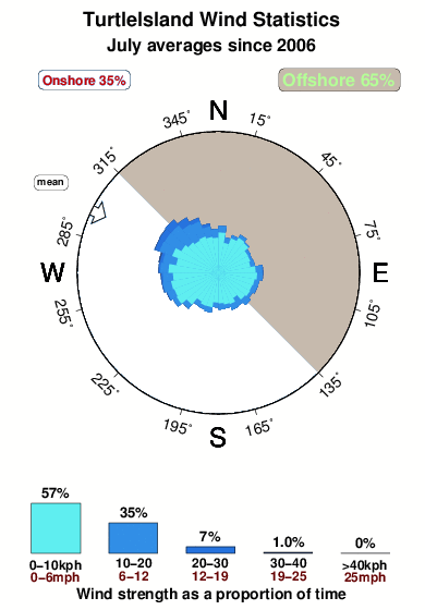


Wind stats for Turtle Island: see the variation in direction and stength by month.
Fotos de Surf
de la galeríaContornos: Carreteras y Ríos: Selecciona un spot desde el menú 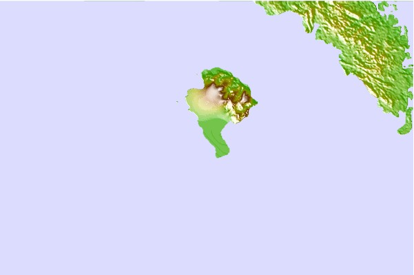
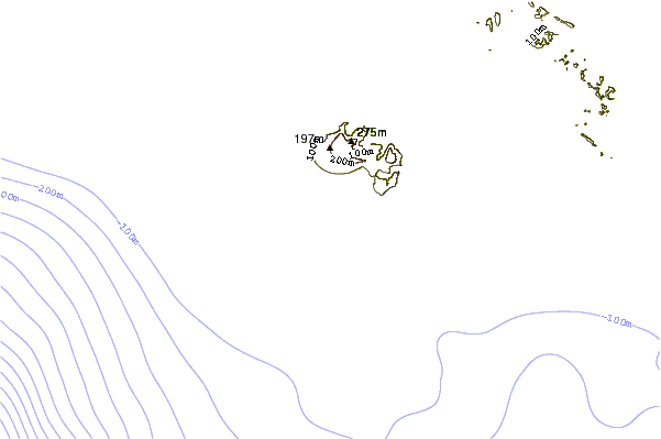

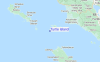
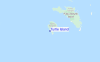
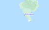
Usa este mapa para navegar hacia las playas de surf de Banyak Islands y estaciones de marea cercanas de Turtle Island
Spots de Surf más cercanos a Turtle Island:
(Clica la ubicación para más detalles)- Closest spot17 mi
- Second closest spot19 mi
- Third closest spot21 mi
- Fourth closest spot58 mi
- Fifth closest spot58 mi
Boyas marinas más cercanas a Turtle Island:
- Closest Boya Marinas2374 mi
- Second closest Boya Marinas2452 mi
- Third closest Boya Marinas2631 mi
- Fourth closest Boya Marinas2647 mi
- Fifth closest Boya Marinas2812 mi
Estaciones de marea más cercanas a Turtle Island:
- Closest estación de mareaSinabang58 mi
- Second closest estación de mareaSibolga118 mi
- Third closest estación de mareaMeulaboh160 mi
- Fourth closest estación de mareaPangkalan Brandan160 mi
- Fifth closest estación de mareaTanjungtiram165 mi
Airports
- The nearest passenger airport to TurtleIsland is Binaka (Gunung Sitoli) Airport (GNS) in Indonesia, which is 118 km (73 miles) away (directly).
- The second closest airport to TurtleIsland is Polonia (Medan) Airport (MES), also in Indonesia, 244 km (152 miles) away.
- /breaks/Turtle-Island/forecasts/latest

 Nearest