
Previsiones:

Pronóstico Corto PlazoFuerte lluvia (totál 20mm), más pesada durante la mañana de lunes. Warm (max 27°C el lunes por la tarde, min 24°C el miércoles por la tarde). Vientos crecientes (calma el lunes por la noche, vientos fuertes desde el SE por la noche de miércoles). | |||||||||||||||||||||
lun 27 | martes 28 | miércoles 29 | |||||||||||||||||||
10 AM | 1 PM | 4 PM | 7 PM | 10 PM | 1 AM | 4 AM | 7 AM | 10 AM | 1 PM | 4 PM | 7 PM | 10 PM | 1 AM | 4 AM | 7 AM | 10 AM | 1 PM | 4 PM | 7 PM | 10 PM | |
Mapa de Altura de Olas |  | 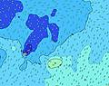 |  |  | 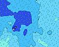 | 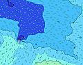 | 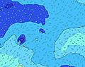 | 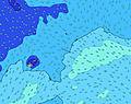 | |||||||||||||
Oleaje Altura (m) Dirección Período (s) | E 7 | E 7 | E 7 | E 7 | E 8 | E 8 | E 8 | ENE 10 | E 8 | E 8 | SW 16 | ENE 9 | ENE 9 | SW 15 | SW 14 | ENE 9 | NE 10 | NE 9 | NE 10 | SW 14 | SW 14 |
Gráfico Olas | |||||||||||||||||||||
37 | 38 | 37 | 40 | 41 | 44 | 48 | 102 | 28 | 29 | 0 | 69 | 75 | 0 | 0 | 25 | 35 | 31 | 33 | 0 | 0 | |
Viento (km/h) | |||||||||||||||||||||
Estado del Viento Viento de Mar Viento de Mar-Cruzado Cruzado Viento de Tierra-Cruzado Viento de Tierra Cristalino | cross-on | on | on | on | on | glassy | cross-off | cross-off | cross-off | cross-off | cross-off | cross-off | cross-off | cross-off | cross-off | cross-off | cross-off | cross-off | cross-off | cross-off | cross-off |
Marea alta | 5:15PM0.86m | 5:24AM1.01m | 5:52PM0.89m | 6:01AM1.03m | 6:27PM0.91m | ||||||||||||||||
Marea baja | 11:12AM0.20m | 11:08PM0.24m | 11:47AM0.17m | 11:44PM0.22m | 12:22PM0.15m | ||||||||||||||||
6:48 | — | — | — | — | — | 6:48 | — | — | — | — | — | — | — | 6:48 | — | — | — | — | — | — | |
— | — | 6:15 | — | — | — | — | — | — | — | 6:15 | — | — | — | — | — | — | — | 6:15 | — | — | |
mm | — | 2 | — | — | 1 | 1 | 2 | — | — | — | — | 1 | 2 | 2 | 2 | 1 | 1 | 1 | 1 | — | — |
Temp. °C | 26 | 26 | 27 | 27 | 26 | 26 | 26 | 26 | 26 | 26 | 26 | 25 | 25 | 25 | 25 | 25 | 25 | 25 | 25 | 24 | 24 |
Enfriamiento °C | 28 | 28 | 30 | 31 | 30 | 31 | 29 | 28 | 28 | 28 | 28 | 26 | 26 | 25 | 24 | 24 | 24 | 23 | 23 | 21 | 21 |
Oleaje 1 Altura (m) Dirección Período (s) | S 12 | S 12 | S 13 | S 12 | S 12 | S 12 | S 12 | S 12 | S 12 | S 12 | SW 16 | SW 15 | SW 15 | SW 15 | SW 14 | SW 14 | SW 14 | SW 14 | SW 14 | SW 14 | SW 14 |
497 | 513 | 539 | 439 | 432 | 432 | 359 | 359 | 353 | 347 | 612 | 581 | 640 | 551 | 482 | 390 | 390 | 293 | 293 | 245 | 245 | |
Oleaje 2 Altura (m) Dirección Período (s) | E 7 | E 7 | E 7 | E 7 | E 8 | SW 18 | SW 18 | SW 17 | SW 16 | SW 16 | S 6 | S 12 | SSE 11 | SSE 14 | SSE 14 | SSE 14 | SSE 15 | SSE 15 | SSE 15 | SSE 14 | SSE 14 |
37 | 38 | 37 | 40 | 41 | 252 | 366 | 487 | 508 | 628 | 51 | 130 | 126 | 108 | 110 | 163 | 228 | 246 | 242 | 236 | 178 | |
Oleaje 3 Altura (m) Dirección Período (s) | NNE 8 | SW 12 | NNE 8 | SW 19 | SW 18 | E 8 | E 8 | ENE 10 | E 8 | E 8 | S 12 | ENE 9 | ENE 9 | S 11 | S 11 | ENE 9 | NE 10 | NE 9 | NE 10 | SSW 12 | S 12 |
23 | 23 | 22 | 94 | 199 | 44 | 48 | 102 | 28 | 29 | 134 | 69 | 75 | 58 | 58 | 25 | 35 | 31 | 33 | 47 | 72 | |
Olas de Viento Altura (m) Dirección Período (s) | — | NNE 8 | — | — | — | — | — | — | — | — | — | SSE 6 | SSE 6 | SSE 6 | SSE 6 | SSE 6 | SSE 6 | SSE 6 | SE 6 | SE 6 | SE 6 |
— | 23 | — | — | — | — | — | — | — | — | — | 51 | 72 | 102 | 108 | 93 | 119 | 144 | 142 | 137 | 148 | |
Viento del Tierra o Mar Limpio más proximo | |||||||||||||||||||||
Distancia (km) | 12 | 80 | 10 | 12 | 12 | 10 | 25 | 25 | 79 | 79 | 105 | 1486 | 79 | 2162 | 2162 | 2162 | 1484 | 1284 | 1278 | 1284 | 1278 |
Mejores Olas Previstas en Upolu | |||||||||||||||||||||
Mejores Olas Previstas en Samoa | |||||||||||||||||||||
Busca-Olas Global | |||||||||||||||||||||
- Map Icons:
 Break
Break Live Wave Height (m)
 Live Wind Speed (km/h)
 Surf Rating (10 Max)
 Ocean Swells (m)
- Wind Speed (km/h)
GRÁTIS! Un widget de Surf-Forecast.com para tu sitio
Este widget grátis de previsiones de surf y tiempo puede ser añadido a cualquier otro sitio y da un resumen de previsiones de olas para Tiavea Bay. Solo necesita cortar y pegar el código HTML de abajo en su web. Puede elegir preferencias de idioma y de unidades (métricas o imperiales) para convenir a los usuarios de su sitio. Clica aquí para obtener el código.
 Nearest