
Previsiones:

Pronóstico Corto PlazoAlgo de llovizna, más pesada durante la noche de miércoles. Warm (max 22°C el lunes por la tarde, min 12°C el miércoles por la mañana). El viento será generalmente ligero. | ||||||||||||||||||||||||
lunes 3 | martes 4 | miércoles 5 | ||||||||||||||||||||||
2 AM | 5 AM | 8 AM | 11 AM | 2 PM | 5 PM | 8 PM | 11 PM | 2 AM | 5 AM | 8 AM | 11 AM | 2 PM | 5 PM | 8 PM | 11 PM | 2 AM | 5 AM | 8 AM | 11 AM | 2 PM | 5 PM | 8 PM | 11 PM | |
Mapa de Altura de Olas |  |  |  |  | 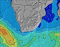 |  |  | 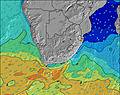 |  | |||||||||||||||
Oleaje Altura (m) Dirección Período (s) | SW 13 | SW 13 | SW 13 | SW 13 | SW 12 | WSW 13 | WSW 12 | WSW 12 | SW 12 | SW 11 | SW 11 | SW 11 | SW 11 | SW 11 | SW 11 | SW 10 | SW 15 | SW 15 | SW 16 | SW 16 | SW 15 | SW 15 | SW 14 | SW 14 |
Gráfico Olas | ||||||||||||||||||||||||
673 | 669 | 649 | 629 | 590 | 499 | 543 | 451 | 542 | 315 | 544 | 422 | 375 | 293 | 287 | 212 | 301 | 767 | 1532 | 2157 | 2390 | 2483 | 2923 | 3420 | |
Viento (km/h) | ||||||||||||||||||||||||
Estado del Viento Viento de Mar Viento de Mar-Cruzado Cruzado Viento de Tierra-Cruzado Viento de Tierra Cristalino | off | glassy | glassy | glassy | glassy | cross | cross-off | cross-off | cross-off | cross | cross | glassy | glassy | cross | cross | cross-off | cross | cross | cross | cross | cross-on | cross-on | cross | cross |
Marea alta | 5:53AM1.57m | 6:14PM1.69m | 6:33AM1.50m | 6:56PM1.63m | 7:21AM1.42m | 7:48PM1.55m | ||||||||||||||||||
Marea baja | 11:50PM0.43m | 11:53AM0.43m | 00:29AM0.47m | 12:31PM0.50m | 1:17AM0.54m | 1:19PM0.59m | ||||||||||||||||||
— | 7:37 | — | — | — | — | — | — | — | 7:35 | — | — | — | — | — | — | — | 7:35 | — | — | — | — | — | — | |
— | — | — | — | — | 6:07 | — | — | — | — | — | — | — | 6:07 | — | — | — | — | — | — | — | 6:08 | — | — | |
mm | — | — | — | — | — | — | — | — | — | — | — | — | — | — | — | — | — | — | — | — | — | — | — | — |
Temp. °C | 17 | 17 | 16 | 19 | 22 | 21 | 19 | 19 | 19 | 18 | 16 | 18 | 20 | 19 | 16 | 15 | 15 | 13 | 12 | 14 | 15 | 15 | 14 | 13 |
Enfriamiento °C | 15 | 16 | 14 | 17 | 20 | 18 | 16 | 16 | 17 | 16 | 14 | 17 | 19 | 18 | 14 | 14 | 14 | 11 | 9 | 10 | 11 | 11 | 11 | 9 |
Oleaje 1 Altura (m) Dirección Período (s) | SW 13 | SW 13 | SW 13 | SW 13 | SW 12 | WSW 13 | WSW 12 | WSW 12 | SW 12 | SW 11 | SW 11 | SW 11 | SW 11 | SW 11 | SW 11 | SW 10 | SW 10 | SW 15 | SW 16 | SW 16 | SW 15 | SW 15 | SW 14 | SW 14 |
673 | 669 | 649 | 629 | 590 | 499 | 543 | 451 | 542 | 315 | 544 | 422 | 375 | 293 | 287 | 212 | 144 | 767 | 1532 | 2157 | 2390 | 2483 | 2923 | 3420 | |
Oleaje 2 Altura (m) Dirección Período (s) | WSW 16 | WSW 16 | WSW 15 | WSW 14 | WSW 13 | SW 12 | SW 12 | SW 12 | WSW 12 | WSW 12 | S 19 | WSW 11 | WSW 11 | W 11 | W 11 | SW 15 | SW 15 | SW 10 | W 10 | W 9 | W 9 | W 9 | W 9 | — |
25 | 51 | 123 | 236 | 184 | 324 | 319 | 309 | 109 | 252 | 7 | 24 | 42 | 82 | 57 | 171 | 301 | 138 | 88 | 60 | 41 | 25 | 14 | — | |
Oleaje 3 Altura (m) Dirección Período (s) | WSW 16 | SE 10 | SE 13 | SE 12 | SE 12 | SE 12 | SE 12 | — | ESE 11 | ESE 11 | ESE 11 | SW 18 | SSW 16 | SW 16 | SW 15 | W 10 | W 10 | W 10 | SW 10 | ESE 10 | — | W 11 | — | — |
25 | 17 | 44 | 38 | 36 | 35 | 34 | — | 12 | 24 | 12 | 12 | 27 | 40 | 79 | 74 | 98 | 71 | 77 | 10 | — | 2 | — | — | |
Olas de Viento Altura (m) Dirección Período (s) | — | — | — | — | — | — | — | SE 11 | SE 3 | — | — | — | — | — | — | — | — | — | — | N 3 | NW 4 | NW 4 | NNW 4 | NNW 4 |
— | — | — | — | — | — | — | 32 | 2 | — | — | — | — | — | — | — | — | — | — | 7 | 21 | 25 | 12 | 29 | |
Viento del Tierra o Mar Limpio más proximo | ||||||||||||||||||||||||
Distancia (km) | 0 | 0 | 0 | 0 | 0 | 1 | 0 | 0 | 0 | 3 | 1 | 0 | 0 | 1 | 1 | 0 | 6 | 6 | 11 | 31 | 423 | 24 | 31 | 31 |
Mejores Olas Previstas en Cape Town | ||||||||||||||||||||||||
Mejores Olas Previstas en South Africa | ||||||||||||||||||||||||
Busca-Olas Global | ||||||||||||||||||||||||
- Map Icons:
 Break
Break Live Wave Height (m)
 Live Wind Speed (km/h)
 Surf Rating (10 Max)
 Ocean Swells (m)
- Wind Speed (km/h)
GRÁTIS! Un widget de Surf-Forecast.com para tu sitio
Este widget grátis de previsiones de surf y tiempo puede ser añadido a cualquier otro sitio y da un resumen de previsiones de olas para Thermopylae. Solo necesita cortar y pegar el código HTML de abajo en su web. Puede elegir preferencias de idioma y de unidades (métricas o imperiales) para convenir a los usuarios de su sitio. Clica aquí para obtener el código.
 Nearest