

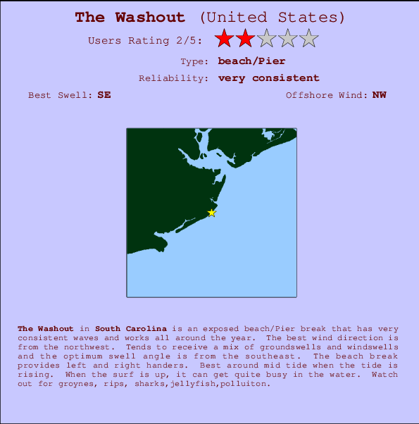
The Washout Surf Guide
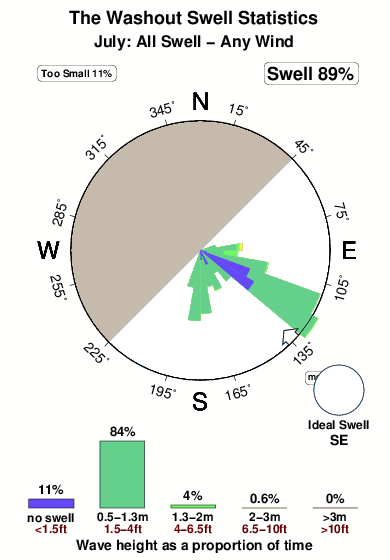
The Washout in South Carolina is an exposed beach/Pier break that is usually a safe bet and works all around the year. The best wind direction is from the northwest. Tends to receive a mix of groundswells and windswells and the best swell direction is from the southeast. The beach break offers both left and right hand waves. Best around mid tide when the tide is rising. When it's working here, it can get crowded. Beware of groynes, rips, sharks,jellyfish,polluiton.
The Washout Spot Info
| Type: | Rating: | Reliability: | Todays Sea Temp*: |
|---|---|---|---|
| very consistent | 29.3°C*ocean temperature recorded from satellite |
Surfing The Washout:
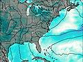
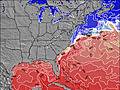
The best conditions reported for surf at The Washout occur when a Southeast swell combines with an offshore wind direction from the Northwest.

Energía de Olas (poder): 12 horas

The Washout Surf:
Wednesday, 15 July 2026, 13:26 Local time| miércoles 15 | ||||
| 11AM | 2PM | 5PM | 8PM | |
| Wave (m) | ||||
| Período (s) | 9 | 9 | 6 | 8 |
| Viento (km/h) | ||||
| Estado del Viento | cross | cross- on |
cross- on |
cross- on |
- /breaks/The-Washout/forecasts/latest
The Washout Surf Guide
The Washout in South Carolina is an exposed beach/Pier break that is usually a safe bet and works all around the year. The best wind direction is from the northwest. Tends to receive a mix of groundswells and windswells and the best swell direction is from the southeast. The beach break offers both left and right hand waves. Best around mid tide when the tide is rising. When it's working here, it can get crowded. Beware of groynes, rips, sharks,jellyfish,polluiton.
The Washout Spot Info
Type: Rating: Reliability: Todays Sea Temp*:  Beach/pier
 2
2very consistent 29.3°C*ocean temperature recorded from satelliteSurfing The Washout:
The best conditions reported for surf at The Washout occur when a Southeast swell combines with an offshore wind direction from the Northwest.
Energía de Olas (poder): 12 horas
Usa la barra de navegación de arriba para ver la temperatura del mar en The Washout, fotografías The Washout, previsiones detalladas de olas para The Washout, vientos y previsión del tiempo, webcams para The Washout, viento actual desde estaciones meteorológicas en Carolina South y predicciones de marea para The Washout. Las mapas de olas para United States enseñarán un mapa grande de United States y los mares que rodean. Los mapas de olas pueden ser animadas para mostrar diferentes componentes de olas, la altura de ola, la energía de ola, el período, junto con previsiones de viento y del tiempo. Previsiones actuales del tiempo y del estado del mar provienen de boyas marinas de United States, del barcos que transitan en la zona y de estaciones meteorológicas costeras. Cada página de previsiones tiene un Busca-Olas Regional y Global para localizar las mejores condiciones para surfear en el área de The Washout.
The Washout Surf:
Wednesday, 15 July 2026, 13:26 Local timemiércoles 15 11AM 2PM 5PM 8PM Wave (m) Período (s) 9 9 6 8 Viento (km/h) Estado del Viento cross cross-
oncross-
oncross-
on- /breaks/The-Washout/forecasts/latest
- /breaks/The-Washout/forecasts/latest/six_day
The Washout Surf Guide
The Washout in South Carolina is an exposed beach/Pier break that is usually a safe bet and works all around the year. The best wind direction is from the northwest. Tends to receive a mix of groundswells and windswells and the best swell direction is from the southeast. The beach break offers both left and right hand waves. Best around mid tide when the tide is rising. When it's working here, it can get crowded. Beware of groynes, rips, sharks,jellyfish,polluiton.
The Washout Spot Info
Type: Rating: Reliability: Todays Sea Temp*: Beach/pier2very consistent 29.3°C*ocean temperature recorded from satelliteSurfing The Washout:
The best conditions reported for surf at The Washout occur when a Southeast swell combines with an offshore wind direction from the Northwest.
Energía de Olas (poder): 12 horas
Usa la barra de navegación de arriba para ver la temperatura del mar en The Washout, fotografías The Washout, previsiones detalladas de olas para The Washout, vientos y previsión del tiempo, webcams para The Washout, viento actual desde estaciones meteorológicas en Carolina South y predicciones de marea para The Washout. Las mapas de olas para United States enseñarán un mapa grande de United States y los mares que rodean. Los mapas de olas pueden ser animadas para mostrar diferentes componentes de olas, la altura de ola, la energía de ola, el período, junto con previsiones de viento y del tiempo. Previsiones actuales del tiempo y del estado del mar provienen de boyas marinas de United States, del barcos que transitan en la zona y de estaciones meteorológicas costeras. Cada página de previsiones tiene un Busca-Olas Regional y Global para localizar las mejores condiciones para surfear en el área de The Washout.
The Washout Surf:
Wednesday, 15 July 2026, 13:26 Local timemiércoles 15 11AM 2PM 5PM 8PM Wave (m) Período (s) 9 9 6 8 Viento (km/h) Estado del Viento cross cross-
oncross-
oncross-
on- /breaks/The-Washout/forecasts/latest
The Washout Surf Guide
The Washout in South Carolina is an exposed beach/Pier break that is usually a safe bet and works all around the year. The best wind direction is from the northwest. Tends to receive a mix of groundswells and windswells and the best swell direction is from the southeast. The beach break offers both left and right hand waves. Best around mid tide when the tide is rising. When it's working here, it can get crowded. Beware of groynes, rips, sharks,jellyfish,polluiton.
The Washout Spot Info
Type: Rating: Reliability: Todays Sea Temp*: Beach/pier2very consistent 29.3°C*ocean temperature recorded from satelliteSurfing The Washout:
The best conditions reported for surf at The Washout occur when a Southeast swell combines with an offshore wind direction from the Northwest.
Energía de Olas (poder): 12 horas
Usa la barra de navegación de arriba para ver la temperatura del mar en The Washout, fotografías The Washout, previsiones detalladas de olas para The Washout, vientos y previsión del tiempo, webcams para The Washout, viento actual desde estaciones meteorológicas en Carolina South y predicciones de marea para The Washout. Las mapas de olas para United States enseñarán un mapa grande de United States y los mares que rodean. Los mapas de olas pueden ser animadas para mostrar diferentes componentes de olas, la altura de ola, la energía de ola, el período, junto con previsiones de viento y del tiempo. Previsiones actuales del tiempo y del estado del mar provienen de boyas marinas de United States, del barcos que transitan en la zona y de estaciones meteorológicas costeras. Cada página de previsiones tiene un Busca-Olas Regional y Global para localizar las mejores condiciones para surfear en el área de The Washout.
The Washout Surf:
Wednesday, 15 July 2026, 13:26 Local timemiércoles 15 11AM 2PM 5PM 8PM Wave (m) Período (s) 9 9 6 8 Viento (km/h) Estado del Viento cross cross-
oncross-
oncross-
onTide Times:
Para Folly River, north, Folly Island, South Carolina, a %{dist} %{km} de %{location}.
PROXIMA ES A LAS (hora local) quedan marea alta marea baja The Washout Tide Times and Tide Chart
Live Weather:
At Charleston Executive Airport (South Carolina), 10 km from The Washout.
light winds from the E
(km/h)
Dry and cloudyAir temperature
30°CCurrent weather near The Washout
Buoy Data:
At Edisto Buoy, 48 miles from The Washout.
8AM 9AM 10AM 11AM Antigüedad de datos 4 hr 3 hr 2 hr 1 hr Altura de Olas (m) 


Período Promedia (s) 5.2 5.3 5.1 5.0 Overall The Washout Surf Consistency and Wind Distribution in julio
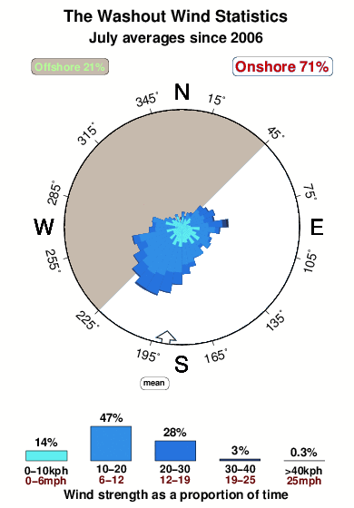


Wind stats for The Washout: see the variation in direction and stength by month.
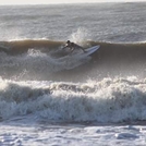
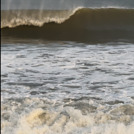
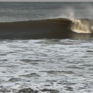
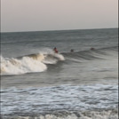
Fotos de Surf
de la galeríaContornos: Carreteras y Ríos: Selecciona un spot desde el menú 


Usa este mapa para navegar hacia las playas de surf de Carolina South y estaciones de marea cercanas de The Washout
Spots de Surf más cercanos a The Washout:
(Clica la ubicación para más detalles)- Closest spot2 mi
- Second closest spot2 mi
- Third closest spot7 mi
- Fourth closest spot11 mi
- Fifth closest spot13 mi
Boyas marinas más cercanas a The Washout:
- Closest Boya Marinas48 mi
- Second closest Boya Marinas105 mi
- Third closest Boya Marinas115 mi
- Fourth closest Boya Marinas131 mi
- Fifth closest Boya Marinas132 mi
Estaciones de marea más cercanas a The Washout:
- Closest estación de mareaFolly River, north, Folly Island1 mi
- Second closest estación de mareaFolly Beach, Folly River bridge, Folly Island2 mi
- Third closest estación de mareaFolly Island (outer coast)2 mi
- Fourth closest estación de mareaFolly Creek, Highway 171 bridge3 mi
- Fifth closest estación de mareaFort Johnson, Charleston Harbor6 mi
Airports
- The closest passenger airport to The Washout is Charleston Afb International Airport (CHS) in USA, 28 km (17 miles) away (directly).
- The second nearest airport to The Washout is Beaufort Mcas Airport (NBC), also in USA, 80 km (50 miles) away.
- Third is Santee Cooper Rgnl (Plymouth) Airport (MNI) in Montserrat Island, 105 km (65 miles) away.
- Savannah Hilton Head International Airport (SAV) in USA is 137 km (85 miles) away.
- Hunter Aaf Airport (SVN), also in USA is the fifth nearest airport to The Washout and is 138 km (86 miles) away.
- /breaks/The-Washout/forecasts/latest

 Nearest