
Previsiones:

Pronóstico Corto PlazoFuerte lluvia (totál 20mm), más pesada durante la noche de miércoles. Warm (max 31°C el martes por la tarde, min 25°C el jueves por la noche). El viento será generalmente ligero. | ||||||||||||||||||||||||
martes 14 | miércoles 15 | jueves 16 | vie 17 | |||||||||||||||||||||
3 AM | 6 AM | 9 AM | 12 PM | 3 PM | 6 PM | 9 PM | 12 AM | 3 AM | 6 AM | 9 AM | 12 PM | 3 PM | 6 PM | 9 PM | 12 AM | 3 AM | 6 AM | 9 AM | 12 PM | 3 PM | 6 PM | 9 PM | 12 AM | |
Mapa de Altura de Olas |  |  |  |  |  |  |  | 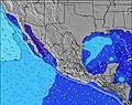 |  | 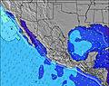 | ||||||||||||||
Oleaje Altura (m) Dirección Período (s) | SSW 13 | SSW 13 | SSW 13 | SW 18 | SW 18 | SW 18 | SSW 12 | SSW 12 | SSW 15 | SW 12 | SW 16 | SW 16 | SW 16 | SSW 13 | S 13 | SW 16 | SSW 13 | SSW 12 | SSW 12 | SSW 15 | S 14 | SSW 13 | SSW 13 | SW 19 |
Gráfico Olas | ||||||||||||||||||||||||
269 | 246 | 269 | 319 | 375 | 375 | 252 | 252 | 222 | 152 | 211 | 264 | 310 | 372 | 355 | 310 | 242 | 175 | 172 | 154 | 189 | 290 | 232 | 181 | |
Viento (km/h) | ||||||||||||||||||||||||
Estado del Viento Viento de Mar Viento de Mar-Cruzado Cruzado Viento de Tierra-Cruzado Viento de Tierra Cristalino | off | cross-off | off | cross-on | cross-on | cross-on | cross | cross-off | off | off | glassy | cross-on | cross-on | cross-on | cross | cross-off | cross-off | off | glassy | cross-on | cross-on | cross-on | glassy | off |
Marea alta | 1:41PM0.78m | 11:55PM0.46m | 2:45PM0.75m | 1:44AM0.45m | 3:50PM0.72m | |||||||||||||||||||
Marea baja | 5:45AM-0.01m | 8:32PM0.41m | 6:53AM0.06m | 9:45PM0.37m | 8:17AM0.15m | 10:45PM0.31m | ||||||||||||||||||
— | 6:15 | — | — | — | — | — | — | — | 6:16 | — | — | — | — | — | — | — | 6:16 | — | — | — | — | — | 6:16 | |
— | — | — | — | — | 7:19 | — | — | — | — | — | — | — | 7:19 | — | — | — | — | — | — | — | 7:19 | — | 7:19 | |
mm | — | 4 | — | — | — | — | — | — | — | 1 | 1 | — | 1 | 1 | 4 | 2 | 4 | 1 | — | — | — | 1 | 1 | 1 |
Temp. °C | 26 | 25 | 27 | 30 | 31 | 30 | 28 | 27 | 26 | 26 | 28 | 30 | 30 | 30 | 28 | 28 | 27 | 26 | 28 | 30 | 30 | 30 | 28 | 27 |
Enfriamiento °C | 29 | 28 | 30 | 33 | 34 | 33 | 32 | 31 | 30 | 29 | 32 | 33 | 33 | 34 | 33 | 33 | 31 | 30 | 33 | 33 | 32 | 33 | 33 | 31 |
Oleaje 1 Altura (m) Dirección Período (s) | SSE 8 | SSW 13 | SSW 13 | SSW 13 | SSW 13 | SSW 13 | SSW 12 | SSW 12 | SSW 15 | SW 12 | SSW 12 | SSW 12 | SSW 13 | SSW 13 | S 13 | SSW 13 | SSW 13 | SSW 12 | SSW 12 | SSW 12 | S 14 | SSW 13 | SSW 13 | SSW 13 |
122 | 246 | 269 | 261 | 257 | 249 | 241 | 241 | 222 | 152 | 129 | 175 | 307 | 372 | 355 | 249 | 242 | 175 | 172 | 115 | 189 | 290 | 232 | 181 | |
Oleaje 2 Altura (m) Dirección Período (s) | SSW 13 | SE 8 | SSE 7 | SSE 7 | SW 18 | SW 18 | SW 18 | SW 18 | S 7 | S 7 | SW 16 | SW 16 | SW 16 | SW 16 | SW 16 | SW 16 | SW 16 | SW 16 | SW 16 | SSW 15 | SSW 12 | SW 15 | SW 15 | SW 15 |
269 | 64 | 73 | 71 | 375 | 375 | 252 | 252 | 38 | 39 | 211 | 264 | 310 | 310 | 310 | 310 | 208 | 163 | 127 | 154 | 111 | 174 | 171 | 171 | |
Oleaje 3 Altura (m) Dirección Período (s) | S 16 | S 6 | SSW 18 | SW 18 | SSE 7 | SSE 7 | SSE 7 | SSE 7 | SW 12 | S 14 | S 7 | S 7 | SSE 7 | SW 21 | SW 21 | S 7 | S 7 | S 15 | S 15 | S 15 | SW 15 | SE 7 | SW 19 | SW 19 |
81 | 30 | 211 | 319 | 36 | 34 | 34 | 21 | 73 | 98 | 27 | 28 | 18 | 71 | 71 | 24 | 24 | 113 | 113 | 113 | 136 | 14 | 181 | 181 | |
Olas de Viento Altura (m) Dirección Período (s) | — | — | — | — | — | — | — | — | — | — | — | — | — | — | — | — | — | — | — | — | — | — | — | — |
— | — | — | — | — | — | — | — | — | — | — | — | — | — | — | — | — | — | — | — | — | — | — | — | |
Viento del Tierra o Mar Limpio más proximo | ||||||||||||||||||||||||
Distancia (km) | 0 | 0 | 0 | 234 | 641 | 527 | 30 | 0 | 0 | 0 | 0 | 661 | 661 | 319 | 89 | 0 | 0 | 0 | 0 | 661 | 662 | 340 | 0 | 0 |
Mejores Olas Previstas en Guerrero | ||||||||||||||||||||||||
Mejores Olas Previstas en Mexico | ||||||||||||||||||||||||
Busca-Olas Global | ||||||||||||||||||||||||
- Map Icons:
 Break
Break Live Wave Height (m)
 Live Wind Speed (km/h)
 Surf Rating (10 Max)
 Ocean Swells (m)
- Wind Speed (km/h)
GRÁTIS! Un widget de Surf-Forecast.com para tu sitio
Este widget grátis de previsiones de surf y tiempo puede ser añadido a cualquier otro sitio y da un resumen de previsiones de olas para Tetitlan. Solo necesita cortar y pegar el código HTML de abajo en su web. Puede elegir preferencias de idioma y de unidades (métricas o imperiales) para convenir a los usuarios de su sitio. Clica aquí para obtener el código.
 Nearest