

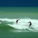
Te Awanga Surf Guide
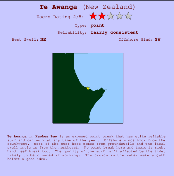
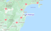
Te Awanga in Hawkes Bay is an exposed reef and point break that has fairly consistent surf and can work at any time of the year. Offshore winds blow from the southwest. Groundswells more frequent than windswells and the optimum swell angle is from the northeast. There is a right hand reef break Good surf at all stages of the tide. Often Crowded. Take care of .
Te Awanga Spot Info
| Type: | Rating: | Reliability: | Todays Sea Temp*: |
|---|---|---|---|
| fairly consistent | 12.6°C*ocean temperature recorded from satellite |
Surfing Te Awanga:
The best conditions reported for surf at Te Awanga occur when a Northeast swell combines with an offshore wind direction from the Southwest.

Energía de Olas (poder): 12 horas


Te Awanga Surf:
Thursday, 16 July 2026, 21:35 Local time| jue | viernes 17 | |||
| 9PM | 0AM | 3AM | 6AM | |
| Wave (m) | ||||
| Período (s) | 16 | 16 | 16 | 16 |
| Viento (km/h) | ||||
| Estado del Viento | off | off | glass | cross- off |
- /breaks/Te-Awanga/forecasts/latest
Te Awanga Surf Guide
Te Awanga in Hawkes Bay is an exposed reef and point break that has fairly consistent surf and can work at any time of the year. Offshore winds blow from the southwest. Groundswells more frequent than windswells and the optimum swell angle is from the northeast. There is a right hand reef break Good surf at all stages of the tide. Often Crowded. Take care of .
Te Awanga Spot Info
Type: Rating: Reliability: Todays Sea Temp*:  Point
Point 2
2fairly consistent 12.6°C*ocean temperature recorded from satelliteSurfing Te Awanga:
The best conditions reported for surf at Te Awanga occur when a Northeast swell combines with an offshore wind direction from the Southwest.
Energía de Olas (poder): 12 horas
Usa la barra de navegación de arriba para ver la temperatura del mar en Te Awanga, fotografías Te Awanga, previsiones detalladas de olas para Te Awanga, vientos y previsión del tiempo, webcams para Te Awanga, viento actual desde estaciones meteorológicas en Hawkes Bay y predicciones de marea para Te Awanga. Las mapas de olas para New Zealand enseñarán un mapa grande de New Zealand y los mares que rodean. Los mapas de olas pueden ser animadas para mostrar diferentes componentes de olas, la altura de ola, la energía de ola, el período, junto con previsiones de viento y del tiempo. Previsiones actuales del tiempo y del estado del mar provienen de boyas marinas de New Zealand, del barcos que transitan en la zona y de estaciones meteorológicas costeras. Cada página de previsiones tiene un Busca-Olas Regional y Global para localizar las mejores condiciones para surfear en el área de Te Awanga.
Te Awanga Surf:
Thursday, 16 July 2026, 21:35 Local timejue viernes 17 9PM 0AM 3AM 6AM Wave (m) Período (s) 16 16 16 16 Viento (km/h) Estado del Viento off off glass cross-
off- /breaks/Te-Awanga/forecasts/latest
- /breaks/Te-Awanga/forecasts/latest/six_day
Te Awanga Surf Guide
Te Awanga in Hawkes Bay is an exposed reef and point break that has fairly consistent surf and can work at any time of the year. Offshore winds blow from the southwest. Groundswells more frequent than windswells and the optimum swell angle is from the northeast. There is a right hand reef break Good surf at all stages of the tide. Often Crowded. Take care of .
Te Awanga Spot Info
Type: Rating: Reliability: Todays Sea Temp*: Point2fairly consistent 12.6°C*ocean temperature recorded from satelliteSurfing Te Awanga:
The best conditions reported for surf at Te Awanga occur when a Northeast swell combines with an offshore wind direction from the Southwest.
Energía de Olas (poder): 12 horas
Usa la barra de navegación de arriba para ver la temperatura del mar en Te Awanga, fotografías Te Awanga, previsiones detalladas de olas para Te Awanga, vientos y previsión del tiempo, webcams para Te Awanga, viento actual desde estaciones meteorológicas en Hawkes Bay y predicciones de marea para Te Awanga. Las mapas de olas para New Zealand enseñarán un mapa grande de New Zealand y los mares que rodean. Los mapas de olas pueden ser animadas para mostrar diferentes componentes de olas, la altura de ola, la energía de ola, el período, junto con previsiones de viento y del tiempo. Previsiones actuales del tiempo y del estado del mar provienen de boyas marinas de New Zealand, del barcos que transitan en la zona y de estaciones meteorológicas costeras. Cada página de previsiones tiene un Busca-Olas Regional y Global para localizar las mejores condiciones para surfear en el área de Te Awanga.
Te Awanga Surf:
Thursday, 16 July 2026, 21:35 Local timejue viernes 17 9PM 0AM 3AM 6AM Wave (m) Período (s) 16 16 16 16 Viento (km/h) Estado del Viento off off glass cross-
off- /breaks/Te-Awanga/forecasts/latest
Te Awanga Surf Guide
Te Awanga in Hawkes Bay is an exposed reef and point break that has fairly consistent surf and can work at any time of the year. Offshore winds blow from the southwest. Groundswells more frequent than windswells and the optimum swell angle is from the northeast. There is a right hand reef break Good surf at all stages of the tide. Often Crowded. Take care of .
Te Awanga Spot Info
Type: Rating: Reliability: Todays Sea Temp*: Point2fairly consistent 12.6°C*ocean temperature recorded from satelliteSurfing Te Awanga:
The best conditions reported for surf at Te Awanga occur when a Northeast swell combines with an offshore wind direction from the Southwest.
Energía de Olas (poder): 12 horas
Usa la barra de navegación de arriba para ver la temperatura del mar en Te Awanga, fotografías Te Awanga, previsiones detalladas de olas para Te Awanga, vientos y previsión del tiempo, webcams para Te Awanga, viento actual desde estaciones meteorológicas en Hawkes Bay y predicciones de marea para Te Awanga. Las mapas de olas para New Zealand enseñarán un mapa grande de New Zealand y los mares que rodean. Los mapas de olas pueden ser animadas para mostrar diferentes componentes de olas, la altura de ola, la energía de ola, el período, junto con previsiones de viento y del tiempo. Previsiones actuales del tiempo y del estado del mar provienen de boyas marinas de New Zealand, del barcos que transitan en la zona y de estaciones meteorológicas costeras. Cada página de previsiones tiene un Busca-Olas Regional y Global para localizar las mejores condiciones para surfear en el área de Te Awanga.
Te Awanga Surf:
Thursday, 16 July 2026, 21:35 Local timejue viernes 17 9PM 0AM 3AM 6AM Wave (m) Período (s) 16 16 16 16 Viento (km/h) Estado del Viento off off glass cross-
offTide Times:
Para Haumoana River Mouth, a %{dist} %{km} de %{location}.
PROXIMA ES A LAS (hora local) quedan marea alta marea baja Te Awanga Tide Times and Tide Chart
Live Weather:
At Cape Kidnappers, 8 km from Te Awanga.
fresh winds from the S
(km/h)
No weather reportAir temperature
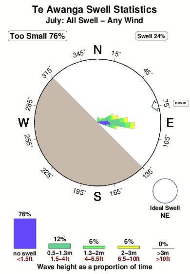
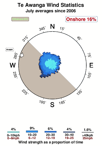
11.4°COverall Te Awanga Surf Consistency and Wind Distribution in julio
Fotos de Surf
de la galeríaContornos: Carreteras y Ríos: Selecciona un spot desde el menú 


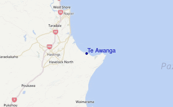
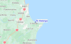
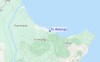
Usa este mapa para navegar hacia las playas de surf de Hawkes Bay y estaciones de marea cercanas de Te Awanga
Spots de Surf más cercanos a Te Awanga:
(Clica la ubicación para más detalles)- Closest spot4 mi
- Second closest spot5 mi
- Third closest spot6 mi
- Fourth closest spot9 mi
- Fifth closest spot11 mi
Boyas marinas más cercanas a Te Awanga:
- Closest Boya Marinas136 mi
- Second closest Boya Marinas178 mi
- Third closest Boya Marinas227 mi
- Fourth closest Boya Marinas227 mi
- Fifth closest Boya Marinas292 mi
Estaciones de marea más cercanas a Te Awanga:
- Closest estación de mareaNapier12 mi
- Second closest estación de mareaWairoa River47 mi
- Third closest estación de mareaWaikokopu60 mi
- Fourth closest estación de mareaGisborne86 mi
- Fifth closest estación de mareaCastlepoint98 mi
Airports
- The closest passenger airport to Te Awanga is Taupo Airport (TUO) in New Zealand, 127 km (79 miles) away (directly).
- The second nearest airport to Te Awanga is Gisborne Airport (GIS), also in New Zealand, 137 km (85 miles) away.
- Third is Palmerston North Airport (PMR) in New Zealand, 140 km (87 miles) away.
- Wanganui Airport (WAG) in New Zealand is 173 km (107 miles) away.
- Rotorua Airport (ROT), also in New Zealand is the fifth nearest airport to Te Awanga and is 180 km (112 miles) away.
- /breaks/Te-Awanga/forecasts/latest


 Nearest