
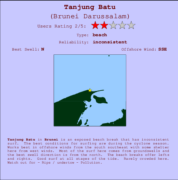
Tanjung Batu Surf Guide
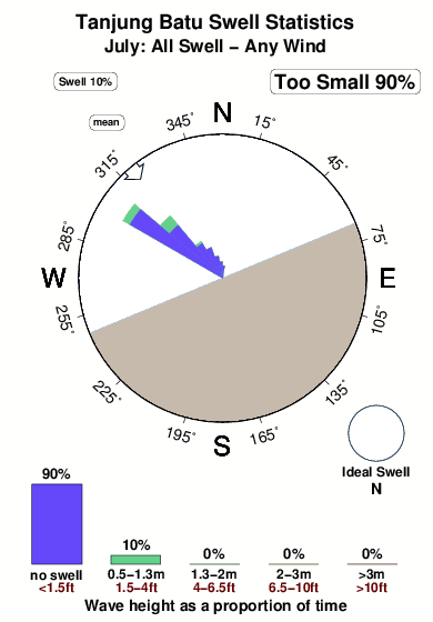
Tanjung Batu in Brunei is an exposed river break that has unreliable waves. The best conditions for surfing are during the cyclone season. The best wind direction is from the south southeast with some shelter here from west winds. Waves just as likely from local windswells as from distant groundswells and the best swell direction is from the north. The river break offers both left and right hand waves. Good surf at all stages of the tide. Unlikely to be too crowded, even when the surf is up. Beware of - Rips / undertow - Pollution.
Tanjung Batu Spot Info
| Type: | Rating: | Reliability: | Todays Sea Temp*: |
|---|---|---|---|
| inconsistent | 30.9°C*ocean temperature recorded from satellite |
Surfing Tanjung Batu:
The best conditions reported for surf at Tanjung Batu occur when a North swell combines with an offshore wind direction from the South-southeast.
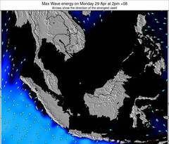
Energía de Olas (poder): 12 horas
Tanjung Batu Surf:
Wednesday, 22 July 2026, 06:07 Local time| miércoles 22 | ||||
| 5AM | 8AM | 11AM | 2PM | |
| Wave (m) | ||||
| Período (s) | 4 | 5 | 5 | 5 |
| Viento (km/h) | ||||
| Estado del Viento | cross- off |
cross- off |
cross | cross- on |
- /breaks/Tanjung-Batu/forecasts/latest
Tanjung Batu Surf Guide
Tanjung Batu in Brunei is an exposed river break that has unreliable waves. The best conditions for surfing are during the cyclone season. The best wind direction is from the south southeast with some shelter here from west winds. Waves just as likely from local windswells as from distant groundswells and the best swell direction is from the north. The river break offers both left and right hand waves. Good surf at all stages of the tide. Unlikely to be too crowded, even when the surf is up. Beware of - Rips / undertow - Pollution.
Tanjung Batu Spot Info
Type: Rating: Reliability: Todays Sea Temp*:  River
River 2
2inconsistent 30.9°C*ocean temperature recorded from satelliteSurfing Tanjung Batu:
The best conditions reported for surf at Tanjung Batu occur when a North swell combines with an offshore wind direction from the South-southeast.
Energía de Olas (poder): 12 horas
Usa la barra de navegación de arriba para ver la temperatura del mar en Tanjung Batu, fotografías Tanjung Batu, previsiones detalladas de olas para Tanjung Batu, vientos y previsión del tiempo, webcams para Tanjung Batu, viento actual desde estaciones meteorológicas en Brunei y predicciones de marea para Tanjung Batu. Las mapas de olas para Brunei Darussalam enseñarán un mapa grande de Brunei Darussalam y los mares que rodean. Los mapas de olas pueden ser animadas para mostrar diferentes componentes de olas, la altura de ola, la energía de ola, el período, junto con previsiones de viento y del tiempo. Previsiones actuales del tiempo y del estado del mar provienen de boyas marinas de Brunei Darussalam, del barcos que transitan en la zona y de estaciones meteorológicas costeras. Cada página de previsiones tiene un Busca-Olas Regional y Global para localizar las mejores condiciones para surfear en el área de Tanjung Batu.
Tanjung Batu Surf:
Wednesday, 22 July 2026, 06:07 Local timemiércoles 22 5AM 8AM 11AM 2PM Wave (m) Período (s) 4 5 5 5 Viento (km/h) Estado del Viento cross-
offcross-
offcross cross-
on- /breaks/Tanjung-Batu/forecasts/latest
- /breaks/Tanjung-Batu/forecasts/latest/six_day
Tanjung Batu Surf Guide
Tanjung Batu in Brunei is an exposed river break that has unreliable waves. The best conditions for surfing are during the cyclone season. The best wind direction is from the south southeast with some shelter here from west winds. Waves just as likely from local windswells as from distant groundswells and the best swell direction is from the north. The river break offers both left and right hand waves. Good surf at all stages of the tide. Unlikely to be too crowded, even when the surf is up. Beware of - Rips / undertow - Pollution.
Tanjung Batu Spot Info
Type: Rating: Reliability: Todays Sea Temp*: River2inconsistent 30.9°C*ocean temperature recorded from satelliteSurfing Tanjung Batu:
The best conditions reported for surf at Tanjung Batu occur when a North swell combines with an offshore wind direction from the South-southeast.
Energía de Olas (poder): 12 horas
Usa la barra de navegación de arriba para ver la temperatura del mar en Tanjung Batu, fotografías Tanjung Batu, previsiones detalladas de olas para Tanjung Batu, vientos y previsión del tiempo, webcams para Tanjung Batu, viento actual desde estaciones meteorológicas en Brunei y predicciones de marea para Tanjung Batu. Las mapas de olas para Brunei Darussalam enseñarán un mapa grande de Brunei Darussalam y los mares que rodean. Los mapas de olas pueden ser animadas para mostrar diferentes componentes de olas, la altura de ola, la energía de ola, el período, junto con previsiones de viento y del tiempo. Previsiones actuales del tiempo y del estado del mar provienen de boyas marinas de Brunei Darussalam, del barcos que transitan en la zona y de estaciones meteorológicas costeras. Cada página de previsiones tiene un Busca-Olas Regional y Global para localizar las mejores condiciones para surfear en el área de Tanjung Batu.
Tanjung Batu Surf:
Wednesday, 22 July 2026, 06:07 Local timemiércoles 22 5AM 8AM 11AM 2PM Wave (m) Período (s) 4 5 5 5 Viento (km/h) Estado del Viento cross-
offcross-
offcross cross-
on- /breaks/Tanjung-Batu/forecasts/latest
Tanjung Batu Surf Guide
Tanjung Batu in Brunei is an exposed river break that has unreliable waves. The best conditions for surfing are during the cyclone season. The best wind direction is from the south southeast with some shelter here from west winds. Waves just as likely from local windswells as from distant groundswells and the best swell direction is from the north. The river break offers both left and right hand waves. Good surf at all stages of the tide. Unlikely to be too crowded, even when the surf is up. Beware of - Rips / undertow - Pollution.
Tanjung Batu Spot Info
Type: Rating: Reliability: Todays Sea Temp*: River2inconsistent 30.9°C*ocean temperature recorded from satelliteSurfing Tanjung Batu:
The best conditions reported for surf at Tanjung Batu occur when a North swell combines with an offshore wind direction from the South-southeast.
Energía de Olas (poder): 12 horas
Usa la barra de navegación de arriba para ver la temperatura del mar en Tanjung Batu, fotografías Tanjung Batu, previsiones detalladas de olas para Tanjung Batu, vientos y previsión del tiempo, webcams para Tanjung Batu, viento actual desde estaciones meteorológicas en Brunei y predicciones de marea para Tanjung Batu. Las mapas de olas para Brunei Darussalam enseñarán un mapa grande de Brunei Darussalam y los mares que rodean. Los mapas de olas pueden ser animadas para mostrar diferentes componentes de olas, la altura de ola, la energía de ola, el período, junto con previsiones de viento y del tiempo. Previsiones actuales del tiempo y del estado del mar provienen de boyas marinas de Brunei Darussalam, del barcos que transitan en la zona y de estaciones meteorológicas costeras. Cada página de previsiones tiene un Busca-Olas Regional y Global para localizar las mejores condiciones para surfear en el área de Tanjung Batu.
Tanjung Batu Surf:
Wednesday, 22 July 2026, 06:07 Local timemiércoles 22 5AM 8AM 11AM 2PM Wave (m) Período (s) 4 5 5 5 Viento (km/h) Estado del Viento cross-
offcross-
offcross cross-
onTide Times:
En Tanjung Batu (0 km).
PROXIMA ES A LAS (hora local) quedan marea alta marea baja Tanjung Batu Tide Times and Tide Chart
Live Weather:
At Brunei International Airport, 21 km from Tanjung Batu.
calm
(km/h)
Dry and partly cloudyAir temperature
25°COverall Tanjung Batu Surf Consistency and Wind Distribution in julio
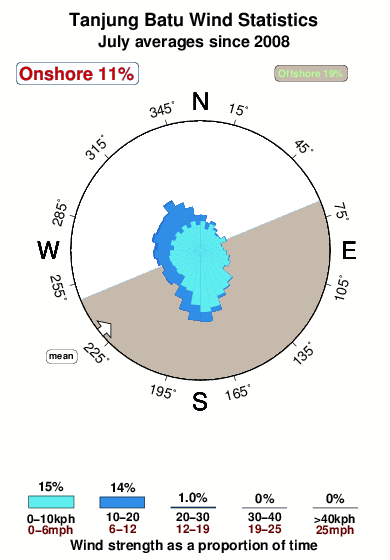


Wind stats for Tanjung Batu: see the variation in direction and stength by month.
Fotos de Surf
de la galeríaContornos: Carreteras y Ríos: Selecciona un spot desde el menú 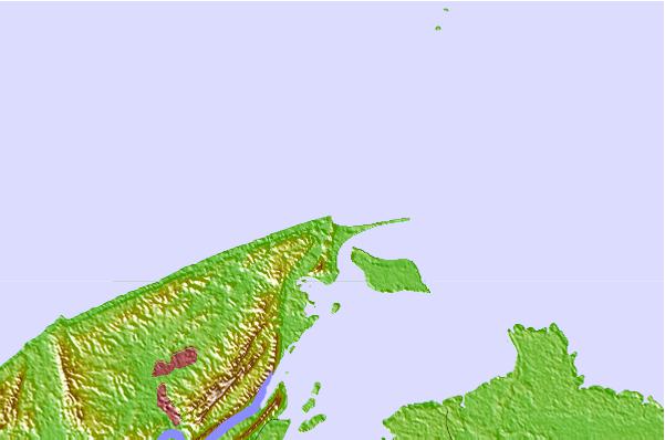

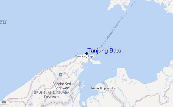
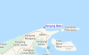
Usa este mapa para navegar hacia las playas de surf de Brunei y estaciones de marea cercanas de Tanjung Batu
Spots de Surf más cercanos a Tanjung Batu:
(Clica la ubicación para más detalles)- Closest spot10 mi
- Second closest spot14 mi
- Third closest spot91 mi
- Fourth closest spot91 mi
- Fifth closest spot103 mi
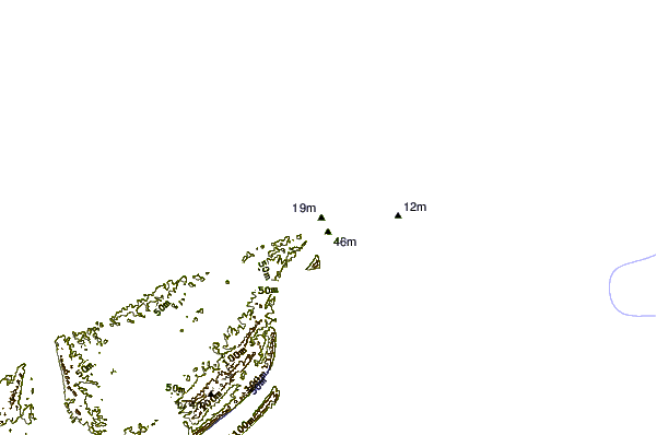
Boyas marinas más cercanas a Tanjung Batu:
- Closest Boya Marinas1465 mi
- Second closest Boya Marinas1526 mi
- Third closest Boya Marinas1686 mi
- Fourth closest Boya Marinas1695 mi
- Fifth closest Boya Marinas1768 mi
Estaciones de marea más cercanas a Tanjung Batu:
- Closest estación de mareaBandar Seri Begawan10 mi
- Second closest estación de mareaVictoria (Labuan)20 mi
- Third closest estación de mareaTutong33 mi
- Fourth closest estación de mareaSeria62 mi
- Fifth closest estación de mareaKuala Belait68 mi
Airports
- The closest passenger airport to Tanjung Batu is Brunei International Airport (BWN) in Brunei, 18 km (11 miles) away (directly).
- The second nearest airport to Tanjung Batu is Labuan Airport (LBU) in Malaysia, 35 km (22 miles) away.
- Third is Marudi Airport (MUR) in Malaysia, 126 km (78 miles) away.
- Miri Airport (MYY) in Malaysia is 143 km (89 miles) away.
- Kota Kinabalu International Airport (BKI), also in Malaysia is the fifth nearest airport to Tanjung Batu and is 148 km (92 miles) away.
- /breaks/Tanjung-Batu/forecasts/latest
 Nearest