
Previsiones:

Pronóstico Corto PlazoFuerte lluvia (totál 46mm), más pesada durante la tarde de jueves. Warm (max 29°C el miércoles por la mañana, min 27°C el martes por la tarde). Mayormente vientos frescos. | ||||||||||||||||||
lun 3 | martes 4 | miércoles 5 | ||||||||||||||||
7 PM | 10 PM | 1 AM | 4 AM | 7 AM | 10 AM | 1 PM | 4 PM | 7 PM | 10 PM | 1 AM | 4 AM | 7 AM | 10 AM | 1 PM | 4 PM | 7 PM | 10 PM | |
Mapa de Altura de Olas |  | 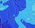 | 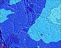 | 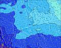 |  |  | 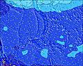 | |||||||||||
Oleaje Altura (m) Dirección Período (s) | NE 14 | NE 13 | NE 14 | SE 9 | SE 9 | SE 8 | SE 8 | SE 8 | SE 8 | ENE 13 | ENE 13 | ENE 13 | NE 13 | NE 13 | NE 12 | NE 12 | NE 12 | ENE 12 |
Gráfico Olas | ||||||||||||||||||
534 | 398 | 471 | 20 | 19 | 18 | 18 | 18 | 18 | 34 | 33 | 33 | 42 | 42 | 36 | 35 | 35 | 54 | |
Viento (km/h) | ||||||||||||||||||
Estado del Viento Viento de Mar Viento de Mar-Cruzado Cruzado Viento de Tierra-Cruzado Viento de Tierra Cristalino | cross-off | cross-off | cross-off | cross-off | cross-off | cross-off | cross-off | cross-off | cross-off | cross-off | cross-off | cross-off | cross-off | cross-off | cross-off | cross-off | cross-off | cross-off |
Marea alta | 11:03PM0.87m | 11:13AM0.71m | 11:27PM0.87m | 12:37PM0.69m | ||||||||||||||
Marea baja | 5:37AM0.42m | 5:01PM0.43m | 6:29AM0.35m | 5:41PM0.52m | ||||||||||||||
— | — | — | 6:05 | — | — | — | — | — | — | — | 6:05 | — | — | — | — | — | — | |
— | — | — | — | — | — | — | 6:46 | — | — | — | — | — | — | — | 6:46 | — | — | |
mm | 2 | 1 | 1 | 2 | 1 | 2 | 2 | 3 | 1 | — | — | 1 | 3 | 2 | 3 | 3 | 2 | 3 |
Temp. °C | 28 | 28 | 28 | 28 | 28 | 28 | 28 | 28 | 27 | 27 | 28 | 28 | 28 | 28 | 29 | 28 | 28 | 28 |
Enfriamiento °C | 28 | 28 | 28 | 28 | 28 | 27 | 27 | 27 | 26 | 26 | 27 | 28 | 28 | 28 | 29 | 28 | 29 | 29 |
Oleaje 1 Altura (m) Dirección Período (s) | NE 14 | NE 13 | NE 14 | NE 14 | NNE 13 | NNE 14 | NNE 14 | NNE 13 | N 13 | N 13 | N 13 | N 13 | N 13 | N 13 | N 13 | N 13 | N 13 | NNW 13 |
534 | 398 | 471 | 418 | 368 | 347 | 415 | 372 | 350 | 414 | 404 | 398 | 321 | 383 | 473 | 480 | 490 | 507 | |
Oleaje 2 Altura (m) Dirección Período (s) | SE 9 | ENE 14 | SE 9 | SE 9 | SE 9 | SE 8 | SE 8 | SE 8 | SE 8 | SE 8 | SSE 8 | SE 8 | SE 8 | SE 8 | SE 8 | SE 8 | NE 12 | ENE 12 |
12 | 38 | 13 | 20 | 19 | 18 | 18 | 18 | 18 | 18 | 26 | 18 | 18 | 18 | 17 | 18 | 35 | 54 | |
Oleaje 3 Altura (m) Dirección Período (s) | ENE 14 | SE 9 | ENE 14 | ENE 14 | ENE 14 | ENE 14 | ENE 14 | ENE 13 | ENE 13 | ENE 13 | ENE 13 | ENE 13 | NE 13 | NE 13 | NE 12 | NE 12 | SE 12 | SE 12 |
39 | 13 | 19 | 18 | 18 | 18 | 18 | 17 | 17 | 34 | 33 | 33 | 42 | 42 | 36 | 35 | 6 | 21 | |
Olas de Viento Altura (m) Dirección Período (s) | WSW 8 | WSW 8 | WSW 8 | WSW 8 | WSW 8 | WSW 8 | WSW 8 | WSW 8 | WSW 8 | WSW 8 | WSW 8 | WSW 8 | WSW 8 | WSW 8 | WSW 8 | WSW 8 | WSW 8 | WSW 8 |
679 | 697 | 623 | 607 | 613 | 644 | 694 | 789 | 827 | 765 | 809 | 870 | 785 | 785 | 785 | 785 | 785 | 782 | |
Viento del Tierra o Mar Limpio más proximo | ||||||||||||||||||
Distancia (km) | 1847 | 1842 | 1823 | 1820 | 1842 | 1820 | 1892 | 1892 | 1842 | 1820 | 1820 | 1820 | 1820 | 1820 | 1847 | 1847 | 1823 | 1820 |
Mejores Olas Previstas en Guam | ||||||||||||||||||
Mejores Olas Previstas en Guam | ||||||||||||||||||
Busca-Olas Global | ||||||||||||||||||
- Map Icons:
 Break
Break Live Wave Height (m)
 Live Wind Speed (km/h)
 Surf Rating (10 Max)
 Ocean Swells (m)
- Wind Speed (km/h)
GRÁTIS! Un widget de Surf-Forecast.com para tu sitio
Este widget grátis de previsiones de surf y tiempo puede ser añadido a cualquier otro sitio y da un resumen de previsiones de olas para Talofofo/The Bay. Solo necesita cortar y pegar el código HTML de abajo en su web. Puede elegir preferencias de idioma y de unidades (métricas o imperiales) para convenir a los usuarios de su sitio. Clica aquí para obtener el código.
 Nearest