
Previsiones:

Pronóstico Corto PlazoLluvia ligera (totál 8mm), cayendo mayormente el domingo por la tarde. Warm (max 30°C el domingo por la mañana, min 25°C el domingo por la noche). El viento será generalmente ligero. | ||||||||||||||||||||||||
domingo 2 | lunes 3 | martes 4 | ||||||||||||||||||||||
2 AM | 5 AM | 8 AM | 11 AM | 2 PM | 5 PM | 8 PM | 11 PM | 2 AM | 5 AM | 8 AM | 11 AM | 2 PM | 5 PM | 8 PM | 11 PM | 2 AM | 5 AM | 8 AM | 11 AM | 2 PM | 5 PM | 8 PM | 11 PM | |
Mapa de Altura de Olas | 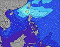 | 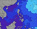 | 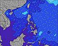 | 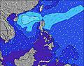 | 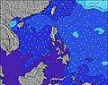 | 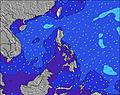 | 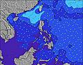 | 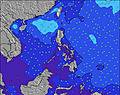 | 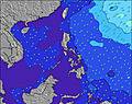 | |||||||||||||||
Oleaje Altura (m) Dirección Período (s) | NNE 9 | ENE 17 | ENE 17 | ENE 17 | ENE 16 | ENE 16 | E 17 | E 15 | E 14 | ENE 15 | ENE 16 | ENE 18 | ENE 18 | ENE 15 | ENE 16 | ENE 16 | ENE 16 | ENE 15 | ENE 15 | ENE 16 | ENE 16 | ENE 18 | ENE 18 | ENE 17 |
Gráfico Olas | ||||||||||||||||||||||||
8 | 29 | 59 | 56 | 51 | 86 | 149 | 109 | 107 | 176 | 259 | 408 | 176 | 246 | 457 | 452 | 582 | 539 | 539 | 546 | 546 | 1106 | 1093 | 1121 | |
Viento (km/h) | ||||||||||||||||||||||||
Estado del Viento Viento de Mar Viento de Mar-Cruzado Cruzado Viento de Tierra-Cruzado Viento de Tierra Cristalino | off | off | glassy | on | cross-on | glassy | off | off | off | off | glassy | cross-on | cross-on | glassy | glassy | cross-off | off | off | glassy | cross-on | on | glassy | glassy | cross-off |
Marea alta | 7:35AM1.84m | 8:13PM1.81m | 8:13AM1.76m | 8:42PM1.81m | 8:55AM1.65m | 9:15PM1.79m | ||||||||||||||||||
Marea baja | 1:37AM0.55m | 1:55PM0.28m | 2:14AM0.52m | 2:25PM0.39m | 2:54AM0.50m | 2:57PM0.52m | ||||||||||||||||||
— | 5:24 | — | — | — | — | — | — | — | 5:26 | — | — | — | — | — | — | — | 5:26 | — | — | — | — | — | — | |
— | — | — | — | — | 5:55 | — | — | — | — | — | — | — | 5:55 | — | — | — | — | — | — | — | 5:55 | — | — | |
mm | — | — | — | — | 1 | 2 | 1 | — | — | — | — | — | 1 | 2 | 1 | — | — | — | — | — | — | — | — | — |
Temp. °C | 25 | 24 | 27 | 30 | 29 | 28 | 26 | 25 | 25 | 25 | 27 | 30 | 29 | 28 | 27 | 26 | 25 | 25 | 27 | 30 | 30 | 29 | 27 | 26 |
Enfriamiento °C | 29 | 27 | 31 | 33 | 33 | 33 | 30 | 29 | 29 | 29 | 31 | 34 | 34 | 33 | 32 | 30 | 29 | 29 | 31 | 33 | 33 | 33 | 31 | 30 |
Oleaje 1 Altura (m) Dirección Período (s) | SE 7 | SE 7 | SE 7 | SE 7 | SE 7 | SE 7 | E 17 | SE 7 | SE 7 | SE 8 | ENE 16 | ENE 18 | ENE 14 | ENE 15 | ENE 16 | ENE 16 | ENE 16 | ENE 15 | ENE 15 | ENE 16 | ENE 16 | ENE 18 | ENE 18 | ENE 17 |
12 | 12 | 12 | 12 | 12 | 18 | 149 | 33 | 44 | 45 | 259 | 408 | 163 | 246 | 457 | 452 | 582 | 539 | 539 | 546 | 546 | 1106 | 1093 | 1121 | |
Oleaje 2 Altura (m) Dirección Período (s) | NNE 9 | ENE 17 | ENE 17 | ENE 17 | ENE 16 | ENE 16 | SE 7 | E 15 | E 14 | ENE 15 | SE 7 | SE 7 | ENE 18 | SE 7 | SE 8 | SE 8 | SE 8 | SE 8 | SE 7 | ENE 20 | ENE 20 | SE 7 | SE 7 | SE 7 |
8 | 29 | 59 | 56 | 51 | 86 | 25 | 109 | 107 | 176 | 33 | 25 | 176 | 25 | 28 | 46 | 46 | 45 | 26 | 346 | 342 | 17 | 12 | 27 | |
Oleaje 3 Altura (m) Dirección Período (s) | ENE 8 | ESE 9 | ESE 8 | ENE 9 | ENE 9 | ENE 9 | ENE 9 | ENE 18 | ENE 18 | ENE 19 | NNE 9 | NNE 9 | SE 7 | ENE 18 | NNE 9 | ESE 9 | ESE 9 | ESE 9 | ENE 21 | SE 7 | SE 7 | ESE 9 | ESE 9 | ESE 10 |
6 | 8 | 7 | 8 | 8 | 8 | 8 | 62 | 64 | 70 | 8 | 8 | 25 | 180 | 7 | 8 | 9 | 8 | 180 | 18 | 17 | 8 | 9 | 9 | |
Olas de Viento Altura (m) Dirección Período (s) | — | — | — | — | SSE 7 | — | — | — | — | — | — | — | SSE 7 | — | — | — | — | — | — | — | — | — | — | — |
— | — | — | — | 81 | — | — | — | — | — | — | — | 105 | — | — | — | — | — | — | — | — | — | — | — | |
Viento del Tierra o Mar Limpio más proximo | ||||||||||||||||||||||||
Distancia (km) | 1904 | 93 | 0 | 68 | 88 | 0 | 0 | 0 | 0 | 0 | 0 | 68 | 14 | 0 | 0 | 0 | 0 | 0 | 0 | 68 | 68 | 0 | 0 | 0 |
Mejores Olas Previstas en Surigao Del Sur | ||||||||||||||||||||||||
Mejores Olas Previstas en Philippines | ||||||||||||||||||||||||
Busca-Olas Global | ||||||||||||||||||||||||
- Map Icons:
 Break
Break Live Wave Height (m)
 Live Wind Speed (km/h)
 Surf Rating (10 Max)
 Ocean Swells (m)
- Wind Speed (km/h)
GRÁTIS! Un widget de Surf-Forecast.com para tu sitio
Este widget grátis de previsiones de surf y tiempo puede ser añadido a cualquier otro sitio y da un resumen de previsiones de olas para Tago River. Solo necesita cortar y pegar el código HTML de abajo en su web. Puede elegir preferencias de idioma y de unidades (métricas o imperiales) para convenir a los usuarios de su sitio. Clica aquí para obtener el código.
 Nearest