
Previsiones:

Pronóstico Corto PlazoLluvia moderada (totál 16mm), más pesada el lunes por la mañana. Warm (max 27°C el lunes por la tarde, min 24°C el miércoles por la noche). Vientos crecientes (calma el martes por la mañana, vientos frescos desde el SSE por la noche de miércoles). | |||||||||||||||||||||||
lunes 3 | martes 4 | miércoles 5 | |||||||||||||||||||||
4 AM | 7 AM | 10 AM | 1 PM | 4 PM | 7 PM | 10 PM | 1 AM | 4 AM | 7 AM | 10 AM | 1 PM | 4 PM | 7 PM | 10 PM | 1 AM | 4 AM | 7 AM | 10 AM | 1 PM | 4 PM | 7 PM | 10 PM | |
Mapa de Altura de Olas |  |  |  |  | 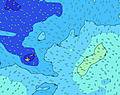 |  |  | 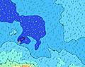 |  | ||||||||||||||
Oleaje Altura (m) Dirección Período (s) | SSE 11 | SSE 11 | SW 15 | SW 15 | SSE 11 | SW 14 | SW 14 | SW 14 | SW 14 | SW 13 | SW 13 | SW 13 | SW 13 | SW 13 | SW 13 | SW 13 | SW 12 | SW 12 | SSW 12 | SSW 13 | SW 12 | SW 19 | SW 18 |
Gráfico Olas | |||||||||||||||||||||||
400 | 426 | 365 | 355 | 346 | 407 | 401 | 390 | 357 | 392 | 444 | 444 | 437 | 437 | 480 | 459 | 346 | 444 | 582 | 507 | 463 | 427 | 494 | |
Viento (km/h) | |||||||||||||||||||||||
Estado del Viento Viento de Mar Viento de Mar-Cruzado Cruzado Viento de Tierra-Cruzado Viento de Tierra Cristalino | cross-off | cross-off | cross-off | cross-off | cross-off | cross-off | cross-off | off | glassy | cross-off | glassy | cross-on | on | on | cross-on | cross-on | cross-on | cross-on | cross-on | cross-on | cross-on | cross-on | cross-on |
Marea alta | 9:31AM0.95m | 10:04PM0.94m | 10:20AM0.91m | 10:54PM0.95m | 11:17AM0.88m | ||||||||||||||||||
Marea baja | 3:19AM0.26m | 3:44PM0.22m | 4:09AM0.27m | 4:29PM0.23m | 5:06AM0.27m | 5:22PM0.24m | |||||||||||||||||
6:47 | — | — | — | — | — | — | — | 6:47 | — | — | — | — | — | — | — | 6:46 | — | — | — | — | — | — | |
— | — | — | — | 6:17 | — | — | — | — | — | — | — | 6:17 | — | — | — | — | — | — | — | 6:17 | — | — | |
mm | 2 | 3 | 2 | — | 1 | 1 | — | 1 | — | — | — | — | — | — | — | — | — | — | 1 | 1 | 1 | 1 | 1 |
Temp. °C | 26 | 26 | 26 | 26 | 27 | 27 | 27 | 26 | 26 | 26 | 26 | 26 | 26 | 25 | 25 | 25 | 25 | 25 | 25 | 25 | 25 | 25 | 25 |
Enfriamiento °C | 27 | 27 | 27 | 27 | 30 | 30 | 30 | 29 | 30 | 30 | 30 | 29 | 28 | 26 | 26 | 26 | 26 | 26 | 26 | 26 | 26 | 25 | 25 |
Oleaje 1 Altura (m) Dirección Período (s) | SSE 11 | SSE 11 | SSE 11 | SSE 11 | SSE 11 | SE 11 | SE 11 | SE 11 | SW 14 | SW 13 | SW 13 | SW 13 | SW 13 | SW 13 | SW 13 | SW 13 | SW 12 | SW 12 | SSW 12 | SW 12 | SW 12 | SW 11 | SSW 12 |
400 | 426 | 335 | 335 | 341 | 293 | 288 | 288 | 357 | 392 | 444 | 444 | 437 | 437 | 480 | 459 | 341 | 444 | 582 | 442 | 463 | 418 | 494 | |
Oleaje 2 Altura (m) Dirección Período (s) | SW 15 | SW 15 | SW 15 | SW 15 | E 8 | SW 14 | SW 14 | SW 14 | SE 11 | SE 12 | SE 10 | E 8 | SE 11 | SE 10 | S 15 | SSW 15 | SSW 14 | S 13 | S 13 | SSW 13 | SSW 12 | S 12 | SW 11 |
262 | 314 | 365 | 355 | 114 | 407 | 401 | 390 | 255 | 259 | 106 | 57 | 163 | 157 | 212 | 284 | 346 | 366 | 427 | 507 | 461 | 425 | 288 | |
Oleaje 3 Altura (m) Dirección Período (s) | ENE 16 | ENE 16 | ENE 16 | ENE 15 | SW 14 | E 8 | E 8 | E 8 | E 8 | E 8 | E 8 | SE 10 | E 8 | E 8 | E 8 | SE 10 | E 8 | SE 10 | SE 10 | SE 11 | SE 11 | SW 19 | SW 18 |
25 | 25 | 24 | 21 | 346 | 89 | 92 | 72 | 72 | 55 | 57 | 100 | 58 | 42 | 42 | 108 | 43 | 85 | 89 | 110 | 134 | 427 | 481 | |
Olas de Viento Altura (m) Dirección Período (s) | E 8 | E 8 | E 8 | E 8 | — | — | — | — | — | — | — | — | S 4 | S 4 | SSE 10 | SSE 4 | SSE 10 | SSE 5 | E 8 | — | — | — | — |
124 | 149 | 138 | 135 | — | — | — | — | — | — | — | — | 5 | 5 | 225 | 23 | 260 | 39 | 80 | — | — | — | — | |
Viento del Tierra o Mar Limpio más proximo | |||||||||||||||||||||||
Distancia (km) | 91 | 76 | 109 | 109 | 30 | 0 | 0 | 0 | 0 | 0 | 0 | 19 | 19 | 91 | 91 | 91 | 91 | 1265 | 1494 | 1494 | 91 | 91 | 1494 |
Mejores Olas Previstas en Upolu | |||||||||||||||||||||||
Mejores Olas Previstas en Samoa | |||||||||||||||||||||||
Busca-Olas Global | |||||||||||||||||||||||
- Map Icons:
 Break
Break Live Wave Height (m)
 Live Wind Speed (km/h)
 Surf Rating (10 Max)
 Ocean Swells (m)
- Wind Speed (km/h)
GRÁTIS! Un widget de Surf-Forecast.com para tu sitio
Este widget grátis de previsiones de surf y tiempo puede ser añadido a cualquier otro sitio y da un resumen de previsiones de olas para Tafatafa. Solo necesita cortar y pegar el código HTML de abajo en su web. Puede elegir preferencias de idioma y de unidades (métricas o imperiales) para convenir a los usuarios de su sitio. Clica aquí para obtener el código.
 Nearest