
Previsiones:

Pronóstico Corto PlazoMayormente seco. Warm (max 25°C el domingo por la mañana, min 23°C el viernes por la tarde). Vientos decreciente (vientos frescos desde el SE el viernes por la noche, Vientos ligeros desde el ESE por la tarde de domingo). | |||||||||||||||||||||
vie 31 | sábado 1 | domingo 2 | |||||||||||||||||||
11 AM | 2 PM | 5 PM | 8 PM | 11 PM | 2 AM | 5 AM | 8 AM | 11 AM | 2 PM | 5 PM | 8 PM | 11 PM | 2 AM | 5 AM | 8 AM | 11 AM | 2 PM | 5 PM | 8 PM | 11 PM | |
Mapa de Altura de Olas |  |  |  |  |  |  |  | 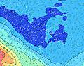 | |||||||||||||
Oleaje Altura (m) Dirección Período (s) | SSW 11 | SSW 12 | S 12 | S 12 | S 12 | SSE 11 | S 11 | SSE 11 | SSE 11 | S 11 | SSW 16 | SSW 16 | SSW 16 | SSW 15 | SSW 15 | SSW 15 | SSW 15 | SSW 15 | SSW 14 | SSW 14 | SSW 14 |
Gráfico Olas | |||||||||||||||||||||
843 | 805 | 464 | 464 | 511 | 693 | 652 | 657 | 634 | 545 | 545 | 539 | 620 | 559 | 636 | 627 | 665 | 656 | 638 | 687 | 649 | |
Viento (km/h) | |||||||||||||||||||||
Estado del Viento Viento de Mar Viento de Mar-Cruzado Cruzado Viento de Tierra-Cruzado Viento de Tierra Cristalino | cross | cross | cross | cross | cross | cross-off | cross-off | cross-off | cross-off | cross-off | cross-off | cross-off | cross-off | cross-off | cross-off | cross-off | cross-off | cross-off | cross-off | cross-off | cross-off |
Marea alta | 1:41PM0.31m | 1:48AM0.28m | 2:03PM0.30m | 2:04AM0.28m | 2:26PM0.29m | ||||||||||||||||
Marea baja | 7:53PM0.03m | 7:55AM0.03m | 8:15PM0.05m | 8:18AM0.04m | 8:36PM0.07m | ||||||||||||||||
— | — | — | — | — | — | 6:24 | — | — | — | — | — | — | — | 6:24 | — | — | — | — | — | — | |
— | — | 5:44 | — | — | — | — | — | — | — | 5:44 | — | — | — | — | — | — | — | 5:45 | — | — | |
mm | — | — | — | — | — | — | — | — | — | — | — | — | — | — | — | — | — | — | — | — | — |
Temp. °C | 23 | 23 | 23 | 23 | 23 | 23 | 23 | 24 | 23 | 24 | 24 | 24 | 24 | 24 | 24 | 24 | 25 | 25 | 25 | 25 | 25 |
Enfriamiento °C | 19 | 20 | 19 | 18 | 19 | 19 | 19 | 21 | 20 | 22 | 22 | 22 | 22 | 22 | 23 | 23 | 25 | 25 | 26 | 25 | 25 |
Oleaje 1 Altura (m) Dirección Período (s) | S 12 | S 12 | S 12 | S 12 | S 12 | SSE 11 | S 11 | SSE 11 | SSE 11 | S 11 | SSE 11 | SSE 11 | S 10 | SSE 10 | SSE 10 | SSE 10 | SSW 15 | SSW 15 | SSW 14 | SSW 14 | SSW 14 |
423 | 416 | 464 | 464 | 511 | 693 | 652 | 657 | 634 | 545 | 469 | 460 | 374 | 349 | 294 | 288 | 665 | 656 | 638 | 687 | 649 | |
Oleaje 2 Altura (m) Dirección Período (s) | NNE 11 | NNE 11 | SW 12 | SW 12 | SSW 12 | SW 11 | SW 10 | SW 11 | SW 10 | SSW 17 | SSW 16 | SSW 16 | SSW 16 | SSW 15 | SSW 15 | SSW 15 | SSE 10 | SSE 10 | SSE 10 | SSE 9 | SSE 9 |
23 | 23 | 224 | 332 | 475 | 241 | 153 | 159 | 147 | 453 | 545 | 539 | 620 | 559 | 636 | 627 | 245 | 240 | 197 | 173 | 151 | |
Oleaje 3 Altura (m) Dirección Período (s) | SSE 13 | SE 13 | SSW 7 | SSW 20 | SSW 20 | SSW 19 | SSW 18 | SSW 18 | SSW 18 | SW 10 | SW 9 | SW 9 | SW 11 | SW 11 | SW 11 | S 20 | S 19 | S 19 | S 18 | S 18 | S 18 |
18 | 7 | 70 | 75 | 149 | 148 | 289 | 404 | 399 | 110 | 87 | 68 | 72 | 41 | 42 | 68 | 118 | 249 | 318 | 308 | 384 | |
Olas de Viento Altura (m) Dirección Período (s) | SSW 11 | SSW 12 | SE 5 | SE 6 | E 5 | ESE 6 | ESE 6 | ESE 6 | E 6 | E 6 | E 6 | E 6 | E 3 | E 6 | E 6 | E 6 | — | — | — | — | — |
843 | 805 | 83 | 114 | 11 | 119 | 90 | 80 | 76 | 58 | 47 | 47 | 6 | 35 | 35 | 28 | — | — | — | — | — | |
Viento del Tierra o Mar Limpio más proximo | |||||||||||||||||||||
Distancia (km) | 2616 | 2580 | 2580 | 2272 | 2272 | 2272 | 2272 | 2294 | 2465 | 1143 | 1143 | 1143 | 1143 | 1145 | 1143 | 27 | 27 | 0 | 0 | 27 | 27 |
Mejores Olas Previstas en Tahiti | |||||||||||||||||||||
Mejores Olas Previstas en French Polynesia | |||||||||||||||||||||
Busca-Olas Global | |||||||||||||||||||||
- Map Icons:
 Break
Break Live Wave Height (m)
 Live Wind Speed (km/h)
 Surf Rating (10 Max)
 Ocean Swells (m)
- Wind Speed (km/h)
GRÁTIS! Un widget de Surf-Forecast.com para tu sitio
Este widget grátis de previsiones de surf y tiempo puede ser añadido a cualquier otro sitio y da un resumen de previsiones de olas para Taapuna. Solo necesita cortar y pegar el código HTML de abajo en su web. Puede elegir preferencias de idioma y de unidades (métricas o imperiales) para convenir a los usuarios de su sitio. Clica aquí para obtener el código.
 Nearest