

Shipwrecks Bay-Peaks Surf Guide
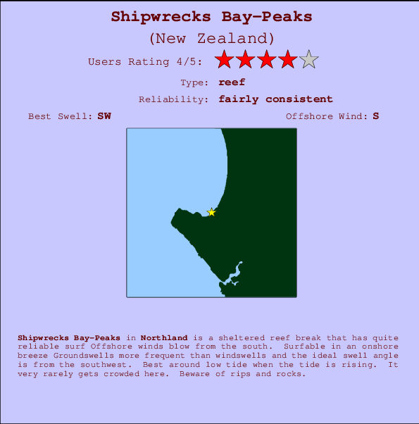
Shipwrecks Bay-Peaks in Northland is a sheltered reef break that has quite reliable surf The best wind direction is from the south. Surfable in an onshore breeze Tends to receive distant groundswells and the best swell direction is from the southwest. A left hand reef. Best around low tide when the tide is rising. Rarely crowded here. Beware of rips and rocks.
Shipwrecks Bay-Peaks Spot Info
| Type: | Rating: | Reliability: | Todays Sea Temp*: |
|---|---|---|---|
 Reef Reef |  4 4 | fairly consistent | 15.9°C*ocean temperature recorded from satellite |
Surfing Shipwrecks Bay-Peaks:
The best conditions reported for surf at Shipwrecks Bay-Peaks occur when a Southwest swell combines with an offshore wind direction from the South.
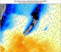
Energía de Olas (poder): 12 horas
Shipwrecks Bay-Peaks Surf:
Sunday, 18 October 2026, 22:55 Local time| dom | lunes 19 | |||
| 10PM | 1AM | 4AM | 7AM | |
| Wave (m) | ||||
| Período (s) | 12 | 12 | 12 | 12 |
| Viento (km/h) | ||||
| Estado del Viento | off | off | off | off |
- /breaks/Shipwrecks-Bay-Peaks/forecasts/latest
Shipwrecks Bay-Peaks Surf Guide
Shipwrecks Bay-Peaks in Northland is a sheltered reef break that has quite reliable surf The best wind direction is from the south. Surfable in an onshore breeze Tends to receive distant groundswells and the best swell direction is from the southwest. A left hand reef. Best around low tide when the tide is rising. Rarely crowded here. Beware of rips and rocks.
Shipwrecks Bay-Peaks Spot Info
Type: Rating: Reliability: Todays Sea Temp*: Reef4fairly consistent 15.9°C*ocean temperature recorded from satelliteSurfing Shipwrecks Bay-Peaks:
The best conditions reported for surf at Shipwrecks Bay-Peaks occur when a Southwest swell combines with an offshore wind direction from the South.
Energía de Olas (poder): 12 horas
Usa la barra de navegación de arriba para ver la temperatura del mar en Shipwrecks Bay-Peaks, fotografías Shipwrecks Bay-Peaks, previsiones detalladas de olas para Shipwrecks Bay-Peaks, vientos y previsión del tiempo, webcams para Shipwrecks Bay-Peaks, viento actual desde estaciones meteorológicas en Northland y predicciones de marea para Shipwrecks Bay-Peaks. Las mapas de olas para New Zealand enseñarán un mapa grande de New Zealand y los mares que rodean. Los mapas de olas pueden ser animadas para mostrar diferentes componentes de olas, la altura de ola, la energía de ola, el período, junto con previsiones de viento y del tiempo. Previsiones actuales del tiempo y del estado del mar provienen de boyas marinas de New Zealand, del barcos que transitan en la zona y de estaciones meteorológicas costeras. Cada página de previsiones tiene un Busca-Olas Regional y Global para localizar las mejores condiciones para surfear en el área de Shipwrecks Bay-Peaks.
Shipwrecks Bay-Peaks Surf:
Sunday, 18 October 2026, 22:55 Local timedom lunes 19 10PM 1AM 4AM 7AM Wave (m) Período (s) 12 12 12 12 Viento (km/h) Estado del Viento off off off off - /breaks/Shipwrecks-Bay-Peaks/forecasts/latest
- /breaks/Shipwrecks-Bay-Peaks/forecasts/latest/six_day
Shipwrecks Bay-Peaks Surf Guide
Shipwrecks Bay-Peaks in Northland is a sheltered reef break that has quite reliable surf The best wind direction is from the south. Surfable in an onshore breeze Tends to receive distant groundswells and the best swell direction is from the southwest. A left hand reef. Best around low tide when the tide is rising. Rarely crowded here. Beware of rips and rocks.
Shipwrecks Bay-Peaks Spot Info
Type: Rating: Reliability: Todays Sea Temp*: Reef4fairly consistent 15.9°C*ocean temperature recorded from satelliteSurfing Shipwrecks Bay-Peaks:
The best conditions reported for surf at Shipwrecks Bay-Peaks occur when a Southwest swell combines with an offshore wind direction from the South.
Energía de Olas (poder): 12 horas
Usa la barra de navegación de arriba para ver la temperatura del mar en Shipwrecks Bay-Peaks, fotografías Shipwrecks Bay-Peaks, previsiones detalladas de olas para Shipwrecks Bay-Peaks, vientos y previsión del tiempo, webcams para Shipwrecks Bay-Peaks, viento actual desde estaciones meteorológicas en Northland y predicciones de marea para Shipwrecks Bay-Peaks. Las mapas de olas para New Zealand enseñarán un mapa grande de New Zealand y los mares que rodean. Los mapas de olas pueden ser animadas para mostrar diferentes componentes de olas, la altura de ola, la energía de ola, el período, junto con previsiones de viento y del tiempo. Previsiones actuales del tiempo y del estado del mar provienen de boyas marinas de New Zealand, del barcos que transitan en la zona y de estaciones meteorológicas costeras. Cada página de previsiones tiene un Busca-Olas Regional y Global para localizar las mejores condiciones para surfear en el área de Shipwrecks Bay-Peaks.
Shipwrecks Bay-Peaks Surf:
Sunday, 18 October 2026, 22:55 Local timedom lunes 19 10PM 1AM 4AM 7AM Wave (m) Período (s) 12 12 12 12 Viento (km/h) Estado del Viento off off off off - /breaks/Shipwrecks-Bay-Peaks/forecasts/latest
Shipwrecks Bay-Peaks Surf Guide
Shipwrecks Bay-Peaks in Northland is a sheltered reef break that has quite reliable surf The best wind direction is from the south. Surfable in an onshore breeze Tends to receive distant groundswells and the best swell direction is from the southwest. A left hand reef. Best around low tide when the tide is rising. Rarely crowded here. Beware of rips and rocks.
Shipwrecks Bay-Peaks Spot Info
Type: Rating: Reliability: Todays Sea Temp*: Reef4fairly consistent 15.9°C*ocean temperature recorded from satelliteSurfing Shipwrecks Bay-Peaks:
The best conditions reported for surf at Shipwrecks Bay-Peaks occur when a Southwest swell combines with an offshore wind direction from the South.
Energía de Olas (poder): 12 horas
Usa la barra de navegación de arriba para ver la temperatura del mar en Shipwrecks Bay-Peaks, fotografías Shipwrecks Bay-Peaks, previsiones detalladas de olas para Shipwrecks Bay-Peaks, vientos y previsión del tiempo, webcams para Shipwrecks Bay-Peaks, viento actual desde estaciones meteorológicas en Northland y predicciones de marea para Shipwrecks Bay-Peaks. Las mapas de olas para New Zealand enseñarán un mapa grande de New Zealand y los mares que rodean. Los mapas de olas pueden ser animadas para mostrar diferentes componentes de olas, la altura de ola, la energía de ola, el período, junto con previsiones de viento y del tiempo. Previsiones actuales del tiempo y del estado del mar provienen de boyas marinas de New Zealand, del barcos que transitan en la zona y de estaciones meteorológicas costeras. Cada página de previsiones tiene un Busca-Olas Regional y Global para localizar las mejores condiciones para surfear en el área de Shipwrecks Bay-Peaks.
Shipwrecks Bay-Peaks Surf:
Sunday, 18 October 2026, 22:55 Local timedom lunes 19 10PM 1AM 4AM 7AM Wave (m) Período (s) 12 12 12 12 Viento (km/h) Estado del Viento off off off off Tide Times:
Para Ahipara Bay, New Zealand, a %{dist} %{km} de %{location}.
PROXIMA ES A LAS (hora local) quedan marea alta marea baja Shipwrecks Bay-Peaks Tide Times and Tide Chart
Live Weather:
At Kaitaia Airport, 18 km from Shipwrecks Bay-Peaks.
light winds from the S
(km/h)
DryAir temperature
10.7°COverall Shipwrecks Bay-Peaks Surf Consistency and Wind Distribution in octubre


Wind stats for Shipwrecks Bay-Peaks: see the variation in direction and stength by month.
Fotos de Surf
de la galeríaContornos: Carreteras y Ríos: Selecciona un spot desde el menú 
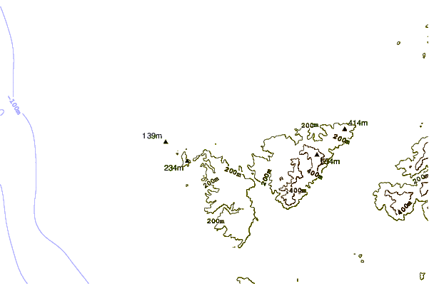

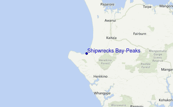
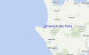
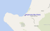
Usa este mapa para navegar hacia las playas de surf de Northland y estaciones de marea cercanas de Shipwrecks Bay-Peaks
Spots de Surf más cercanos a Shipwrecks Bay-Peaks:
(Clica la ubicación para más detalles)- Closest spot1 mi
- Second closest spot1 mi
- Third closest spot2 mi
- Fourth closest spot2 mi
- Fifth closest spot4 mi
Boyas marinas más cercanas a Shipwrecks Bay-Peaks:
- Closest Boya Marinas93 mi
- Second closest Boya Marinas260 mi
- Third closest Boya Marinas381 mi
- Fourth closest Boya Marinas421 mi
- Fifth closest Boya Marinas422 mi
Estaciones de marea más cercanas a Shipwrecks Bay-Peaks:
- Closest estación de mareaAhipara Bay2 mi
- Second closest estación de mareaDairy Factory Wharf11 mi
- Third closest estación de mareaOmaia Island14 mi
- Fourth closest estación de mareaSheigis Beacon21 mi
- Fifth closest estación de mareaHouhora River Entrance24 mi
Airports
- The closest passenger airport to Shipwrecks Bay-Peaks is Kaitaia Airport (KAT) in New Zealand, which is 17 km (11 miles) away (directly).
- The second nearest airport to Shipwrecks Bay-Peaks is Kerikeri Airport (KKE), also in New Zealand, 71 km (44 miles) away.
- The third closest airport is Whangarei Airport (WRE), also in New Zealand, 129 km (80 miles) away.
- /breaks/Shipwrecks-Bay-Peaks/forecasts/latest

 Nearest