
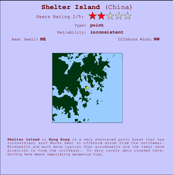
Shelter Island Surf Guide
Shelter Island in - is a very sheltered point break that only works when conditions are just right Offshore winds blow from the northwest. Waves more likely to be from local windswells than distant groundswells and the optimum wave angle is from the northeast. Even when there are waves, it's not likley to be crowded. Surfing here means negotiating dangerous rips.
Shelter Island Spot Info
| Type: | Rating: | Reliability: | Todays Sea Temp*: |
|---|---|---|---|
| inconsistent | 29.3°C*ocean temperature recorded from satellite |
Surfing Shelter Island:
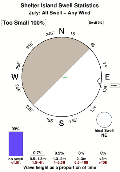
The best conditions reported for surf at Shelter Island occur when a Northeast swell combines with an offshore wind direction from the Northwest.
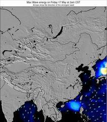
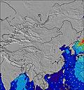
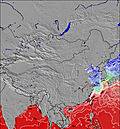
Energía de Olas (poder): 12 horas

Shelter Island Surf:
Tuesday, 28 July 2026, 18:34 Local time| martes 28 | mié | |||
| 5PM | 8PM | 11PM | 2AM | |
| Wave (m) | ||||
| Período (s) | 6 | 6 | 6 | 6 |
| Viento (km/h) | ||||
| Estado del Viento | cross- on |
on | on | on |
- /breaks/Shelter-Island_1/forecasts/latest
Shelter Island Surf Guide
Shelter Island in - is a very sheltered point break that only works when conditions are just right Offshore winds blow from the northwest. Waves more likely to be from local windswells than distant groundswells and the optimum wave angle is from the northeast. Even when there are waves, it's not likley to be crowded. Surfing here means negotiating dangerous rips.
Shelter Island Spot Info
Type: Rating: Reliability: Todays Sea Temp*:  Point
Point 2
2inconsistent 29.3°C*ocean temperature recorded from satelliteSurfing Shelter Island:
The best conditions reported for surf at Shelter Island occur when a Northeast swell combines with an offshore wind direction from the Northwest.
Energía de Olas (poder): 12 horas
Usa la barra de navegación de arriba para ver la temperatura del mar en Shelter Island, fotografías Shelter Island, previsiones detalladas de olas para Shelter Island, vientos y previsión del tiempo, webcams para Shelter Island, viento actual desde estaciones meteorológicas en Hong Kong y predicciones de marea para Shelter Island. Las mapas de olas para China enseñarán un mapa grande de China y los mares que rodean. Los mapas de olas pueden ser animadas para mostrar diferentes componentes de olas, la altura de ola, la energía de ola, el período, junto con previsiones de viento y del tiempo. Previsiones actuales del tiempo y del estado del mar provienen de boyas marinas de China, del barcos que transitan en la zona y de estaciones meteorológicas costeras. Cada página de previsiones tiene un Busca-Olas Regional y Global para localizar las mejores condiciones para surfear en el área de Shelter Island.
Shelter Island Surf:
Tuesday, 28 July 2026, 18:34 Local timemartes 28 mié 5PM 8PM 11PM 2AM Wave (m) Período (s) 6 6 6 6 Viento (km/h) Estado del Viento cross-
onon on on - /breaks/Shelter-Island_1/forecasts/latest
- /breaks/Shelter-Island_1/forecasts/latest/six_day
Shelter Island Surf Guide
Shelter Island in - is a very sheltered point break that only works when conditions are just right Offshore winds blow from the northwest. Waves more likely to be from local windswells than distant groundswells and the optimum wave angle is from the northeast. Even when there are waves, it's not likley to be crowded. Surfing here means negotiating dangerous rips.
Shelter Island Spot Info
Type: Rating: Reliability: Todays Sea Temp*: Point2inconsistent 29.3°C*ocean temperature recorded from satelliteSurfing Shelter Island:
The best conditions reported for surf at Shelter Island occur when a Northeast swell combines with an offshore wind direction from the Northwest.
Energía de Olas (poder): 12 horas
Usa la barra de navegación de arriba para ver la temperatura del mar en Shelter Island, fotografías Shelter Island, previsiones detalladas de olas para Shelter Island, vientos y previsión del tiempo, webcams para Shelter Island, viento actual desde estaciones meteorológicas en Hong Kong y predicciones de marea para Shelter Island. Las mapas de olas para China enseñarán un mapa grande de China y los mares que rodean. Los mapas de olas pueden ser animadas para mostrar diferentes componentes de olas, la altura de ola, la energía de ola, el período, junto con previsiones de viento y del tiempo. Previsiones actuales del tiempo y del estado del mar provienen de boyas marinas de China, del barcos que transitan en la zona y de estaciones meteorológicas costeras. Cada página de previsiones tiene un Busca-Olas Regional y Global para localizar las mejores condiciones para surfear en el área de Shelter Island.
Shelter Island Surf:
Tuesday, 28 July 2026, 18:34 Local timemartes 28 mié 5PM 8PM 11PM 2AM Wave (m) Período (s) 6 6 6 6 Viento (km/h) Estado del Viento cross-
onon on on - /breaks/Shelter-Island_1/forecasts/latest
Shelter Island Surf Guide
Shelter Island in - is a very sheltered point break that only works when conditions are just right Offshore winds blow from the northwest. Waves more likely to be from local windswells than distant groundswells and the optimum wave angle is from the northeast. Even when there are waves, it's not likley to be crowded. Surfing here means negotiating dangerous rips.
Shelter Island Spot Info
Type: Rating: Reliability: Todays Sea Temp*: Point2inconsistent 29.3°C*ocean temperature recorded from satelliteSurfing Shelter Island:
The best conditions reported for surf at Shelter Island occur when a Northeast swell combines with an offshore wind direction from the Northwest.
Energía de Olas (poder): 12 horas
Usa la barra de navegación de arriba para ver la temperatura del mar en Shelter Island, fotografías Shelter Island, previsiones detalladas de olas para Shelter Island, vientos y previsión del tiempo, webcams para Shelter Island, viento actual desde estaciones meteorológicas en Hong Kong y predicciones de marea para Shelter Island. Las mapas de olas para China enseñarán un mapa grande de China y los mares que rodean. Los mapas de olas pueden ser animadas para mostrar diferentes componentes de olas, la altura de ola, la energía de ola, el período, junto con previsiones de viento y del tiempo. Previsiones actuales del tiempo y del estado del mar provienen de boyas marinas de China, del barcos que transitan en la zona y de estaciones meteorológicas costeras. Cada página de previsiones tiene un Busca-Olas Regional y Global para localizar las mejores condiciones para surfear en el área de Shelter Island.
Shelter Island Surf:
Tuesday, 28 July 2026, 18:34 Local timemartes 28 mié 5PM 8PM 11PM 2AM Wave (m) Período (s) 6 6 6 6 Viento (km/h) Estado del Viento cross-
onon on on Tide Times:
Para Clubhouse Point, a %{dist} %{km} de %{location}.
PROXIMA ES A LAS (hora local) quedan marea alta marea baja Shelter Island Tide Times and Tide Chart
Live Weather:
At Cha Kwo Ling wx, 8 km from Shelter Island.
wind obs. (8 kph from 37 degs) was rejected
(km/h)
dryAir temperature
27°COverall Shelter Island Surf Consistency and Wind Distribution in julio
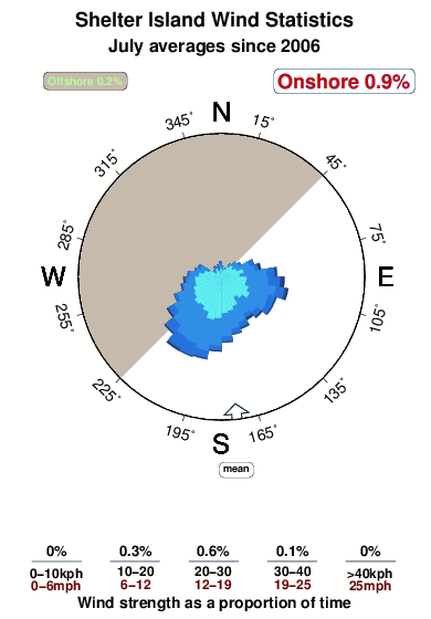


Wind stats for Shelter Island: see the variation in direction and stength by month.
Fotos de Surf
de la galeríaContornos: Carreteras y Ríos: Selecciona un spot desde el menú 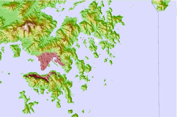
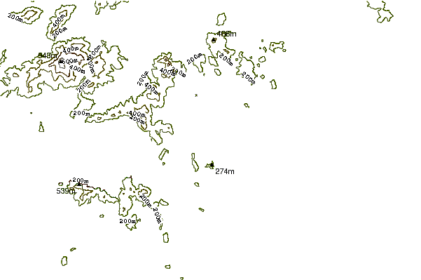
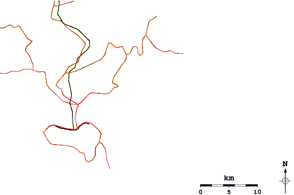
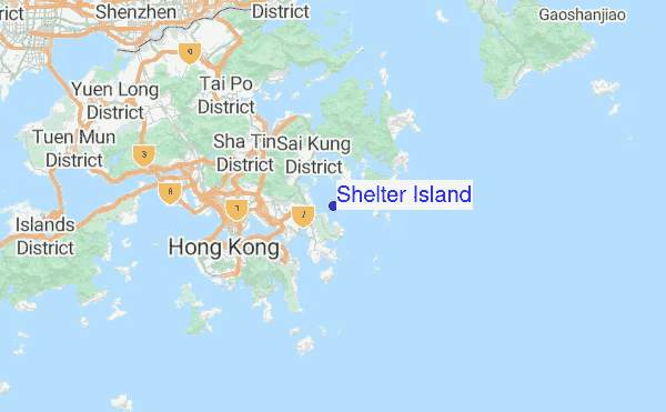
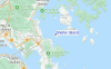
Usa este mapa para navegar hacia las playas de surf de Hong Kong y estaciones de marea cercanas de Shelter Island
Spots de Surf más cercanos a Shelter Island:
(Clica la ubicación para más detalles)- Closest spot4 mi
- Second closest spot6 mi
- Third closest spot7 mi
- Fourth closest spot8 mi
- Fifth closest spot8 mi
Boyas marinas más cercanas a Shelter Island:
- Closest Boya Marinas638 mi
- Second closest Boya Marinas716 mi
- Third closest Boya Marinas883 mi
- Fourth closest Boya Marinas902 mi
- Fifth closest Boya Marinas1032 mi
Estaciones de marea más cercanas a Shelter Island:
- Closest estación de mareaHong Kong8 mi
- Second closest estación de mareaYung Shue Wan14 mi
- Third closest estación de mareaShenzhen18 mi
- Fourth closest estación de mareaZhuhai47 mi
- Fifth closest estación de mareaMacau49 mi
Airports
- The closest passenger airport to Shelter Island is Hong Kong International Airport (HKG) in Hong Kong, 40 km (25 miles) away (directly).
- The second nearest airport to Shelter Island is Baoan (Shenzhen) Airport (SZX) in China, 61 km (38 miles) away.
- Third is Macau International Airport (MFM) in Macau, 76 km (47 miles) away.
- Baiyun (Guangzhou) Airport (CAN) in China is 143 km (89 miles) away.
- Wai Sha Airport (Shantou) Airport (SWA), also in China is the fifth nearest airport to Shelter Island and is 272 km (169 miles) away.
- /breaks/Shelter-Island_1/forecasts/latest
 Nearest