
Previsiones:

Pronóstico Corto PlazoMayormente seco. Very mild (max 17°C el viernes por la tarde, min 14°C el miércoles por la noche). El viento será generalmente ligero. | ||||||||||||||||||||||||
mié 15 | jueves 16 | viernes 17 | sáb 18 | |||||||||||||||||||||
5 PM | 8 PM | 11 PM | 2 AM | 5 AM | 8 AM | 11 AM | 2 PM | 5 PM | 8 PM | 11 PM | 2 AM | 5 AM | 8 AM | 11 AM | 2 PM | 5 PM | 8 PM | 11 PM | 2 AM | 5 AM | 8 AM | 11 AM | 2 PM | |
Mapa de Altura de Olas |  |  |  |  |  |  |  |  | 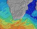 | |||||||||||||||
Oleaje Altura (m) Dirección Período (s) | SW 16 | SW 14 | SW 14 | SW 14 | SW 14 | SW 13 | SW 13 | SW 13 | SW 13 | SW 12 | SW 12 | SW 12 | SW 12 | SW 11 | SW 11 | SW 11 | SW 10 | SW 10 | SW 10 | SW 10 | SW 10 | SW 9 | SW 10 | SW 10 |
Gráfico Olas | ||||||||||||||||||||||||
3326 | 3859 | 3953 | 3705 | 3048 | 2681 | 2381 | 1942 | 1534 | 1261 | 1189 | 1249 | 1187 | 913 | 835 | 703 | 599 | 465 | 416 | 377 | 320 | 350 | 459 | 480 | |
Viento (km/h) | ||||||||||||||||||||||||
Estado del Viento Viento de Mar Viento de Mar-Cruzado Cruzado Viento de Tierra-Cruzado Viento de Tierra Cristalino | glassy | cross-off | glassy | glassy | glassy | cross | cross | cross-on | cross | cross-off | cross-off | cross-off | cross-off | glassy | glassy | cross-on | glassy | cross | glassy | glassy | cross-on | cross-on | cross-on | cross-on |
Marea alta | 4:12PM1.61m | 4:28AM1.54m | 4:55PM1.62m | 5:11AM1.48m | 5:37PM1.59m | 5:54AM1.39m | ||||||||||||||||||
Marea baja | 10:25PM0.08m | 10:40AM0.02m | 11:11PM0.10m | 11:20AM0.07m | 11:55PM0.15m | 12:00PM0.16m | ||||||||||||||||||
— | — | — | — | 7:48 | — | — | — | — | — | — | — | 7:48 | — | — | — | — | — | — | — | 7:48 | — | — | — | |
5:54 | — | — | — | — | — | — | — | 5:54 | — | — | — | — | — | — | — | 5:55 | — | — | — | — | — | — | 5:57 | |
mm | — | — | — | — | — | — | — | — | — | — | — | — | — | — | — | — | — | — | — | — | — | — | — | — |
Temp. °C | 15 | 15 | 14 | 14 | 14 | 14 | 14 | 15 | 15 | 15 | 15 | 14 | 15 | 15 | 16 | 17 | 17 | 16 | 16 | 16 | 16 | 15 | 16 | 16 |
Enfriamiento °C | 15 | 14 | 14 | 15 | 15 | 14 | 13 | 14 | 13 | 14 | 15 | 14 | 15 | 15 | 17 | 17 | 17 | 16 | 16 | 16 | 16 | 14 | 15 | 14 |
Oleaje 1 Altura (m) Dirección Período (s) | SW 16 | SW 14 | SW 14 | SW 14 | SW 14 | SW 13 | SW 13 | SW 13 | SW 13 | SW 12 | SW 12 | SW 12 | SW 12 | SW 11 | SW 11 | SW 11 | SW 10 | SW 10 | SW 10 | SW 10 | SW 10 | SW 9 | SW 10 | SW 10 |
3326 | 3859 | 3953 | 3705 | 3048 | 2681 | 2381 | 1942 | 1534 | 1261 | 1189 | 1249 | 1187 | 913 | 835 | 703 | 599 | 465 | 416 | 377 | 320 | 350 | 459 | 480 | |
Oleaje 2 Altura (m) Dirección Período (s) | W 9 | — | — | — | — | — | — | — | — | — | — | — | — | — | — | — | S 14 | S 13 | S 13 | S 13 | S 12 | S 12 | SW 14 | SW 13 |
110 | — | — | — | — | — | — | — | — | — | — | — | — | — | — | — | 15 | 31 | 55 | 51 | 72 | 136 | 187 | 295 | |
Oleaje 3 Altura (m) Dirección Período (s) | — | — | — | — | — | — | — | — | — | — | — | — | — | — | — | — | — | SW 17 | SW 16 | SW 16 | SW 15 | SW 15 | S 11 | S 11 |
— | — | — | — | — | — | — | — | — | — | — | — | — | — | — | — | — | 11 | 10 | 40 | 36 | 75 | 123 | 85 | |
Olas de Viento Altura (m) Dirección Período (s) | — | — | — | — | — | — | — | — | — | — | — | — | — | — | — | — | — | — | — | — | — | — | — | — |
— | — | — | — | — | — | — | — | — | — | — | — | — | — | — | — | — | — | — | — | — | — | — | — | |
Viento del Tierra o Mar Limpio más proximo | ||||||||||||||||||||||||
Distancia (km) | 0 | 0 | 0 | 0 | 0 | 3 | 12 | 12 | 7 | 0 | 0 | 0 | 0 | 0 | 0 | 1 | 0 | 12 | 0 | 0 | 1 | 3 | 3 | 3 |
Mejores Olas Previstas en Cape Town | ||||||||||||||||||||||||
Mejores Olas Previstas en South Africa | ||||||||||||||||||||||||
Busca-Olas Global | ||||||||||||||||||||||||
- Map Icons:
 Break
Break Live Wave Height (m)
 Live Wind Speed (km/h)
 Surf Rating (10 Max)
 Ocean Swells (m)
- Wind Speed (km/h)
GRÁTIS! Un widget de Surf-Forecast.com para tu sitio
Este widget grátis de previsiones de surf y tiempo puede ser añadido a cualquier otro sitio y da un resumen de previsiones de olas para Sandy Bay. Solo necesita cortar y pegar el código HTML de abajo en su web. Puede elegir preferencias de idioma y de unidades (métricas o imperiales) para convenir a los usuarios de su sitio. Clica aquí para obtener el código.
 Nearest