
Previsiones:

Pronóstico Corto PlazoFuerte lluvia (totál 32mm), más pesada durante la noche del viernes. Warm (max 28°C el lunes por la tarde, min 26°C el viernes por la noche). Mayormente vientos frescos. | |||||||||||||||||||
vie 17 | sábado 18 | domingo 19 | |||||||||||||||||
5 PM | 8 PM | 11 PM | 2 AM | 5 AM | 8 AM | 11 AM | 2 PM | 5 PM | 8 PM | 11 PM | 2 AM | 5 AM | 8 AM | 11 AM | 2 PM | 5 PM | 8 PM | 11 PM | |
Mapa de Altura de Olas |  |  | 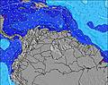 | 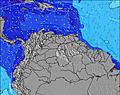 |  | 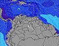 | 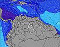 | ||||||||||||
Oleaje Altura (m) Dirección Período (s) | ENE 7 | ENE 7 | ENE 7 | ENE 7 | ENE 7 | ENE 8 | ENE 8 | ENE 8 | ENE 8 | ENE 8 | ENE 8 | ENE 8 | ENE 8 | ENE 8 | ENE 8 | ENE 8 | ENE 8 | ENE 8 | ENE 8 |
Gráfico Olas | |||||||||||||||||||
269 | 294 | 376 | 415 | 456 | 540 | 522 | 534 | 511 | 527 | 468 | 452 | 408 | 408 | 441 | 474 | 460 | 460 | 460 | |
Viento (km/h) | |||||||||||||||||||
Estado del Viento Viento de Mar Viento de Mar-Cruzado Cruzado Viento de Tierra-Cruzado Viento de Tierra Cristalino | cross-on | cross-on | cross-on | cross-on | cross-on | cross-on | cross-on | cross-on | cross-on | cross-on | cross-on | cross-on | cross-on | cross-on | cross-on | cross | cross | cross-on | cross-on |
Marea alta | 6:09PM0.78m | 6:01AM0.85m | 6:50PM0.78m | 6:52AM0.76m | 7:30PM0.78m | ||||||||||||||
Marea baja | 11:52PM0.29m | 12:28PM0.17m | 00:49AM0.29m | 1:06PM0.24m | |||||||||||||||
— | — | — | — | 5:48 | — | — | — | — | — | — | — | 5:48 | — | — | — | — | — | — | |
6:30 | — | — | — | — | — | — | — | 6:30 | — | — | — | — | — | — | — | 6:30 | — | — | |
mm | 1 | 1 | 1 | 3 | 2 | 1 | 1 | 1 | 1 | 1 | 1 | 2 | 2 | 2 | 2 | 3 | 1 | 1 | 1 |
Temp. °C | 27 | 26 | 26 | 26 | 26 | 26 | 27 | 27 | 27 | 26 | 26 | 26 | 26 | 26 | 27 | 27 | 26 | 26 | 26 |
Enfriamiento °C | 29 | 27 | 27 | 26 | 26 | 26 | 27 | 28 | 28 | 27 | 27 | 27 | 27 | 27 | 28 | 27 | 27 | 27 | 27 |
Oleaje 1 Altura (m) Dirección Período (s) | — | — | — | N 9 | N 9 | N 9 | N 9 | NNE 8 | N 8 | NNE 9 | NNE 9 | N 9 | — | NNE 9 | — | — | — | — | — |
— | — | — | 2 | 2 | 2 | 2 | 7 | 1 | 7 | 7 | 1 | — | 8 | — | — | — | — | — | |
Oleaje 2 Altura (m) Dirección Período (s) | — | — | — | — | — | — | — | — | — | — | — | — | — | — | — | — | — | — | — |
— | — | — | — | — | — | — | — | — | — | — | — | — | — | — | — | — | — | — | |
Oleaje 3 Altura (m) Dirección Período (s) | — | — | — | — | — | — | — | — | — | — | — | — | — | — | — | — | — | — | — |
— | — | — | — | — | — | — | — | — | — | — | — | — | — | — | — | — | — | — | |
Olas de Viento Altura (m) Dirección Período (s) | ENE 7 | ENE 7 | ENE 7 | ENE 7 | ENE 7 | ENE 8 | ENE 8 | ENE 8 | ENE 8 | ENE 8 | ENE 8 | ENE 8 | ENE 8 | ENE 8 | ENE 8 | ENE 8 | ENE 8 | ENE 8 | ENE 8 |
269 | 294 | 376 | 415 | 456 | 540 | 522 | 534 | 511 | 527 | 468 | 452 | 408 | 408 | 441 | 474 | 460 | 460 | 460 | |
Viento del Tierra o Mar Limpio más proximo | |||||||||||||||||||
Distancia (km) | 162 | 630 | 614 | 569 | 569 | 614 | 658 | 658 | 626 | 658 | 658 | 162 | 162 | 162 | 658 | 658 | 626 | 626 | 249 |
Mejores Olas Previstas en Tobago | |||||||||||||||||||
Mejores Olas Previstas en Trinidad and Tobago | |||||||||||||||||||
Busca-Olas Global | |||||||||||||||||||
- Map Icons:
 Break
Break Live Wave Height (m)
 Live Wind Speed (km/h)
 Surf Rating (10 Max)
 Ocean Swells (m)
- Wind Speed (km/h)
GRÁTIS! Un widget de Surf-Forecast.com para tu sitio
Este widget grátis de previsiones de surf y tiempo puede ser añadido a cualquier otro sitio y da un resumen de previsiones de olas para Salibea Bay. Solo necesita cortar y pegar el código HTML de abajo en su web. Puede elegir preferencias de idioma y de unidades (métricas o imperiales) para convenir a los usuarios de su sitio. Clica aquí para obtener el código.
 Nearest