
Previsiones:

Pronóstico Corto PlazoMayormente seco. Very mild (max 18°C el viernes por la tarde, min 12°C el miércoles por la noche). El viento será generalmente ligero. | ||||||||||||||||||||||||
miércoles 15 | jueves 16 | viernes 17 | ||||||||||||||||||||||
2 AM | 5 AM | 8 AM | 11 AM | 2 PM | 5 PM | 8 PM | 11 PM | 2 AM | 5 AM | 8 AM | 11 AM | 2 PM | 5 PM | 8 PM | 11 PM | 2 AM | 5 AM | 8 AM | 11 AM | 2 PM | 5 PM | 8 PM | 11 PM | |
Mapa de Altura de Olas |  |  |  |  | 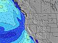 |  |  | 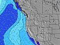 |  | |||||||||||||||
Oleaje Altura (m) Dirección Período (s) | SW 18 | SW 18 | SW 18 | NW 10 | NW 6 | NW 6 | NW 6 | WNW 20 | NW 9 | SW 16 | WNW 19 | WNW 19 | WNW 19 | WNW 18 | WNW 18 | WNW 18 | WNW 17 | WNW 17 | WNW 17 | WNW 17 | WNW 17 | NW 7 | NW 7 | WNW 16 |
Gráfico Olas | ||||||||||||||||||||||||
152 | 216 | 194 | 388 | 209 | 297 | 215 | 216 | 214 | 207 | 283 | 283 | 280 | 352 | 333 | 413 | 428 | 423 | 428 | 423 | 492 | 651 | 535 | 457 | |
Viento (km/h) | ||||||||||||||||||||||||
Estado del Viento Viento de Mar Viento de Mar-Cruzado Cruzado Viento de Tierra-Cruzado Viento de Tierra Cristalino | off | cross-off | cross-off | cross | cross | cross | cross-off | cross-off | cross-off | glassy | glassy | cross | cross | cross | cross-off | cross-off | cross-off | cross-off | glassy | cross | cross | cross-off | cross-off | glassy |
Marea alta | 00:04AM2.51m | 1:52PM1.87m | 00:56AM2.41m | 2:33PM1.93m | 1:48AM2.25m | 3:14PM1.98m | ||||||||||||||||||
Marea baja | 7:14AM-0.63m | 7:04PM0.72m | 7:58AM-0.54m | 8:00PM0.64m | 8:40AM-0.37m | 8:57PM0.57m | ||||||||||||||||||
— | 5:54 | — | — | — | — | — | — | — | 5:54 | — | — | — | — | — | — | — | 5:56 | — | — | — | — | — | — | |
— | — | — | — | — | — | 8:51 | — | — | — | — | — | — | — | 8:50 | — | — | — | — | — | — | — | 8:50 | — | |
mm | — | — | — | — | — | — | — | — | — | — | — | — | — | — | — | — | — | — | — | — | — | — | — | — |
Temp. °C | 14 | 13 | 14 | 16 | 17 | 17 | 15 | 13 | 12 | 12 | 13 | 15 | 17 | 16 | 15 | 13 | 13 | 12 | 14 | 15 | 18 | 18 | 16 | 13 |
Enfriamiento °C | 13 | 11 | 12 | 13 | 13 | 13 | 12 | 12 | 11 | 11 | 13 | 13 | 13 | 12 | 11 | 11 | 12 | 10 | 13 | 13 | 14 | 14 | 14 | 13 |
Oleaje 1 Altura (m) Dirección Período (s) | WNW 9 | NW 9 | WNW 10 | SW 18 | SW 18 | SW 17 | SW 17 | WNW 9 | NW 9 | WNW 9 | WNW 9 | WNW 9 | WNW 19 | WNW 18 | WNW 18 | WNW 18 | WNW 17 | WNW 17 | NW 6 | WNW 17 | WNW 17 | WNW 16 | WNW 16 | WNW 16 |
119 | 216 | 169 | 194 | 192 | 148 | 103 | 94 | 211 | 141 | 138 | 68 | 280 | 352 | 333 | 413 | 428 | 423 | 134 | 423 | 492 | 469 | 457 | 457 | |
Oleaje 2 Altura (m) Dirección Período (s) | SW 18 | SW 18 | SW 18 | SSW 12 | WNW 20 | WNW 20 | WNW 20 | WNW 20 | WNW 19 | WNW 19 | WNW 19 | WNW 19 | SW 16 | SW 16 | SW 16 | SW 16 | SW 16 | SW 15 | WNW 17 | SW 19 | SW 19 | SW 19 | SW 19 | WNW 12 |
152 | 194 | 194 | 59 | 133 | 136 | 133 | 216 | 214 | 207 | 283 | 283 | 159 | 159 | 159 | 157 | 155 | 186 | 428 | 231 | 231 | 181 | 127 | 93 | |
Oleaje 3 Altura (m) Dirección Período (s) | SSW 12 | W 13 | SSW 12 | WNW 13 | WNW 13 | SSW 12 | WNW 13 | SW 16 | SW 16 | SW 16 | SW 16 | SW 16 | SSW 12 | WNW 12 | WNW 12 | SSW 12 | SSW 11 | SSW 11 | SW 15 | SW 15 | SW 14 | SW 14 | SW 14 | SW 14 |
61 | 87 | 58 | 59 | 60 | 57 | 53 | 130 | 163 | 161 | 161 | 159 | 26 | 29 | 29 | 13 | 13 | 12 | 106 | 104 | 74 | 74 | 74 | 103 | |
Olas de Viento Altura (m) Dirección Período (s) | NW 5 | NNW 5 | NW 5 | NW 10 | NW 6 | NW 6 | NW 6 | NW 6 | — | — | — | NW 5 | NW 5 | NW 5 | NW 6 | NW 6 | NW 6 | NW 7 | — | NW 6 | NW 6 | NW 7 | NW 7 | NW 7 |
35 | 47 | 25 | 388 | 209 | 297 | 215 | 77 | — | — | — | 17 | 78 | 152 | 191 | 172 | 162 | 138 | — | 150 | 326 | 651 | 535 | 323 | |
Viento del Tierra o Mar Limpio más proximo | ||||||||||||||||||||||||
Distancia (km) | 20 | 20 | 20 | 34 | 602 | 601 | 230 | 20 | 20 | 20 | 20 | 34 | 538 | 538 | 273 | 20 | 20 | 20 | 20 | 34 | 34 | 602 | 34 | 20 |
Mejores Olas Previstas en South Oregon | ||||||||||||||||||||||||
Mejores Olas Previstas en United States | ||||||||||||||||||||||||
Busca-Olas Global | ||||||||||||||||||||||||
- Map Icons:
 Break
Break Live Wave Height (m)
 Live Wind Speed (km/h)
 Surf Rating (10 Max)
 Ocean Swells (m)
- Wind Speed (km/h)
GRÁTIS! Un widget de Surf-Forecast.com para tu sitio
Este widget grátis de previsiones de surf y tiempo puede ser añadido a cualquier otro sitio y da un resumen de previsiones de olas para Rainbow Rocks. Solo necesita cortar y pegar el código HTML de abajo en su web. Puede elegir preferencias de idioma y de unidades (métricas o imperiales) para convenir a los usuarios de su sitio. Clica aquí para obtener el código.
 Nearest