
Portete Surf Guide
Portete in Limon is an exposed reef break that has fairly consistent surf Offshore winds blow from the south southwest. Waves more likely to be from local windswells than distant groundswells and the ideal wave direction is from the northeast. A right hand reef break. When the surf is up, it can get quite busy in the water. Take care of rips,jellyfish and coral.
Portete Spot Info
| Type: | Rating: | Reliability: | Todays Sea Temp*: |
|---|---|---|---|
| fairly consistent | 28.8°C*ocean temperature recorded from satellite |
Surfing Portete:
The best conditions reported for surf at Portete occur when a Northeast swell combines with an offshore wind direction from the South-southwest.

Energía de Olas (poder): 12 horas


Portete Surf:
Friday, 17 July 2026, 14:26 Local time| viernes 17 | sáb | |||
| 3PM | 6PM | 9PM | 0AM | |
| Wave (m) | ||||
| Período (s) | 10 | 10 | 10 | 10 |
| Viento (km/h) | ||||
| Estado del Viento | cross- on |
glass | cross- off |
glass |
- /breaks/Portete_1/forecasts/latest
Portete Surf Guide
Portete in Limon is an exposed reef break that has fairly consistent surf Offshore winds blow from the south southwest. Waves more likely to be from local windswells than distant groundswells and the ideal wave direction is from the northeast. A right hand reef break. When the surf is up, it can get quite busy in the water. Take care of rips,jellyfish and coral.
Portete Spot Info
Type: Rating: Reliability: Todays Sea Temp*:  Reef
Reef 2
2fairly consistent 28.8°C*ocean temperature recorded from satelliteSurfing Portete:
The best conditions reported for surf at Portete occur when a Northeast swell combines with an offshore wind direction from the South-southwest.
Energía de Olas (poder): 12 horas
Usa la barra de navegación de arriba para ver la temperatura del mar en Portete, fotografías Portete, previsiones detalladas de olas para Portete, vientos y previsión del tiempo, webcams para Portete, viento actual desde estaciones meteorológicas en Limon y predicciones de marea para Portete. Las mapas de olas para Costa Rica enseñarán un mapa grande de Costa Rica y los mares que rodean. Los mapas de olas pueden ser animadas para mostrar diferentes componentes de olas, la altura de ola, la energía de ola, el período, junto con previsiones de viento y del tiempo. Previsiones actuales del tiempo y del estado del mar provienen de boyas marinas de Costa Rica, del barcos que transitan en la zona y de estaciones meteorológicas costeras. Cada página de previsiones tiene un Busca-Olas Regional y Global para localizar las mejores condiciones para surfear en el área de Portete.
Portete Surf:
Friday, 17 July 2026, 14:26 Local timeviernes 17 sáb 3PM 6PM 9PM 0AM Wave (m) Período (s) 10 10 10 10 Viento (km/h) Estado del Viento cross-
onglass cross-
offglass - /breaks/Portete_1/forecasts/latest
- /breaks/Portete_1/forecasts/latest/six_day
Portete Surf Guide
Portete in Limon is an exposed reef break that has fairly consistent surf Offshore winds blow from the south southwest. Waves more likely to be from local windswells than distant groundswells and the ideal wave direction is from the northeast. A right hand reef break. When the surf is up, it can get quite busy in the water. Take care of rips,jellyfish and coral.
Portete Spot Info
Type: Rating: Reliability: Todays Sea Temp*: Reef2fairly consistent 28.8°C*ocean temperature recorded from satelliteSurfing Portete:
The best conditions reported for surf at Portete occur when a Northeast swell combines with an offshore wind direction from the South-southwest.
Energía de Olas (poder): 12 horas
Usa la barra de navegación de arriba para ver la temperatura del mar en Portete, fotografías Portete, previsiones detalladas de olas para Portete, vientos y previsión del tiempo, webcams para Portete, viento actual desde estaciones meteorológicas en Limon y predicciones de marea para Portete. Las mapas de olas para Costa Rica enseñarán un mapa grande de Costa Rica y los mares que rodean. Los mapas de olas pueden ser animadas para mostrar diferentes componentes de olas, la altura de ola, la energía de ola, el período, junto con previsiones de viento y del tiempo. Previsiones actuales del tiempo y del estado del mar provienen de boyas marinas de Costa Rica, del barcos que transitan en la zona y de estaciones meteorológicas costeras. Cada página de previsiones tiene un Busca-Olas Regional y Global para localizar las mejores condiciones para surfear en el área de Portete.
Portete Surf:
Friday, 17 July 2026, 14:26 Local timeviernes 17 sáb 3PM 6PM 9PM 0AM Wave (m) Período (s) 10 10 10 10 Viento (km/h) Estado del Viento cross-
onglass cross-
offglass - /breaks/Portete_1/forecasts/latest
Portete Surf Guide
Portete in Limon is an exposed reef break that has fairly consistent surf Offshore winds blow from the south southwest. Waves more likely to be from local windswells than distant groundswells and the ideal wave direction is from the northeast. A right hand reef break. When the surf is up, it can get quite busy in the water. Take care of rips,jellyfish and coral.
Portete Spot Info
Type: Rating: Reliability: Todays Sea Temp*: Reef2fairly consistent 28.8°C*ocean temperature recorded from satelliteSurfing Portete:
The best conditions reported for surf at Portete occur when a Northeast swell combines with an offshore wind direction from the South-southwest.
Energía de Olas (poder): 12 horas
Usa la barra de navegación de arriba para ver la temperatura del mar en Portete, fotografías Portete, previsiones detalladas de olas para Portete, vientos y previsión del tiempo, webcams para Portete, viento actual desde estaciones meteorológicas en Limon y predicciones de marea para Portete. Las mapas de olas para Costa Rica enseñarán un mapa grande de Costa Rica y los mares que rodean. Los mapas de olas pueden ser animadas para mostrar diferentes componentes de olas, la altura de ola, la energía de ola, el período, junto con previsiones de viento y del tiempo. Previsiones actuales del tiempo y del estado del mar provienen de boyas marinas de Costa Rica, del barcos que transitan en la zona y de estaciones meteorológicas costeras. Cada página de previsiones tiene un Busca-Olas Regional y Global para localizar las mejores condiciones para surfear en el área de Portete.
Portete Surf:
Friday, 17 July 2026, 14:26 Local timeviernes 17 sáb 3PM 6PM 9PM 0AM Wave (m) Período (s) 10 10 10 10 Viento (km/h) Estado del Viento cross-
onglass cross-
offglass Tide Times:
Para Limon, Costa Rica, a %{dist} %{km} de %{location}.
PROXIMA ES A LAS (hora local) quedan marea alta marea baja Portete Tide Times and Tide Chart
Live Weather:
At Limon International Airport, 7 km from Portete.
wind obs. (11 kph from 100 degs) was rejected
(km/h)
Dry and partly cloudyAir temperature
29°COverall Portete Surf Consistency and Wind Distribution in julio
Fotos de Surf
de la galeríaContornos: Carreteras y Ríos: Selecciona un spot desde el menú 


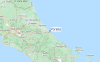
Usa este mapa para navegar hacia las playas de surf de Limon y estaciones de marea cercanas de Portete
Spots de Surf más cercanos a Portete:
(Clica la ubicación para más detalles)- Closest spot1 mi
- Second closest spot2 mi
- Third closest spot4 mi
- Fourth closest spot6 mi
- Fifth closest spot7 mi
Boyas marinas más cercanas a Portete:
- Closest Boya Marinas483 mi
- Second closest Boya Marinas694 mi
- Third closest Boya Marinas1085 mi
- Fourth closest Boya Marinas1104 mi
- Fifth closest Boya Marinas1116 mi
Estaciones de marea más cercanas a Portete:
- Closest estación de mareaLimon3 mi
- Second closest estación de mareaAlmirante67 mi
- Third closest estación de mareaBocas del Toro, Almirante Bay73 mi
- Fourth closest estación de mareaSan Juan del Norte (Greytown)76 mi
- Fifth closest estación de mareaGolfito95 mi
Airports
- The closest passenger airport to Portete is Limon International Airport (LIO) in Costa Rica, 8 km (5 miles) away (directly).
- The second nearest airport to Portete is Cap Manuel Nino International (Changuinola) Airport (CHX) in Panama, 87 km (54 miles) away.
- Third is Bocas Del Toro Airport (BOC) in Panama, 117 km (73 miles) away.
- Juan Santamaria International Airport (SJO) in Costa Rica is 124 km (77 miles) away.
- Palmar Sur Airport (PMZ), also in Costa Rica is the fifth nearest airport to Portete and is 126 km (78 miles) away.

- /breaks/Portete_1/forecasts/latest


 Nearest